Esri UC2013. Technical Workshop. Type Presentation Name Here
|
|
|
- Martin Maxwell
- 5 years ago
- Views:
Transcription


1 Type Presentation Name Here


2 2013 Esri International User Conference July 8 12, 2013 San Diego, California Technical Workshop 3D Analyst An Introduction Deepinder Deol Michael Contreras


3 Why use 3D GIS? Because our world is 3D Improve understanding 3D is easy for everyone to understand Solve 3D problems Some spatial problems can only be solved in 3D Better communication 3D makes it easier to articulate ideas
4 What can you do with ArcGIS 3D? 3D Geodesign Multiscale 3D Models ArcGIS for 3D Cities Surface modeling Share 3D scenes Native lidar support 3D Analysis Integrated 3D
5 Contents What is 3D Analyst? ArcGlobe ArcScene 3D Effects 3D Symbology 3D Editing Graphics, Animation and Customization 3D Geoprocessing Demo
6 What is 3D Analyst? ArcGIS extension that provides capabilities for: Interactive 3D Visualization of spatial data 3D Editing of feature data 3D Geoprocessing tools Publish globe services (ArcGIS Server) Publish globe documents (Publisher toolbar) for use in ArcReader Export ArcScene documents to 3D web scenes


7 Applications with 3D Functionality ArcGlobe ArcScene ArcMap ArcCatalog
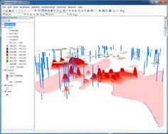
8 Data Types Vector features Points, lines, polygons, multipatches Surface types Triangular Irregular Networks (TINs) Rasters Terrain datasets LAS datasets

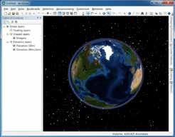
9 ArcGlobe 3D visualization application Data placed on 3D globe Map like & oblique views Integrated topography One logical globe surface One multi-resolution mesh Caching Disk cache and memory cache Levels-of-detail (raster data)

10 ArcGlobe: Levels-of-detail Far (less detail) Near (more detail)


11 ArcGlobe: Types of layers Elevation - defines globe surface Draped - relative to globe surface Floating - Not relative to globe surface

12 ArcGlobe: Navigation Modes Global mode Surface mode
13 ArcScene 3D visualization application Memory based application Better for smaller study areas Stereo viewing is supported Export to 3D web scene (.3ws)
 Swipe tool (ArcGlobe only) Flicker tool (ArcGlobe only)")
14 3D Effects Toolbar Real-time feedback for Transparency Front/backface culling Lighting Depth priority (ArcScene only) Swipe tool (ArcGlobe only) Flicker tool (ArcGlobe only)


15 3D Symbology Applied to feature data Add realism to your documents Match to symbols in style
16 3D Styles Points - 3D Geometric primitives: Spheres, Cones, etc. - 3D Models: Street furniture, Houses, etc. - 3D Character Markers - Import 3D models Lines - OpenFlight (*.flt), 3DS Max (*.3ds), Virtual Reality Markup Language (*.vrml), and SketchUp (*.skp), Collada (*.dae) models - 3D Texture Line Symbols: Pavement, Concrete, etc. - 3D Geometric primitives (ArcScene): Tube, Strip, Wall etc. Polygons - 3D Texture Fill Symbols: grass texture...

17 3D Editing Feature editing in ArcGlobe and ArcScene Template based editing Support for snapping
18 3D Graphics and KML support 3D Graphics Toolbar Digitize point, line, polygons and text graphics Apply 3D Symbology to the graphic elements Keyhole MarkUp Language (ArcGlobe only) Add KML data using the KML toolbar in ArcGlobe


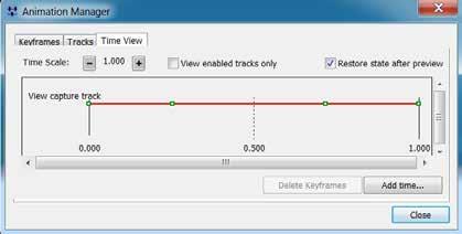
19 Animation Tools
20 Customization framework Customization environments - Visual Basic for Applications (VBA) in ArcGlobe and ArcScene applications - C#, VB.NET, Java, C++, etc. GlobeControl and SceneControl - Used in custom applications - Can easily view existing documents

21 3D Geoprocessing Surface creation Surface analysis Output raster and vector datasets 3D feature creation Data Conversion CityEngine toolset (new in 10.2)
 at")
22 Features From CityEngine Rules Creates 3D geometries Uses CityEngine rules Technical workshop: 3D Analyst: Working with 3D Analyst and CityEngine Where: Room 09 When: Tuesday (07/09) at 1:30PM

23 Export to 3D Web Scene Export ArcScene documents Upload to ArcGIS Online No plug-in required View in browser - Firefox, Chrome etc. Whitepaper (coming soon)
24 Demo
3D Analysis Tools and Visualization with ArcGIS. Jie Chang Jinwu Ma
 3D Analysis Tools and Visualization with ArcGIS Jie Chang Jinwu Ma Why 3D GIS? Because our world is 3D Improve understanding 3D is easy for everyone to understand Solve 3D problems Some spatial problems
From 2D to 3D at Esri
 From 2D to 3D at Esri OGC/EuroSDR workshop on CityGML in National Mapping Paul Hardy phardy@esri.com Business Development Consultant National Mapping & Cadastre Esri 3D GIS Visualize Manage Share Analyze
Creating, managing and utilizing a 3D Virtual City in ArcGIS Tamrat Belayneh Eric Wittner
 Creating, managing and utilizing a 3D Virtual City in ArcGIS 10.1 Tamrat Belayneh (tbelayneh@esri.com) Eric Wittner (ewittner@esri.com ) Contents 3D Mapping & Ingredients of a 3D Virtual City Creating
Contents What is 3D Mapping Creating g the 3D Dataset Ingredients of a 3D Virtual City Publishing 3D Globes The Road ahead Questions and Answers
 Creating a 3D Virtual City Using ArcGIS Tamrat Belayneh Hardeep Bajwa Contents What is 3D Mapping Creating g the 3D Dataset Ingredients of a 3D Virtual City Publishing 3D Globes The Road ahead Questions
Visualization with ArcGlobe. Brady Hoak
 Visualization with ArcGlobe Brady Hoak Contents What is ArcGlobe? 3D Mapping and ArcGlobe Displaying data in ArcGlobe ArcGlobe tools Tips for constructing ArcGlobe documents New at ArcGIS 9.3 ArcGIS integration
From 2D to 3D at Esri
 From 2D to 3D at Esri Paul Hardy, Esri Inc phardy@esri.com, Cambridge, UK SHORT PAPER This short paper provides an overview of the 3D capabilities of a modern GIS, illustrated by the Esri ArcGIS system,
3D Data Modelling at Esri. Paul Hardy Business Development Consultant Esri Europe
 3D Data Modelling at Esri Paul Hardy phardy@esri.com Business Development Consultant Esri Europe Users of 3D GIS Local government Facilities management Civil engineering 3D GIS Defense / Public Safety
3D Analyst Visualization with ArcGlobe. Brady Hoak, ESRI DC
 3D Analyst Visualization with ArcGlobe Brady Hoak, ESRI DC 3D GIS Viewing geospatial data in 3D leads to new insights 2D 3D Sometimes you need to edit your data in 3D 2D 3D Some problems can only be solved
Surface Analysis with 3D Analyst
 2013 Esri International User Conference July 8 12, 2013 San Diego, California Technical Workshop Surface Analysis with 3D Analyst Khalid H. Duri Esri UC2013. Technical Workshop. Why use 3D GIS? Because
Lidar Working with LAS Datasets
 2013 Esri International User Conference July 8 12, 2013 San Diego, California Technical Workshop Lidar Working with LAS Datasets Raghav Vemula (3D Team) Esri UC2013. Technical Workshop. Agenda Las Dataset
Sharing 3D Content on the Web
 Sharing 3D Content on the Web Nathan Shephard, Gert van Maren Why 3D GIS? Because our world is 3D Improve understanding 3D is easy for everyone to understand Better communication 3D makes it easier to
Exporting ArcScene to 3D Web Scenes. Documents. An Esri White Paper November 2013
 Exporting ArcScene to 3D Web Scenes Documents An Esri White Paper November 2013 Copyright 2013 Esri All rights reserved. Printed in the United States of America. The information contained in this document
GEOGRAPHIC INFORMATION SYSTEMS Lecture 25: 3D Analyst
 GEOGRAPHIC INFORMATION SYSTEMS Lecture 25: 3D Analyst 3D Analyst - 3D Analyst is an ArcGIS extension designed to work with TIN data (triangulated irregular network) - many of the tools in 3D Analyst also
Cartographic Techniques and Representations
 Cartographic Techniques and Representations NEARC 2007 ESRI Technical Session ESRI, Boston Overview of Presentation Labeling and Annotation Masking Layout Tips Cartographic Representations Labeling versus
3D in the Browser with WebGL. Chris Andrews 3D Product Manager Javier Gutierrez 3D Product Engineer
 3D in the Browser with WebGL Chris Andrews 3D Product Manager Javier Gutierrez 3D Product Engineer Just sayin This is not a programming class Goal is to help you learn about a technology area that impacts
CityEngine: An Introduction
 CityEngine: An Introduction Gert van Maren Product Management lead for 3D Esri UC 2014 Technical Workshop Esri UC 2014 Technical Workshop Why 3D GIS? Because our world is 3D Improve understanding 3D is
COPYRIGHTED MATERIAL. Introduction to 3D Data: Modeling with ArcGIS 3D Analyst and Google Earth CHAPTER 1
 CHAPTER 1 Introduction to 3D Data: Modeling with ArcGIS 3D Analyst and Google Earth Introduction to 3D Data is a self - study tutorial workbook that teaches you how to create data and maps with ESRI s
Using VBA and ArcMap to Create and Export 3D Buildings
 Using VBA and ArcMap to Create and Export 3D Buildings Abstract Brian Bradshaw Layers in ArcScene containing polygon features can be extruded to create 3D blocks for display in the current scene. While
ArcGIS Pro: Mapping & Visualization. David Watkins, Edie Punt &
 ArcGIS Pro: Mapping & Visualization David Watkins, Edie Punt & Craig Williams @daviddwatkins, @epunt, & @williamscraigm Mapping an Visualization Vision In ArcGIS Pro Improve drawing performance and quality
Answer the following general questions: 1. What happens when you right click on an icon on your desktop? When you left double click on an icon?
 Name: Date: June 27th, 2011 GIS Boot Camps For Educators Practical: Explore ArcGIS 10 Desktop Tools and functionality Day_1 Lecture 1 Sources: o ArcGIS Desktop help o ESRI website o Getting to Know ArcGIS
3DCity: Create 3D city features
 3DCity: Create 3D city features Workflow: 3D City Creation Version: 1.0 Date: September 12, 2012 Map templates and workflows are ArcGIS resources that can be used to help create 2D / 3D maps and web map
Getting Started with ArcGIS for Server. Charmel Menzel and Ken Gorton
 Getting Started with ArcGIS for Server Charmel Menzel and Ken Gorton Agenda What is ArcGIS for Server? Types of Web services Publishing resources onto the Web Clients to ArcGIS for Server Editions and
An ESRI Technical Paper May 2007 Techniques for Consuming 3D Textured Objects in ArcGlobe and ArcScene
 An ESRI Technical Paper May 2007 Techniques for Consuming 3D Textured Objects in ArcGlobe and ArcScene ESRI 380 New York St., Redlands, CA 92373-8100 USA TEL 909-793-2853 FAX 909-793-5953 E-MAIL info@esri.com
Integrating CAD Data with ArcGIS
 Integrating CAD Data with ArcGIS Agenda An Overview of CAD Drawings CAD Data Structure in ArcGIS Visualization Georeferencing Data Conversion ArcGIS for AutoCAD Q & A CAD Drawings - Overview Widely used
Creating and Maintaining Your 3D Basemap. Brian Sims Dan Hedges Gert van Maren
 Creating and Maintaining Your 3D Basemap Brian Sims Dan Hedges Gert van Maren Complementary Resource Email (no marketing) A copy of the presentation Links to today s web demos Links to training materials
Your Prioritized List. Priority 1 Faulted gridding and contouring. Priority 2 Geoprocessing. Priority 3 Raster format
 Your Prioritized List Priority 1 Faulted gridding and contouring Priority 2 Geoprocessing Priority 3 Raster format Priority 4 Raster Catalogs and SDE Priority 5 Expanded 3D Functionality Priority 1 Faulted
What s New in Desktop 10.1
 What s New in Desktop 10.1 Damian Spangrud Esri Redlands Trip Down Memory Lane ArcGIS A Complete System for Geographic Information Cloud Web Online Mobile Enterprise Desktop Sharing Information sharing
Chris Rotondo, GIS Specialist. Prince George s County Planning Department The Maryland-National Capital Park and Planning Commission
 Chris Rotondo, GIS Specialist Prince George s County Planning Department The Maryland-National Capital Park and Planning Commission MSGIC, July 2015 A 150-page report on implementing 3D technology, prepared
Developers Road Map to ArcGIS Desktop and ArcGIS Engine
 Developers Road Map to ArcGIS Desktop and ArcGIS Engine Core ArcObjects Desktop Team ESRI Developer Summit 2008 1 Agenda Dev Summit ArcGIS Developer Opportunities Desktop 9.3 SDK Engine 9.3 SDK Explorer
PUG List. Raster Analysis 3D Analysis Geoprocessing. Steve Kopp
 PUG List Raster Analysis 3D Analysis Geoprocessing Steve Kopp Contour Polygons Spatial Analyst - color-filled contours. Similar to thematic classification, where blue = -1000 to zero, and red = 0 to +1000,
What s s Coming in ArcGIS 10 Desktop
 What s s Coming in ArcGIS 10 Desktop Damian Spangrud ArcGIS Product Manager, ESRI dspangrud@esri.com (or at least turn to silent) ArcGIS 10 A Simple & Pervasive System for Using Maps & Geographic Information
Publishing image services in ArcGIS
 Esri International User Conference San Diego, California Technical Workshops July 26, 2012 Publishing image services in ArcGIS Wenxue Ju & Melanie Harlow What is an image service? A way to make image and
Building 3D models with the horizons method
 ARC HYDRO GROUNDWATER TUTORIALS SUBSURFACE ANALYST Building 3D models with the horizons method Arc Hydro Groundwater (AHGW) is a geodatabase design for representing groundwater datasets within ArcGIS.
3D in the ArcGIS Platform. Chris Andrews
 3D in the ArcGIS Platform Chris Andrews Geospatial 3D is already all around us 3D is expanding the GIS community s opportunity to provide value 3D City & Infrastructure Models Generated 3D features Photogrammetrc
ArcGIS Pro Terminology Guide
 ArcGIS Pro Terminology Guide Essential Terminology or Functionality That s New to ArcGIS Pro ArcGIS Pro Project Map Scene Ribbon Tab on the ribbon View Active view Pane Gallery Task Quick Access Toolbar
ArcGIS Pro Terminology Guide
 ArcGIS Pro Terminology Guide Sharing Terminology and User Interface Cross-Reference Share content Project package (.ppkx) Map package (.mpkx) Layer package (.lpkx) Share or publish a web layer Share Web
ArcGIS Desktop The Road Ahead. Amadea Azerki
 ArcGIS Desktop The Road Ahead Amadea Azerki Agenda An Overview of ArcGIS 10 Desktop Enhancements User Interface Mapping Editing Analysis Sharing Q & A ArcGIS 10 Overview Focuses on Usability and Productivity
Nye funktioner i ArcGIS Pro - ArcGIS Pro 2.1
 Nye funktioner i ArcGIS Pro - ArcGIS Pro 2.1 Paulina Karkauskaite GIS Konsulent Paulinak@geoinfo.dk Tlf: +45 53 39 59 16 Niklas Gregersen Presales GIS Konsulent Niklasg@geoinfo.dk Tlf: +45 53 39 59 28
Introduction to 3D Analysis. Jinwu Ma Jie Chang Khalid Duri
 Introduction to 3D Analysis Jinwu Ma Jie Chang Khalid Duri Area & Volume 3D Analyst Features Detect Change Determine Cut/Fill Calculate Surface Area & Volume Data Management Data Creation Data Conversion
Contents 3D Visualization (Mapping) defined Globe Data Display Management & Architecture Caching and optimization Data Preparation and Usage Tips Cust
 defined Globe Data Display Management & Architecture Caching and optimization Data Preparation and Usage Tips Cust") Developers Guide to 3D Visualization in ArcGIS 9.2 Nathan Shephard Tamrat Belayneh Developer Summit 2007 1 Contents 3D Visualization (Mapping) defined Globe Data Display Management & Architecture Caching
Developers Guide to 3D Visualization in ArcGIS 9.2 Nathan Shephard Tamrat Belayneh Developer Summit 2007 1 Contents 3D Visualization (Mapping) defined Globe Data Display Management & Architecture Caching
ArcMap: Tips and Tricks
 Esri International User Conference San Diego, California Technical Workshops July 23 27, 2012 ArcMap: Tips and Tricks Miriam Schmidts Jorge Ruiz-Valdepena Agenda Navigating ArcMap Repairing data links
ArcGIS Pro: What s New in Editing and Data Management
 Federal GIS Conference February 9 10, 2015 Washington, DC ArcGIS Pro: What s New in Editing and Data Management Robert LeClair ArcGIS Pro Overview Esri FedUC 2015 Technical Workshop ArcGIS Pro: What's
Designing and Using Cached Map Services
 Esri International User Conference San Diego, California Technical Workshops July 2012 Designing and Using Cached Map Services Sterling Quinn Eric Rodenberg What we will cover Session Topics - Map cache
hereby recognizes that Timotej Verbovsek has successfully completed the web course 3D Analysis of Surfaces and Features Using ArcGIS 10
 3D Analysis of Surfaces and Features Using ArcGIS 10 Completed on September 5, 2012 3D Visualization Techniques Using ArcGIS 10 Completed on November 19, 2011 Basics of Map Projections (for ArcGIS 10)
ArcGIS Pro Editing: An Introduction. Jennifer Cadkin & Phil Sanchez
 ArcGIS Pro Editing: An Introduction Jennifer Cadkin & Phil Sanchez See Us Here WORKSHOP ArcGIS Pro Editing: An Introduction LOCATION SDCC - Ballroom 20 D TIME FRAME Thursday 10:00 11:00 ArcGIS Pro: 3D
Introduction to GIS 2011
 Introduction to GIS 2011 Digital Elevation Models CREATING A TIN SURFACE FROM CONTOUR LINES 1. Start ArcCatalog from either Desktop or Start Menu. 2. In ArcCatalog, create a new folder dem under your c:\introgis_2011
Desktop. ArcGIS Server. ArcGIS
 Getting Started with ArcGIS Server Nakul Bhatia and David Crosby ESRI Charlotte 1 Agenda g Overview of ArcGIS Server 9.3.1 Working with GIS Services Using g Web GIS Service Clients ArcGIS Online Map Caching
Working with Metadata in ArcGIS
 Esri International User Conference San Diego, California Technical Workshops July 26, 2012 Working with Metadata in ArcGIS Aleta Vienneau Metadata in ArcGIS ArcGIS metadata goals Editing metadata Setting
3D Indoor Routing and Visualization for the University of Redlands
 University of Redlands InSPIRe @ Redlands MS GIS Program Major Individual Projects Geographic Information Systems 2015 3D Indoor Routing and Visualization for the University of Redlands Umar Makdoom University
introduction to 3D data
 introduction to 3D data MODELING WITH ARCGIS 3D ANALYST AND GOOGLE EARTH K. HEATHER KENNEDY Introduction to 3D Data Introduction to 3D Data Modeling with ArcGIS 3D Analyst and Google Earth K. Heather
Outline Overview of Spatiotemporal data Storage and management of temporal data Feature Raster Array (netcdf) Visualization of temporal data Analysis
 Visualization of temporal data Analysis") Working with Temporal Data in ArcGIS Nawajish Noman Jeff Bigos Workshop on Spatial-Temporal Modeling Center for Geographic Analysis, Harvard University, April 10 th 2009 Outline Overview of Spatiotemporal
Working with Temporal Data in ArcGIS Nawajish Noman Jeff Bigos Workshop on Spatial-Temporal Modeling Center for Geographic Analysis, Harvard University, April 10 th 2009 Outline Overview of Spatiotemporal
ArcGIS Pro. Terminology Guide
 ArcGIS Pro Terminology Guide Essential Terminology or Functionality That s New to ArcGIS Pro ArcGIS Pro Project Map Scene Ribbon Tab on the ribbon View Active view Pane Gallery Task Quick Access Toolbar
Basics of Using LiDAR Data
 Conservation Applications of LiDAR Basics of Using LiDAR Data Exercise #2: Raster Processing 2013 Joel Nelson, University of Minnesota Department of Soil, Water, and Climate This exercise was developed
Making the Most of Raster Analysis with Living Atlas Data. Aileen Buckley, PhD, Research Cartographer Esri - Redlands
 Making the Most of Raster Analysis with Living Atlas Data Aileen Buckley, PhD, Research Cartographer Esri - Redlands Spatial Analysis with Online Data Your Desktop Web Device Never scrounge for or download
Working with Elevation Data URPL 969 Applied GIS Workshop: Rethinking New Orleans After Hurricane Katrina Spring 2006
 Working with Elevation Data URPL 969 Applied GIS Workshop: Rethinking New Orleans After Hurricane Katrina Spring 2006 This GIS lab exercise will explore Light Detection And Ranging (LiDAR) data for New
ArcGIS Viewer for Microsoft Silverlight An Introduction
 Esri International User Conference San Diego, CA Technical Workshops July 12, 2011 ArcGIS Viewer for Microsoft Silverlight An Introduction Art Haddad, Rich Zwaap, and Derek Law Agenda Background Product
ArcGIS GeoEvent Server: Making 3D Scenes Come Alive with Real-Time Data
 ArcGIS GeoEvent Server: Making 3D Scenes Come Alive with Real-Time Data Morakot Pilouk, Ph.D. Senior Software Developer, Esri mpilouk@esri.com @mpesri Agenda 1 2 3 4 5 6 3D for ArcGIS Real-Time GIS Static
ICIT. Brian Hiller ESRI Account Manger. What s new in ArcGIS 10
 ICIT Brian Hiller ESRI Account Manger What s new in ArcGIS 10 ArcGIS 10 Fast Easy Powerful Everywhere late June 2010 ArcGIS System for Geographic Information Desktop Server Mobile Online A System A Complete
ArcGIS Pro and CityEngine: A Deep Dive. Deepinder Deol Eric Wittner
 ArcGIS Pro and CityEngine: A Deep Dive Deepinder Deol Eric Wittner When to use ArcGIS Pro? When to use CityEngine? Procedural Geometry ArcGIS Pro CityEngine 2D to 3D procedural engine Yes Yes Interactive
Moving Desktop Applications to ArcGIS Server
 Moving Desktop Applications to ArcGIS Server Kelly Hutchins Jian Huang ESRI Developer Summit 2008 1 Schedule 75 minute session 60 65 minute lecture 10 15 minutes Q & A following the lecture Cell phones
Surface Creation & Analysis with 3D Analyst
 Esri International User Conference July 23 27 San Diego Convention Center Surface Creation & Analysis with 3D Analyst Khalid Duri Surface Basics Defining the surface Representation of any continuous measurement
Lesson 8 : How to Create a Distance from a Water Layer
 Created By: Lane Carter Advisor: Paul Evangelista Date: July 2011 Software: ArcGIS 10 Lesson 8 : How to Create a Distance from a Water Layer Background This tutorial will cover the basic processes involved
Creating a 3D GIS Program in the City of Cambridge
 Creating a 3D GIS Program in the City of Cambridge JEFF AMERO CITY OF CAMBRIDGE ESRI User Conference, San Diego, CA July 13, 2017 Presentation Overview -Bringing 3D GIS to Cambridge -Components of the
Best Practices for Designing Effective Map Services
 2013 Esri International User Conference July 8 12, 2013 San Diego, California Technical Workshop Best Practices for Designing Effective Map Services Ty Fitzpatrick Tanu Hoque What s in this session Map
Network Analyst: An Introduction
 2013 Esri International User Conference July 8 12, 2013 San Diego, California Technical Workshop Network Analyst: An Introduction Patrick Stevens Robert Garrity Esri UC2013. Technical Workshop. Introduction
Creating Great Labels Using Maplex
 Esri International User Conference San Diego, CA Technical Workshops July 11 15, 2011 Creating Great Labels Using Maplex Craig Williams Natalie Vines 2 Presentation Overview What are the types of text
City of Kitchener Evolution of 3D Modeling. Presented by: Mike Elliott Adam Clark
 City of Kitchener Evolution of 3D Modeling Presented by: Mike Elliott Adam Clark Project Description There has been a building interest from the public and staff in exploring 3D mapping or modeling There
Using Imagery for Intelligence Analysis
 2013 Esri International User Conference July 8 12, 2013 San Diego, California Technical Workshop Using Imagery for Intelligence Analysis Renee Bernstein Natalie Campos Esri UC2013. Technical Workshop.
Creating Contours using ArcMap
 Creating Contours with ArcMap and ArcScene Digital elevation models (DEMs) are geospatial datasets that contain elevation values sampled according to a regularly spaced rectangular grid. They can be used
Topology in the Geodatabase an Introduction. Erik Hoel Doug Morgenthaler
 Topology in the Geodatabase an Introduction Erik Hoel Doug Morgenthaler ESRI Super Secret Topology Laboratory, May 2012 Agenda ArcGIS Topology defined Validating a topology Editing a topology Geoprocessing
Desktop Workflows: An Introduction to ArcGIS Pro. David Watkins, Mark Smithgall
 Desktop Workflows: An Introduction to ArcGIS Pro David Watkins, Mark Smithgall ArcGIS for Desktop Desktop Web Device ArcMap ArcCatalog ArcScene ArcGlobe ArcGIS Pro Portal Server Online Content and Services
A Second Look at DEM s
 A Second Look at DEM s Overview Detailed topographic data is available for the U.S. from several sources and in several formats. Perhaps the most readily available and easy to use is the National Elevation
THE HONG KONG POLYTECHNIC UNIVERSITY DEPARTMENT OF LAND SURVEYING & GEO-INFORMATICS LSGI521 PRINCIPLES OF GIS
 THE HONG KONG POLYTECHNIC UNIVERSITY DEPARTMENT OF LAND SURVEYING & GEO-INFORMATICS LSGI521 PRINCIPLES OF GIS Student name: Student ID: Table of Content Working with files, folders, various software and
Bouncing ball animation made up of 6 frames
 Incorporating Animation into your Analysis and Presentation Colin Childs UC2009 Technical Workshop 1 Content What is Animation What is ArcGIS animation What can be Animated Animation concepts Building
Managing Lidar and Photogrammetric Point Clouds. Lindsay Weitz Cody Benkelman
 and Photogrammetric Point Clouds Lindsay Weitz Cody Benkelman Presentation Context What is lidar, and how does it work? Not this presentation! What can you do with lidar in ArcGIS? What does Esri recommend
USING 3D GIS SIMULATION FOR URBAN DESIGN
 Do-Hyung Kim Ilir Bejleri USING 3D GIS SIMULATION FOR URBAN DESIGN Abstract The Florida town of High Springs joins the University of Florida to develop a vision for the revitalization of its historic town
An Introduction to Using Lidar with ArcGIS and 3D Analyst
 FedGIS Conference February 24 25, 2016 Washington, DC An Introduction to Using Lidar with ArcGIS and 3D Analyst Jim Michel Outline Lidar Intro Lidar Management Las files Laz, zlas, conversion tools Las
Lab 18c: Spatial Analysis III: Clip a raster file using a Polygon Shapefile
 Environmental GIS Prepared by Dr. Zhi Wang, CSUF EES Department Lab 18c: Spatial Analysis III: Clip a raster file using a Polygon Shapefile These instructions enable you to clip a raster layer in ArcMap
Tutorial 17: Desert City Tutorial
 Tutorial 17: Desert City Tutorial Table of Contents Tutorial 17: Desert city........................................... 3 2 Tutorial 17: Desert city Download items Tutorial data Tutorial PDF Prerequisites
ArcGIS 4: Sharing Content on the Web STUDENT EDITION
 ArcGIS 4: Sharing Content on the Web STUDENT EDITION Copyright 2016 Esri All rights reserved. Course version 3.1.1. Version release date July 2016. Printed in the United States of America. The information
TRAINING COURSE CATALOG
 GEOSPATIAL EXPLOITATION PRODUCTS (GXP ) TRAINING COURSE CATALOG Revised: May 08, 2014 www.baesystems.com/gxp ALL SCHEDULED TRAINING COURSES HELD IN OUR REGIONAL TRAINING CENTERS ARE FREE FOR CURRENT GXP
Getting Started With LP360
 Getting Started With LP360 12/22/2015 1 Contents What is LP360?... 3 System Requirements... 3 Installing LP360... 4 How to Enable the LP360 Extension... 4 How to Display the LP360 Toolbar... 4 How to Import
Getting Started. Extruding Features. Convert to feature class
 http://gmv.cast.uark.edu A Method Store for Advanced Survey and Modeling Technologies Mon, 01 Apr 2013 03:29:18 +0000 en-us hourly 1 http://wordpress.org/?v=3.5.1 http://gmv.cast.uark.edu/modeling/software-visualization/sketchup/workflow-sketchup/arcscene-tosketchup-to-arcscene/
3D CITY MODELLING WITH CYBERCITY-MODELER
 1 3D CITY MODELLING WITH CYBERCITY-MODELER Kilian Ulm 1 and Daniela Poli 1 1. CyberCity AG, Zurich, Switzerland, (kilian.ulm, daniela.poli)@cybercity.tv ABSTRACT 3D city models using stereo aerial-/satellite
Migrating to ArcGIS Pro. John Sharrard, Esri Solutions Engineer
 Migrating to ArcGIS Pro John Sharrard, Esri Solutions Engineer jsharrard@esri.com ArcGIS Desktop Desktop Web Device ArcMap ArcCatalog ArcScene ArcGlobe ArcGIS Pro Portal Server Online Content and Services
ArcGIS for Developers. Kevin Deege Educational Services Washington DC
 ArcGIS for Developers Kevin Deege Educational Services Washington DC Introductions Who am I? Who are you? ESRI Product Development Experience? What development languages are you using? What types of applications
An Introduction to Data Interoperability
 Esri International User Conference San Diego, California 2012 Technical Workshops July 24/25 An Introduction to Data Interoperability Bruce Harold - Esri Dale Lutz Safe Software Background Why Data Interoperability?
LAB #7 Creating TIN and 3D scenes (ArcScene) GISC, UNIVERSITY OF CALIFORNIA BERKELEY
 GISC, UNIVERSITY OF CALIFORNIA BERKELEY") LAB #7 Creating TIN and 3D scenes (ArcScene) GISC, UNIVERSITY OF CALIFORNIA BERKELEY The purpose of this laboratory is to introduce and explore surface data analysis using a vector data model: TIN. We
LAB #7 Creating TIN and 3D scenes (ArcScene) GISC, UNIVERSITY OF CALIFORNIA BERKELEY The purpose of this laboratory is to introduce and explore surface data analysis using a vector data model: TIN. We
What's New in ArcGIS 9.2 Service Packs
 What's New in ArcGIS 9.2 Service Packs 18 July 2007 Updated for Service Pack 3 This document describes the main enhancements to 9.2 added by the service packs. It does not cover the bug fixes and quality
Getting the most from the Maplex Label Engine
 Esri International User Conference San Diego, California Technical Workshops July 26, 2012 Getting the most from the Maplex Label Engine Craig Williams Natalie Matthews 2 Presentation Overview What are
Virtualizing Boathouses in Dwejra, Malta for Access through WebGIS Applications (Abstract)
") Virtualizing Boathouses in Dwejra, Malta for Access through WebGIS Applications (Abstract) Daniel LANGENHAUN, Erich BUHMANN, Matthias PIETSCH, Santosh CHOUGULE and Philip PAAR 1 Keywords Digital Landscape
Virtualizing Boathouses in Dwejra, Malta for Access through WebGIS Applications (Abstract) Daniel LANGENHAUN, Erich BUHMANN, Matthias PIETSCH, Santosh CHOUGULE and Philip PAAR 1 Keywords Digital Landscape
START>PROGRAMS>ARCGIS>
 Department of Urban Studies and Planning Spring 2006 Department of Architecture Site and Urban Systems Planning 11.304J / 4.255J GIS EXERCISE 2 Objectives: To generate the following maps using ArcGIS Software:
GeoPlanner Workshop. Esri Ocean GIS Forum November 4, Pete Aniello and Rob Stauder
 GeoPlanner Workshop Esri Ocean GIS Forum November 4, 2015 Pete Aniello and Rob Stauder Purpose and Take-aways Learn how to: - Create services - Use services in ArcGIS Online - Use services in GeoPlanner
Image Services for Elevation Data
 Image Services for Elevation Data Peter Becker Need for Elevation Using Image Services for Elevation Data sources Creating Elevation Service Requirement: GIS and Imagery, Integrated and Accessible Field
Tutorial 1: Finding and Displaying Spatial Data Using ArcGIS
 Tutorial 1: Finding and Displaying Spatial Data Using ArcGIS This tutorial will introduce you to the following: Websites where you may browse to find geospatial information Identifying spatial data, usable
ArcGIS Pro Editing. Jennifer Cadkin & Phil Sanchez
 ArcGIS Pro Editing Jennifer Cadkin & Phil Sanchez ArcGIS Pro Editing Overview Provides tools that allow you to maintain, update, and create new data - Modifying geometry, drawing new features - Entering
ArcGIS Pro and CityEngine. Eric Wittner
 ArcGIS Pro and CityEngine Eric Wittner Procedural Modeling Provides a Flexible 3D Design Environment Supporting a Rapid and Repeatable Process Steps Author Rules (or use Library) Generate Multiple Design
RASTER ANALYSIS S H A W N L. P E N M A N E A R T H D A T A A N A LY S I S C E N T E R U N I V E R S I T Y O F N E W M E X I C O
 RASTER ANALYSIS S H A W N L. P E N M A N E A R T H D A T A A N A LY S I S C E N T E R U N I V E R S I T Y O F N E W M E X I C O TOPICS COVERED Spatial Analyst basics Raster / Vector conversion Raster data
ArcMap Tips and Tricks
 2013 Esri International User Conference July 8 12, 2013 San Diego, California Technical Workshop ArcMap Tips and Tricks Jack Horton Jorge Ruiz-Valdepeña Esri UC2013. Technical Workshop. Jorge s Agenda
Rapid generation of 3D GIS content from reality capture data sources. Keir Keightley, HDR
 Rapid generation of 3D GIS content from reality capture data sources Keir Keightley, HDR Purpose Why do we want 3D GIS content? A picture is worth a thousand words, and more, if you can navigate it in