POSEIDON, INSPIRE updated citizen science project. Andrej Abramić, Alejandro Garcia Mendoza, Ricardo Haroun Tabraue and José Juan Castro Hernández
|
|
|
- Mae Simmons
- 5 years ago
- Views:
Transcription

1


2 POSEIDON, INSPIRE updated citizen science project Andrej Abramić, Alejandro Garcia Mendoza, Ricardo Haroun Tabraue and José Juan Castro Hernández


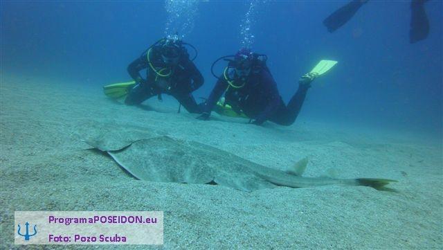
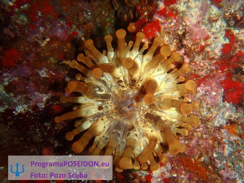
3 Programa POSEIDON Citizen Science project that deals with marine biodiversity; Project financed by Fundación Biodiversidad, ; Marine species are reported (photo, local name & location) by citizens and validated by experts (marine biologists - experts in sharks, invertebrates, fish.) Goal obtain marine biodiversity data within the citizen collaboration, increasing awareness on biodiversity issues


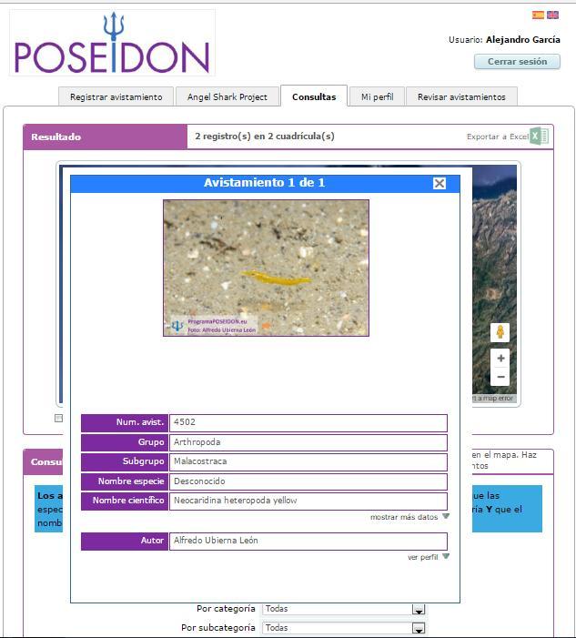


4 User interface
 Number of samples > 8000, 7263 validated (3119 photos) Number of registered users > 400 We believe that use of Programa Poseidon can go much")
5 Current results Project finalized but still running ( ), still we are obtaining new records, but intensity is decreasing (need new push) Campaigns to get to the target citizens groups (scuba divers, whale watchers ) Number of samples > 8000, 7263 validated (3119 photos) Number of registered users > 400 We believe that use of Programa Poseidon can go much further


6 INSPIRE? Why include INSPIRE data management into Programa Poseidon? NOT LEGAL/PROJECT REQUIREMENT EcoAqua Institute of ULPGC - important producer of the scientific marine/maritime data in the Macaronesia region. The institute applies sharing data policy and in 2016 the goal is to apply INSPIRE data management. Motivation to be a part of distributed Spanish SDI & European SDI is to increase visibility of EcoAqua work and shared information SDI/INSPIRE data management we see primely as a tool NO RESEARCH ON DATA SCIENCE To properly understand INSPIRE data management methods, To apply in our future international developments - searching for efficiency in development
7 Open source/free of charge software no budget for tools Using exclusively open source/free of charge software Data management that can be applied without elevated additional costs to understand and adopt process: metadata development & management data harmonization Development of the internet services - discovery, view and download
 We used web tools offered through the INSPIRE web site/data specification corner Technical guidelines DS")
8 Data harmonization Original data base in MySQL, managed and shared also as.shp files Transformation done with Humboldt Alignment Editor (HALE) We used web tools offered through the INSPIRE web site/data specification corner Technical guidelines DS documents /Interactive Data Specification Mapping tables, HTML view of the UML models, application schemas (XSD)

")


9 Transformation Simple relationship from source data set to INSPIRE confirmant one to one Poseidon (source) conformant INSPIRE transformation simple transformation - renaming, assign new properties, without geometry calulation (geometry point or square)
 no need for One-the-fly transformation Monthly update of INSPIRE data set HALE provides support for One-off One off better performance than On fly, wider")
10 Architecture applied What architecture to apply : One off or transformation On fly One-off transformation + external web based services WMS/WFS Even POSEIDON is not static data set (as bathymetry or geology data, weekly or even daily update) no need for One-the-fly transformation Monthly update of INSPIRE data set HALE provides support for One-off One off better performance than On fly, wider choice of software components Duplicate, triplicate (our use case) copies of data base storage and management image by Chris Schubert
11 Developing view/download network services We use GeoServer with INSPIRE extension that provide support for extended capabilities WMS & WFS (WCS) First idea to serve plane INSPIRE compliant data model as a *.shp (WFS) Following conceptual data model - quite simple solution HALE is providing flat data model Not possible as *.shp, (*.dbf) not support more than 10 characters attribute name We needed to include the PostGIS data base as a conversion data base Possible to serve plane gml file with all required atributes Possible to serve complex structure gml file
12 Developing discovery services Development of the metadata with metadata editor in xml need to embed manually reference system code, using the INSPIRE metadata editor European Open Source Metadata Editor (EUOSME) Development of the catalogue CSW with GeoNetwork DISCOVERY Finally connected to INSPIRE metadata catalog through national SDI (IDEE España)
 on INSPIRE web, Interactive data specs, INSPIRE cluster, Technical Guidelines Understanding what need to be done and how is time")

13 Conclusions Data Harmonization INSPIRE interoperability - Data Harmonization Available tools (no cost) and support more than satisfying, HALE, Data specification (corner) on INSPIRE web, Interactive data specs, INSPIRE cluster, Technical Guidelines Understanding what need to be done and how is time consuming Expert knowledge needed (+awareness what is actually available) Planning INSPIRE data models is a good solution for developing data flows within international project We can not expect from our partners to provide INSPIRE compliant data set without providing our extensive support (providing courses and training )
14 Conclusions Network services Available number of tools (no cost) Easy to serve WMS, view network services Complicate to serve INSPIRE compliant WFS - include PostGIS data base (use it only for the bridge to serve INSPIRE gml) decrease robustness of the system Easy to serve WFS for INSPIRE liked data Flat data models (without complex features). Easy to transform into INSPIRE compliant file Download services provide efficient data flows updated data must - extremely useful in the projects Discovery services metadata management should be part of the project dissemination process

15 Thank you for your attention.and patience
Introduction to INSPIRE. Network Services
 Introduction to INSPIRE. Network Services European Commission Joint Research Centre Institute for Environment and Sustainability Digital Earth and Reference Data Unit www.jrc.ec.europa.eu Serving society
Compass INSPIRE Services. Compass INSPIRE Services. White Paper Compass Informatics Limited Block 8, Blackrock Business
 Compass INSPIRE Services White Paper 2010 Compass INSPIRE Services Compass Informatics Limited Block 8, Blackrock Business Park, Carysfort Avenue, Blackrock, County Dublin, Ireland Contact Us: +353 1 2104580
Rui Reis, Maria José Vale, Marcelo Ribeiro, Bruno Meneses Geospatial World Forum 2016, May 2016, Rotterdam
 LC change detection and planning indicators Rui Reis, Maria José Vale, Marcelo Ribeiro, Bruno Meneses Summary 1. 2. 3. 4. 5. 6. 7. 8. Introduction Pilot overview Data description Inspire data harmonization
HUMBOLDT Application Scenario: Protected Areas
 CC by Erlend Schei Copyright by Kecko Copyright by Michael Bezzina CC by Gunnar Ries Copyright by Michael Bezzina Copyright by Michael Bezzina Copyright by Michael Bezzina CC by fs999 CC by Jordan Nielsen
Use case 1 INSPIRE harmonization of existing Energy Performance Certificate datasets Phase 1
 The European Commission s science and knowledge service Joint Research Centre Use case 1 INSPIRE harmonization of existing Energy Performance Certificate datasets Phase 1 Giacomo Martirano (external consultant)
Relation between Geospatial information projects related to GBIF
 Relation between Geospatial information projects related to GBIF Synthesys 3.6-Synthesys 3.7-GBIF.DE- BioGeomancer The most up to date work can always be found at: http://www.biogeografia.com/synthesys
GENeric European Sustainable Information Space for Environment.
 GENeric European Sustainable Information Space for Environment http://www.genesis-fp7.eu/ Outline Introduction The GENESIS FP7 project The GENESIS solution s architecture GENESIS experience with INSPIRE
Web apps for INSPIRE: the ELISE Energy pilot example
 Web apps for INSPIRE: the ELISE Energy pilot example 6 September 2017 Authors: Daniele Francioli Giacomo Martirano Maria Teresa Borzacchiello Francesco Pignatelli Outline Overview of the ELISE Energy Pilot
Framework specification, logical architecture, physical architecture, requirements, use cases.
 Title: A5.2-D3 3.3.1 Alignment Editor Specification Editor(s)/Organisation(s): Thorsten Reitz (Fraunhofer IGD) Contributing Authors: Thorsten Reitz (Fraunhofer IGD), Marian de Vries (TUD) References: A1.8-D4
ARCHITECTURE OF SPATIAL DATA INFRASTRUCTURE (SDI) (DRAFT)
 (DRAFT)") ARCHITECTURE OF SPATIAL DATA INFRASTRUCTURE (SDI) (DRAFT) Author: Carlo Cipolloni September 20, 2018 Version 1.0 A SDI platform to support the SEIS in the ENP South region Introduction Based on the Contribution
ARCHITECTURE OF SPATIAL DATA INFRASTRUCTURE (SDI) (DRAFT) Author: Carlo Cipolloni September 20, 2018 Version 1.0 A SDI platform to support the SEIS in the ENP South region Introduction Based on the Contribution
INSPIRE & Linked Data: Bridging the Gap Part II: Tools for linked INSPIRE data
 Making the Web an Exploratory Place for Geospatial Knowledge INSPIRE & Linked Data: Bridging the Gap Part II: Tools for linked INSPIRE data Michalis Alexakis Spiros Athanasiou Nikos Georgomanolis Giorgos
GeoNode Integration with SDIs and Community Mapping
 GeoNode Integration with SDIs and Community Mapping Salvador Bayarri sbayarri@gmail.com World Bank Consultant Contents Accessing other SDI services Catalog harvesting through Geonetwork Cascading external
Workshop 4.4: Lessons Learned and Best Practices from GI-SDI Projects II
 Workshop 4.4: Lessons Learned and Best Practices from GI-SDI Projects II María Cabello EURADIN technical coordinator On behalf of the consortium mcabello@tracasa.es euradin@navarra.es Scope E-Content Plus
INSPIRE: The ESRI Vision. Tina Hahn, GIS Consultant, ESRI(UK) Miguel Paredes, GIS Consultant, ESRI(UK)
 Miguel Paredes, GIS Consultant, ESRI(UK)") INSPIRE: The ESRI Vision Tina Hahn, GIS Consultant, ESRI(UK) Miguel Paredes, GIS Consultant, ESRI(UK) Overview Who are we? Introduction to ESRI Inc. and ESRI(UK) Presenters ArcGIS The ESRI Solution to
INSPIRE: The ESRI Vision Tina Hahn, GIS Consultant, ESRI(UK) Miguel Paredes, GIS Consultant, ESRI(UK) Overview Who are we? Introduction to ESRI Inc. and ESRI(UK) Presenters ArcGIS The ESRI Solution to
Standards, standardisation & INSPIRE Status, issues, opportunities
 Standards, standardisation & INSPIRE Status, issues, opportunities INSPIRE Coordination Team 6 th MIG meeting, 13-14 June 2017 Joint Research Centre The European Commission's science and knowledge service
Webservice-energy.org GEO Community Portal & Spatial Data Infrastructure for Energy
 Webservice-energy.org GEO Community Portal & Spatial Data Infrastructure for Energy Lionel Menard / Oct. 23 2017 Centre Observation, Impacts, Energy Research activities: Use of Earth observation data (Models,
Deliverable D3.12. Contract number: OJEU 2010/S Deliverable: D3.12 Author: Igor Antolovic Date: Version: Final
 Deliverable D3.12 Final and public version of the implemented web site with full functionality that hosts all relevant information on the Climate Atlas of the Carpathian Region, including a public download
Metadata for Data Discovery: The NERC Data Catalogue Service. Steve Donegan
 Metadata for Data Discovery: The NERC Data Catalogue Service Steve Donegan Introduction NERC, Science and Data Centres NERC Discovery Metadata The Data Catalogue Service NERC Data Services Case study:
Basic Principles of MedWIS - WISE interoperability
 Co-ordination committee seminar of the national focal points Basic Principles of MedWIS - WISE interoperability Eduardo García ADASA Sistemas Nice - France Agenda WISE vs MedWIS WISE WISE DS WISE vs WISE
Land Cover spatial datasets harmonization in Portugal using HALE
 Land Cover spatial datasets harmonization in Portugal using HALE Teresa Zuna, Alexandra Fonseca, Danilo Furtado, Ana Luísa Gomes, André Serronha, Paulo Patrício Introduction DGT is the entity responsible
Application of the Catalogue and Validator tools in the context of Inspire Alberto Belussi, Jody Marca, Mauro Negri, Giuseppe Pelagatti
 Application of the Catalogue and Validator tools in the context of Inspire Alberto Belussi, Jody Marca, Mauro Negri, Giuseppe Pelagatti Politecnico di Milano giuseppe.pelagatti@polimi.it spatialdbgroup.polimi.it
The GeoPortal Cookbook Tutorial
 The GeoPortal Cookbook Tutorial Wim Hugo SAEON/ SAEOS SCOPE OF DISCUSSION Background and Additional Resources Context and Concepts The Main Components of a GeoPortal Architecture Implementation Options
Testing - an essential aspect of establishing an SDI
 Testing - an essential aspect of establishing an SDI Clemens Portele, Anders Östman, Michael Koutroumpas, Xin He, Janne Kovanen, Markus Schneider, Andriani Skopeliti INSPIRE Conference 2011 30 June 2011
Experience federating the metadata catalogue of IGN in the Spanish Open Data Portal
 Experience federating the metadata catalogue of IGN in the Spanish Open Data Portal Paloma Abad E. López, A.F. Rodríguez, A. Sánchez, S. Castro, S. Soriano, J.I Sánchez 1 Summary IGN Metadata Catalogue
The cadastral data and standards based on XML in Poland
 The cadastral data and standards based on XML in Poland Jarosław Bydłosz, Piotr Parzych AGH University of Science and Technology Cracow, Poland 1 XML XML Extensible Markup Language Extensible Markup Language
Challenges to be INSPIRE compliant: CDDA into Protected Sites
 Challenges to be INSPIRE compliant: CDDA into Protected Sites María Cabello Pedro Mendive Summary Background The project Lessons learned Harmonizati on process Background Annex 1 Addresses Protected Sites
OpenData and INSPIRE with GeoServer, GeoNetwork and MapStore: lessons learned from real-world use cases
 OpenData and INSPIRE with GeoServer, GeoNetwork and MapStore: lessons learned from real-world use cases Ing. Simone Giannecchini, GeoSolutions Silvana Griffa, CSI Piemonte Giovanni Menduni, City of Florence
Christian Ansorge 27th April CDDA webinar 27th April Linked Approach as reporting mechanism
 Christian Ansorge 27th April 2017 CDDA webinar 27th April 2017 Linked Approach as reporting mechanism Generic Linked Approach Scope Background and motivation for reporting reusing INSPIRE Introduction
Initial Operating Capability & The INSPIRE Community Geoportal
 INSPIRE Conference, Rotterdam, 15 19 June 2009 1 Infrastructure for Spatial Information in the European Community Initial Operating Capability & The INSPIRE Community Geoportal EC INSPIRE GEOPORTAL TEAM
Technical implementation of INSPIRE: feed-back from experiences
 Technical implementation of INSPIRE: feed-back from experiences Lisbon 27 February 2013 1 Modèle TN-02.018-1.2 Dominique.laurent@ign.fr Plan Introduction Metadata Services Interoperability 2 Introduction
The Butterfly Effect. A proposal for distribution and management for butterfly data programs. Dave Waetjen SESYNC Butterfly Workshop May 10, 2012
 The Butterfly Effect A proposal for distribution and management for butterfly data programs Dave Waetjen SESYNC Butterfly Workshop May 10, 2012 http://butterfly.ucdavis.edu Citizen Science based Observation
INSPIRE Download Services of the CNIG (Spain) Emilio López Romero
 Emilio López Romero") INSPIRE Download Services of the CNIG (Spain) Emilio López Romero 1 The beginning One day, few years ago, we decided to implement INSPIRE seriously 2 The sources The first step was to identify the available
INSPIRE Download Services of the CNIG (Spain) Emilio López Romero 1 The beginning One day, few years ago, we decided to implement INSPIRE seriously 2 The sources The first step was to identify the available
INSPIRE compliant e-reporting under the air quality directives from a member state perspective (Belgium)
") INSPIRE compliant e-reporting under the air quality directives from a member state perspective (Belgium) Olav Peeters Belgian Interregional Environment Agency (IRCEL CELINE) Content Who are we (IRCEL CELINE)
INSPIRE compliant e-reporting under the air quality directives from a member state perspective (Belgium) Olav Peeters Belgian Interregional Environment Agency (IRCEL CELINE) Content Who are we (IRCEL CELINE)
Spatial Data on the Web
 Spatial Data on the Web Tools and guidance for data providers The European Commission s science and knowledge service W3C Data on the Web Best Practices 35 W3C/OGC Spatial Data on the Web Best Practices
Closing the INSPIRE Implementation Gap by Contributing to SDI Technology Development
 Closing the INSPIRE Implementation Gap by Contributing to SDI Technology Development Experiences from the Envibase project Lena Hallin-Pihlatie, Riikka Repo, Suvi Hatunen, Ilkka Rinne Finnish Environment
The Scottish Spatial Data Infrastructure (SSDI)
") The Scottish Spatial Data Infrastructure (SSDI) INSPIRE Conference Istanbul Monday 25 th June 2012 15:55 Geoportals and registries II Tim Duffy BGS Edinburgh (trd@bgs.ac.uk) Shona Nicol Alex Ramage NERC
The Scottish Spatial Data Infrastructure (SSDI) INSPIRE Conference Istanbul Monday 25 th June 2012 15:55 Geoportals and registries II Tim Duffy BGS Edinburgh (trd@bgs.ac.uk) Shona Nicol Alex Ramage NERC
Metadata of geographic information
 Metadata of geographic information Kai Koistinen Management of environmental data and information 4.10.2017 Topics Metadata of geographic information What is metadata? Metadata standards and recommendations
Interoperability and gvsig
 CEN/TC 287 Madrid, 25-02-2009 Interoperability and gvsig Gabriel Carrión Rico Francisco José Peñarrubia Jorge Piera Llodrá Carlos Sánchez Periñán Director of gvsig project. Conselleria D' Infraestructures
SAFER the GIGAS Effect
 SAFER the GIGAS Effect How INSPIRE, GMES and GEOSS are influencing EC projects Arnaud Cauchy 23/06/2010 Agenda GIGAS Project Summary SAFER Project Summary SAFER Original Approach GIGAS Influences SAFER
INSPIRE roadmap and architecture: lessons learned INSPIRE 2017
 INSPIRE roadmap and architecture: lessons learned INSPIRE 2017 Stijn Goedertier GIM Thierry Meessen GIM Jeff Konnen ACT Luxembourg Patrick Weber ACT Luxembourg 1 Administration du cadastre et de la topographie
Oceanic Observatory for the Iberian Shelf
 Oceanic Observatory for the Iberian Shelf B.Vila Barcelona, 26th September 2016 Objectives: The Project Improve the oceanic observation at the North Western Iberian coast (meteorological, oceanographical
Achieving Interoperability using the ArcGIS Platform. Satish Sankaran Roberto Lucchi
 Achieving Interoperability using the ArcGIS Platform Satish Sankaran Roberto Lucchi Thank you Please fill out the session survey in your mobile app Select [Achieving Interoperability using the ArcGIS Platform]
INSPIRE Biodiversity Mashup
 INSPIRE Biodiversity Mashup Current Status 1 Kathi Schleidt Katharina.Schleidt@umweltbundesamt.at Martin Koška martin.koska@sazp.sk Peter Mozolík peter.mozolik@sazp.sk Barbara Pratschner - babsip@mac.com
The federal geo-platform:
 The federal geo-platform: Targeting the statistical community Nathalie Delattre (IGN Belgium), Pierre Jamagne (Statistics Belgium), Ann Crabbé (KULeuven/SADL) INSPIRE Conference, Strasbourg 6-8 septembre
Developing a Free and Open Source Software based Spatial Data Infrastructure. Jeroen Ticheler
 Developing a Free and Open Source Software based Spatial Data Infrastructure Jeroen Ticheler 1 License This work is licensed under the Creative Commons Attribution-NonCommercial-ShareAlike 2.5 License.
Extension of INSPIRE Download Services TG for Observation Data
 Extension of INSPIRE Download Services TG for Observation Data Simon Jirka (52 North) 14 th June 2014, MIG Workshop on WCS-based INSPIRE Download Services Agenda Motivation Sensor Web Proposed Update for
GeoDCAT-AP Representing geographic metadata by using the "DCAT application profile for data portals in Europe"
 GeoDCAT-AP Representing geographic metadata by using the "DCAT application profile for data portals in Europe" Andrea Perego, Vlado Cetl, Anders Friis-Christensen, Michael Lutz, Lorena Hernandez Joint
The coastal data in the regional and national territorial data repertory. Genova 24 Aprile 2012 Anna Cerrato Regione Liguria
 The coastal data in the regional and national territorial data repertory Genova 24 Aprile 2012 Anna Cerrato Regione Liguria www.rndt.gov.it Experience from data providers in using transformation tools
GeoPortal 4 Everybody
 GeoPortal 4 Everybody Karel Charvát, Jáchym Čepický, Štěpán Kafka, Premysl Vohnout, Martin Vlk Czech Centre for Science and Society Help Service Remote Sensing DT Member What is GeoPortal GeoPortal is
Title: Author(s)/Organisation(s): Working Group: References: Quality Assurance: A5.2-D3 [3.7] Information Grounding Service Component Specification
![Title: Author(s)/Organisation(s): Working Group: References: Quality Assurance: A5.2-D3 [3.7] Information Grounding Service Component Specification](/thumbs/80/81830659.jpg "Title: Author(s)/Organisation(s): Working Group: References: Quality Assurance: A5.2-D3 [3.7] Information Grounding Service Component Specification") Title: A5.2-D3 [3.7] Information Grounding Service Component Specification Author(s)/Organisation(s): Ana Belén Antón/ETRA Working Group: Architecture Team/WP05 References: A1.8-D5 User Involvement Document,
Title: A5.2-D3 [3.7] Information Grounding Service Component Specification Author(s)/Organisation(s): Ana Belén Antón/ETRA Working Group: Architecture Team/WP05 References: A1.8-D5 User Involvement Document,
From Geoportal to Spatial Data Service Platform. Jani Kylmäaho National Land Survey of Finland Development Centre
 From Geoportal to Spatial Data Service Platform Jani Kylmäaho National Land Survey of Finland Development Centre Introduction National Land Survey of Finland - 1900 employees Development Centre - 120 employees
The UK Marine Environmental Data and Information Network MEDIN
 The UK Marine Environmental Data and Information Network MEDIN M. Charlesworth, R. Lowry, H. Freeman, J. Rapaport, B Seeley Content MEDIN - a brief overview for context Discovery Metadata Standard and
Research, stakeholders and results transfer in the Pacific islands: first results of a multi-organisation project
 19th International Congress on Modelling and Simulation, Perth, Australia, 12 16 December 2011 http://mssanz.org.au/modsim2011 Research, stakeholders and results transfer in the Pacific islands: first
ELF download services
 ELF download services Presentation to: Author: Date: ELF workshop in Moldova Marcin Grudzień 8 h September2015 14 September, 2015 Plan Introduction Specification documents The envisaged production process
Suggestions for writing Abstract Test Suites (ATS) for INSPIRE conformance testing for Metadata and Network Services
 for INSPIRE conformance testing for Metadata and Network Services") Suggestions for writing Abstract Test Suites (ATS) for INSPIRE conformance testing for Metadata and Network Services MIWP-5 Workshop 02. December 2014 Sven Böhme, Federal Agency for Cartography and Geodesy
Suggestions for writing Abstract Test Suites (ATS) for INSPIRE conformance testing for Metadata and Network Services MIWP-5 Workshop 02. December 2014 Sven Böhme, Federal Agency for Cartography and Geodesy
Heterogeneous Missions Accessibility: Interoperability for Earth Observation
 Heterogeneous Missions Accessibility: Interoperability for Earth Observation Pier Giorgio Marchetti - European Space Agency pier.giorgio.marchetti@esa.int Slide 1 EO missions Earth Explorer Global Challenges
GeoNetwork: metadata and cataloging French (GeoSource) and Swiss (geocat.ch) experiences
 and Swiss (geocat.ch) experiences") GeoNetwork: metadata and cataloging French (GeoSource) and Swiss (geocat.ch) experiences camptocamp SA / 12. mars 2009 / www.camptocamp.com / info@camptocamp.com Camptocamp, a Franco-Swiss company A Franco-Swiss
GeoNetwork: metadata and cataloging French (GeoSource) and Swiss (geocat.ch) experiences camptocamp SA / 12. mars 2009 / www.camptocamp.com / info@camptocamp.com Camptocamp, a Franco-Swiss company A Franco-Swiss
Serving Large-Scale Coverages - How to Tame an Elephant
 Serving Large-Scale s - How to Tame an Elephant OGC Workshop 2 INSPIRE Conference Edinburgh, 29-jun-2011 Peter Baumann Jacobs University rasdaman GmbH OGC WCS.SWG chair OGC spec editor Sensor & Image Data
Processing and dissemination of satellite remote sensing data in an heterogeneous environment.
 Victoria, BC, Canada on 25 September 2007 FOSS4G2007 Conference 1 Processing and dissemination of satellite remote sensing data in an heterogeneous environment. Armin Burger, Paul Hasenohr armin.burger@jrc.it,
Validation experience
 Validation experience Paloma Abad Head of SDI Department SDI Workshop 26-06-2018 INSPIRE KEN INSPIRE KEN, june 2018 1 Points 1. Introduction 2. Interoperability 3. Geoportal Thematic Viewer 4. Conclusions
Leveraging OGC Services in ArcGIS Server. Satish Sankaran, Esri Yingqi Tang, Esri
 Leveraging OGC Services in ArcGIS Server Satish Sankaran, Esri Yingqi Tang, Esri GIS Creating and Managing Geo Information Products - Proprietary - Open Specifications - Standards Dissemination of Geo
METAINFORMATION INFRASTRUCTURE FOR GEOSPATIAL INFORMATION
 2010/2 PAGES 1 7 RECEIVED 15. 6. 2009 ACCEPTED 2. 3. 2010 T. KLIMENT METAINFORMATION INFRASTRUCTURE FOR GEOSPATIAL INFORMATION ABSTRACT Tomáš KLIMENT email: tomas.kliment@stuba.sk Research field: Spatial
Landslide Damage on Chemin de Fer de la Mure near Grenoble,
 Contents 1 What is the INSPIRE directive, and why is it important?... 3 1.1 What is the aim of this document?... 4 1.2 Who will this document be useful to?... 4 2 An overview of INSPIRE specifications...
The European Commission s science and knowledge service. Joint Research Centre
 The European Commission s science and knowledge service Joint Research Centre GeoDCAT-AP The story so far Andrea Perego, Antonio Rotundo, Lieven Raes GeoDCAT-AP Webinar 6 June 2018 What is GeoDCAT-AP Geospatial
Toward Horizon 2020: INSPIRE, PSI and other EU policies on data sharing and standardization
 Toward Horizon 2020: INSPIRE, PSI and other EU policies on data sharing and standardization www.jrc.ec.europa.eu Serving society Stimulating innovation Supporting legislation The Mission of the Joint Research
LPIS Workshop Applications and Quality
 2009 MARS Conference, 18-20 th November, 2009, Taormina 1 LPIS Workshop Applications and Quality 6-8 th October, Tallinn, Estonia Wim Devos, Valentina Sagris & Pavel Milenov EC Joint Research Centre Institute
Data Conversion or a wrapper mediator? The Italian example of INSPIRE implementation
 Data Conversion or a wrapper mediator? The Italian example of INSPIRE implementation Carlo Cipolloni Geological Survey of Italy ISPRA Italian INSPIRE National Contact Point member ISPRA has carried out
GeoServer, The Open Source Solution for the interoperable management of geospatial data
 GeoServer, The Open Source Solution for the interoperable management of geospatial data Ing. Andrea Aime, GeoSolutions Ing. Simone Giannecchini, GeoSolutions Outline Who is GeoSolutions? Quick intro to
DATA SHARING AND DISCOVERY WITH ARCGIS SERVER GEOPORTAL EXTENSION. Clive Reece, Ph.D. ESRI Geoportal/SDI Solutions Team
 DATA SHARING AND DISCOVERY WITH ARCGIS SERVER GEOPORTAL EXTENSION Clive Reece, Ph.D. ESRI Geoportal/SDI Solutions Team Geoportal Extension for ArcGIS Server Context within an Enterprise Spatial Data Infrastructure
A5.2-D3 [3.5] Workflow Design and Construction Service Component Specification. Eva Klien (FHG), Christine Giger (ETHZ), Dániel Kristóf (FOMI)
![A5.2-D3 [3.5] Workflow Design and Construction Service Component Specification. Eva Klien (FHG), Christine Giger (ETHZ), Dániel Kristóf (FOMI)](/thumbs/90/102649368.jpg "A5.2-D3 [3.5] Workflow Design and Construction Service Component Specification. Eva Klien (FHG), Christine Giger (ETHZ), Dániel Kristóf (FOMI)") Title: A5.2-D3 [3.0] A Lightweight Introduction to the HUMBOLDT Framework V3.0 Author(s)/Organisation(s): Daniel Fitzner (FhG), Thorsten Reitz (FhG) Working Group: Architecture Team / WP5 References: A5.2-D3
Title: A5.2-D3 [3.0] A Lightweight Introduction to the HUMBOLDT Framework V3.0 Author(s)/Organisation(s): Daniel Fitzner (FhG), Thorsten Reitz (FhG) Working Group: Architecture Team / WP5 References: A5.2-D3
INSPIRE Spatial Data on the Web building a user-friendly webby SDI
 INSPIRE Spatial Data on the Web building a user-friendly webby SDI Linda van den Brink & Friso Penninga (presented by Rob van de Velde) Geonovum Agenda Objective of this presentation: Apply insights from
Conceptual schema matching with the Ontology Mapping Language: requirements and evaluation
 0 Conceptual schema matching with the Ontology Mapping Language: requirements and evaluation Marian de Vries / Thorsten Reitz AGILE workshop 2009 2008 Humboldt Consortium http://www.esdi-humboldt.eu Dr.
EMODnet Bathymetry. By Dick M.A. Schaap Coordinator. 20 th April 2016, EGU 2016, Vienna - Austria
 EMODnet Bathymetry By Dick M.A. Schaap Coordinator 20 th April 2016, EGU 2016, Vienna - Austria EMODNet Bathymetry Ongoing in 3 consecutive projects since 2009 with expanding consortium (at present >30
ISA Action 1.17: A Reusable INSPIRE Reference Platform (ARE3NA)
") ISA Action 1.17: A Reusable INSPIRE Reference Platform (ARE3NA) Expert contract supporting the Study on RDF and PIDs for INSPIRE Deliverable D.EC.3.2 RDF in INSPIRE Open issues, tools, and implications
ISA Action 1.17: A Reusable INSPIRE Reference Platform (ARE3NA) Expert contract supporting the Study on RDF and PIDs for INSPIRE Deliverable D.EC.3.2 RDF in INSPIRE Open issues, tools, and implications
Validation in the Netherlands and European Location Framework
 Validation in the Netherlands and European Location Framework INSPIRE Workshop on validation and conformity testing 15 16 May 2014 Thijs Brentjens Contents Geonovum and ELF INSPIRE INSPIRE in the Netherlands
GeoDCAT-AP: Use cases and open issues
 Authors Affiliation Andrea Perego, Anders Friis-Christensen, Michael Lutz European Commission, Joint Research Centre (JRC) (https://ec.europa.eu/jrc/) This paper illustrates some issues and use cases identified
Infrastructure for Spatial Information in Europe. Proposed action for update of MIWP: Alternative encodings for INSPIRE data
 INSPIRE Infrastructure for Spatial Information in Europe Proposed action for update of MIWP: Alternative encodings for INSPIRE data Type Creator MIWP Action fiche DG ENV Date/status/version 20/11/2017
The French Geoportal : linking discovery and view network services. INSPIRE Conference Krakow
 The French Geoportal : linking discovery and view network services ( BRGM ) D.Richard (IGN) F. Robida Context of the French Geoportal The governance mechanism Transversal organisation based on the Ministry
INSPIRE Conference Automatic metadata generation for the Web geo-resources
 INSPIRE Conference 2011 Automatic metadata generation for the Web geo-resources B. Borjas, A.J. Florczyk, F.J. López-Pellicer, J. Nogueras-Iso, F.J. Zarazaga-Soria June 28, 2011. Edinburgh Advanced Information
Integrating the UK Location Information Infrastructure and data.gov.uk
 Integrating the UK Location Information Infrastructure and data.gov.uk Rod Kedge - UK Location Programme 1 July 20011 This presentation The issue: How to derive the benefits of INSPIRE Background UKLII
INSPIRE & Environment Data in the EU
 INSPIRE & Environment Data in the EU Andrea Perego Research Data infrastructures for Environmental related Societal Challenges Workshop @ pre-rda P6 Workshops, Paris 22 September 2015 INSPIRE in a nutshell
ELF extensions. Presentation to: INSPIRE MIG-T. Author: Anja Hopfstock (ELF WP2 Data Specifications) Date: 25 th February 2016.
 Date: 25 th February 2016.") ELF extensions Presentation to: Author: Date: INSPIRE MIG-T Anja Hopfstock (ELF WP2 Data Specifications) 25 th February 2016 What is ELF in connection to INSPIRE? Arrangements within NMCAs in Europe to
ELF extensions Presentation to: Author: Date: INSPIRE MIG-T Anja Hopfstock (ELF WP2 Data Specifications) 25 th February 2016 What is ELF in connection to INSPIRE? Arrangements within NMCAs in Europe to
A Web-based XML Schema Visualizer José Paulo Leal & Ricardo Queirós CRACS INESCPORTO LA
 schem@doc A Web-based XML Schema Visualizer José Paulo Leal & Ricardo Queirós CRACS INESCPORTO LA Agenda Motivation Overview Architecture Deployment Main features o XSD extension o Navigation area o View
Using INSPIRE Services for Reporting and Exchange of Air Quality Information under CAFE Directive Test bed Results
 Using INSPIRE Services for Reporting and Exchange of Air Quality Information under CAFE Directive Test bed Results Alina Kmiecik, Dominik Kobus, Magdalena Bednarek, Piotr Krok, Anna Zamolska 26,6/2012,
PRODUCT BROCHURE ERDAS APOLLO MANAGING AND SERVING GEOSPATIAL INFORMATION
 PRODUCT BROCHURE ERDAS APOLLO MANAGING AND SERVING GEOSPATIAL INFORMATION ERDAS APOLLO Do you have large volumes of geospatial information, regularly updated data stores, and a distributed user base? Do
Data transformation Addresses
 Data transformation Addresses according to INSPIRE Ing. Michal Med ČÚZK April 17, 2015 1 Introduction 2 3 4 Introduction About data and services INSPIRE harmonised data and download and view service were
ESRI & Interoperability. David Danko ISO TC 211 Metadata Project Leader OGC Metadata WG Chair ESRI Senior Consultant GIS Standards
 ESRI & Interoperability David Danko ISO TC 211 Metadata Project Leader OGC Metadata WG Chair ESRI Senior Consultant GIS Standards ddanko@esri.com GIS has always required Interoperability Social Factors
Best Practice Network for SDI in Nature Conservation
 Co-funded by the Community Programme econtentplus ECP-2007-GEO-317007 Best Practice Network for SDI in Nature Conservation http://www.nature-sdi.eu Newsletter no. 4 - July 2011 Natura 2000 and the new
MAKING INSPIRE DATA DISCOVERABLE AND FINDABLE THROUGH POPULAR SEARCH ENGINES
 MAKING INSPIRE DATA DISCOVERABLE AND FINDABLE THROUGH POPULAR SEARCH ENGINES EXPERIMENTATION ON FRENCH GEOCATALOGUE A FELIACHI, S GRELLET AND TVILMUS IT CONTEXT BRGM, French geological survey, is implementing
Statistical Viewer. Coping with the Complexity
 Statistical Viewer Coping with the Complexity Overview What s DataCove and Ghosting EuroStat as a Data Resource DataCove Statistical Viewer The Way from Here to There Conclusions What We Do Data Modelling:
ERDAS APOLLO Managing and Serving Geospatial Information
 ERDAS APOLLO Managing and Serving Geospatial Information ERDAS APOLLO Do you have large volumes of geospatial information, regularly updated data stores, and a distributed user base? Do you need a single,
Basic Profile 1.0. Promoting Web Services Interoperability Across Platforms, Applications and Programming Languages
 Promoting Web Services Interoperability Across Platforms, Applications and Programming Languages Basic Profile 1.0 August 12, 2003 WS-I GOALS Achieve interoperability Integrate specifications Promote consistent
Data discovery and access via the SeaDataNet CDI system
 Data discovery and access via the SeaDataNet CDI system Central dataproducts and data services on distributed data. Peter Thijsse MARIS CLIPC IS-ENES workshop, KNMI, November 2014 Outline 1. Introduction
Spatial Data on the Web
 Spatial Data on the Web Tools and guidance for data providers Clemens Portele, Andreas Zahnen, Michael Lutz, Alexander Kotsev The European Commission s science and knowledge service Joint Research Centre
Achieving Interoperability Using Open Standards
 FedGIS Conference February 24 25, 2016 Washington, DC Achieving Interoperability Using Open Standards Satish Sankaran Marten Hogeweg Agenda Understanding Interoperability What, Why and How? ArcGIS Platform
From the INSPIRE Engine Room
 From the INSPIRE Engine Room Michael Lutz ENiiG Conference, Lisbon 9 November 2016 Joint Research Centre the European Commission's in-house science service The JRC's role in INSPIRE Support MS in implementation
SDI Tecnological Components and Standards
 SDI Tecnological Components and Standards Salvador Bayarri sbayarri@gmail.com World Bank Consultant Contents The SDI architecture model Software components: the SDI stack Basic services Metadata SDI access
Dictionary Driven Exchange Content Assembly Blueprints
 Dictionary Driven Exchange Content Assembly Blueprints Concepts, Procedures and Techniques (CAM Content Assembly Mechanism Specification) Author: David RR Webber Chair OASIS CAM TC January, 2010 http://www.oasis-open.org/committees/cam
National Geographic Institute
 National Geographic Institute National Center for Geographic Information A specific website for metadata in Spain: MD Geoportal Alejandra Sánchez Maganto A.F.Rodríguez, P. Abad, E. López, M. Juanatey,
Metadata Requirements for Digital Museum Environments
 Metadata Requirements for Digital Museum Environments Manjula Patel UKOLN, University of Bath m.patel@ukoln.ac.uk Unless otherwise stated this work is licensed under a Creative Commons Attribution-ShareAlike