Initial GMES Service for Geospatial Reference Data Access. Remote Sensing Department. INDRA ESPACIO
|
|
|
- Mavis Green
- 5 years ago
- Views:
Transcription


1 Initial GMES Service for Geospatial Reference Data Access Remote Sensing Department. INDRA ESPACIO Brussels,
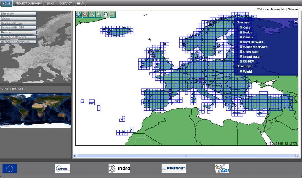
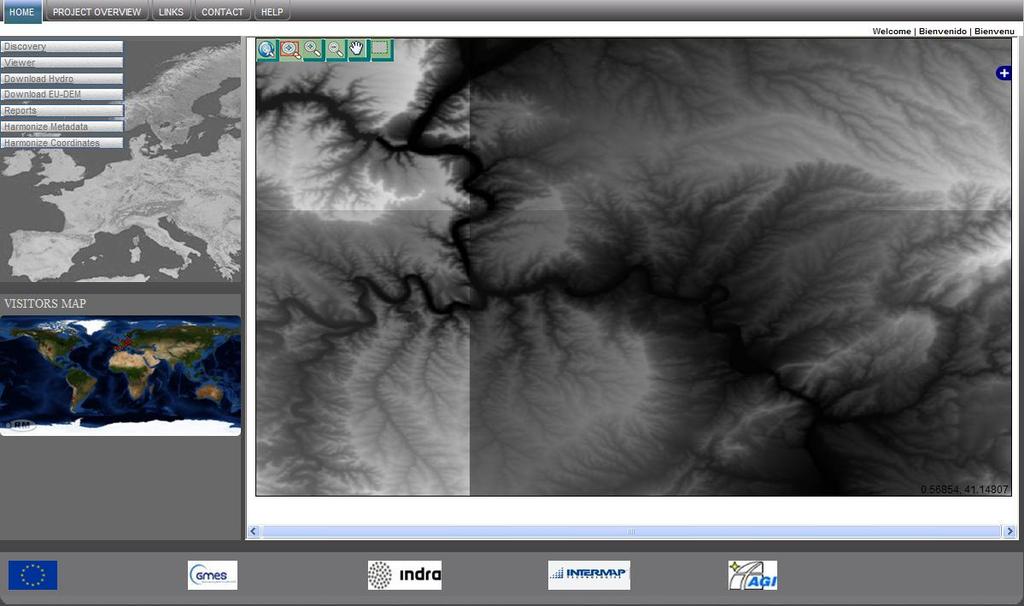
2 CONTENT 01 Overview 02 EU-DEM 03 Hydrography 04 Production Coordination 05 Access System 2
3 OVERVIEW GMES Global Monitoring for Environment and Security Preparatory Actions HR Sealing Layer Urban Atlas GSGRDA GSGRDA Start: Dec 2009 End: Dec 2012 Applications: EU-DEM: LMCS, ERCS, Flood prevention, etc Hydrography: WISE, WFD reporting, EEA is acting as main prescriptor and user contact point as well as it is tightly involved in the on-going evaluation. 3
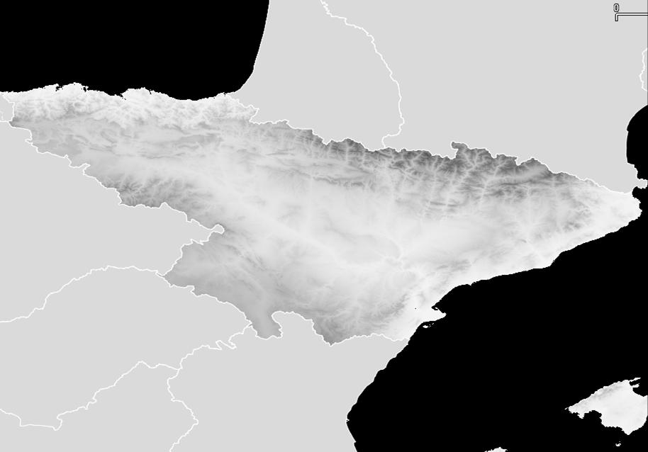
4 EU-DEM Requirements 30m pixel +/- 7m height accuracy Fulfilling LMCS and ERCS Solution ASTER GDEM based SRTM for accuracy improvement -> Manual Edition Access to NEXTMap 1 arcsec for LMCS Access to NEXTMap 0,15 arcsec for ERCS Ownership of EU-DEM by EC 4
5 Service Definition Product Coverage Data Sources Resolution Vertical Accuracy Access LMCS EU-DEM EEA38 SRTM & ASTER NEXTMap Enhanced EU-DEM 20 Western EU countries NEXTMap Europe DTM 1 arc-second +/- 7.0 metres RMSE 1 arc-second +/- 1.0 metre (resampled from RMSE 0.15 arc-second) Unrestricted Restricted as per End User License Agreement ERCS NEXTMap Europe DTM Core Product 20 Western EU countries NEXTMap Europe 0.15 arc-second +/- 1.0 metre RMSE Restricted as per End User License Agreement 5


 Total of")
6 Production Methodology - Intermap 1. Data Preparation Aligning input data (NEXTMap, GDEM, ASTER, Landsat, ) Pilot area definition (2 x 2 ) Total of 1,165 tiles (1 ) SRTM 60 N GDEM NEXTMap 6

7 Production Methodology - Intermap 2. Process Development ASTER GDEM void masking Horizontal/Vertical shift correction FITS & Interpolator Algorithm port Fusion & water burn-in tool User & test documentation, edit rules, work instructions Training 7

8 Production Methodology - Intermap 3. Data Processing Production of un-edited EU-DEM Running developed tools for: Horizontal & vertical shift correction in ASTER GDEM Void filling/interpolation Weighted averaging 8


9 Production Methodology - Intermap 4. Data Editing & Harmonization Edge matching of EU-DEM & NEXTMap Enhanced EU-DEM Editing of blunders and water features in 3D stereo environment using QCed water layer provided by AGI GDEM NEXTMap ASTER mole runs 9

10 Production Methodology - Intermap 5. Final Data QC & Validation Vertical accuracy checks using available reference data (LiDAR, VCPs, etc.) Tiles review for adherence to product specifications Validate adherence to edit rules Reports 10
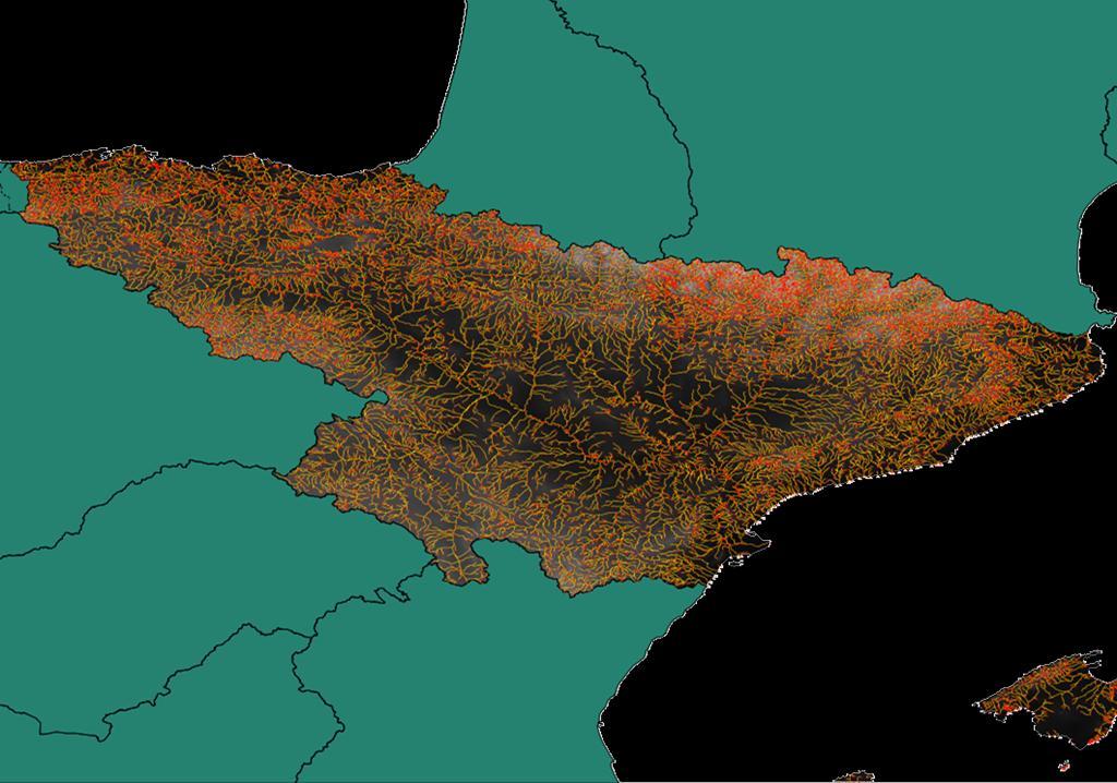
11 Hydrography Requirements 1: scale Support for WISE applications Relation with ECRINS and ERM (INSPIRE) Solution Extraction of water bodies from IMAGE2006 Delineation of river lines on top of IMAGE2006 Reference material: ECRINS, Topographic maps, Google Earth, etc Generation of river network topology Integration with EU-DEM 11
12 Production Methodology HYDROGRAPHY (AGI) 1. Data Preparation Download IMAGE 2006/2009 Transformation to production-ready CRS and formats Creation of satellite imagery database and spatial index for easy search and preview of the available scenes Selection of the best available imagery for production: Early-to-mid-summer season Cloud-free coverage (<5%) Mosaicking of identified image batches (same date) Selecting replacements for patching areas not suitable for production (clouds/shadows, snow/ice, etc.) Acquisition of the ancillary datasets: GEONAMES Euro-Regional Map (1:150,000) National datasets (if available) 12

13 INITIAL GMES SERVICE for GEOSPATIAL REFERENCE 2. Process DATA ACCESS Development PRODUCTION OF HYDRO- DATASETS: - Polygons extracted from IMAGE 2006/ Lines delineated from satellite images - Points generated from network topology QA/QC PROCEDURES: - Internal QA/QC ISO 9001: % of processed images inspected Iterative processing to reach compliance to specs. 20% of all vector objects checked for each unit - External QA/QC by project partners 100% large hydro-polygons checked during the data integration process TECHNOLOGY: - Use of FOSS GIS tools GRASS GIS scripts for production of polygons PostgreSQL/PostGIS for database storage OGC services (WMS) for on-line data publishing 13


14 3. Data Processing INITIAL GMES SERVICE for GEOSPATIAL REFERENCE DATA ACCESS IMAGE 2006 REFLECTANCE NDVI WATER 14

15 INITIAL 4. GMES Data SERVICE Editing for & GEOSPATIAL Harmonization REFERENCE DATA ACCESS Accuracy up to 10 m Automatic cleanup of coverages 100% inspection for artefacts QC 20% of all objects 15
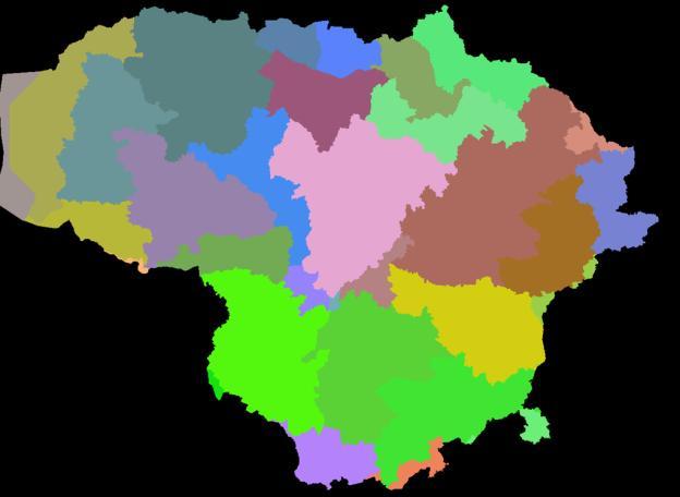
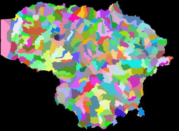
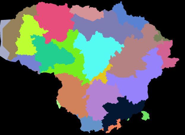
16 Watersheds and sub-watersheds 16
17 Production Coordination Requirements Integration of water bodies with EUDEM Assignment of node heights based on EU-DEM Ensuring rivers flowing down for river polygons Solution Production workflow 17

18 EU-HYDRO / EU-DEM overlay PRODUCTION SEQUENCE 18

19 EU-HYDRO / EU-DEM overlay 19

20 EU-HYDRO / EU-DEM overlay 20
21 Access System Requirements Services based on open standards Fulfilling INSPIRE requirements Client showcase Solution Final hosting site still to be defined Metadata schema implementing INSPIRE rules for every theme Base services implemented with open source software Metadata: GeoNetwork WMS/WCS/WFS: GeoServer/GeoWebCache 21
22 Project Status Hydrographic layer content already defined: tables, attributes, metadata, etc. EUDEM layer features already defined Two Prototype areas produced for testing purposes Production nearly finished for water bodies (more than 98% tiles already Qced and ready for EU-DEM burning ) More than 50% of EUDEM produced Hydrographic layers already started (first river basin on QC) In assessment conformance to 1: scale in term of contents Access System and Client Showcase already developed. 22
23 Project Plan EU-DEM planned to be finished in M23 Hydrographic layers to be finished in M32 23
24 24
25 25

26 26

27 27

28 28

29 Antonio Garzón Project Manager Mar Egeo, 4. Polígono Industrial nº San Fernando de Henares Madrid España T agarzon@indra.es 29
NEXTMap World 10 Digital Elevation Model
 NEXTMap Digital Elevation Model Intermap Technologies, Inc. 8310 South Valley Highway, Suite 400 Englewood, CO 80112 10012015 NEXTMap (top) provides an improvement in vertical accuracy and brings out greater
VALIDATION OF A NEW 30 METER GROUND SAMPLED GLOBAL DEM USING ICESAT LIDARA ELEVATION REFERENCE DATA
 VALIDATION OF A NEW 30 METER GROUND SAMPLED GLOBAL DEM USING ICESAT LIDARA ELEVATION REFERENCE DATA M. Lorraine Tighe Director, Geospatial Solutions Intermap Session: Photogrammetry & Image Processing
NEXTMap World 30 Digital Surface Model
 NEXTMap World 30 Digital Surface Model Intermap Technologies, Inc. 8310 South Valley Highway, Suite 400 Englewood, CO 80112 083013v3 NEXTMap World 30 (top) provides an improvement in vertical accuracy
Improving wide-area DEMs through data fusion - chances and limits
 Improving wide-area DEMs through data fusion - chances and limits Konrad Schindler Photogrammetry and Remote Sensing, ETH Zürich How to get a DEM for your job? for small projects (or rich people) contract
TerrainOnDemand ArcGIS
 TM TerrainOnDemand ArcGIS Connect to Intermap Technologies NEXTMap data within: ArcGIS Desktop 9.3.1 and Above AGDQS0312 TerrainOnDemand ArcGIS 2 TerrainOnDemand ArcGIS Table of Contents 1. Introduction...1
Towards a pan-european infrastructure for marine and ocean data management + Importance of standards
 Towards a pan-european infrastructure for marine and ocean data management + Importance of standards By Dick M.A. Schaap Technical Coordinator SeaDataNet & Coordinator EMODnet Bathymetry Hydrography Day,
Downloading and importing DEM data from ASTER or SRTM (~30m resolution) into ArcMap
 into ArcMap") Downloading and importing DEM data from ASTER or SRTM (~30m resolution) into ArcMap Step 1: ASTER or SRTM? There has been some concerns about the quality of ASTER data, nicely exemplified in the following
Downloading and importing DEM data from ASTER or SRTM (~30m resolution) into ArcMap Step 1: ASTER or SRTM? There has been some concerns about the quality of ASTER data, nicely exemplified in the following
Image Services for Elevation Data
 Image Services for Elevation Data Peter Becker Need for Elevation Using Image Services for Elevation Data sources Creating Elevation Service Requirement: GIS and Imagery, Integrated and Accessible Field
European Location Framework (ELF) acting as a facilitator implementing INSPIRE
 acting as a facilitator implementing INSPIRE") www.eurogeographics.org European Location Framework (ELF) acting as a facilitator implementing INSPIRE Saulius Urbanas, Mick Cory (EuroGeographics) 29 October 2016 Copyright 2013 EuroGeographics EuroGeographics
www.eurogeographics.org European Location Framework (ELF) acting as a facilitator implementing INSPIRE Saulius Urbanas, Mick Cory (EuroGeographics) 29 October 2016 Copyright 2013 EuroGeographics EuroGeographics
SeaDataNet, Pan-European infrastructure for marine and ocean data management + EMODNET Bathymetry
 SeaDataNet, Pan-European infrastructure for marine and ocean data management + EMODNET Bathymetry By Dick M.A. Schaap Technical Coordinator SeaDataNet & Coordinator EMODNet Bathymetry Limassol Cyprus,
Server Usage & Third-Party Viewers
 Server Usage & Third-Party Viewers October 2016 HiPER LOOK Version 1.4.16.0 Copyright 2015 PIXIA Corp. All Rights Reserved. Table of Contents HiPER LOOK Server Introduction... 2 Google Earth... 2 Installation...2
Basic Principles of MedWIS - WISE interoperability
 Co-ordination committee seminar of the national focal points Basic Principles of MedWIS - WISE interoperability Eduardo García ADASA Sistemas Nice - France Agenda WISE vs MedWIS WISE WISE DS WISE vs WISE
Stellenbosch University Digital Elevation Model (SUDEM) 2016 Edition (v16.01)
 2016 Edition (v16.01)") Stellenbosch University Digital Elevation Model (SUDEM) 2016 Edition (v16.01) ii Stellenbosch University Digital Elevation Model (SUDEM) 2016 Edition (v16.01) Adriaan van Niekerk Centre for Geographical
Stellenbosch University Digital Elevation Model (SUDEM) 2016 Edition (v16.01) ii Stellenbosch University Digital Elevation Model (SUDEM) 2016 Edition (v16.01) Adriaan van Niekerk Centre for Geographical
SEIS. (Shared Environmental Information System) From concept to information services
 From concept to information services") SEIS (Shared Environmental Information System) From concept to information services Stefan Jensen EEA supported by Sheila Cryan and Jon Maidens GSDI 11, Rotterdam 19.6.2009 What is SEIS is about... Sharing
SEIS (Shared Environmental Information System) From concept to information services Stefan Jensen EEA supported by Sheila Cryan and Jon Maidens GSDI 11, Rotterdam 19.6.2009 What is SEIS is about... Sharing
The Feature Analyst Extension for ERDAS IMAGINE
 The Feature Analyst Extension for ERDAS IMAGINE Automated Feature Extraction Software for GIS Database Maintenance We put the information in GIS SM A Visual Learning Systems, Inc. White Paper September
Lecture 4: Digital Elevation Models
 Lecture 4: Digital Elevation Models GEOG413/613 Dr. Anthony Jjumba 1 Digital Terrain Modeling Terms: DEM, DTM, DTEM, DSM, DHM not synonyms. The concepts they illustrate are different Digital Terrain Modeling
Managing Lidar and Photogrammetric Point Clouds. Lindsay Weitz Cody Benkelman
 and Photogrammetric Point Clouds Lindsay Weitz Cody Benkelman Presentation Context What is lidar, and how does it work? Not this presentation! What can you do with lidar in ArcGIS? What does Esri recommend
ERDAS IMAGINE THE WORLD S MOST WIDELY-USED REMOTE SENSING SOFTWARE PACKAGE
 PRODUCT BROCHURE ERDAS IMAGINE THE WORLD S MOST WIDELY-USED REMOTE SENSING SOFTWARE PACKAGE 1 ERDAS IMAGINE The world s most widely-used remote sensing software package 2 ERDAS IMAGINE The world s most
Imagery and Raster Data in ArcGIS. Abhilash and Abhijit
 Imagery and Raster Data in ArcGIS Abhilash and Abhijit Agenda Imagery in ArcGIS Mosaic datasets Raster processing ArcGIS is a Comprehensive Imagery System Integrating All Types, Sources, and Sensor Models
ArcGIS for Server Imagery Update. Cody A. Benkelman Technical Product Manager, Imagery
 ArcGIS for Server Imagery Update Cody A. Benkelman Technical Product Manager, Imagery Outline Mosaic dataset Management and dissemination of imagery - Dynamic image services, Tiled Cache Visualization
TrueOrtho with 3D Feature Extraction
 TrueOrtho with 3D Feature Extraction PCI Geomatics has entered into a partnership with IAVO to distribute its 3D Feature Extraction (3DFE) software. This software package compliments the TrueOrtho workflow
Introduction to INSPIRE. Network Services
 Introduction to INSPIRE. Network Services European Commission Joint Research Centre Institute for Environment and Sustainability Digital Earth and Reference Data Unit www.jrc.ec.europa.eu Serving society
An Introduction to Lidar & Forestry May 2013
 An Introduction to Lidar & Forestry May 2013 Introduction to Lidar & Forestry Lidar technology Derivatives from point clouds Applied to forestry Publish & Share Futures Lidar Light Detection And Ranging
WFD Reporting Guidance 2016
 COMMON IMPLEMENTATION STRATEGY FOR THE WATER FRAMEWORK DIRECTIVE AND THE FLOODS DIRECTIVE WFD Reporting Guidance 2016 Annex 6 Final Version 6.0.6 Document endorsed by EU Water Directors at their meeting
Onshore remote sensing applications: an overview
 Onshore remote sensing applications: an overview Dr. Richard Teeuw and Dr. Malcolm Whitworth School of Earth and Environmental Sciences, University of Portsmouth, UK. Overview Presentation on the applications
Web apps for INSPIRE: the ELISE Energy pilot example
 Web apps for INSPIRE: the ELISE Energy pilot example 6 September 2017 Authors: Daniele Francioli Giacomo Martirano Maria Teresa Borzacchiello Francesco Pignatelli Outline Overview of the ELISE Energy Pilot
EarthLookCZ as Czech way to GMES
 EarthLookCZ as Czech way to GMES Karel Charvat 1 and Petr Horak 1 1 WirelessInfo, Czech Republic, charvat@wirelessinfo.cz Abstract Global Monitoring for Environment and Security is one of 4 ranges of solutions
PROJECT REPORT. Allegany County Acquisition and Classification for FEMA Region 3 FY 12 VA LiDAR. USGS Contract: G12PD00040.
 PROJECT REPORT For the Allegany County Acquisition and Classification for FEMA Region 3 FY 12 VA LiDAR USGS Contract: G12PD00040 Prepared for: United States Geological Survey & Federal Emergency Management
Esri International User Conference. July San Diego Convention Center. Lidar Solutions. Clayton Crawford
 Esri International User Conference July 23 27 San Diego Convention Center Lidar Solutions Clayton Crawford Outline Data structures, tools, and workflows Assessing lidar point coverage and sample density
ELIMINATION OF THE OUTLIERS FROM ASTER GDEM DATA
 ELMNATON OF THE OUTLERS FROM ASTER GDEM DATA Hossein Arefi and Peter Reinartz Remote Sensing Technology nstitute German Aerospace Center (DLR) 82234 Wessling, Germany hossein.arefi@dlr.de, peter.reinartz@dlr.de
Technical Considerations and Best Practices in Imagery and LiDAR Project Procurement
 Technical Considerations and Best Practices in Imagery and LiDAR Project Procurement Presented to the 2014 WV GIS Conference By Brad Arshat, CP, EIT Date: June 4, 2014 Project Accuracy A critical decision
An Introduction to Using Lidar with ArcGIS and 3D Analyst
 FedGIS Conference February 24 25, 2016 Washington, DC An Introduction to Using Lidar with ArcGIS and 3D Analyst Jim Michel Outline Lidar Intro Lidar Management Las files Laz, zlas, conversion tools Las
MY DEWETRA IPAFLOODS REPORT
 Grant Contract N. ECHO/SUB/2014/692292 Programme for Prevention, Preparedness and Response to Floods in the Western Balkans and Turkey IPA FLOODS Capacity Building Activities 2016 MY DEWETRA IPAFLOODS
Image Management in ArcGIS. Vinay Viswambharan
 Image Management in ArcGIS Vinay Viswambharan Topics covered Primary Imagery Management Information Model - Mosaic Dataset Sharing Imagery using mosaic datasets/image services. Image Services and Cloud
Alberta-wide ALOS DSM "ALOS_DSM15.tif", "ALOS_DSM15_c6.tif"
 Alberta-wide ALOS DSM "ALOS_DSM15.tif", "ALOS_DSM15_c6.tif" Alberta Biodiversity Monitoring Institute Geospatial Centre May 2017 Contents 1. Overview... 2 1.1. Summary... 2 1.2 Description... 2 1.3 Credits...
ENVI THE PREMIER SOFTWARE FOR EXTRACTING INFORMATION FROM GEOSPATIAL DATA
 ENVI THE PREMIER SOFTWARE FOR EXTRACTING INFORMATION FROM GEOSPATIAL DATA HarrisGeospatial.com BENEFITS Use one solution to work with all your data types Access a complete suite of analysis tools Customize
Drone2Map for ArcGIS: Bring Drone Imagery into ArcGIS
 Drone2Map for ArcGIS: Bring Drone Imagery into ArcGIS Mike Sweeney 1 Drone2Map for ArcGIS Turn Drones into Enterprise Productivity Tools ArcGIS Drone2Map for ArcGIS Create 2D and 3D products from raw drone
What s New in Imagery in ArcGIS. Presented by: Christopher Patterson Date: September 12, 2017
 What s New in Imagery in ArcGIS Presented by: Christopher Patterson Date: September 12, 2017 Agenda Ortho Mapping Elevation extraction Drone2Map Raster Analytics ArcGIS is a Comprehensive Imagery System
EMODnet Bathymetry. By Dick M.A. Schaap Coordinator. 20 th April 2016, EGU 2016, Vienna - Austria
 EMODnet Bathymetry By Dick M.A. Schaap Coordinator 20 th April 2016, EGU 2016, Vienna - Austria EMODNet Bathymetry Ongoing in 3 consecutive projects since 2009 with expanding consortium (at present >30
ERDAS IMAGINE THE WORLD S MOST WIDELY-USED REMOTE SENSING SOFTWARE PACKAGE
 PRODUCT BROCHURE ERDAS IMAGINE THE WORLD S MOST WIDELY-USED REMOTE SENSING SOFTWARE PACKAGE 1 ERDAS IMAGINE The world s most widely-used remote sensing software package 2 ERDAS IMAGINE The Theworld s world
Developing a Free and Open Source Software based Spatial Data Infrastructure. Jeroen Ticheler
 Developing a Free and Open Source Software based Spatial Data Infrastructure Jeroen Ticheler 1 License This work is licensed under the Creative Commons Attribution-NonCommercial-ShareAlike 2.5 License.
Towards Automating Spatial Data Quality Evaluation in the Finnish National Topographic Database
 Towards Automating Spatial Data Quality Evaluation in the Finnish National Topographic Database SDQ 2018: International Workshop on Spatial Data Quality Wednesday 7th February 2018 Nils Mesterton and Riikka
Raster Analysis and Image Processing in ArcGIS Enterprise
 Raster Analysis and Image Processing in ArcGIS Enterprise Vinay Viswambharan, Jie Zhang Overview Patterns of use - Introduction to image processing and analysis in ArcGIS - Client/Server side processing
The European Soil Data Centre, the European Soil Bureau Network and INSPIRE Data Specifications for Soil
 The European Soil Data Centre, the European Soil Bureau Network and INSPIRE Data Specifications for Soil Marc Van Liedekerke, Panos Panagos, Luca Montanarella Land Management and Natural Harzards Unit
A Method to Create a Single Photon LiDAR based Hydro-flattened DEM
 A Method to Create a Single Photon LiDAR based Hydro-flattened DEM Sagar Deshpande 1 and Alper Yilmaz 2 1 Surveying Engineering, Ferris State University 2 Department of Civil, Environmental, and Geodetic
Sharing geographic data across the GEF IW Portfolio: IW:LEARN Web-based GIS
 1 Sharing geographic data across the GEF IW Portfolio: IW:LEARN Web-based GIS 16-22 March 2009 Sean Khan (Project Manager) sean.khan@unep.org Dr. Richard Cooper (Regional Coordinator) richard@iwlearn.org
NATIONWIDE POINT CLOUDS AND 3D GEO- INFORMATION: CREATION AND MAINTENANCE GEORGE VOSSELMAN
 NATIONWIDE POINT CLOUDS AND 3D GEO- INFORMATION: CREATION AND MAINTENANCE GEORGE VOSSELMAN OVERVIEW National point clouds Airborne laser scanning in the Netherlands Quality control Developments in lidar
Lidar and GIS: Applications and Examples. Dan Hedges Clayton Crawford
 Lidar and GIS: Applications and Examples Dan Hedges Clayton Crawford Outline Data structures, tools, and workflows Assessing lidar point coverage and sample density Creating raster DEMs and DSMs Data area
Distributed Image Analysis Using the ArcGIS API for Python
 Distributed Image Analysis Using the ArcGIS API for Python Jie Zhang, Elizabeth Graham The ArcGIS Platform Is a Comprehensive Imagery Platform System of Engagement System of Insight Professional Imagery
Daniela Cristiana Docan I 6th Sept. I INSPIRE Conference 2017, Strasbourg. EEA Data Quality Management supporting INSPIRE implementation
 Daniela Cristiana Docan I 6th Sept. I INSPIRE Conference 2017, Strasbourg EEA Data Quality Management supporting INSPIRE implementation Data Quality in INSPIRE INSPIRE Technical Guidelines use ISO 19157
INSPIRE overview and possible applications for IED and E-PRTR e- Reporting Alexander Kotsev
 INSPIRE overview and possible applications for IED and E-PRTR e- Reporting Alexander Kotsev www.jrc.ec.europa.eu Serving society Stimulating innovation Supporting legislation The European data puzzle 24
Sentinel-1 Toolbox. Offset Tracking Tutorial Issued August Jun Lu Luis Veci
 Sentinel-1 Toolbox Offset Tracking Tutorial Issued August 2016 Jun Lu Luis Veci Copyright 2016 Array Systems Computing Inc. http://www.array.ca/ http://step.esa.int Offset Tracking Tutorial The goal of
Testing - an essential aspect of establishing an SDI
 Testing - an essential aspect of establishing an SDI Clemens Portele, Anders Östman, Michael Koutroumpas, Xin He, Janne Kovanen, Markus Schneider, Andriani Skopeliti INSPIRE Conference 2011 30 June 2011
INTEGRATION OF TREE DATABASE DERIVED FROM SATELLITE IMAGERY AND LIDAR POINT CLOUD DATA
 INTEGRATION OF TREE DATABASE DERIVED FROM SATELLITE IMAGERY AND LIDAR POINT CLOUD DATA S. C. Liew 1, X. Huang 1, E. S. Lin 2, C. Shi 1, A. T. K. Yee 2, A. Tandon 2 1 Centre for Remote Imaging, Sensing
THE USE OF MULTIPLE DATA SOURCES IN THE PROCESS OF TOPOGRAPHIC MAPS UPDATING
 THE USE OF MULTIPLE DATA SOURCES IN THE PROCESS OF TOPOGRAPHIC MAPS UPDATING A.Cantemir a,e*, A. Visan b, N. Parvulescu c, M.Dogaru d,e a Dep. Of Cartography and Photogrammetry, National Centre of Cartography,
Use case 1 INSPIRE harmonization of existing Energy Performance Certificate datasets Phase 1
 The European Commission s science and knowledge service Joint Research Centre Use case 1 INSPIRE harmonization of existing Energy Performance Certificate datasets Phase 1 Giacomo Martirano (external consultant)
BRIEF EXAMPLES OF PRACTICAL USES OF LIDAR
 BRIEF EXAMPLES OF PRACTICAL USES OF LIDAR PURDUE ROAD SCHOOL - 3/9/2016 CHRIS MORSE USDA-NRCS, STATE GIS COORDINATOR LIDAR/DEM SOURCE DATES LiDAR and its derivatives (DEMs) have a collection date for data
Managing Imagery and Raster Data using Mosaic Datasets
 Esri European User Conference October 15-17, 2012 Oslo, Norway Hosted by Esri Official Distributor Managing Imagery and Raster Data using Mosaic Datasets Peter Becker ArcGIS is a Comprehensive Imagery
Raster Analytics in Image Server: An Introduction. Mike Muller
 Raster Analytics in Image Server: An Introduction Mike Muller Introduction and Context The ArcGIS Platform and ArcGIS Image Server enable access to imagery and analysis through a wide range of integrated
What s New in Imagery in ArcGIS. Presented by: Christopher Patterson Date: October 18, 2017
 What s New in Imagery in ArcGIS Presented by: Christopher Patterson Date: October 18, 2017 Imagery in ArcGIS Advancing 2010 Stretch, Extract Bands Clip, Mask Reproject, Orthorectify, Pan Sharpen Vegetation
LiDAR data overview. Dr. Keiko Saito Global Facility for Disaster Reduction and Recovery (GFDRR)
") LiDAR data overview Dr. Keiko Saito Global Facility for Disaster Reduction and Recovery (GFDRR) LiDAR (Light Detecting And Ranging) 3D height profile Laser emitted from sensor onboard aircraft to measure
LiDAR data overview Dr. Keiko Saito Global Facility for Disaster Reduction and Recovery (GFDRR) LiDAR (Light Detecting And Ranging) 3D height profile Laser emitted from sensor onboard aircraft to measure
GOVERNMENT GAZETTE REPUBLIC OF NAMIBIA
 GOVERNMENT GAZETTE OF THE REPUBLIC OF NAMIBIA N$7.20 WINDHOEK - 7 October 2016 No. 6145 CONTENTS Page GENERAL NOTICE No. 406 Namibia Statistics Agency: Data quality standard for the purchase, capture,
LIDAR MAPPING FACT SHEET
 1. LIDAR THEORY What is lidar? Lidar is an acronym for light detection and ranging. In the mapping industry, this term is used to describe an airborne laser profiling system that produces location and
Data Acquisition Through the Geospatial Products and Services Contract (GPSC)
") Data Acquisition Through the Geospatial Products and Services Contract (GPSC) Kathryn Yoder GPSC COTR ESRI, 2015 U.S. Department of the Interior U.S. Geological Survey Overview Background Info Acquisition
Data Acquisition Through the Geospatial Products and Services Contract (GPSC) Kathryn Yoder GPSC COTR ESRI, 2015 U.S. Department of the Interior U.S. Geological Survey Overview Background Info Acquisition
Files Used in this Tutorial
 RPC Orthorectification Tutorial In this tutorial, you will use ground control points (GCPs), an orthorectified reference image, and a digital elevation model (DEM) to orthorectify an OrbView-3 scene that
A geoinformatics-based approach to the distribution and processing of integrated LiDAR and imagery data to enhance 3D earth systems research
 A geoinformatics-based approach to the distribution and processing of integrated LiDAR and imagery data to enhance 3D earth systems research Christopher J. Crosby, J Ramón Arrowsmith, Jeffrey Connor, Gilead
Alaska Department of Transportation Roads to Resources Project LiDAR & Imagery Quality Assurance Report Juneau Access South Corridor
 Alaska Department of Transportation Roads to Resources Project LiDAR & Imagery Quality Assurance Report Juneau Access South Corridor Written by Rick Guritz Alaska Satellite Facility Nov. 24, 2015 Contents
Use of open-source GIS for the preprocessing of distributed hydrological. models
 Use of open-source GIS for the preprocessing of distributed hydrological models F. Branger, I. Braud, S. Debionne, J. Dehotin, S. Jankowfsky, O. Vannier, P. Viallet Who are we? Cemagref Hydrology-Hydraulics
Esri Best Practices: QA/QC For Your Geodata. Michelle Johnson & Chandan Banerjee
 Esri Best Practices: QA/QC For Your Geodata Michelle Johnson & Chandan Banerjee Overview Understand Document Implement Understanding QA/QC Understanding QA/QC Fit For Use - support your GIS applications?
Files Used in this Tutorial
 RPC Orthorectification Tutorial In this tutorial, you will use ground control points (GCPs), an orthorectified reference image, and a digital elevation model (DEM) to orthorectify an OrbView-3 scene that
New Features in SOCET SET Stewart Walker, San Diego, USA
 New Features in SOCET SET Stewart Walker, San Diego, USA 2610083107A EXPORT CONTROL DATA. This presentation is approved for export as of 31 August 2007. The actual product and its technical information
ENVI. Get the Information You Need from Imagery.
 Visual Information Solutions ENVI. Get the Information You Need from Imagery. ENVI is the premier software solution to quickly, easily, and accurately extract information from geospatial imagery. Easy
High Resolution Digital Elevation Model (HRDEM) CanElevation Series Product Specifications. Edition
 CanElevation Series Product Specifications. Edition") High Resolution Digital Elevation Model (HRDEM) CanElevation Series Product Specifications Edition 1.1 2017-08-17 Government of Canada Natural Resources Canada Telephone: +01-819-564-4857 / 1-800-661-2638
High Resolution Digital Elevation Model (HRDEM) CanElevation Series Product Specifications Edition 1.1 2017-08-17 Government of Canada Natural Resources Canada Telephone: +01-819-564-4857 / 1-800-661-2638
Webservice-energy.org GEO Community Portal & Spatial Data Infrastructure for Energy
 Webservice-energy.org GEO Community Portal & Spatial Data Infrastructure for Energy Lionel Menard / Oct. 23 2017 Centre Observation, Impacts, Energy Research activities: Use of Earth observation data (Models,
Towards a pan-european infrastructure for marine and ocean data management + Importance of standards
 Towards a pan-european infrastructure for marine and ocean data management + Importance of standards By Dick M.A. Schaap MARIS Technical Coordinator SeaDataNet & ODIP Coordinator EMODnet Bathymetry Münster
Watershed Modeling National Streamflow Statistics Program (NSS) Interface
 Interface") v. 9.1 WMS 9.1 Tutorial Watershed Modeling National Streamflow Statistics Program (NSS) Interface Use the NSS interface to estimate peak flows at different recurrence intervals Objectives Delineate a basin
v. 9.1 WMS 9.1 Tutorial Watershed Modeling National Streamflow Statistics Program (NSS) Interface Use the NSS interface to estimate peak flows at different recurrence intervals Objectives Delineate a basin
EarthCube and Cyberinfrastructure for the Earth Sciences: Lessons and Perspective from OpenTopography
 EarthCube and Cyberinfrastructure for the Earth Sciences: Lessons and Perspective from OpenTopography Christopher Crosby, San Diego Supercomputer Center J Ramon Arrowsmith, Arizona State University Chaitan
QUESTIONS & ANSWERS FOR. ORTHOPHOTO & LiDAR AOT
 QUESTIONS & ANSWERS FOR ORTHOPHOTO & LiDAR AOT Question# 1. Section 3.2 Will the imagery be clipped to the 1000m boundary? If so, what color will be used for null valued pixels? Yes, the imagery will be
Feature Extraction from Imagery & Lidar. Kurt Schwoppe, Esri Mark Romero, Esri Gregory Bacon, Fairfax County
 Feature Extraction from & Lidar Kurt Schwoppe, Esri Mark Romero, Esri Gregory Bacon, Fairfax County Today s Speakers Image Processing Experts and Good Colleagues Kurt Schwoppe Industry Lead Esri Mark Romero
Workflows for Managing and Serving Elevation (and Lidar) Data. Cody Benkelman
 Data. Cody Benkelman") Workflows for Managing and Serving Elevation (and Lidar) Data Cody Benkelman Outline Usage Modes Data Management - Architecture - Workflow Automation for Repeatability & Scalability A few options re: Cloud,
Workflows for Managing and Serving Elevation (and Lidar) Data Cody Benkelman Outline Usage Modes Data Management - Architecture - Workflow Automation for Repeatability & Scalability A few options re: Cloud,
Landslide Damage on Chemin de Fer de la Mure near Grenoble,
 Contents 1 What is the INSPIRE directive, and why is it important?... 3 1.1 What is the aim of this document?... 4 1.2 Who will this document be useful to?... 4 2 An overview of INSPIRE specifications...
The ArcGIS Platform for Managing, Processing, and Sharing UAV Data
 The ArcGIS Platform for Managing, Processing, and Sharing UAV Data Cody Benkelman, Technical Product Manager - Imagery David Gadsden, Nonprofit Program Manager Esri Advancing GIS Strong and Growing..Serving
Using Databases for 3D Data Management From Point Cloud to City Model
 Using Databases for 3D Data Management From Point Cloud to City Model Hans Viehmann 1 1 ORACLE Corporation, Server Technologies Division, Hamburg, Germany, hans.viehmann@oracle.com Abstract With the cost
Hamilton County Enhances GIS Base Mapping with 1-foot Contours
 Hamilton County Enhances GIS Base Mapping with 1-foot Contours Presented by Larry Stout, Hamilton County GIS Manager Brad Fugate, Woolpert Inc. Today s Presentation Hamilton County s 2004 Base Mapping
Quality Control Concepts for LiDAR
 Quality Control Concepts for LiDAR January 24, 2012 Engineering Architecture Design-Build Surveying GeoSpatial Solutions Presentation Objectives Offer realistic and constructive advice for LiDAR project
Hands on Exercise Using ecognition Developer
 1 Hands on Exercise Using ecognition Developer 2 Hands on Exercise Using ecognition Developer Hands on Exercise Using ecognition Developer Go the Windows Start menu and Click Start > All Programs> ecognition
Managing and Serving Elevation and Lidar Data. Cody Benkelman UC 2018
 Managing and Serving Elevation and Lidar Data Cody Benkelman UC 2018 Outline Usage Modes Data Management - Architecture - Workflow Automation for Repeatability & Scalability A few options Usage Modes of
CHARACTERISTICS OF WORLDWIDE AND NEARLY WORLDWIDE HEIGHT MODELS
 CHARACTERISTICS OF WORLDWIDE AND NEARLY WORLDWIDE HEIGHT MODELS Karsten Jacobsen Leibniz University Hannover, Institute of Photogrammetry and Geoinformation, Germany; jacobsen@ipi.uni-hannover.de ISPRS
 http://ipafloods.mydewetra.org 1 My Dewetra IPA FLOODS FLOOD RISK Information System Support the Approximation of EU Floods Directive Compliancy with International standards (INSPIRE, OGC) and protocols
3D GAMING AND CARTOGRAPHY - DESIGN CONSIDERATIONS FOR GAME-BASED GENERATION OF VIRTUAL TERRAIN ENVIRONMENTS
 3D GAMING AND CARTOGRAPHY - DESIGN CONSIDERATIONS FOR GAME-BASED GENERATION OF VIRTUAL TERRAIN ENVIRONMENTS Abstract Oleggini L. oleggini@karto.baug.ethz.ch Nova S. nova@karto.baug.ethz.ch Hurni L. hurni@karto.baug.ethz.ch
Introduction to the Image Analyst Extension. Mike Muller, Vinay Viswambharan
 Introduction to the Image Analyst Extension Mike Muller, Vinay Viswambharan What is the Image Analyst Extension? The Image Analyst Extension (IA) is an application extension which extends ArcGIS Pro with
Image Management and Dissemination. Peter Becker
 Image Management and Dissemination Peter Becker OUTLINE Requirements Intro to Mosaic Datasets Workflows & Demo Dynamic Mosaicking, On-the-fly processing Properties Differentiator Raster Catalog, ISDef,
Contents of Lecture. Surface (Terrain) Data Models. Terrain Surface Representation. Sampling in Surface Model DEM
 Data Models. Terrain Surface Representation. Sampling in Surface Model DEM") Lecture 13: Advanced Data Models: Terrain mapping and Analysis Contents of Lecture Surface Data Models DEM GRID Model TIN Model Visibility Analysis Geography 373 Spring, 2006 Changjoo Kim 11/29/2006 1
Lecture 13: Advanced Data Models: Terrain mapping and Analysis Contents of Lecture Surface Data Models DEM GRID Model TIN Model Visibility Analysis Geography 373 Spring, 2006 Changjoo Kim 11/29/2006 1
Setting up the Ihlet Social Cadastre
 Setting up the Ihlet Social Cadastre Ihlet KHT Dr. Attila Molnár, GI consultant Bela Jarolics Rome, Italy TOPICS Goal of the project Architecture Database Solution Standards, communication Metadata Security
Accuracy Characteristics of ALOS World 3D 30m DSM
 Accuracy Characteristics of ALOS World 3D 30m DSM Karsten Jacobsen Leibniz University Hannover, Germany Institute of Photogrammetry and Geoinformation jacobsen@ipi.uni-hannover.de 1 Introduction Japanese
Marine and Coastal Data Services in the Cloud. Richard Rombouts - Snowflake Software Ltd. & Keiran Millard SeaZone Solutions Ltd.
 Marine and Coastal Data Services in the Cloud Richard Rombouts - Snowflake Software Ltd. & Keiran Millard SeaZone Solutions Ltd. Marine Geospatial Data Inspired Marine Data? SeaZone HydroSpatial Global
CO-REGISTERING AND NORMALIZING STEREO-BASED ELEVATION DATA TO SUPPORT BUILDING DETECTION IN VHR IMAGES
 CO-REGISTERING AND NORMALIZING STEREO-BASED ELEVATION DATA TO SUPPORT BUILDING DETECTION IN VHR IMAGES Alaeldin Suliman, Yun Zhang, Raid Al-Tahir Department of Geodesy and Geomatics Engineering, University
ENVI Automated Image Registration Solutions
 ENVI Automated Image Registration Solutions Xiaoying Jin Harris Corporation Table of Contents Introduction... 3 Overview... 4 Image Registration Engine... 6 Image Registration Workflow... 8 Technical Guide...
ENVI 5 & E3De. The Next Generation of Image Analysis
 ENVI 5 & E3De The Next Generation of Image Analysis The information contained in this document pertains to software products and services that are subject to the controls of the Export Administration Regulations
Automated Feature Extraction from Aerial Imagery for Forestry Projects
 Automated Feature Extraction from Aerial Imagery for Forestry Projects Esri UC 2015 UC706 Tuesday July 21 Bart Matthews - Photogrammetrist US Forest Service Southwestern Region Brad Weigle Sr. Program