Introduction to xpswmm2010
|
|
|
- Branden Webster
- 5 years ago
- Views:
Transcription

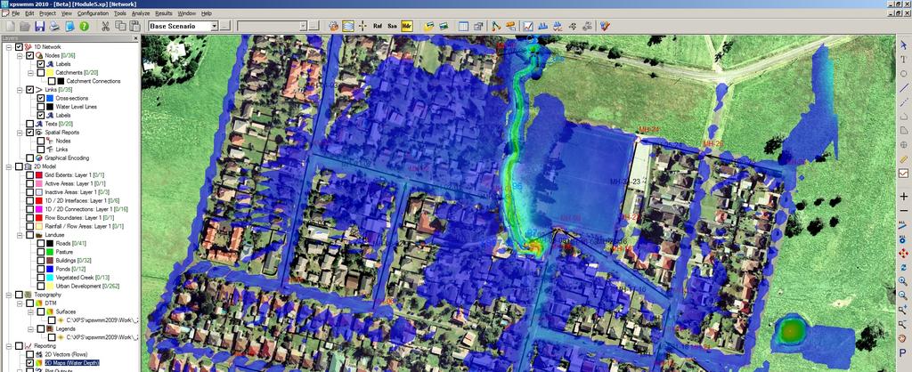

1 Introduction to xpswmm2010
2 Agenda for this webinar This is our 9 th Webinar in about the last 8 months Webinars have been recorded and are available at We anticipate less than1 hour in duration Subtopics include: Significant changes to 1D xpswmm/xpstorm Significant changes to XP2D add-on module xpswmm/xpstorm Addition of the LA County WSPG I will use some typical models to demonstrate some of these new capabilities Answer questions provided through chat
3 Development Schedule A few years ago we began a quarterly maintenance schedule starting with version Quarterly maintenance updates and 1 major upgrade each year i.e. 2009, 2009 SP1 to SP3 now 2010 version Changes are listed in Changes.txt file Comprises user requests, maintenance items and enhancements Maintenance Updates are available from downloads page and do not require a password All development to the product is documented and scheduled using FogBugz and is visible to all in the company Maintenance updates have some new enhancements but mostly address issues recorded in service requestor and from our own extended internal testing New version name is xpswmm2010
4 New Items in xpswmm2010 Some new items in 2010: Dynamic Long Section Views Enhanced Supports dual drainage Includes embedded xptables Contour labels now displayed for DTMs New Intel Compiled Engine - improved speed Catchment Redirection rewrite Modify invert elevations for nodes now sets to lowest connected link invert regardless of existing value More points allowed in a pump curve using the configuration parameter PUMP_CURVE_POINT=X where X>30


5 Dynamic Long Section Integrated Tables with Profile for Dual Drainage editing Similar change to Dynamic Section Views


6 Contour Labels Set label spacing and alignment Labels are on major contours

7 Catchment Redirection Catchment surfaces are now required to be separated before redirection 100% or 0% impervious
8 XPSWMM Engines Default (Fortran SWMM4 Based) engine is now compiled with Intel Compiler swmmengw2d.exe Benchmark tests show speed improvements in all cases: 1D Benchmark now completes in 36% of the time on the same hardware and Windows 7 vs. Vista 2D Benchmark now completes in 90% of the time on the same hardware and Windows 7 vs. Vista We also ship SWMM5 engine as before SWMM5.dll and now also ship beta version of XP Software version of SWMM5 xp_swmm_engine.dll Continue to ship the old Compaq compiled engine as well swmmengw2d_c.exe 2D Engine is the latest Tuflow build ( AE-iSP)

9 Modify Elevations If node invert is below connected link inverts the node invert will be raised Previous versions would only lower this value
10 New Items in xp2d Latest Tuflow Engine ( AE-iSP) 2D Scenario management now supported with active/inactive layer management 2D Dynamic Elevations implemented (Dam Break, Fence collapse) 2D Elevation shapes added for additional terrain manipulation 2D Initial Water level boundaries supported (ponds, lakes) 2D results files can be directly loaded and viewed with right mouse click allowing comparison of multiple sets of 2D results

11 2D Scenario Management Scenario Management now possible for 2D modeling Add New Layers and make layers active/inactive for scenarios

12 2D Dynamic Elevation Shapes Used to Simulate collapsing fences, levee breaches, dam breaks etc. Essentially these are geometry changes with trigger points


13 2D Elevation Shapes Supports both Polylines and Polygons Allow special terrain edits when TIN is missing them and useful in 2D scenarios such as alternative levee heights or land grading


14 2D Initial Water Levels Polygons can be drawn/imported and have unique starting water levels (lakes, wetlands etc.)


15 Multiple 2D Results Load multiple 2D results sets for comparisons of scenarios Use different color coding schemes and animate results


16 LA WSPG LA County WSPG procedure implemented WSPG Water Surface Profile Gradient Software Setting to switch to this mode New Node and Link Dialogs Future Webinar will introduce this new product offering Public Domain, Professional and Add-on module versions

17 WSPG Plan View Interrogate model in a new plan view Use different color coding schemes and animate results
Modeling Storm Sewer Networks in the City of Newport News, Virginia Using Two Different Software Solutions
 Modeling Storm Sewer Networks in the City of Newport News, Virginia Using Two Different Software Solutions Mid-Atlantic Chapter APWA Annual Conference May 9 th, 2013 Overview + Storm Water Modeling Basics
2D Model Implementation for Complex Floodplain Studies. Sam Crampton, P.E., CFM Dewberry
 2D Model Implementation for Complex Floodplain Studies Sam Crampton, P.E., CFM Dewberry 2D Case Studies Case Study 1 Rain-on-Grid 2D floodplain simulation for unconfined flat topography in coastal plain
NEW xpswmm & xpstorm 2017
 NEW xpswmm & xpstorm 2017 Housekeeping Ask Questions! Type queries into the Questions Field in the GoToWebinar interface. The webinar will be recorded and posted on xpsolutions.com If you have REGISTERED,
Modeling Detention Ponds Malaysian Example (v2009)
") Modeling Detention Ponds Malaysian Example (v2009) This tutorial demonstrates the usability of xpswmm and xpstorm for simulating detention basins in urban areas. This fictitious example includes the use
Modeling Detention Ponds Malaysian Example (v2009) This tutorial demonstrates the usability of xpswmm and xpstorm for simulating detention basins in urban areas. This fictitious example includes the use
Building a new model in wspg2010
 Building a new model in wspg2010 The Water Surface Profile Gradient 2010 (wspg2010 by XP Software) model is a hydraulic analysis system that computes and plots uniform and non-uniform steady flow water
xpwspg 2010 Modeling
 xpwspg 2010 Modeling The xpwspg capability in XP s products includes building/enhancing WSPG models with GIS/CAD data and presenting models with various graphical outputs. In this tutorial, users will
WMS 10.0 Tutorial Storm Drain Modeling SWMM Modeling Learn how to link a hydrologic model to the SWMM storm drain model
 v. 10.0 WMS 10.0 Tutorial Learn how to link a hydrologic model to the SWMM storm drain model Objectives Build a rational method hydrologic model and compute sub-basin flows. Import storm drain network
WMS 9.1 Tutorial Storm Drain Modeling SWMM Modeling Learn how to link a hydrologic model to the SWMM storm drain model
 v. 9.1 WMS 9.1 Tutorial Learn how to link a hydrologic model to the SWMM storm drain model Objectives Build a rational method hydrologic model and compute sub-basin flows. Import storm drain network information
Connecting 1D and 2D Domains
 Connecting 1D and 2D Domains XP Solutions has a long history of Providing original, high-performing software solutions Leading the industry in customer service and support Educating our customers to be
Comparing 2D Approaches for Complex FEMA Studies
 Comparing 2D Approaches for Complex FEMA Studies Presented by: Ted Cassidy, P.E., PH (STARR2-Dewberry) Sam Crampton, P.E., CFM (STARR2-Dewberry) Mike DePue, P.E., CFM (STARR2-Atkins) Agenda Introduction
Migrating from Autodesk Land Desktop to Autodesk Civil 3D CV42-3L
 December 2-5, 2003 MGM Grand Hotel Las Vegas Migrating from Autodesk Land Desktop to Autodesk Civil 3D CV42-3L About the Speaker: Pete Kelsey is an Autodesk Authorized Consultant an Autodesk Certified
Learn how to link a hydrologic model to the SWMM storm drain model
 v. 10.1 WMS 10.1 Tutorial Learn how to link a hydrologic model to the SWMM storm drain model Objectives Build a rational method hydrologic model and compute sub-basin flows. Import storm drain network
VERSION 2016 Service Pack 1, 17.1 (Officially Released 6 April 2016)
") One of the many advantages of using XP Solutions products is the knowledge that we are continually improving the software, adding new features that keep our customers equipped with the latest modeling
One of the many advantages of using XP Solutions products is the knowledge that we are continually improving the software, adding new features that keep our customers equipped with the latest modeling
Advanced 1D/2D Modeling Using HEC-RAS
 Advanced 1D/2D Modeling Using HEC-RAS Davis, California Objectives This is an advanced course in applying computer program HEC-RAS. The course provides participants with the knowledge to effectively use
TCP MDT Digital Terrain Model - V7.5
 TCP MDT Digital Terrain Model - V7.5 Standard Version Introduction The Standard Version is suitable for carrying out all kinds of topographical survey projects, terrain profiles, volume calculations etc.
The 3D Analyst extension extends ArcGIS to support surface modeling and 3- dimensional visualization. 3D Shape Files
 NRM 435 Spring 2016 ArcGIS 3D Analyst Page#1 of 9 0B3D Analyst Extension The 3D Analyst extension extends ArcGIS to support surface modeling and 3- dimensional visualization. 3D Shape Files Analogous to
What s new in Civil Designer 2015
 What s new in Civil Designer 2015 We have concentrated on adding in additional functionality requested by our extensive client base as well as optimising existing features. Survey & Terrain Significant
Roadway Design using GeoTools
 Roadway Design using GeoTools Introduction GeoTools is a general-purpose productivity tool for users of all types of geographic data. In the Civil Tools section, there are many tools for Civil engineering
This loads a preset standard set of data appropriate for Malaysian modeling projects.
 XP Software On-Site Detention (OSD) Example Step 1 Open xpswmm2010 program Or from Start menu select Programs XPS - then select xpswmm2010 Select Create From Template Save file, e.g. Filename.xp The program
HEC-RAS 5.0 Training New Zealand Workshop Guide
 HEC-RAS 5.0 Training New Zealand Workshop Guide Prepared by: Krey Price Surface Water Solutions 57 Bromfield Drive Kelmscott WA 6111 Australia Tel. +61 400 367 542 e-mail: info@surfacewater.biz website:
Watershed Modeling Advanced DEM Delineation
 v. 10.1 WMS 10.1 Tutorial Watershed Modeling Advanced DEM Delineation Techniques Model manmade and natural drainage features Objectives Learn to manipulate the default watershed boundaries by assigning
XP Solutions has a long history of Providing original, high-performing software solutions Leading the industry in customer service and support
 XP Solutions has a long history of Providing original, high-performing software solutions Leading the industry in customer service and support Educating our customers to be more successful in their work.
v. 8.4 Prerequisite Tutorials Watershed Modeling Advanced DEM Delineation Techniques Time minutes
 v. 8.4 WMS 8.4 Tutorial Modeling Orange County Rational Method GIS Learn how to define a rational method hydrologic model for Orange County (California) from GIS data Objectives This tutorial shows you
WMS 9.1 Tutorial Hydraulics and Floodplain Modeling Floodplain Delineation Learn how to us the WMS floodplain delineation tools
 v. 9.1 WMS 9.1 Tutorial Hydraulics and Floodplain Modeling Floodplain Delineation Learn how to us the WMS floodplain delineation tools Objectives Experiment with the various floodplain delineation options
Surfaces - Objectives
 Surfaces - Objectives Cover the Basic DTM Point Types Creating a new InRoads Surface Surface processing in InRoads Loading 3D data into a Surface A bit about Surface Properties Overview of the View Surface
Enhancing TUFLOW Output. Introduction. XMDF Output Files. Australian 2011/2012 TUFLOW Workshops. Bill Syme, BMT WBM,
 Enhancing TUFLOW Output Introduction New output options in TUFLOW Animations Recap some underutilised outputs GIS techniques 2 XMDF Output Files Benefits All outputs in one XMDF file Very quick load times
2D Modeling for Approximate Areas. Monica S. Urisko, P.E. CFM
 2D Modeling for Approximate Areas Monica S. Urisko, P.E. CFM Ferrin P. Affleck, P.E. CFM Outline Types of Modeling Available Steady vs Unsteady 1D vs 2D Software available Basics of 2D modeling Inputs
Title: Improving Your InRoads DTM. Mats Dahlberg Consultant Civil
 Title: Improving Your InRoads DTM Mats Dahlberg Consultant Civil Improving Your InRoads Digital Terrain Model (DTM) Digital Terrain Model A digital representation of a surface topography or terrain composed
OPERATION MANUAL FOR DTM & ORTHOPHOTO
 BANGLADESH DIGITAL MAPPING ASSISTANCE PROJECT (BDMAP) OPERATION MANUAL FOR DTM & ORTHOPHOTO AUGUST 2011 VERSION 1 Introduction 1. General This Operation Manual is prepared by officers of Survey of Bangladesh
2D Hydraulic Modeling, Steering Stream Restoration Design
 2D Hydraulic Modeling, Steering Stream Restoration Design PREPARED FOR: EcoStream 2018 Stream Ecology & Restoration Conference Presented By: Matthew D. Gramza, P.E., CFM, CPESC Civil & Environmental Consultants,
Bentley OpenRoads Workshop 2017 FLUG Fall Training Event
 Bentley OpenRoads Workshop 2017 FLUG Fall Training Event F-1P - Designing with a Pond Bentley Systems, Incorporated 685 Stockton Drive Exton, PA 19341 www.bentley.com Practice Workbook This workbook is
HEC-RAS 3.0 January, 2001 Release Notes
 HEC-RAS 3.0 January, 2001 Release Notes A new version of HEC-RAS (3.0) has been released with significant new features over the previous version (2.21). Version 3.0 includes unsteady flow routing capabilities,
MSCad DTM and Volume Calculations
 MSCad DTM and Volume Calculations Session Outline 1.0 Introduction of software 1.1 Introduction of instructor and experience 1.2 Discussion of software (QuickSurf, Intellicad, Cogo) 1.3 Review of access
Modelling with AR&R 2016
 Modelling with AR&R 2016 XP Solutions Software for modeling wastewater, stormwater, and floods Graphical User Interface (GUI) and analytical engines CAD/GIS type interface and data management tools Graphical
2-D Hydraulic Modeling Theory & Practice
 2-D Hydraulic Modeling Theory & Practice Author: Maged A. Aboelata, PhD, PE, CFM Presenter: Heather Zhao, PE, CFM October 2017 Presentation Outline * 1-D vs. 2-D modeling * Theory of 2-D simulation * Commonly
Evolution of an Integrated 1D/2D Modeling Package for Urban Drainage
 18 Evolution of an Integrated 1D/2D Modeling Package for Urban Drainage Thomas E. Barnard, Anthony W. Kuch, Geoffrey R. Thompson, Sudesh Mudaliar and Brett C. Phillips Recent flooding events in North America
v TUFLOW-2D Hydrodynamics SMS Tutorials Time minutes Prerequisites Overview Tutorial
 v. 12.2 SMS 12.2 Tutorial TUFLOW-2D Hydrodynamics Objectives This tutorial describes the generation of a TUFLOW project using the SMS interface. This project utilizes only the two dimensional flow calculation
Validation of Exported Field Data in GEOPAK Drainage (Survey to Drainage)
") Validation of Exported Field Data in GEOPAK Drainage (Survey to Drainage) 1.1 Overview The Export to GEOPAK Drainage tool can be utilized to leverage data collected by field surveys (i.e., pipes and structures)
Validation of Exported Field Data in GEOPAK Drainage (Survey to Drainage) 1.1 Overview The Export to GEOPAK Drainage tool can be utilized to leverage data collected by field surveys (i.e., pipes and structures)
v Modeling Orange County Unit Hydrograph GIS Learn how to define a unit hydrograph model for Orange County (California) from GIS data
 from GIS data") v. 10.1 WMS 10.1 Tutorial Modeling Orange County Unit Hydrograph GIS Learn how to define a unit hydrograph model for Orange County (California) from GIS data Objectives This tutorial shows how to define
v. 10.1 WMS 10.1 Tutorial Modeling Orange County Unit Hydrograph GIS Learn how to define a unit hydrograph model for Orange County (California) from GIS data Objectives This tutorial shows how to define
Benefits of 2D Modeling for Urban Stormwater Master Planning Niles, Illinois
 Benefits of 2D Modeling for Urban Stormwater Master Planning Niles, Illinois Patrick Lach, P.E., CFM, Hey and Associates, Inc. Steve Vinezeano, ICMA CM, LEED AP Assistant Village Manager Three Geographic
Tutorial (Intermediate level): Dense Cloud Classification and DTM generation with Agisoft PhotoScan Pro 1.1
: Dense Cloud Classification and DTM generation with Agisoft PhotoScan Pro 1.1") Tutorial (Intermediate level): Dense Cloud Classification and DTM generation with Agisoft PhotoScan Pro 1.1 This tutorial illustrates how to perform dense point cloud classification in manual and automatic
Tutorial (Intermediate level): Dense Cloud Classification and DTM generation with Agisoft PhotoScan Pro 1.1 This tutorial illustrates how to perform dense point cloud classification in manual and automatic
Tools, Tips and Workflows LP360 Under the Hood - The Conflation Point Cloud Task LP360
 Tools, Tips and Workflows LP360 Lewis Graham Revision 1.0 l In the January issue of GeoCue News, we discussed the new Point (PCT) overhaul that we released in LP360 2013.2. The focus of the last article
Improved Applications with SAMB Derived 3 meter DTMs
 Improved Applications with SAMB Derived 3 meter DTMs Evan J Fedorko West Virginia GIS Technical Center 20 April 2005 This report sums up the processes used to create several products from the Lorado 7
The complete design environment for road planning & construction ANADELTA TESSERA.
 The complete design environment for road planning & construction Short Description Short Description ANADELTA TESSERA Tessera is the professional, standards-based road design solution helping civil engineers
Follow-Up on the Nueces River Groundwater Problem Uvalde Co. TX
 Follow-Up on the Nueces River Groundwater Problem Uvalde Co. TX Analysis by Ryan Kraft 12/4/2014 1 Problem Formulation A reduction in discharge was detected at a gauging station along a portion of the
City of La Crosse Online Mapping Website Help Document
 City of La Crosse Online Mapping Website Help Document This document was created to assist in using the new City of La Crosse online mapping sites. When the website is first opened, a map showing the City
AEC Logic. AEC Terrain. A program to manage earth works in a construction project. Yudhishtirudu Gaddipati 29-Jun-13
 AEC Logic AEC Terrain A program to manage earth works in a construction project Yudhishtirudu Gaddipati 29-Jun-13 Contents 1 Introduction:... 5 2 Program Launch... 5 2.1 How to Launch Program... 5 2.2
12d Model Training Notes Training Modules for 12d Model
 12d Model Training Notes Training Modules for 12d Model June 2018 12d Model V11.0 Training Modules for 12d Model Manual June 2018 Disclaimer 12d Model is supplied without any express or implied warranties
Using ArcGIS Server Data to Assist in Planimetric Update Process. Jim Stout - IMAGIS Rick Hammond Woolpert
 Using ArcGIS Server Data to Assist in Planimetric Update Process Jim Stout - IMAGIS Rick Hammond Woolpert Using ArcGIS Server Data to Assist in Planimetric Update Process Jim Stout - IMAGIS Rick Hammond
Digital Terrain Model V 6.5
 TCP MDT Digital Terrain Model V 6.5 Professional Version Introduction The Professional Version is designed to assist users in all the phases of carrying out a Surveying or Civil Engineering project. Its
v Introduction to WMS WMS 11.0 Tutorial Become familiar with the WMS interface Prerequisite Tutorials None Required Components Data Map
 s v. 11.0 WMS 11.0 Tutorial Become familiar with the WMS interface Objectives Import files into WMS and change modules and display options to become familiar with the WMS interface. Prerequisite Tutorials
Grading and Volumes CHAPTER INTRODUCTION OBJECTIVES
 CHAPTER 10 Grading and Volumes INTRODUCTION AutoCAD Civil 3D uses surface breaklines, cogo points, contours, feature lines, and grading objects to create a surface design. There are numerous ways to grade
Tutorial 17: Desert City Tutorial
 Tutorial 17: Desert City Tutorial Table of Contents Tutorial 17: Desert city........................................... 3 2 Tutorial 17: Desert city Download items Tutorial data Tutorial PDF Prerequisites
WMS 10.1 Tutorial Hydraulics and Floodplain Modeling Simplified Dam Break Learn how to run a dam break simulation and delineate its floodplain
 v. 10.1 WMS 10.1 Tutorial Hydraulics and Floodplain Modeling Simplified Dam Break Learn how to run a dam break simulation and delineate its floodplain Objectives Setup a conceptual model of stream centerlines
WMS 8.4 Tutorial Hydraulics and Floodplain Modeling Simplified Dam Break Learn how to run a dam break simulation and delineate its floodplain
 v. 8.4 WMS 8.4 Tutorial Hydraulics and Floodplain Modeling Simplified Dam Break Learn how to run a dam break simulation and delineate its floodplain Objectives Setup a conceptual model of stream centerlines
CALPUFF View. Graphical Interface for the US EPA Approved Long Range Transport Model - CALPUFF
 CALPUFF View Graphical Interface for the US EPA Approved Long Range Transport Model - CALPUFF These release notes cover CALPUFF View Version 3.0.0. They provide: New Features Resolved Issues Tel: (519)
Understanding Geospatial Data Models
 Understanding Geospatial Data Models 1 A geospatial data model is a formal means of representing spatially referenced information. It is a simplified view of physical entities and a conceptualization of
L7 Raster Algorithms
 L7 Raster Algorithms NGEN6(TEK23) Algorithms in Geographical Information Systems by: Abdulghani Hasan, updated Nov 216 by Per-Ola Olsson Background Store and analyze the geographic information: Raster
TerraScan Tool Guide
 TerraScan Main Toolbox General Toolbar Draw Toolbar Groups Toolbar Vectorize Towers Toolbar Road Toolbar Buildings Toolbar Building Edges Toolbar View Laser Toolbar Model Toolbar Vectorize Wires Toolbar
Validation of Exported Field Data in GEOPAK Drainage (Survey to Drainage)
") Validation of Exported Field Data in GEOPAK Drainage (Survey to Drainage) 1.1 Overview The Export to GEOPAK Drainage tool can be utilized to leverage data collected by field surveys (i.e., pipes and structures)
Validation of Exported Field Data in GEOPAK Drainage (Survey to Drainage) 1.1 Overview The Export to GEOPAK Drainage tool can be utilized to leverage data collected by field surveys (i.e., pipes and structures)
New Features in TerraScan. Arttu Soininen Software developer Terrasolid Ltd
 New Features in TerraScan Arttu Soininen Software developer Terrasolid Ltd TerraBaby Currently version 0.3 Size 6.6 K Final release expected 2024, version 18.0 MicroStation XM Terra Applications do not
TABLE OF CONTENT. VERSION 15: WHAT S NEW p. 2
 VERSION 15: WHAT S NEW p. 2 TABLE OF CONTENT 1. General... 5 1.1. Vectorisation of images... 5 1.1.1. Vectorise lines... 5 1.1.2. Edges... 5 1.2. Helmert... 6 1.3. Annotations:... 6 1.3.1. Manhole pointers...
Tools, Tips, and Workflows LP360 Under the Hood: Cross-sections LP360
 LP360 Lewis Graham Revision 1.0 l As we outlined in a previous LP360 Under the Hood, we have added volumetric analysis to LP360. This feature was first released with 2013.2 at the end of last year with
AutoCAD Civil 3D 2010 Education Curriculum Student Workbook Unit 2: Create Ground Data
 AutoCAD Civil 3D 2010 Education Curriculum Student Workbook Unit 2: Create Ground Data Lesson 3 Surfaces Overview In this lesson, you learn how to work with surfaces in AutoCAD Civil 3D. Surfaces are threedimensional
Day 1. HEC-RAS 1-D Training. Rob Keller and Mark Forest. Break (9:45 am to 10:00 am) Lunch (12:00 pm to 1:00 pm)
 Lunch (12:00 pm to 1:00 pm)") Day 1 HEC-RAS 1-D Training Rob Keller and Mark Forest Introductions and Course Objectives (8:00 am to 8:15 am) Introductions: Class and Content Module 1 Open Channel Hydraulics (8:15 am to 9:45 am) Lecture
Day 1 HEC-RAS 1-D Training Rob Keller and Mark Forest Introductions and Course Objectives (8:00 am to 8:15 am) Introductions: Class and Content Module 1 Open Channel Hydraulics (8:15 am to 9:45 am) Lecture
Drainage Tools Overview Create Refined Watershed TIN CHAPTER 15
 CHAPTER 15 Drainage Tools 15.1 Overview GEOPAK supports a myriad of tools to analyze and evaluate drainage patterns of a GEOPAK Digital Terrain Model. Tools for delineating watersheds, flow paths, flow
Introduction to GIS 2011
 Introduction to GIS 2011 Digital Elevation Models CREATING A TIN SURFACE FROM CONTOUR LINES 1. Start ArcCatalog from either Desktop or Start Menu. 2. In ArcCatalog, create a new folder dem under your c:\introgis_2011
Should Contours Be Generated from Lidar Data, and Are Breaklines Required? Lidar data provides the most
 Should Contours Be Generated from Lidar Data, and Are Breaklines Required? Lidar data provides the most accurate and reliable representation of the topography of the earth. As lidar technology advances
Watershed Modeling Orange County Hydrology Using GIS Data
 v. 9.1 WMS 9.1 Tutorial Watershed Modeling Orange County Hydrology Using GIS Data Learn how to delineate sub-basins and compute soil losses for Orange County (California) hydrologic modeling Objectives
Watershed Modeling With DEMs: The Rest of the Story
 Watershed Modeling With DEMs: The Rest of the Story Lesson 7 7-1 DEM Delineation: The Rest of the Story DEM Fill for some cases when merging DEMs Delineate Basins Wizard Smoothing boundaries Representing
v Introduction to WMS Become familiar with the WMS interface WMS Tutorials Time minutes Prerequisite Tutorials None
 s v. 10.0 WMS 10.0 Tutorial Become familiar with the WMS interface Objectives Read files into WMS and change modules and display options to become familiar with the WMS interface. Prerequisite Tutorials
Civil 3D Introduction
 Civil 3D Introduction Points Overview Points are data collected by surveyors which represent existing site conditions (elevations, boundaries, utilities, etc.). Each point is numbered (or named) and has
Make a TOPOGRAPHIC MAP
 How can you make a topographic map, and what information can you get from it? Activity Overview To build the Panama Canal, engineers dammed the Chagres River. In the process, new lakes were formed, a valley
Pipe Networks CHAPTER INTRODUCTION OBJECTIVES
 CHAPTER 11 Pipe Networks INTRODUCTION Pipe networks are integral to a site-design solution. The piping system s complexity can vary from simple culverts to several storm and sanitary networks that service
TCP MDT Digital Terrain Model - V7
 TCP MDT Digital Terrain Model - V7 Professional Version Introduction The Professional Version is designed to assist the user at all stages of developing a project in the context of Topography and Civil
LD20493 From AutoCAD Civil 3D to Storm and Sanitary Analysis - Pond Design Using Volume-Grading Tools
 LD20493 From AutoCAD Civil 3D to Storm and Sanitary Analysis - Pond Design Using Volume-Grading Tools Kevin Larkin LSC Design, Inc. Learning Objectives Learn how to dynamically model stormwater ponds using
If you are relying on someone else to provide existing ground data to you, use the guidelines below to ensure you receive the best data available.
 That CAD Girl J ennifer dib ona Website: www.thatcadgirl.com Email: thatcadgirl@aol.com Phone: (919) 417-8351 Fax: (919) 573-0351 Basics of Existing Ground Surface Generation The accuracy of an existing
Advanced Computer Graphics Project Report. Terrain Approximation
 Advanced Computer Graphics Project Report Terrain Approximation Wenli Li (liw9@rpi.edu) 1. Introduction DEM datasets are getting larger and larger with increasing precision, so that approximating DEM can
Geogiga Seismic Pro 8.0 Release Notes
 Geogiga Seismic Pro 8.0 Release Notes Copyright 2015, All rights reserved. Table of Contents Introduction...1 Part 1 General Enhancements...3 Trace Display...4 Color Section Display...6 Curve Plotting...8
GIS Tools for Hydrology and Hydraulics
 1 OUTLINE GIS Tools for Hydrology and Hydraulics INTRODUCTION Good afternoon! Welcome and thanks for coming. I once heard GIS described as a high-end Swiss Army knife: lots of tools in one little package
Guideline for Importing Survey Data into Bentley Power InRoads v8i SS2
 Guideline for Importing Survey Data into Bentley Power InRoads v8i SS2 I. REQUIREMENTS from the Geomatics/Survey Function: 1. A CAD-only drawing in.dwg file format ver. 2013, (that can be created natively
Hamilton County Enhances GIS Base Mapping with 1-foot Contours
 Hamilton County Enhances GIS Base Mapping with 1-foot Contours Presented by Larry Stout, Hamilton County GIS Manager Brad Fugate, Woolpert Inc. Today s Presentation Hamilton County s 2004 Base Mapping
Creating raster DEMs and DSMs from large lidar point collections. Summary. Coming up with a plan. Using the Point To Raster geoprocessing tool
 Page 1 of 5 Creating raster DEMs and DSMs from large lidar point collections ArcGIS 10 Summary Raster, or gridded, elevation models are one of the most common GIS data types. They can be used in many ways
APPENDIX E2. Vernal Pool Watershed Mapping
 APPENDIX E2 Vernal Pool Watershed Mapping MEMORANDUM To: U.S. Fish and Wildlife Service From: Tyler Friesen, Dudek Subject: SSHCP Vernal Pool Watershed Analysis Using LIDAR Data Date: February 6, 2014
Agren Disclaimer. WaterwayBuilder Introduction
 User Manual Agren Disclaimer The content and products associated with Agren WaterwayBuilder are provided to you on an asis and as available basis. Agren, Inc. makes no representations or warranties of
Interface with. 3DMC Machine Control
 Interface with 3DMC Machine Control Preamble In our experience software options are often only used in their simplest forms particularly when combined with data transfer. This document aims to uncover
v Map Module Operations SMS Tutorials Prerequisites Requirements Time Objectives
 v. 12.3 SMS 12.3 Tutorial Objectives This tutorial describes the fundamental tools in the Map module of the SMS. This tutorial provides information that is useful when constructing any type of geometric
Introduction to GIS. Geographic Information Systems SOCR-377 9/24/2015. R. Khosla Fall Semester The real world. What in the world is GIS?
 Introduction to GIS Geographic Information Systems SOCR-377 What in the world is GIS? GIS is simultaneously the telescope, the microscope, the computer and the Xerox machine of regional analysis and synthesis
AutoCAD Civil 3D 2010 Education Curriculum Instructor Guide Unit 4: Environmental Design
 AutoCAD Civil 3D 2010 Education Curriculum Instructor Guide Unit 4: Environmental Design Lesson 2 Watershed Analysis Overview In this lesson, you learn about how AutoCAD Civil 3D software is used to analyze
Label Design Program Label Artist-II Manual Rev. 1.01
 Label Design Program Label Artist-II Manual Rev. 1.01 http://www.bixolon.com Contents 1. Introduction... 2 2. Supported Operating Systems... 2 3. Features... 3 3-1 Menu... 3 3-1-1 New... 3 3-1-2
Visualization Insider A Little Background Information
 Visualization Insider A Little Background Information Visualization Insider 2 Creating Backgrounds for 3D Scenes Backgrounds are a critical part of just about every type of 3D scene. Although they are
v Water Distribution System Modeling Working with WMS Tutorials Building a Hydraulic Model Using Shapefiles Prerequisite Tutorials None
 v. 10.1 WMS 10.1 Tutorial Water Distribution System Modeling Working with EPANET Building a Hydraulic Model Using Shapefiles Objectives Open shapefiles containing the geometry and attributes of EPANET
Revolve Vertices. Axis of revolution. Angle of revolution. Edge sense. Vertex to be revolved. Figure 2-47: Revolve Vertices operation
 Revolve Vertices The Revolve Vertices operation (edge create revolve command) creates circular arc edges or helixes by revolving existing real and/or non-real vertices about a specified axis. The command
XP Solutions has a long history of Providing original, high-performing software solutions Leading the industry in customer service and support
 Housekeeping Ask Questions! Type queries into the Question Field in the GoToWebinar interface. The webinar will be recorded and posted on innovyze.com If you have REGISTERED, you will receive an email
Objectives This tutorial will introduce how to prepare and run a basic ADH model using the SMS interface.
 v. 12.1 SMS 12.1 Tutorial Objectives This tutorial will introduce how to prepare and run a basic ADH model using the SMS interface. Prerequisites Overview Tutorial Requirements ADH Mesh Module Scatter
WMS 9.0 Tutorial Hydraulics and Floodplain Modeling HEC-RAS Analysis Learn how to setup a basic HEC-RAS analysis using WMS
 v. 9.0 WMS 9.0 Tutorial Hydraulics and Floodplain Modeling HEC-RAS Analysis Learn how to setup a basic HEC-RAS analysis using WMS Objectives Learn how to build cross sections, stream centerlines, and bank
James Schneider Advanced Materials and Technology
 (CEC-90153) Minnesota DOT Deploy GCS900, Business Center HCE and VisionLink with the DOTs GEOPAK software to automatically monitor large scale excavation in Carver County James Schneider Advanced Materials
Terrain Processing for Efficient 1D and 2D H&H Modeling. Dean Djokic and Zichuan Ye, Esri Inc.
 Terrain Processing for Efficient 1D and 2D H&H Modeling Dean Djokic and Zichuan Ye, Esri Inc. Overview Overview of GIS for H&H modeling support (why do we do this) Terrain processing techniques 1D vs.
GEOGRAPHIC INFORMATION SYSTEMS Lecture 25: 3D Analyst
 GEOGRAPHIC INFORMATION SYSTEMS Lecture 25: 3D Analyst 3D Analyst - 3D Analyst is an ArcGIS extension designed to work with TIN data (triangulated irregular network) - many of the tools in 3D Analyst also
v TUFLOW FV SMS 13.0 Tutorial Requirements Time Prerequisites Objectives
 v. 13.0 SMS 13.0 Tutorial Objectives This tutorial demonstrates creating a simple model of a short section of river using the SMS TUFLOW FV interface. A mesh for an inbank area of a river will be built,