FOR 274: Surfaces from Lidar. Lidar DEMs: Understanding the Returns. Lidar DEMs: Understanding the Returns
|
|
|
- Marcus Hood
- 5 years ago
- Views:
Transcription

1 FOR 274: Surfaces from Lidar LiDAR for DEMs The Main Principal Common Methods Limitations Readings: See Website Lidar DEMs: Understanding the Returns The laser pulse travel can travel through trees before hitting the ground. Secondary returns might not be from the ground Non ground objects could include: Shrubs Ladder Fuels Seedlings Buildings Wildlife TANKS!!! Lidar DEMs: Understanding the Returns The different vertical structure of deciduous and coniferous forests can be highlighted by the returns 1


 Adaptive Gain (values are")

2 Lidar DEMs: Understanding the Returns In modern lidar systems, 1-9 returns are possible depending on sensor. The returns from one pulse are not in the same horizontal or vertical location. 1st 2nd 3rd Lidar DEMs: Understanding the Returns The Intensity is an output of all Lidar acquisitions Intensity Intensity of the object reflecting the laser 8-bit scale (0-255) Adaptive Gain (values are not calibrated) Orthorectified image Lidar DEMs: Understanding the Returns The Intensity is different for hardwood and coniferous forests 2


3 Lidar DEMs: The Raw Data Lidar DEMs: The Raw Data Lidar DEMs: The General Principal To generate a DEM from Lidar we identify what returns are associated with the ground reflections and delete all the rest. 3


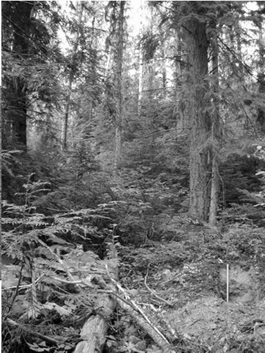
4 Lidar DEMs: The General Principal Many different methods exist to identify the ground from nonground returns. They are called filtering methods The challenge in forestry is that most of those filtering methods don t cope well with non-ground objects beneath the first returns: Shrubs, seedlings, wildlife, ladder fuels, coarse woody debris, slash, etc, etc, etc Source: Campbell 2007 Lidar DEMs: The General Principal This process is repeated until the surface stops changing: Lidar DEMs: The General Principal 4


5 Lidar DEMs: The General Principal Lidar DEMs: The Block Minimum Method Block Minimum: The Lidar points are divided into grid cells and the lowest point is chosen as the ground. Easy to Implement Does not work well in high canopy cover forests Lidar DEMs: The Block Minimum Method Block Minimum: When canopy cover / biomass is high there may be very few ground returns in your bin You might need select lowest point in 5x5m area instead of 1x1 m areas If the bin is too large you might miss topographic features!!! 5


6 Lidar DEMs: The Block Minimum Method In this case a Block Minimum 6 x 6 meter bin size was still not enough to see enough ground returns. Lidar DEMs: The Block Minimum Method In general, Block Minimum has problems with shrub and understory or when canopy cover is high From Zang et.al, (2000) Lidar DEMs: The Slope Threshold Method Slope Threshold: Starting at the 1 st point, all points higher than a slope from the first point are deleted. Then repeat at the next point 6
 Lidar DEMs: The Progressive Curvature Filter What is a curvature?")

7 Lidar DEMs: The Slope Threshold Method Problems where features have abrupt edges: buildings/cliffs Building Footprint Problems in high canopy cover From Vosselman, (2000) Lidar DEMs: The Progressive Curvature Filter What is a curvature? An aberration from the ground A point higher than the surrounding points Not an edge!!! Curvatures Edges Lidar DEMs: The Progressive Curvature Filter We have curvatures in Forestry. This method is widely used by the USFS and other agencies (ARS, BLM, etc). 7


8 Lidar DEMs: The Progressive Curvature Filter We have curvatures in Forestry. As the filter does each pass, the curvatures in the forest becomes less distinct Lidar DEMs: The Progressive Curvature Filter We have curvatures in Forestry. This method repeats until a smooth surface remains Lidar DEMs: The Progressive Curvature Filter DEM produced in high biomass area. 8


9 Lidar DEMs: Common Errors - Les Moutons Source Lefsky (2005) Lidar DEMs: Common Errors - Les Moutons Lidar DEMs: Common Errors Data Gaps Data Gaps: If too few ground returns are present the ground surface may miss real topographic features 9

10 Lidar DEMs: Common Errors Data Gaps Data Gaps: Similar problems can occur when the lowest return is from elevated vegetation FOR 274: Plot Level Metrics Plot Level Metrics from Lidar Heights Other Plot Measures Sources of Error Readings: See Website Plot Level Metrics: Getting at Canopy Heights Heights are an Implicit Output of Lidar data 10

")
11 Calculating Heights Plot Level Metrics: What is the Point Cloud Anyway? Each distance from the plane to the surfaces is recorded: D1 D6 Returns from surfaces further away from the sensor have a greater distance but a lower relative elevation than those closer returns Calculating Heights Plot Level Metrics: What is the Point Cloud Anyway? The point cloud shows the distances from the sensor to the surfaces. To be useful, we need to flip this up-side down world. Calculating Heights Plot Level Metrics: Getting at Canopy Heights Dc Df Heights = Df- Dc We flip the data by subtracting the distance from the plane to the closer surfaces (Dc) from the distance from the plane to the furthest away surfaces (Df). 11


12 Plot Level Metrics: Getting at Canopy Heights To get heights, subtract the elevations of the closer lidar points from the filtered ground surface elevations obtained from the Lidar DEM Plot Level Metrics: Getting at Canopy Heights This produces a point cloud where the DEM has a height of zero and the returns closer to the sensor have increasingly higher heights z 0 Plot Level Metrics: Getting at Canopy Heights When in forestry continuous surfaces are fit to the non-ground heights this is often called a canopy height model 12

 Trees too tall")
13 Plot Level Metrics: Canopy Height Models Image source: H-E Anderson Plot Level Metrics: Canopy Height Models Image source: MJ Falkowski Plot Level Metrics: Sources of Height Error Interpolation Error: The ground surface may be derived incorrectly due to insufficient ground returns at specific trees. Can occur in patches of high canopy cover or when sub-canopy features are present (seedlings, fuel buildup, etc) Trees too tall when ground surface is defined too low Trees too short when ground surface is defined too high 13

14 Plot Level Metrics: Sources of Height Error Scale Error: The ground surface may be derived incorrectly BUT have a consistent bias (up or down) due to insufficient ground returns across a series of trees. This can also happen when the method to obtain the ground has been over-smoothed: i.e. too many returns deleted Plot Level Metrics: Sources of Height Error Tree Measurement Errors: If too few returns are obtained per tree the maximum height may not be close to the actual tree height In general Lidar will miss the tree top and will underestimate the true maximum tree height Ideal Top Missed Tree Missed Plot Level Metrics: Missing the Tree Top The underestimation seen in Lidar is also a challenge in field tree measurements!!! When using clinometers, rangefinders, etc you may not be able to see the tree top! 14
")


15 Plot Level Metrics: Sources of Height Error Interaction between laser pulse (distance) and slope This can be further influenced by scan angle Plot Level Metrics: Getting Maximum Tree Height Plot Level Metrics: Getting Maximum Tree Height Assume each local maximum in the canopy surface is a tree-top Tree Height Popescu, S.C., Wynne, R.H. and Nelson, R.F. (


16 Plot Level Metrics: Tree Crown Widths and Locations Valley Following 1. Assume each local maximum in the canopy surface is a tree-top 2. Apply contours to the canopy surface map 4. Find the local minimums surrounding each local maximum 5. Calculate Average N-S and E-W Diameter Plot Level Metrics: Tree Crown Widths and Locations Using a GIS: Manually measure the width of each tree and delineate them into polygons 5 m 10 m Plot Level Metrics: Tree Crown Widths and Locations Using Allometric Equations: 1. Assume each local maximum in the canopy surface is a tree-top 2. Derive crown diameter from height relations: cd = 2.56 * 0.14h From: Falkowski, M.J., Smith, A.M.S., et al., (2006). Automated estimation of individual conifer tree height and crown diameter via Two-dimensional spatial wavelet analysis of lidar data, Canadian Journal of Remote Sensing, Vol. 32, No. 2,
.")
17 Plot Level Metrics: Tree Crown Widths and Locations Using Automatic Methods 1. Convert each lidar canopy height model into a raster grid (via a GIS) 2. Use automated methods to detect the location and crown width of each lidar tree For more information see: Falkowski, M.J., Smith, A.M.S., et al., (2006). Automated estimation of individual conifer tree height and crown diameter via Two-dimensional spatial wavelet analysis of lidar data, Canadian Journal of Remote Sensing, Vol. 32, No. 2, Lidar Height Data Plot Level Metrics: Tree Crown Widths and Locations Using Automatic Methods 1. Convert each lidar canopy height model into a raster grid (via a GIS) 2. Use automated methods to detect the location and crown width of each lidar tree For more information see: Falkowski, M.J., Smith, A.M.S., et al., (2006). Automated estimation of individual conifer tree height and crown diameter via Two-dimensional spatial wavelet analysis of lidar data, Canadian Journal of Remote Sensing, Vol. 32, No. 2, Crown Diameter Plot Level Metrics: Crown Base Height Crown Base Height: 1. Convert each lidar canopy height model into a raster grid (via a GIS) 2. Use automated methods to detect the location and crown width of each lidar tree 3. Within the crown diameter find the lowest height > than a set value (e.g. assume heights < 1m from trees: shrubs, rocks, etc) Crown Diameter 17
18 Plot Level Metrics: Crown Bulk Density Crown Bulk Density 1. Convert each lidar canopy height model into a raster grid (via a GIS) 2. Use automated methods to detect the location and crown width of each lidar tree 3. Assume trees have a specific shape cone, cylinder Volume 4. Use allometric equations via field measures to get foliar biomass CBD = Foliar Biomass / Volume Crown Diameter Plot Level Metrics: Crown Class Analysis of the Lidar data will be able to highlight trees above the canopy and importantly how tall the neighboring trees are. What do you think the main limitation is? Plot Level Metrics: Diameter at Breast Height Lidar can t yet measure DBH directly: Must model DBH from tree heights and crown widths OR use other allometric methods to directly get Biomass. See Week 6 readings. This creates a challenge as most Growth & Yield and Productivity models rely on a measure of DBH. Therefore we need to develop Lidar aware allometric relationships! 18


19 FOR 274: Stand Level Metrics Stand Level Metrics from Lidar The Need for Stand Metrics Heights Structural Metrics Fuels Readings: See Website Why Do We Care About Stand Metrics? Forestry is rarely interested with the individual tree or a plot: Stand measures are of interest Panhandle NF D Taylor Lidar Stand Metrics: Canopy Height Model Maximum height in each bin Bins need to be large enough to ensure that the height represents the local top of canopy 19


20 Height Distributions Lidar Stand Metrics: 2D and 3D perspective Heights 2 dimensional Heights 3 dimensional Horizontal Distributions Vertical Distributions Lidar Stand Metrics: Canopy Cover & Density Canopy Cover: Canopy Returns Total (Veg + ground) Returns Canopy Density: Canopy Returns Total Veg Only Returns Lidar Stand Metrics: Getting at Stand Metrics When we created a DEM we identified what returns were associated with the ground reflections and deleted the rest. These layers of canopy returns can provide information on stand level metrics 20


21 Lidar Stand Metrics: Getting at Stand Metrics For a stand if we plot the count of returns that are present in 2m vertical bins we produce a Histogram of stand heights Lidar Stand Metrics: Getting at Stand Metrics We can also plot a Histogram as a Density Function that shows the relative quantity of returns in a given height bracket when compared to the total The shapes of these histogram provide clues on the structure of the vegetation in the stand Lidar Stand Metrics: Density within Stratum m m m 5-12 m 2-5 m Canopy density across 5 height ranges Forest Structure Models 21


22 Lidar Stand Metrics: Stand Canopy Height Profiles Canopy Height Map : Lidar Stand Metrics: Canopy Height Profiles Canopy Height Map : Lidar Stand Metrics: Canopy Height Profiles Canopy Height Map : 22

23 Lidar Stand Metrics: Canopy Height Profiles These curves can assist in delineating stands or identifying the Forest successional Structure stage Models of the vegetation within the stands 23
FOR 474: Forest Inventory. Plot Level Metrics: Getting at Canopy Heights. Plot Level Metrics: What is the Point Cloud Anyway?
 FOR 474: Forest Inventory Plot Level Metrics from Lidar Heights Other Plot Measures Sources of Error Readings: See Website Plot Level Metrics: Getting at Canopy Heights Heights are an Implicit Output of
An Introduction to Lidar & Forestry May 2013
 An Introduction to Lidar & Forestry May 2013 Introduction to Lidar & Forestry Lidar technology Derivatives from point clouds Applied to forestry Publish & Share Futures Lidar Light Detection And Ranging
TREE CROWN DELINEATION FROM HIGH RESOLUTION AIRBORNE LIDAR BASED ON DENSITIES OF HIGH POINTS
 TREE CROWN DELINEATION FROM HIGH RESOLUTION AIRBORNE LIDAR BASED ON DENSITIES OF HIGH POINTS M.Z.A. Rahman a, *, B. G. H. Gorte a a Delft Institute of Earth Observation and Space Systems (DEOS), Delft
2010 LiDAR Project. GIS User Group Meeting June 30, 2010
 2010 LiDAR Project GIS User Group Meeting June 30, 2010 LiDAR = Light Detection and Ranging Technology that utilizes lasers to determine the distance to an object or surface Measures the time delay between
Airborne Laser Scanning: Remote Sensing with LiDAR
 Airborne Laser Scanning: Remote Sensing with LiDAR ALS / LIDAR OUTLINE Laser remote sensing background Basic components of an ALS/LIDAR system Two distinct families of ALS systems Waveform Discrete Return
Alberta's LiDAR Experience Lessons Learned Cosmin Tansanu
 Alberta's LiDAR Experience Lessons Learned Cosmin Tansanu Analysis Forester Alberta Environment and Sustainable Resource Development We are mandated to provide environmental leadership. We need to push
Multi-temporal LIDAR data for forestry an approach to investigate timber yield changes
 Multi-temporal LIDAR data for forestry an approach to investigate timber yield changes UniSA Stefan Peters, Jixue Liu, David Bruce, Jiuyong Li ForestrySA Jim O Hehir, Mary-Anne Larkin, Anthony Hay 1 Why
A GIS-BASED ALGORITHM TO GENERATE A LIDAR PIT-FREE CANOPY HEIGHT MODEL
 DOI 10.1515/pesd-2017-0027 PESD, VOL. 11, no. 2, 2017 A GIS-BASED ALGORITHM TO GENERATE A LIDAR PIT-FREE CANOPY HEIGHT MODEL Casiana Marcu 1, Florian Stătescu 2, Nicoleta Iurist 3 Key words: GIS, LIDAR,
Airborne LiDAR Data Acquisition for Forestry Applications. Mischa Hey WSI (Corvallis, OR)
") Airborne LiDAR Data Acquisition for Forestry Applications Mischa Hey WSI (Corvallis, OR) WSI Services Corvallis, OR Airborne Mapping: Light Detection and Ranging (LiDAR) Thermal Infrared Imagery 4-Band
Airborne LiDAR Data Acquisition for Forestry Applications Mischa Hey WSI (Corvallis, OR) WSI Services Corvallis, OR Airborne Mapping: Light Detection and Ranging (LiDAR) Thermal Infrared Imagery 4-Band
Esri International User Conference. July San Diego Convention Center. Lidar Solutions. Clayton Crawford
 Esri International User Conference July 23 27 San Diego Convention Center Lidar Solutions Clayton Crawford Outline Data structures, tools, and workflows Assessing lidar point coverage and sample density
Forest Structure Estimation in the Canadian Boreal forest
 Forest Structure Estimation in the Canadian Boreal forest Michael L. Benson Leland E.Pierce Kathleen M. Bergen Kamal Sarabandi Kailai Zhang Caitlin E. Ryan The University of Michigan, Radiation Lab & School
CLASSIFICATION OF NONPHOTOGRAPHIC REMOTE SENSORS
 CLASSIFICATION OF NONPHOTOGRAPHIC REMOTE SENSORS PASSIVE ACTIVE DIGITAL CAMERA THERMAL (e.g. TIMS) VIDEO CAMERA MULTI- SPECTRAL SCANNERS VISIBLE & NIR MICROWAVE HYPERSPECTRAL (e.g. AVIRIS) SLAR Real Aperture
Generate Digital Elevation Models Using Laser Altimetry (LIDAR) Data
 Data") Generate Digital Elevation Models Using Laser Altimetry (LIDAR) Data Literature Survey Christopher Weed October 2000 Abstract Laser altimetry (LIDAR) data must be processed to generate a digital elevation
Generate Digital Elevation Models Using Laser Altimetry (LIDAR) Data Literature Survey Christopher Weed October 2000 Abstract Laser altimetry (LIDAR) data must be processed to generate a digital elevation
LiDAR Data Processing:
 LiDAR Data Processing: Concepts and Methods for LEFI Production Gordon W. Frazer GWF LiDAR Analytics Outline of Presentation Data pre-processing Data quality checking and options for repair Data post-processing
SIMULATED LIDAR WAVEFORMS FOR THE ANALYSIS OF LIGHT PROPAGATION THROUGH A TREE CANOPY
 SIMULATED LIDAR WAVEFORMS FOR THE ANALYSIS OF LIGHT PROPAGATION THROUGH A TREE CANOPY Angela M. Kim and Richard C. Olsen Remote Sensing Center Naval Postgraduate School 1 University Circle Monterey, CA
N.J.P.L.S. An Introduction to LiDAR Concepts and Applications
 N.J.P.L.S. An Introduction to LiDAR Concepts and Applications Presentation Outline LIDAR Data Capture Advantages of Lidar Technology Basics Intensity and Multiple Returns Lidar Accuracy Airborne Laser
Lidar and GIS: Applications and Examples. Dan Hedges Clayton Crawford
 Lidar and GIS: Applications and Examples Dan Hedges Clayton Crawford Outline Data structures, tools, and workflows Assessing lidar point coverage and sample density Creating raster DEMs and DSMs Data area
LiDAR forest inventory with single-tree, double- and single-phase procedures
 LiDAR forest inventory with single-tree, double- and single-phase procedures Robert C. Parker and David L. Evans Department of Forestry, Forest and Wildlife Research Center, Mississippi State University,
Contents of Lecture. Surface (Terrain) Data Models. Terrain Surface Representation. Sampling in Surface Model DEM
 Data Models. Terrain Surface Representation. Sampling in Surface Model DEM") Lecture 13: Advanced Data Models: Terrain mapping and Analysis Contents of Lecture Surface Data Models DEM GRID Model TIN Model Visibility Analysis Geography 373 Spring, 2006 Changjoo Kim 11/29/2006 1
Lecture 13: Advanced Data Models: Terrain mapping and Analysis Contents of Lecture Surface Data Models DEM GRID Model TIN Model Visibility Analysis Geography 373 Spring, 2006 Changjoo Kim 11/29/2006 1
Generate Digital Elevation Models Using Laser Altimetry (LIDAR) Data. Christopher Weed
 Data. Christopher Weed") Generate Digital Elevation Models Using Laser Altimetry (LIDAR) Data Christopher Weed Final Report EE 381K Multidimensional Digital Signal Processing December 11, 2000 Abstract A Laser Altimetry (LIDAR)
Generate Digital Elevation Models Using Laser Altimetry (LIDAR) Data Christopher Weed Final Report EE 381K Multidimensional Digital Signal Processing December 11, 2000 Abstract A Laser Altimetry (LIDAR)
VOXEL TREE MODELING FOR ESTIMATING LEAF AREA DENSITY AND WOODY MATERIAL VOLUME USING 3-D LIDAR DATA
 VOXEL TREE MODELING FOR ESTIMATING LEAF AREA DENSITY AND WOODY MATERIAL VOLUME USING 3-D LIDAR DATA F. Hosoi, Y. Nakai, K.Omasa Graduate School of Agricultural and Life Sciences, The University of Tokyo,
Lidar Sensors, Today & Tomorrow. Christian Sevcik RIEGL Laser Measurement Systems
 Lidar Sensors, Today & Tomorrow Christian Sevcik RIEGL Laser Measurement Systems o o o o Online Waveform technology Stand alone operation no field computer required Remote control through wireless network
Integration of airborne LiDAR and hyperspectral remote sensing data to support the Vegetation Resources Inventory and sustainable forest management
 Integration of airborne LiDAR and hyperspectral remote sensing data to support the Vegetation Resources Inventory and sustainable forest management Executive Summary This project has addressed a number
Masking Lidar Cliff-Edge Artifacts
 Masking Lidar Cliff-Edge Artifacts Methods 6/12/2014 Authors: Abigail Schaaf is a Remote Sensing Specialist at RedCastle Resources, Inc., working on site at the Remote Sensing Applications Center in Salt
LASERDATA LIS build your own bundle! LIS Pro 3D LIS 3.0 NEW! BETA AVAILABLE! LIS Road Modeller. LIS Orientation. LIS Geology.
 LIS 3.0...build your own bundle! NEW! LIS Geology LIS Terrain Analysis LIS Forestry LIS Orientation BETA AVAILABLE! LIS Road Modeller LIS Editor LIS City Modeller colors visualization I / O tools arithmetic
LiDAR and its use for the enhanced forest inventory
 LiDAR and its use for the enhanced forest inventory Richard Fournier Département de géomatique appliquée Workshop of the Canadian Institute of Forestry Corner Brook, Newfoundland, March 27 2013 LiDAR -
Improvement of the Edge-based Morphological (EM) method for lidar data filtering
 method for lidar data filtering") International Journal of Remote Sensing Vol. 30, No. 4, 20 February 2009, 1069 1074 Letter Improvement of the Edge-based Morphological (EM) method for lidar data filtering QI CHEN* Department of Geography,
International Journal of Remote Sensing Vol. 30, No. 4, 20 February 2009, 1069 1074 Letter Improvement of the Edge-based Morphological (EM) method for lidar data filtering QI CHEN* Department of Geography,
COMPONENTS. The web interface includes user administration tools, which allow companies to efficiently distribute data to internal or external users.
 COMPONENTS LASERDATA LIS is a software suite for LiDAR data (TLS / MLS / ALS) management and analysis. The software is built on top of a GIS and supports both point and raster data. The following software
Existing Elevation Data Sets. Quality Level 2 (QL2) Lidar Data Sets. Better Land Characterization More Accurate Results!
 Lidar Data Sets. Better Land Characterization More Accurate Results!") Existing Elevation Data Sets Out of Date: Most > 40 yrs old Data range from 15 yrs old to > 70 yrs old Spatial Resolution: 33 ft (10 m) or coarser Vertical Accuracy: 3.3 ft 6.6 ft (1 2 m) or worse Quality
Existing Elevation Data Sets Out of Date: Most > 40 yrs old Data range from 15 yrs old to > 70 yrs old Spatial Resolution: 33 ft (10 m) or coarser Vertical Accuracy: 3.3 ft 6.6 ft (1 2 m) or worse Quality
Investigating the Structural Condition of Individual Trees using LiDAR Metrics
 Investigating the Structural Condition of Individual Trees using LiDAR Metrics Jon Murray 1, George Alan Blackburn 1, Duncan Whyatt 1, Christopher Edwards 2. 1 Lancaster Environment Centre, Lancaster University,
Light Detection and Ranging (LiDAR)
") Light Detection and Ranging (LiDAR) http://code.google.com/creative/radiohead/ Types of aerial sensors passive active 1 Active sensors for mapping terrain Radar transmits microwaves in pulses determines
Light Detection and Ranging (LiDAR) http://code.google.com/creative/radiohead/ Types of aerial sensors passive active 1 Active sensors for mapping terrain Radar transmits microwaves in pulses determines
Best practices for generating forest inventory attributes from airborne laser scanning data using the area-based approach
 1 Best practices for generating forest inventory attributes from airborne laser scanning data using the area-based approach Joanne White Research Scientist Canadian Forest Service CIF Best Practices Workshop
LiDAR Applications. Examples of LiDAR applications. forestry hydrology geology urban applications
 LiDAR Applications Examples of LiDAR applications forestry hydrology geology urban applications 1 Forestry applications canopy heights individual tree and crown mapping estimated DBH and leaf area index
The Reference Library Generating Low Confidence Polygons
 GeoCue Support Team In the new ASPRS Positional Accuracy Standards for Digital Geospatial Data, low confidence areas within LIDAR data are defined to be where the bare earth model might not meet the overall
HEURISTIC FILTERING AND 3D FEATURE EXTRACTION FROM LIDAR DATA
 HEURISTIC FILTERING AND 3D FEATURE EXTRACTION FROM LIDAR DATA Abdullatif Alharthy, James Bethel School of Civil Engineering, Purdue University, 1284 Civil Engineering Building, West Lafayette, IN 47907
Introduction to LiDAR
 Introduction to LiDAR Our goals here are to introduce you to LiDAR data. LiDAR data is becoming common, provides ground, building, and vegetation heights at high accuracy and detail, and is available statewide.
DEM Artifacts: Layering or pancake effects
 Outcomes DEM Artifacts: Stream networks & watersheds derived using ArcGIS s HYDROLOGY routines are only as good as the DEMs used. - Both DEM examples below have problems - Lidar and SRTM DEM products are
Municipal Projects in Cambridge Using a LiDAR Dataset. NEURISA Day 2012 Sturbridge, MA
 Municipal Projects in Cambridge Using a LiDAR Dataset NEURISA Day 2012 Sturbridge, MA October 15, 2012 Jeff Amero, GIS Manager, City of Cambridge Presentation Overview Background on the LiDAR dataset Solar
Nearest Neighbor Methods for Imputing Missing Data Within and Across Scales
 Nearest Neighbor Methods for Imputing Missing Data Within and Across Scales Valerie LeMay University of British Columbia, Canada and H. Temesgen, Oregon State University Presented at the Evaluation of
FOOTPRINTS EXTRACTION
 Building Footprints Extraction of Dense Residential Areas from LiDAR data KyoHyouk Kim and Jie Shan Purdue University School of Civil Engineering 550 Stadium Mall Drive West Lafayette, IN 47907, USA {kim458,
Changes in the Phase 3 Indicator Field Guide Chapters from version 2.0 to version 3.0
 Changes in the Phase 3 Indicator Field Guide Chapters from version 2.0 to version 3.0 Changes documented in change proposals are indicated in bold type. The corresponding proposal name can be seen using
Construction Engineering. Research Laboratory ERDC/CERL TR-11-8
 ERDC/CERL TR-11-8 Landscape Scale Assessment of Predominant Pine Canopy Height for Red-cockaded Woodpecker Habitat Assessment Using Light Detection and Ranging (LIDAR) Data Scott A. Tweddale and Douglas
Land Cover Classification Techniques
 Land Cover Classification Techniques supervised classification and random forests Developed by remote sensing specialists at the USFS Geospatial Technology and Applications Center (GTAC), located in Salt
EXERCISE 4 Calculate Lidar Metrics
 EXERCISE 4 Calculate Lidar Metrics Objective Last Updated: April, 2016 Version: Fusion 3.50 There are three parts to this exercise. Part 1 describes the process to extract metrics from the fixed radius
REGISTRATION OF AIRBORNE LASER DATA TO SURFACES GENERATED BY PHOTOGRAMMETRIC MEANS. Y. Postolov, A. Krupnik, K. McIntosh
 REGISTRATION OF AIRBORNE LASER DATA TO SURFACES GENERATED BY PHOTOGRAMMETRIC MEANS Y. Postolov, A. Krupnik, K. McIntosh Department of Civil Engineering, Technion Israel Institute of Technology, Haifa,
LiDAR Derived Contours
 LiDAR Derived Contours Final Delivery June 10, 2009 Prepared for: Prepared by: Metro 600 NE Grand Avenue Portland, OR 97232 Watershed Sciences, Inc. 529 SW Third Avenue, Suite 300 Portland, OR 97204 Metro
LiForest Software White paper. TRGS, 3070 M St., Merced, 93610, Phone , LiForest
 0 LiForest LiForest is a platform to manipulate large LiDAR point clouds and extract useful information specifically for forest applications. It integrates a variety of advanced LiDAR processing algorithms
GIS LAB 8. Raster Data Applications Watershed Delineation
 GIS LAB 8 Raster Data Applications Watershed Delineation This lab will require you to further your familiarity with raster data structures and the Spatial Analyst. The data for this lab are drawn from
Applied Cartography and Introduction to GIS GEOG 2017 EL. Lecture-7 Chapters 13 and 14
 Applied Cartography and Introduction to GIS GEOG 2017 EL Lecture-7 Chapters 13 and 14 Data for Terrain Mapping and Analysis DEM (digital elevation model) and TIN (triangulated irregular network) are two
Using Lidar and ArcGIS to Predict Forest Inventory Variables
 Using Lidar and ArcGIS to Predict Forest Inventory Variables Dr. Kevin S. Lim kevin@limgeomatics.com P.O. Box 45089, 680 Eagleson Road Ottawa, Ontario, K2M 2G0, Canada Tel.: 613-686-5735 Fax: 613-822-5145
A Method to Create a Single Photon LiDAR based Hydro-flattened DEM
 A Method to Create a Single Photon LiDAR based Hydro-flattened DEM Sagar Deshpande 1 and Alper Yilmaz 2 1 Surveying Engineering, Ferris State University 2 Department of Civil, Environmental, and Geodetic
Plantation Resource Mapping using LiDAR
 IFA Symposium Improving Plantation Productivity Mt Gambier, 12-14 May 2014 Field Day Tour Plantation Resource Mapping using LiDAR Christine Stone (NSW DPI) and Jan Rombouts (ForestrySA) Airborne Laser
Analysis of Airborne Laser Scanning Data with Regional Shape Descriptors
 Analysis of Airborne Laser Scanning Data with Regional Shape Descriptors Zehra Shah 1, Stewart He 2, Peter Tittmann 3 & Nina Amenta 4 1 Computer Science, UC Davis - zshah@ucdavis.edu 2 Computer Science,
High Resolution Tree Models: Modeling of a Forest Stand Based on Terrestrial Laser Scanning and Triangulating Scanner Data
 ELMF 2013, 11-13 November 2013 Amsterdam, The Netherlands High Resolution Tree Models: Modeling of a Forest Stand Based on Terrestrial Laser Scanning and Triangulating Scanner Data Lothar Eysn Lothar.Eysn@geo.tuwien.ac.at
Lidar Talking Points Status of lidar collection in Pennsylvania Estimated cost and timeline
 Lidar Talking Points Pennsylvania has an immediate need for new lidar (topographic) data coverage. Some uses of the data are enumerated later in this document. USGS has calculated an average return on
Small-footprint full-waveform airborne LiDAR for habitat assessment in the ChangeHabitats2 project
 Small-footprint full-waveform airborne LiDAR for habitat assessment in the ChangeHabitats2 project Werner Mücke, András Zlinszky, Sharif Hasan, Martin Pfennigbauer, Hermann Heilmeier and Norbert Pfeifer
Airborne Laser Survey Systems: Technology and Applications
 Abstract Airborne Laser Survey Systems: Technology and Applications Guangping HE Lambda Tech International, Inc. 2323B Blue Mound RD., Waukesha, WI-53186, USA Email: he@lambdatech.com As mapping products
Should Contours Be Generated from Lidar Data, and Are Breaklines Required? Lidar data provides the most
 Should Contours Be Generated from Lidar Data, and Are Breaklines Required? Lidar data provides the most accurate and reliable representation of the topography of the earth. As lidar technology advances
Evaluation of Multi-Return LIDAR for Forestry Applications
 Inventory & Monitoring Project Report Liaison and Special Projects US Department of Agriculture Forest Service Engineering Remote Sensing Applications Center November 2000 RSAC-2060/4810-LSP-0001-RPT1
Voxelised metrics for forest inventory. Grant Pearse Phenotype Cluster Group Meeting April 2018
 Voxelised metrics for forest inventory Grant Pearse Phenotype Cluster Group Meeting April 2018 Overview Voxelisation for forest inventory Background on LiDAR metric analysis Voxelisation what and why?
[Youn *, 5(11): November 2018] ISSN DOI /zenodo Impact Factor
![[Youn *, 5(11): November 2018] ISSN DOI /zenodo Impact Factor](/thumbs/91/105079225.jpg "[Youn *, 5(11): November 2018] ISSN DOI /zenodo Impact Factor") GLOBAL JOURNAL OF ENGINEERING SCIENCE AND RESEARCHES AUTOMATIC EXTRACTING DEM FROM DSM WITH CONSECUTIVE MORPHOLOGICAL FILTERING Junhee Youn *1 & Tae-Hoon Kim 2 *1,2 Korea Institute of Civil Engineering
GLOBAL JOURNAL OF ENGINEERING SCIENCE AND RESEARCHES AUTOMATIC EXTRACTING DEM FROM DSM WITH CONSECUTIVE MORPHOLOGICAL FILTERING Junhee Youn *1 & Tae-Hoon Kim 2 *1,2 Korea Institute of Civil Engineering
Terrain Modeling and Mapping for Telecom Network Installation Using Scanning Technology. Maziana Muhamad
 Terrain Modeling and Mapping for Telecom Network Installation Using Scanning Technology Maziana Muhamad Summarising LiDAR (Airborne Laser Scanning) LiDAR is a reliable survey technique, capable of: acquiring
Algorithms for GIS csci3225
 Algorithms for GIS csci3225 Laura Toma Bowdoin College LiDAR data in GIS LiDAR (Light Detection and Ranging) Each point records: its geographic location x,y its height z the number of returns in its pulse
AUTOMATED TREETOP DETECTION AND TREE CROWN IDENTIFICATION. USING DISCRETE-RETURN LiDAR DATA. Haijia n Liu. Thesis Prepared for the Degree of
 AUTOMATED TREETOP DETECTION AND TREE CROWN IDENTIFICATION USING DISCRETE-RETURN LiDAR DATA Haijia n Liu Thesis Prepared for the Degree of MASTER OF SCIENCE UNIVERSITY OF NORTH TEXAS May 2013 APPROVED:
High- Versus Low-Density LiDAR in a Double-Sample Forest Inventory
 High- Versus Low-Density LiDAR in a Double-Sample Forest Inventory Robert C. Parker and Patrick A. Glass, Department of Forestry, Forest and Wildlife Research Center, Mississippi State University, Mississippi
Steps for Modeling a Proposed New Reservoir in GIS
 Steps for Modeling a Proposed New Reservoir in GIS Requirements: ArcGIS ArcMap, ArcScene, Spatial Analyst, and 3D Analyst There s a new reservoir proposed for Right Hand Fork in Logan Canyon. I wanted
sensors ISSN Article
 Sensors 2009, 9, 1541-1558; doi:10.3390/s90301541 OPEN ACCESS sensors ISSN 1424-8220 www.mdpi.com/journal/sensors Article Improving Measurement of Forest Structural Parameters by Co-Registering of High
GPS Located Accuracy Assessment Plots on the Modoc National Forest
 This file was created by scanning the printed publication. Errors identified by the software have been corrected; however, some errors may remain. GPS Located Accuracy Assessment Plots on the Modoc National
An Introduction to Using Lidar with ArcGIS and 3D Analyst
 FedGIS Conference February 24 25, 2016 Washington, DC An Introduction to Using Lidar with ArcGIS and 3D Analyst Jim Michel Outline Lidar Intro Lidar Management Las files Laz, zlas, conversion tools Las
APPENDIX E2. Vernal Pool Watershed Mapping
 APPENDIX E2 Vernal Pool Watershed Mapping MEMORANDUM To: U.S. Fish and Wildlife Service From: Tyler Friesen, Dudek Subject: SSHCP Vernal Pool Watershed Analysis Using LIDAR Data Date: February 6, 2014
BRIEF EXAMPLES OF PRACTICAL USES OF LIDAR
 BRIEF EXAMPLES OF PRACTICAL USES OF LIDAR PURDUE ROAD SCHOOL - 3/9/2016 CHRIS MORSE USDA-NRCS, STATE GIS COORDINATOR LIDAR/DEM SOURCE DATES LiDAR and its derivatives (DEMs) have a collection date for data
LIDAR MAPPING FACT SHEET
 1. LIDAR THEORY What is lidar? Lidar is an acronym for light detection and ranging. In the mapping industry, this term is used to describe an airborne laser profiling system that produces location and
GEOGRAPHIC INFORMATION SYSTEMS Lecture 24: Spatial Analyst Continued
 GEOGRAPHIC INFORMATION SYSTEMS Lecture 24: Spatial Analyst Continued Spatial Analyst - Spatial Analyst is an ArcGIS extension designed to work with raster data - in lecture I went through a series of demonstrations
Chapters 1 7: Overview
 Chapters 1 7: Overview Photogrammetric mapping: introduction, applications, and tools GNSS/INS-assisted photogrammetric and LiDAR mapping LiDAR mapping: principles, applications, mathematical model, and
ANALYSIS OF MIDDLE PULSE DATA BY LIDAR IN THE FOREST
 ANALYSIS OF MIDDLE PULSE DATA BY LIDAR IN THE FOREST Katsutoshi. OKAZAKI a, *, Noritsuna. FUJII a a Asia Air Survey Co.Ltd,, 1-2-2, Manpukuji, Asao-ku, Kawasaki, Kanagawa, Japan - (kts.okazaki, nor.fujii)@ajiko.co.jp
Exercise 4: Extracting Information from DEMs in ArcMap
 Exercise 4: Extracting Information from DEMs in ArcMap Introduction This exercise covers sample activities for extracting information from DEMs in ArcMap. Topics include point and profile queries and surface
Lab 12: Sampling and Interpolation
 Lab 12: Sampling and Interpolation What You ll Learn: -Systematic and random sampling -Majority filtering -Stratified sampling -A few basic interpolation methods Data for the exercise are in the L12 subdirectory.
Package itcsegment. July 6, 2017
 Type Package Title Individual Tree Crowns Segmentation Version 0.6 Date 2017-07-05 Author Michele Dalponte Package itcsegment July 6, 2017 Maintainer Michele Dalponte Three
Lecture 11. LiDAR, RADAR
 NRMT 2270, Photogrammetry/Remote Sensing Lecture 11 Calculating the Number of Photos and Flight Lines in a Photo Project LiDAR, RADAR Tomislav Sapic GIS Technologist Faculty of Natural Resources Management
A DATA DRIVEN METHOD FOR FLAT ROOF BUILDING RECONSTRUCTION FROM LiDAR POINT CLOUDS
 A DATA DRIVEN METHOD FOR FLAT ROOF BUILDING RECONSTRUCTION FROM LiDAR POINT CLOUDS A. Mahphood, H. Arefi *, School of Surveying and Geospatial Engineering, College of Engineering, University of Tehran,
MODELLING FOREST CANOPY USING AIRBORNE LIDAR DATA
 MODELLING FOREST CANOPY USING AIRBORNE LIDAR DATA Jihn-Fa JAN (Taiwan) Associate Professor, Department of Land Economics National Chengchi University 64, Sec. 2, Chih-Nan Road, Taipei 116, Taiwan Telephone:
Quantitative structure tree models from terrestrial laser scanner data Pasi Raumonen! Tampere University of Technology!
 Quantitative structure tree models from terrestrial laser scanner data Pasi Raumonen! Tampere University of Technology!! Silvilaser 2015, 28-30 September 2015, La Grande Motte, France Tree modelling How
Automated Feature Extraction from Aerial Imagery for Forestry Projects
 Automated Feature Extraction from Aerial Imagery for Forestry Projects Esri UC 2015 UC706 Tuesday July 21 Bart Matthews - Photogrammetrist US Forest Service Southwestern Region Brad Weigle Sr. Program
Building Segmentation and Regularization from Raw Lidar Data INTRODUCTION
 Building Segmentation and Regularization from Raw Lidar Data Aparajithan Sampath Jie Shan Geomatics Engineering School of Civil Engineering Purdue University 550 Stadium Mall Drive West Lafayette, IN 47907-2051
About LIDAR Data. What Are LIDAR Data? How LIDAR Data Are Collected
 1 of 6 10/7/2006 3:24 PM Project Overview Data Description GIS Tutorials Applications Coastal County Maps Data Tools Data Sets & Metadata Other Links About this CD-ROM Partners About LIDAR Data What Are
Calypso Construction Features. Construction Features 1
 Calypso 1 The Construction dropdown menu contains several useful construction features that can be used to compare two other features or perform special calculations. Construction features will show up
An Accuracy Assessment of Derived Digital Elevation Models from Terrestrial Laser Scanning in a Sub-Tropical Forested Environment
 Article An Accuracy Assessment of Derived Digital Elevation Models from Terrestrial Laser Scanning in a Sub-Tropical Forested Environment Jasmine Muir 1,2,3, * ID, Nicholas Goodwin 1,2, John Armston 1,2,4
DESCRIBING FOREST STANDS USING TERRESTRIAL LASER-SCANNING
 DESCRIBING FOREST STANDS USING TERRESTRIAL LASER-SCANNING T. Aschoff a, *, M. Thies a, H. Spiecker a a Institute for Forest Growth, University of Freiburg, Tennenbacherstr. 4, D-79106 Freiburg, Germany
E3De. E3De Discover the Next Dimension of Your Data.
 International Support Exelis Visual Information Solutions is a global company with direct offices in North America, Europe, and Asia. Combined with our extensive, worldwide distributor network, we can
FINAL DRAFT FIREMON Database User Manual Updated 04/04/2005. FIREMON Database. User Manual EXECUTIVE SUMMARY
 FIREMON Database User Manual EXECUTIVE SUMMARY The FIREMON database software allows users to enter data, generate summary reports, and perform other data management tasks. The FIREMON database software
Department of Geography, University of North Texas, Denton, TX, USA. Online publication date: 01 April 2010 PLEASE SCROLL DOWN FOR ARTICLE
 This article was downloaded by: [Dong, Pinliang] On: 1 April 2010 Access details: Access Details: [subscription number 920717327] Publisher Taylor & Francis Informa Ltd Registered in England and Wales
Tree height measurements and tree growth estimation in a mire environment using digital surface models
 Tree height measurements and tree growth estimation in a mire environment using digital surface models E. Baltsavias 1, A. Gruen 1, M. Küchler 2, P.Thee 2, L.T. Waser 2, L. Zhang 1 1 Institute of Geodesy
3D Convolutional Neural Networks for Landing Zone Detection from LiDAR
 3D Convolutional Neural Networks for Landing Zone Detection from LiDAR Daniel Mataruna and Sebastian Scherer Presented by: Sabin Kafle Outline Introduction Preliminaries Approach Volumetric Density Mapping
Automated Extraction of Buildings from Aerial LiDAR Point Cloud and Digital Imaging Datasets for 3D Cadastre - Preliminary Results
 Automated Extraction of Buildings from Aerial LiDAR Point Cloud and Digital Imaging Datasets for 3D Pankaj Kumar 1*, Alias Abdul Rahman 1 and Gurcan Buyuksalih 2 ¹Department of Geoinformation Universiti
GEO 6895: Airborne laser scanning - workflow, applications, value. Christian Hoffmann
 GEO 6895: Airborne laser scanning - workflow, applications, value. Christian Hoffmann Agenda Why LiDAR? The value of an end-to-end workflow The Trimble AX-Series Data processing & modelling Information
Airborne discrete return LiDAR data was collected on September 3-4, 2007 by
 SUPPLEMENTAL MATERIAL 2 LiDAR Specifications Airborne discrete return LiDAR data was collected on September 3-4, 2007 by Watershed Sciences, Inc. (Corvallis, Oregon USA). LiDAR was collected approximately
AUTOMATED 4 AXIS ADAYfIVE SCANNING WITH THE DIGIBOTICS LASER DIGITIZER
 AUTOMATED 4 AXIS ADAYfIVE SCANNING WITH THE DIGIBOTICS LASER DIGITIZER INTRODUCTION The DIGIBOT 3D Laser Digitizer is a high performance 3D input device which combines laser ranging technology, personal
Watershed Sciences 4930 & 6920 GEOGRAPHIC INFORMATION SYSTEMS
 HOUSEKEEPING Watershed Sciences 4930 & 6920 GEOGRAPHIC INFORMATION SYSTEMS Quizzes Lab 8? WEEK EIGHT Lecture INTERPOLATION & SPATIAL ESTIMATION Joe Wheaton READING FOR TODAY WHAT CAN WE COLLECT AT POINTS?
ENY-C2005 Geoinformation in Environmental Modeling Lecture 4b: Laser scanning
 1 ENY-C2005 Geoinformation in Environmental Modeling Lecture 4b: Laser scanning Petri Rönnholm Aalto University 2 Learning objectives To recognize applications of laser scanning To understand principles
) on threshold image, yield contour lines in raster format
 on threshold image, yield contour lines in raster format") CONTOURLINES FROM DEM-GRID USING IMAGE PROCESSING TECHNIQUES HAkan Malmstrom Swedish Space Corporation P.O. Box 4207, S-7 04 Solna Sweden Commission III Digial Elevation Models (DEM) are often stored and
CONTOURLINES FROM DEM-GRID USING IMAGE PROCESSING TECHNIQUES HAkan Malmstrom Swedish Space Corporation P.O. Box 4207, S-7 04 Solna Sweden Commission III Digial Elevation Models (DEM) are often stored and