Data Storage and Dissemination Outline
|
|
|
- Steven Haynes
- 5 years ago
- Views:
Transcription
1 Data Storage and Dissemination Outline Past/Existing data management overview Future data management: Goals Broad description of proposed solution Key details of proposed solutions Challenges and lessons Next steps
2 Data Systems General Architecture (Past) EXISTING TIP APPLICATION Question: What would be different about future regional transportation system performance with or without certain projects? TIP DB GIS: Coverages & Shapefiles LAND USE MODEL MTP DB EXISTING MTP APPLICATION TRAVEL DEMAND MODEL
3 Goals of proposed Enterprise Solution: Support model suite enhancements and future possibilities Process automation Quicker model run and analysis turnaround Support planning policy framework (Plan<->TIP<->PSRC project Approval) General efficiency and increased capability: simultaneous multi-user access automated data validation In-your-face metadata Solid foundation for region-wide data sharing and publication (WWW) (note WA-TRANS FGDC Transportation Framework pilot, Summer 2005)
4 Vision I am a Park & Ride......with 200 stalls...with 20 bike slots I am a multi-modal link.....on HSS...named SR-99...with 2 GP lanes north and south...with a class three bicycle lane NB...related to trans. model link #224 I am an airport......generating 20,000 person-trips am peak...with 689 based passenger aircraft I am an analysis zone......of type "Urban Center"...named "Seatac"...within county "King"...with 19,345 residents in 2000 I monitor SR on MM/DD/YYYY in am peak hour ,500 cars northbound...4,900 cars southbound...38 bicycles southbound I am a freight depot......generating 500 truck trips in am peak...attracting 400 truck trips in am peak...attracting 25 air freight landings am peak I am a bus station......receiving 20 buses in am peak...sending out 19 buses in am peak...handling these routes......metro ST 101 I will be a train station in receiving 10 trains in am peak...sending 10 trains in am peak I am a link improvement......in the MTP...modeled in package X5...on SR-99...to be complete in resulting in... Browsing Application Concept
5 System Architecture Transportation Components (After) EXISTING TIP APPLICATION GENERAL USE APPLICATION LAND USE MODEL? TIP DB MAINTENANCE APPLICATION GEO DATA GIS: Coverages BASE & Shapefiles TRAVEL MODEL I/O APPLICATION ANY LEGITIMATE CLIENT EXISTING MTP APPLICATION MTP DB RDBMS TRAVEL DEMAND MODEL
6 Key Feature: Integrated Data Model Transportation Network (in progress) Multimodal: One edge layer plus one junction layer for ALL modes (the reference network ) Granular: Ref net spatial layers plus related attribute tables encapsulate attributes for both directions and all times of day for present AND future possibilities Dynamic: Possible future state(s) of the network determined by queries at runtime NOT in data Land use and demographic data (future) Controlled: Results of data processes are published (along with metadata) once All data is transparent: accessible to all Data is secure: editable to few

7 Transportation Reference Network: Users view

:")


8 Transportation: a Project-based Approach Project defined (for the data system): Future event with completion date Geographic location Alters transportation system Can be modeled


9 Key feature: future year networks derived from operation on reference and project layers + = BASE YEAR NETWORK FUTURE PROJECTS FUTURE NETWORK
10 Key feature: model automation Automated, query-based scenario creation In/out service years Other selection criteria (optional) Other rule-based network thinning (optional) Automated travel model (in progress) and LU model (future) inputs generation Automated travel model (in progress) and LU model (future) forecast retrieval into Geodatabase
11 Key feature: data maintenance support Software helper application together with server features Ensures validity across all dependant layers Maintains relationships between different databases Maintains metadata (such as datestamps)
12 Overview of Applications For power GIS and database managers: to manage the geometric network and project data, including editing and maintenance functions EXISTING TIP APPLICATION GENERAL USE APPLICATION 3 For general users with little or no GIS experience: A user friendly mapping interface to query and display projects and other business data 1 TIP DB MAINTENANCE APPLICATION GEO DATA BASE MODEL I/O APPLICATION 2 MTP DB RDBMS For transportation modelers: To convert the geometric network and projects data to EMME/2 format and vice versa EXISTING MTP APPLICATION TRAVEL DEMAND MODEL

13 Maintenance Application: User View Additional Option: Scan project DB s for all projects that need to be mapped

14 Maintenance Application: Mapping a project

15 General Use Application: Data Loading and Metadata


16 Model I/O Application: Create an EMME/2 Input Scenario


17 Model I/O Application: Create an EMME/2 Input Scenario (Cont.)

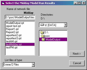
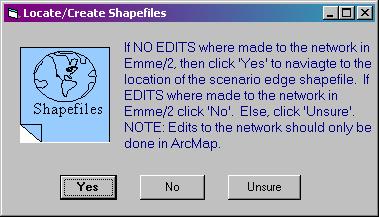
18 Model I/O Application: Display Model Output to Geodatabase
19 Status Transportation: in beta test cycle Demographic & LU data plus any supporting application(s): about to restart design External data import/export: future
20 Lessons Learned Migrating legacy data to new system: more huge than you ever think Software and data model development: proceed together in many small steps Question: your data integration success stories or lessons?
21 Questions?
22 Key lesson: Many small cyclical steps Each iteration of schema prompts application update application test reveals data or schema issue which when fixed allows a new application feature to be attempted for which the feasible application solutions prompt a schema update
23 Key challenge: Discovering what new capabilities and limits are present in commercial software Geometric network (only feature available when project started) exposes insufficient spatial relationship tools New relational database capability is significant advance but has performance and functional issues Stock loading and validation tools cumbersome and implement only part of underlying data provider capabilities
24 Key lesson: migration timing and planning Document the migration (in detail) so that the entire process can be repeated easily Revise migration plan with each schema/application iteration to foresee migration implications Data migration is the bulk of the work Assume more manual work than marketing flyers imply
25 GIS Contacts at PSRC Jeff Frkonja Senior Planner Puget Sound Regional Council Andy Norton Senior GIS Analyst Puget Sound Regional Council
26 Transportation Layer: TransNexus

27 Project Event Editing

28 General Use Application: Display Projects or Model Results
29 New Enterprise Data Model (Transportation) MTP Projects: ProjectID Title Description Cost Sponsor Etc TIP Projects: ProjectID Title Description Cost Sponsor $ Programming Etc Other Project Route Feature Class Transportation Reference Network: Junction and Edge Feature Classes Transit Routes Geodatabase Trans Nexuses
30 Transportation Reference Network: Edges Freeway Expressway HOV Reversible Ramp Arterial Local Non-Motor Ferry Rail Monorail Busway Light rail Centroid Connector FACILITY TYPES PSRC Edge ID Direction (From/To Node) Modes Design Characteristics Speed limit In/out service dates Date last modified CORE ATTRIBUTES Unique ID By Time of Day Business timestamp Metadata timestamp
31 Transportation Reference Network: Junctions Generic Centroid FACILITY TYPES Station: monorail Station: lightrail Station: ferry Station: bus Station: commuterrail Park and Ride
32 Transportation Projects Layer: Business Rules Projects must be represented by a linear route (or a polygon) Project routes must coincide with one or more reference edges Project outcomes attributes correspond to ref edge attributes PSRC Edge ID Direction (From/To Node) Modes Design Characteristics In/out service dates Project design characteristics replace base year characteristics for scenarios in which project participates

33 Transportation Projects: User s View

34 Maintenance Application: Project/ref coincidence

35 Maintenance Application: New ref features
36 Key challenge: Articulate business rules for Geodatabase-to-EMME/2 data exchange Goal clarity: separating what should be from what is Legacy model manipulated exogenous data to achieve calibration (i.e., a road with 2.3 northbound lanes) Triage: which chosen design goals are best met in which system component (Geodatabase, application, or model?) More realistic network representation=>geodb Complexity: can rule-based automation work? Shadow HOV and weave links one geodatabase edge becomes separate SOV and HOV links in model
INTRODUCTION TO CUBE
 INTRODUCTION TO CUBE 1 WELCOME TO CUBE... 2 1.1 OVERVIEW... 2 1.2 THE ARCHITECTURE OF CUBE... 3 1.3 THE CUBE USER ENVIRONMENT... 5 1.4 INTEGRATION WITH ARCGIS... 7 1.5 INTEGRATION OF THE CUBE EXTENSIONS...
Travel Demand Modeling and Project Coding Procedures
 Travel Demand Modeling and Project Coding Procedures Revised July 2008 As described in the Final Transportation Conformity Rule (section 93.122), travel demand models used to generate emission estimates
Discover Cube 6.4 Tutorial
 Discover Cube 6.4 Tutorial Copyright 2007 2016 Citilabs, Inc. All rights reserved. Citilabs is a registered trademark of Citilabs, Inc. All other brand names and product names used in this book are trademarks,
Networks in GIS. Geometric Network. Network Dataset. Utilities and rivers One-way flow. Traffic data 2-way flow Multi-modal data
 Unit 6: Networks Networks in GIS Model the flow of resources Consist of a set of connected centers or junctions (ArcGIS) displayed as points. Junctions are connected by links, or edges (ArcGIS) displayed
El Dorado County Travel Demand Model 2012 Update. October 14, FINAL User s Manual. Prepared for: El Dorado County.
 El Dorado County Travel Demand Model 2012 Update October 14, 2013 FINAL User s Manual Prepared for: El Dorado County Prepared by: Copyright 2013, Kimley Horn and Associates, Inc. TABLE OF CONTENTS 1. USER
Transportation Network Development and Algorithm
 Chapter 5 Transportation Network Development and Algorithm Key words: network development, network properties, shortest path algorithms. 5.1 Transportation Networks In order to predict how the demand for
November 28, 2012 ALTERNATIVES ANALYSIS PUBLIC MEETING
 November 28, 2012 ALTERNATIVES ANALYSIS PUBLIC MEETING Project Background Description of the Project Alternatives Analysis Process Project Progress Activity Stations Comments Adjourn 2 VIA spent 2 years
APPENDIX G. VMT Spreadsheet Tool. FINAL REPORT Improved Data & Tools for Integrated Land Use-Transportation Planning in California TOPICS:
 FINAL REPORT Improved Data & Tools for Integrated Land Use-Transportation Planning in California APPENDIX G VMT Spreadsheet Tool TOPICS: 1. Overview of Tool 2. Code Documentation 3. User Guide 4. Validation
Lesson 4: Training Model & User Interface Components
 Lesson 4: Training Model & User Interface Components 1 Infrastructure/Supply Data Highway Networks Intersection Data Transit Networks User/Demand Data Zonal Data Matrices Other Databases Visualization
Ioannis Psarros Department of Civil Engineering and Intermodal Freight Transportation Institute, Memphis, TN
 Ioannis Psarros Department of Civil Engineering and Intermodal Freight Transportation Institute, Memphis, TN CIVL 7904/8904: Traffic Flow Theory (Spring 2014) April 5, 2014 Transportation Research Increased
Network Analyst: Performing Network Analysis
 Esri International User Conference San Diego, California Technical Workshops July 24, 2012 Network Analyst: Performing Network Analysis Jay Sandhu Deelesh Mandloi Goals We assume you have some familiarity
ArcMap - EXPLORING THE DATABASE Part I. SPATIAL DATA FORMATS Part II
 Week 5 ArcMap - EXPLORING THE DATABASE Part I SPATIAL DATA FORMATS Part II topics of the week Exploring the Database More on the Table of Contents Exploration tools Identify, Find, Measure, Map tips, Hyperlink,
Using GPS Based Origin-Destination Data to Improve Traffic Studies. Michael R. Wahlstedt, PE, PTOE OTEC October 11, 2017
 Using GPS Based Origin-Destination Data to Improve Traffic Studies Michael R. Wahlstedt, PE, PTOE OTEC October 11, 2017 Overview Benefits of using O-D data for traffic analysis, particularly for operational
Washington Statewide Trails Database Project
 Washington Statewide Trails Database Project Project Overview Washington still is missing a statewide trails database. To date, some of the state and federal hiking, biking, horse and rail trails data
I-495 & I-270 Managed Lanes Study. Edit presentation title MM/DD/YYYY 1
 I-495 & I-270 Managed Lanes Study Edit presentation title MM/DD/YYYY 1 Public transit to Tysons BW Parkway improvements MARC service and capacity improvements I-495 & I-270 Managed Lanes Congestion MCDOT
Downtown Boise Multimodal Center
 Treasure Valley High Capacity Transit Study Downtown Boise Multimodal Center Environmental Assessment June 2009 Prepared by the Federal Transit Administration and Valley Regional Transit. U.S. Department
ArcGIS Network Analyst and Network Dataset. Jim McKinney ESRI
 ArcGIS Network Analyst and Network Dataset Jim McKinney ESRI ArcGIS Network Analyst Everything in ArcView GIS 3x and more Routing Directions Network Analysis Tight Integration with Geoprocessing Models
What is Network Analyst?
 What is Network Analyst? Extension for analyzing transportation networks Four network solvers Route Closest Facility Service Area Uses Network Datasets Origin-Destination (OD) Cost Matrix Specialized layers
Visualization and modeling of traffic congestion in urban environments
 1th AGILE International Conference on Geographic Information Science 27 Page 1 of 1 Visualization and modeling of traffic congestion in urban environments Authors: Ben Alexander Wuest and Darka Mioc, Department
Research towards the finalization of European Transport Information System (ETIS)
") Research towards the finalization of European Transport Information System (ETIS) A. Ballis, Ass. Professor, E. Koukoutsis, Ass. Professor I. Lagou, Researcher, S. Zannos, PhD. Candidate F. Giannopoulos,
Research towards the finalization of European Transport Information System (ETIS) A. Ballis, Ass. Professor, E. Koukoutsis, Ass. Professor I. Lagou, Researcher, S. Zannos, PhD. Candidate F. Giannopoulos,
S-03-SegB: South Federal Way to Fife LRT
 Project Number S-03-SegB Subarea South King/Pierce Primary Mode Light Rail Facility Type Corridor Length 4.0 miles Version ST Board Workshop Date Last Modified 11-25-2015 PROJECT AREA AND REPRESENTATIVE
LAB 1: Introduction to ArcGIS 8
 LAB 1: Introduction to ArcGIS 8 Outline Introduction Purpose Lab Basics o About the Computers o About the software o Additional information Data ArcGIS Applications o Starting ArcGIS o o o Conclusion To
NJTPA Enterprise GIS Implementation
 GIS-T 24 th Annual Symposium Presented by Zenobia L. Fields March 28th, 2011 DATA COLLECT COORDINATE DISTRIBUTE PRODUCE MAINTAIN ANALYZE Overarching Project Goal: Develop a Data Management Tool Consolidate
Using GPS-enabled Cell Phones to Improve Multimodal Planning and Facilitate Travel Behavior Change
 Using GPS-enabled Cell Phones to Improve Multimodal Planning and Facilitate Travel Behavior Change Center for Urban Transportation Research (CUTR) Computer Science & Engineering (CSE) Overview Background
From Integrated Corridor Management To Integrated Regional Mobility
 From Integrated Corridor Management To Integrated Regional Mobility Agenda Regional Mobility Dallas ICM Operational Needs Expansion and Enhancements Transit Improvements MPO s Leadership Future Direction
Key Terms. Attribute join Target table Join table Spatial join
 Key Terms Attribute join Target table Join table Spatial join Lect 10A Building Geodatabase Create a new file geodatabase Map x,y data Convert shape files to geodatabase feature classes Spatial Data Formats
a. Co-Chairs will recap the work to date and explain the intent of the Downtown Access Strategy Update.
 TRANSPORTATION COMMITTEE DATE: Thursday, January 24, 2019 TIME: 12:00 p.m. 1:30 a.m. PLACE: Bellevue Downtown Association Fifth Floor Conference Room Co-Chairs: Amy Carlson & Susan Stead AGENDA 1. Welcome,
An Assessment of Congestion in the Kansas City Region using the MARC Travel Demand Model
 An Assessment of Congestion in the Kansas City Region using the MARC Travel Demand Model The Congestion Management Process Federal Regulations state that all metropolitan planning organizations must carry
Metropolitan Council Transportation Committee. September 12, 2016
 Metropolitan Council Welcome Commissioner Ulrich SCALE and Collective Impact in Scott County - Mayor Williams Regional Priority Corridors Highways Transit Moving Forward SCALE Scott County Association
An Analysis of TDM Impacts on a Corridor Segment Research Findings
 An Analysis of TDM Impacts on a Corridor Segment Research Findings Phil Winters, CUTR TDM Program Director Liren Zhou, Graduate Research Assistant Sachin Rai, ITS Research Associate Nevine Georggi, TDM
Tip Sheet: Using the Selection Tools for Querying
 Tip Sheet: Using the Selection Tools for Querying Written by Barbara M. Parmenter, revised 10/2/2015 OVERVIEW OF SELECTION TOOLS... 1 TIPS FOR USING SELECT BY ATTRIBUTE... 3 TIPS FOR USING SELECT BY LOCATION...
ITS Canada Annual Conference and General Meeting. May 2013
 Evaluation of Travel Time Data Collection Technologies: An Innovative Approach for a Large- Scale Network ITS Canada Annual Conference and General Meeting May 2013 Study Steps Obtain the traffic data from
Referencing Traffic Data on a Linear Referencing System
 Referencing Traffic Data on a Linear Referencing System Kent L. Taylor, P. E. North Carolina Department of Transportation What is an LRS? Linear related to a line Reference provides a method to locate
OR 217,I-5 Experience Portland, OR
 OR 217,I-5 Experience Portland, OR By: Abby Caringula Parsons Brinckerhoff July 8th, 2011 Presentation Outline Background VISUM Network Adjustment Model Origin-Destination(O-D) Demand Development ANM Export
Final Report. Interstate-680 Bus-on-Shoulder Feasibility Assessment. prepared for
 Final Report Interstate-680 Bus-on-Shoulder Feasibility Assessment prepared for Metropolitan Transportation Commission & Contra Costa Transportation Authority prepared by HDR in association with Fehr &
APPENDIX D. Traffic Impact Analysis
 APPENDIX D Traffic Impact Analysis TRAFFIC IMPACT ANALYSIS CALEXICO SOLAR FARM I County of Imperial, California July 8, 2011 LLG Ref. 3-11-2034 Prepared by: Cara Leone Transportation Planner II Under the
Appendix-A: Usage of EventFilter Utility Program
 The present the usage of the utility programs developed for the purpose of the subarea focusing study in TRANSIMS. The running method of the program in a command line is shown first, followed by the explanation
GIS Basics for Urban Studies
 GIS Basics for Urban Studies Date: March 21, 2018 Contacts: Mehdi Aminipouri, Graduate Peer GIS Faciliator, SFU Library (maminipo@sfu.ca) Keshav Mukunda, GIS & Map Librarian Librarian for Geography (kmukunda@sfu.ca)
M50 Demand Management Study
 Study Briefing paper to the Strategic Policy Committees (Transport) of : Dun Laoghaire Rathdown County Council, Dublin City Council Fingal County Council South Dublin Co Council 5 th June 2013 December
An Integrated Model for Planning and Traffic Engineering
 Ninth TRB Planning Methods Applications Conference Baton Rouge, Louisiana, April 2003 An Integrated Model for Planning and Traffic Engineering Wolfgang Scherr, Innovative Transportation Concepts, Inc.,
Webinar on Shared Transportation Services - Leveraging GTFS with Regional Partners. June 20, 2018
 Webinar on Shared Transportation Services - Leveraging GTFS with Regional Partners Webinar & Audio Information The call-in phone number is: 1-xxx-xxx-xxxx & enter xxxxxxx# at the prompt. Participants will
Travel Time on the Highway 7 Corridor YORK REGION. Robert Bruce President TPA North America Inc.
 Travel Time on the Highway 7 Corridor YORK REGION Robert Bruce President TPA North America Inc. Presentation Overview Introduction to vivanext project Project Description Bluetooth Traffic Monitoring Overview
TRANSPORT SUSTAINABILITY
 TRANSPORT SUSTAINABILITY IN SAN FRANCISCO Dr. Charles R. Rivasplata San Jose State University CODATU XVII Session 8 5 th November 2017 San Francisco: Background Data Major city in the U.S. Cultural, historic
SDOT TRANSPORTATION OPERATIONS CENTER (TOC)
") SDOT TRANSPORTATION OPERATIONS CENTER (TOC) Presented at Western ITE, July 20, 2015 by: Erin Ehlinger, Traffic Engineer Trevor Partap, SDOT ITS Operations Engineer Jason Cambridge, SDOT IT Engineer SEATTLE
SDOT TRANSPORTATION OPERATIONS CENTER (TOC) Presented at Western ITE, July 20, 2015 by: Erin Ehlinger, Traffic Engineer Trevor Partap, SDOT ITS Operations Engineer Jason Cambridge, SDOT IT Engineer SEATTLE
Investigation of Routing Options for the Nova Scotia Road Network (NSRN)
") Nova Scotia Investigation of Routing Options for the Nova Scotia Road Network (NSRN) 2007 GIS T Conference Nashville, TN March 25 28, 2007 David Loukes, P.Eng. Vice President 1 Nova Scotia Opus International
Nova Scotia Investigation of Routing Options for the Nova Scotia Road Network (NSRN) 2007 GIS T Conference Nashville, TN March 25 28, 2007 David Loukes, P.Eng. Vice President 1 Nova Scotia Opus International
Connected Corridors Face-to-Face Meeting. Tuesday, Dec 6th, :30 3:30 pm Caltrans D7 HQ
 Connected Corridors Face-to-Face Meeting Tuesday, Dec 6th, 2016 1:30 3:30 pm Caltrans D7 HQ Dec 6th, 2016 Agenda 2 Introductions Schedule Update Outreach High Level Design and Implementation Software Hardware
Forestry Data Model User Guide. Version 2.0 January, 2013
 Forestry Data Model User Guide Version 2.0 January, 2013 Table of Contents Introduction... 1 Advantages of Using a Geodatabase... 1 Subtypes and Domains... 2 Subtypes... 2 Domains... 3 The Forestry Data
Global Geographic Information Systems
 Global Geographic Information Systems There Is No Democracy in Spatial Data Management* *Stay tuned to find out why Ellen West Nodwell Global GIS Manager It is a greater good discussion but some people
Person Trip Data Browser and Analyzer
 Person Trip Data Browser and Analyzer Understanding human mobility from spatial perspective QUICK GUIDE Version 0.0.0 By Dr. Ko Ko Lwin Division of Spatial Information Science Faculty of Life and Environmental
Intermodal trip composition: the MyWay meta-planning approach
 Intermodal trip composition: the MyWay meta-planning approach MyWay Final Workshop Barcelona Activa - 18 th February 2016 Michal Jakob Artificial Intelligence Center Czech Technical University in Prague
TRAFFIC CONCURRENCY INFORMATION
 PUBLIC WORKS DEPARTMENT 33325 8 th Avenue South Federal Way WA 98003-6325 253-835-2700; Fax 253-835-2709 www.cityoffederalway.com TRAFFIC CONCURRENCY INFORMATION What is a Concurrency Application? The
Streamlining Editing Workflows. Amber Bethell
 Streamlining Editing Workflows Amber Bethell Workflow for solving geographic problems Ask a question Create or acquire data Validate and update data Analyze data Create cartographic product Act upon knowledge
Introduction to GIS & Mapping: ArcGIS Desktop
 Introduction to GIS & Mapping: ArcGIS Desktop Your task in this exercise is to determine the best place to build a mixed use facility in Hudson County, NJ. In order to revitalize the community and take
PLANNING COMMISSION JUNE 7, 2018 PUBLIC HEARING
 PLANNING COMMISSION JUNE 7, 2018 PUBLIC HEARING SUBJECT: MUNICIPAL CODE AMENDMENT TO UPDATE TITLE 10, VEHICLES AND TRAFFIC, AND TITLE 19, ZONING ORDINANCE, WEST HOLLYWOOD MUNICIPAL CODE TO AMEND THE TRANSPORTATION
IP-S2 HD. High Definition 3D Mobile Mapping System
 IP-S2 HD High Definition 3D Mobile Mapping System Integrated, turnkey solution Georeferenced, Time-Stamped, Point Clouds and Imagery High Density, Long Range LiDAR sensor for ultimate in visual detail
Transit Development Plan/Transportation Demand. Chuck Steigerwald Director of Strategic Planning. Management Plan
 Transit Development Plan/Transportation Demand Chuck Steigerwald Director of Strategic Planning Management Plan OmniRide Strategic Plan Phase III TDP/TDMP Recommended service changes Ten-year plan Final
Introduction. chapter one. Transport databases Data models Agile methods Building the agile geodatabase Book organization
 1 chapter one Introduction Transport databases Data models Agile methods Building the agile geodatabase Book organization Modes of travel can be quite different but all follow a conceptual structure consisting
Urban Road Traffic Simulation Techniques
 ANALELE UNIVERSITĂłII EFTIMIE MURGU REŞIłA ANUL XVIII, NR. 2, 2011, ISSN 1453-7397 Ana Maria Nicoleta Mocofan Urban Road Traffic Simulation Techniques For achieving a reliable traffic control system it
SHRP2 C10: Jacksonville
 SHRP2 C10: Jacksonville Partnership to Develop an Integrated Advanced Travel Demand Model and a Fine grained Timesensitive Network Presented by: Stephen Lawe Key Agency Partners: Florida Department of
High Speed Rail Update
 Update Mobility Solutions, Infrastructure and Sustainability Committee October 8, 2018 Brady Redwine Vice President Texas Central Molly Carroll Executive Director Project City of Dallas 1 Presentation
Travel Demand Modeling for Planners. Matt Grabau & Mike Davis Urban Transportation Planners
 Travel Demand Modeling for Planners Matt Grabau & Mike Davis Urban Transportation Planners GBNRTC s s Models - 4-Step Regional Model - Activity-based Model - Mesoscopic / Microscopic Model Model Characteristics
Building an Enterprise GeoDatabase to Support a Service Oriented Architecture
 Dan Widner VDOT Dan.Widner@vdot.virginia.gov Paul Bucher Keane, Inc Paul.Bucher@vdot.virginia.gov Historical Perspective and Vision Technical Approach Historical Perspective and Vision A Bit of History
Intelligent Transportation Systems (ITS)
") Intelligent Transportation Systems (ITS) Systems Engineering (SE) Requirement Intelligent Transportation Systems (ITS) means electronics, communications, or information processing used singly or in combination
Intelligent Transportation Systems (ITS) Systems Engineering (SE) Requirement Intelligent Transportation Systems (ITS) means electronics, communications, or information processing used singly or in combination
TRANSPORTATION DEMAND MANAGEMENT (TDM) PLAN FOR MINNETONKA
 PLAN FOR MINNETONKA") TRANSPORTATION DEMAND MANAGEMENT (TDM) PLAN FOR MINNETONKA Kyle Burrows Kristina Nesse Andrew Owen Renan Snowden Humphrey School of Public Affairs University of Minnesota AGENDA Transportation Demand Management:
TRANSPORTATION DEMAND MANAGEMENT (TDM) PLAN FOR MINNETONKA Kyle Burrows Kristina Nesse Andrew Owen Renan Snowden Humphrey School of Public Affairs University of Minnesota AGENDA Transportation Demand Management:
DRAFT LETTER FOR DISCUSSION APPROVED BY SCT PLANNING ADVISORY COMMITTEE ON MARCH 9, Subject: Regional Centers Framework Update Project
 DRAFT LETTER FOR DISCUSSION APPROVED BY SCT PLANNING ADVISORY COMMITTEE ON MARCH 9, 2017 Puget Sound Regional Council 1011 Western Ave Suite 500 Seattle, WA 98104 Subject: Regional Centers Framework Update
Maximizing Asset ROI for Self & Clients in a Public Sector Setting. July 16 th San Diego
 Maximizing Asset ROI for Self & Clients in a Public Sector Setting July 16 th San Diego State of Washington Population: 7.53 M Area: 71,303 Sq. Miles Population density: 107 population/mi² Puget Sound
Regional Centers Framework Update. Growth Management Policy Board July 6, 2017
 Regional Centers Framework Update Growth Management Policy Board July 6, 2017 Today s Meeting Project Update Purpose + Follow-up Continue discussion of: Military Installations Manufacturing/Industrial
Dulles Area Transportation Association
 Dulles Area Transportation Association February 8, 2017 Susan Shaw, P.E., Megaprojects Director Virginia Department of Transportation Transform 66: Outside the Beltway 2 Project Scope Multimodal improvements
Preliminary Review of the PDP Requirements
 Preliminary Review of the PDP Requirements Planning RSTWG Meeting March 22, 2010 Prepared by Paula Okunieff Objectives, Clarifications, Assumptions Planning Data Typology and Classification Document Organization
Los Angeles County Metropolitan Transportation Authority (Metro) Arterial Performance Measures Framework
 Arterial Performance Measures Framework") Los Angeles County Metropolitan Transportation Authority (Metro) Arterial Performance Measures Framework Anita Vandervalk-Ostrander Iteris, Inc. Santa Ana, California, USA Steven Gota, Deputy Executive
Los Angeles County Metropolitan Transportation Authority (Metro) Arterial Performance Measures Framework Anita Vandervalk-Ostrander Iteris, Inc. Santa Ana, California, USA Steven Gota, Deputy Executive
Public Outreach Overview Tuesday, September 27. COTA William J. Lhota Building 33 N. High St. Columbus, OH 43215
 Public Outreach Overview Tuesday, September 27 COTA William J. Lhota Building 33 N. High St. Columbus, OH 43215 Project Overview Goals and Overview Create a community vision for the future of public transportation
UX Research: Good to Go website
 UX Research: Good to Go website https://www.wsdot.wa.gov/goodtogo/default.htm Report by Jen Bailey The story Overview The Good to Go website is a division of Washington State Department of Transportation
2014 UNIFIED TRANSPORTATION PROGRAM (UTP) UPDATE
 UPDATE") 2014 UNIFIED TRANSPORTATION PROGRAM (UTP) UPDATE Texas Transportation Commission June 26, 2014 Proposed amendments under consideration Funding-level adjustments Project list updates Projects under consideration
2014 UNIFIED TRANSPORTATION PROGRAM (UTP) UPDATE Texas Transportation Commission June 26, 2014 Proposed amendments under consideration Funding-level adjustments Project list updates Projects under consideration
Appendix D Supportive Transportation Materials
 Appendix D Supportive Transportation Materials D.1. Stakeholder Input and Coordination As noted in Section 1.7 of the main Master Plan document, there have been several opportunities for stakeholders to
TMC of the Future. Matt Lee Associate Vice President
 TMC of the Future Matt Lee Associate Vice President Overview Traffic Operations Centers Transportation Management Centers TMCs are transforming to be more proactive in addressing recurring as well as non-recurring
Applying Analysis Tools in Planning for Operations
 Applying Analysis Tools in Planning for Operations Case Study #2 Incorporating Highway Capacity Manual Procedures into Long-Range Transportation Planning Notice This document is disseminated under the
3 ITS Standards Deployment and Testing Strategies
 3 ITS Standards Deployment and Testing Strategies In chapter 2, this report reviewed some of the ITS deployments shaping the application of ITS Standards in New York State. These projects, and others,
NCTCOG MTP Policy Bundle Application for TXDOT
 MTP Policy Application Acknowledgement I hereby certify that all information provided and contained herein is complete, accurate, and true. I am authorized to provide information on behalf of my agency.
The Maryland Transit Administration. A Plan to Connect Baltimore
 The Maryland Transit Administration A Plan to Connect Baltimore 1 What We ve Heard Over 1,100 stakeholder comments submitted through the Bus Network Improvement Project (BNIP) Six workshops, three pop-up
Kansas Division. January 31, 2018
 Division January 31, 6111 SW 29 th, Suite 100 Topeka, 66614 (785) 273-2600 (785) 273-2620 (fax) www.fhwa.dot.gov/ksdiv/index.htm Catherine M. Patrick, P.E. State Transportation Engineer Department of Transportation
Business Advisory Committee. October 1, 2013
 Business Advisory Committee October 1, 2013 1 Today s Topics Hennepin County Community Works Update Project Development Update Ridership Next Steps Success Measures Update Member and Committee Reports/Public
The Blue Line Extension
 The Blue Line Extension NORTH CAROLINA JOINT TRANSPORTATION OVERSIGHT COMMITTEE Presented by Carolyn Flowers CATS Chief Executive Officer Raleigh, NC February 10, 2012 Overview Charlotte Area Transit System
BMW Motorrad. 1BMW Motorrad USA RA Rally Barber Motorsports Park
 1BMW Motorrad USA Page BMW Motorrad Navigator RA BMW Motorrad USA Rally Page 2 Getting more out of the BMW Navigator V: The power users seminar Ben Johnson Ben Johnson, Technical Sales & Marketing Manager,
PRIME FREQUENTLY ASKED QUESTIONS
 Frequently Asked Questions (FAQs) offer a quick reference to getting the most effective use of PRIME. FAQs can be accessed under the Support menu located on the PRIME Navigation Bar. Accounts and Data
vision42
 vision42 www.vision42.org vision4 auto-free light rail 2 boulevard for 42nd Street Roxanne Warren, AIA, Chair George Haikalis, ASCE, Co-Chair Institute for Rational Urban Mobility,Inc. www.vision42.org
Overview of the Spatial Data Standards for Facilities, Infrastructure, and Environment (SDSFIE)
") Overview of the Spatial Data Standards for Facilities, Infrastructure, and Environment (SDSFIE) Eileen Goff, GeomorphIS December 8, 2005 Geodatabase Committee Meeting What are the Spatial Data Standards?
Overview of the Spatial Data Standards for Facilities, Infrastructure, and Environment (SDSFIE) Eileen Goff, GeomorphIS December 8, 2005 Geodatabase Committee Meeting What are the Spatial Data Standards?
Building Success through Partnerships
 Building Success through Partnerships Washington APA Conference October 12, 2012 Vision Regional urban center Transit oriented district 5,000 new homes 25,000 new jobs Today Analysis of successful partnerships
LSGI 521: Principles of GIS. Lecture 5: Spatial Data Management in GIS. Dr. Bo Wu
 Lecture 5: Spatial Data Management in GIS Dr. Bo Wu lsbowu@polyu.edu.hk Department of Land Surveying & Geo-Informatics The Hong Kong Polytechnic University Contents 1. Learning outcomes 2. From files to
Insight into the Utility Network. Erik Hoel and Tom Brown March 13, 2018
 Insight into the Utility Network Erik Hoel and Tom Brown March 13, 2018 Utility network New network framework to support utility and telco solutions Vision: Provide utility customers with the ability to
Portal: Applications of New Technology to Transportation Data Archiving. Kristin Tufte & the Portal Team NATMEC, July 1, 2014, Chicago, IL
 + Portal: Applications of New Technology to Transportation Data Archiving Kristin Tufte & the Portal Team NATMEC, July, 24, Chicago, IL + Who is Kristin? 2 years Data Management System Design and Implementation
CIE4801 Transportation and spatial modelling Beyond the 4-step model
 CIE4801 Transportation and spatial modelling Beyond the 4-step model Erik de Romph, Transport & Planning 31-08-18 Delft University of Technology Challenge the future Multi disciplinary 2 Contents Input
Exercise 1: An Overview of ArcMap and ArcCatalog
 Exercise 1: An Overview of ArcMap and ArcCatalog Introduction: ArcGIS is an integrated collection of GIS software products for building a complete GIS. ArcGIS enables users to deploy GIS functionality
Memorandum CITY OF DALLAS
 Memorandum DATE March 22, 2013 CITY OF DALLAS TO SUBJECT Members of the Transportation and Environment Committee: Linda L. Koop (Chair), Sheffie Kadane (Vice Chair), Sandy Greyson, Delia Jasso, Vonciel
Chapter 17 Creating a New Suit from Old Cloth: Manipulating Vector Mode Cartographic Data
 Chapter 17 Creating a New Suit from Old Cloth: Manipulating Vector Mode Cartographic Data Imagine for a moment that digital cartographic databases were a perfect analog of the paper map. Once you digitized
When Communities of Interest Collide: Harmonizing Vocabularies Across Operational Areas C. L. Connors, The MITRE Corporation
 When Communities of Interest Collide: Harmonizing Vocabularies Across Operational Areas C. L. Connors, The MITRE Corporation Three recent trends have had a profound impact on data standardization within
Feature Enhancements by Release
 Autodesk Map Feature Enhancements by Release This document highlights the feature enhancements that have occurred with each release of Autodesk Map software from Release 4 (2000i) through the current 2004
Smart City IoT Solution Brings Data Insight to Transportation
 Smart City IoT Solution Brings Data Insight to Transportation The customer summary Customer name San Diego Metropolitan Transit System Industry Transportation Location San Diego Cisco, Davra Networks,
Digiroad Description of Data Objects. Release 4/2017 (November 20th 2017)
") Digiroad Description of Data Objects Release 4/2017 (November 20th 2017) Table of contents 1 Glossary... 1 2 General information... 2 2.1 Data sources and collection... 3 2.2 Data quality... 3 2.3 Data
Digiroad Description of Data Objects Release 4/2017 (November 20th 2017) Table of contents 1 Glossary... 1 2 General information... 2 2.1 Data sources and collection... 3 2.2 Data quality... 3 2.3 Data
Data Quality in the MDM Ecosystem
 Solution Guide Data Quality in the MDM Ecosystem What is MDM? The premise of Master Data Management (MDM) is to create, maintain, and deliver the most complete and comprehensive view possible from disparate
"In the Moment" Travel Study A GPS Smartphone Application Planning Applications Conference Atlantic City, New Jersey
 "In the Moment" Travel Study A GPS Smartphone Application 2015 Planning Applications Conference Atlantic City, New Jersey Background What is rmove? A GPS-enabled smartphone application, written for ios