GIS-BASED SUPPORT FOR IMPLEMENTING POLICIES AND PLANS TO INCREASE ACCESS TO ENERGY SERVICES IN GHANA
|
|
|
- Elfrieda Reed
- 5 years ago
- Views:
Transcription

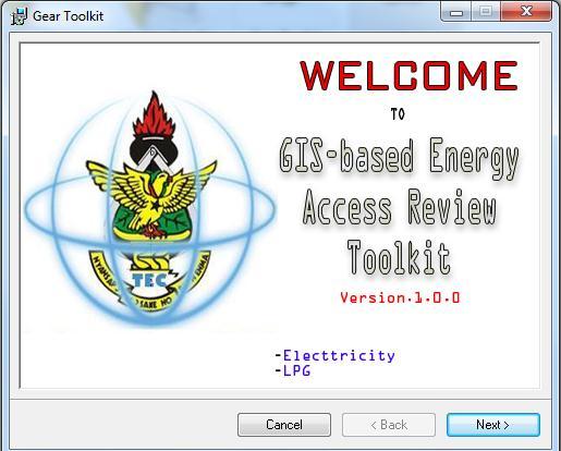
1 GIS-BASED SUPPORT FOR IMPLEMENTING POLICIES AND PLANS TO INCREASE ACCESS TO ENERGY SERVICES IN GHANA Appendix 3: GEAR Toolkit User Guide and Training Manual March 2012 Francis Kemausuor; Abeeku Brew-Hammond; George Yao Obeng; Alfred Duker; Frank Ohene Annor; Festus Boamah; Isaac Adu-Poku; Daniel Ladzagla 1
 Dag-Hammarskjöld-Weg 1-5 65760 Eschborn Germany The EUEI PDF is an instrument of the EU Energy")
2 Imprint EU Energy Initiative Partnership Dialogue Facility (EUEI PDF) c/o Deutsche Gesellschaft für Internationale Zusammenarbeit (GIZ) Dag-Hammarskjöld-Weg Eschborn Germany The EUEI PDF is an instrument of the EU Energy Initiative (EUEI). 2
3 1 OVERVIEW OF THE GEAR TOOLKIT Gear Toolkit is an interactive computer-based Decision Support System (DSS) developed to compile, analyze and present data for Energy planning and management. This will aids in providing precise information needed to make timely decisions related to electrifying a community, region or district in the country However, with the inherent limitations faced by the traditional system of record-keeping (files and papers) and the voluminous nature of data involved during planning, an automated system can be developed using Geo information Technology. Geo Information technology makes use of GIS Technology in the management of geographic features. Training materials i. The Gear Toolkit Software ii. A Computer 3
4 2 TRAINING MODULES 2.1 Exploring the GEAR Toolkit The Gear Toolkit consist of the following: Map Explorer: For viewing spatial data on electrified/un-electrified communities in Regions and Entire country. Query window :For Interrogating the map and its Attributes Geo-database window: Updating and Editing Feature attributes National statistics window: National, regional and District Database of Electrified and Un-electrified Communities in Ghana. National statistics window on LPG: Regional Database of LPG Access in Ghana. System settings window :User Access and Other Configurations Help window: Help manual for users of the Toolkit 2.2 System Requirement This is a complete system requirements and recommendations for your Gear Toolkit software. This media is supported on Windows XP, Windows Server 2003, Windows Vista, Windows 7 and Windows Server 2008 operating systems with 32 bit architecture/ platform. The Microsoft.NET Framework 3.5 SP1 is required to install the Gear Toolkit. The Microsoft.NET Framework 3.5 SP1 setup is available in the DotNet35 folder. 2.3 Installing Gear Toolkit Insert the Gear Toolkit installation Disc in a media (Computer). If auto run is enabled, a setup menu will appear. If auto run is disabled, navigate to the install media or to your extracted ISO image location and run the Toolkit application. Existing users o Use the Detect Conflicts utility, under Uninstallation / remove the existing software on the setup menu, to locate and automatically remove previous application products that are installed on your machine. Select the software you want to install from the setup menu and follow the instructions to complete the installation process. If you have any questions about the items listed on the setup menu, additional information regarding an item can be found by hovering the mouse on the product link. 4
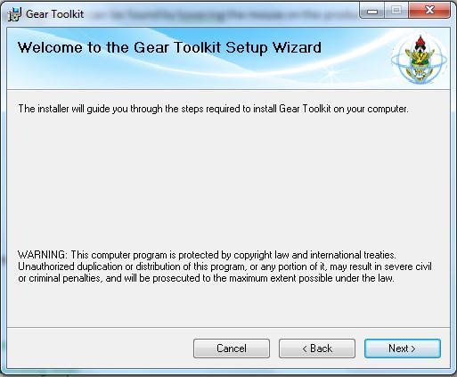
5 Installation procedure 5

6 3 GETTING STARTED Run the Application Logging into the System as Administrator or a Guest Perform spatial Queries, Making Further analysis and generating output. Generate a report based on Query Preparing for printing Running the Application: The Gear Toolkit creates a shortcut icon on the Desktop. Double click the icon to lunch the application. Wait patiently for the splash screen to load the Toolkit. After loading the Login Logging into the System: The Login session is a security interface that checks who want to use the Gear Toolkit. The login interface is made up of a User type (Administrator or Staff), a username and a password. Then the system checks the details with a user s database and if it finds matches the system grants access. A user has three attempts to try to inter the system. After that the system logs out automatically. After a successful login, a welcome interface welcomes you and then proceeds to the main Toolkit Main Interface appears 6

7 3.1 Using the map Explorer i. On The Energy Center interface click Map window menu Button 7

8 ii. iii. Click the Region of your choice to display the un-electrified and electrified communities. The result of a query is displayed below for Ashanti region. 8

9 iv. The Toolbar consists of a series of buttons that access commonly used functions. It is located directly under the Main Menu in the top left of the screen. It contains functions to manage projects and to manipulate and query the map. New This Button opens a new project. Open Project This button allows the user to navigate to a pre-existing project. Save Project Saves any changes made to the current project or allows the user to save a project under a new name and location. Add Data This button brings up the Open window which allows the user to navigate to and select files containing layers to add to the current project. Pan This button is used when manipulating the map and changes the cursor to a four directional arrow when active. Click and hold the left mouse button to grab the map then move the mouse in the desired direction to move the map. Releasing the mouse button releases the map. Select This button selects data in a specified area on the map. Click and drag the mouse to create a rectangle over the desired features. The cursor is changed to a pointing hand when this function is active. Zoom This button provides the user with two options for zooming in and out. First the user can click the left mouse button to zoom in and the right mouse button to zoom out. Second, the user can zoom to a portion of the map by drawing a rectangle around the desired portion. Note: regardless of which function is active (Pan, Select or Zoom) a mouse with a scroll wheel can zoom by rolling the wheel forward or out by rolling backward Identifier 9

10 This button changes the mouse to a crosshairs and is used to access detailed information about a desired portion of the map. Click an area of the map to open the Feature Identifier window which contains a table of information associated with the selected feature. Attributes This button opens the Attribute Table Editor which will be discussed at length in another chapter. Zoom to Maximum Extents Clicking this button automatically zoom the map to its fullest extent. Gear Toolkit add-on toolbar The print current map enables one to print the output of the Map Explorer Query. The map layout enables the preparation of map for printing Go back to the map Explorer panel sends you back to the map Explorer panel 10


11 3.2 The Gear Toolkit Legend The Gear Toolkit Legend displays all the map layers in the current project. It also provides tools to manipulate the layers. The figure below shows the Legend Window as it typically appears during a project. Checkboxes 11

12 These indicate whether a layer is visible (checked) or hidden (unchecked) in the current view on the Map Display. Layer Symbology These provide a visual indicator for the layer. If the layer is a polygon, the indicator for that layer will be represented by the colour of the polygon. If the layer is a line or point, the icon will be represented by the colour and features of the line or point and so on. Point Symbolizer Dialog Double clicking the indicator for a layer with point type data brings up the Points Symbolizer Dialog window. This window contains options for managing the various characteristics of the point symbol. It is divided into four main parts: Symbol Layers, Symbolizer Characteristics, Symbol Type and Placement. Also of note are the Apply, Cancel and OK buttons at the bottom right of the window. After making any changes within the dialog click the Apply button to apply the changes to the map without closing the window or the OK button to apply the changes and close the window. Click Cancel to ignore the changes and close the window. A colour button and opacity slider can be used for altering the colour and transparency of the symbol. Click the colour button on the left to bring up the Colour window with basic colour options as well as any user defined custom colours. Click the Define Custom Colours button to create custom colours by clicking and dragging the crosshairs to the desired spot on the colour spectrum. There is also a vertical slider to the right of the spectrum that determines the lightness and saturation of the colour. Click the Add to Custom Colours 12


13 button to add the colour to the Custom colours section of the Colour window. Click OK to accept the changes or Cancel to decline. Upon exiting the Colour window the user can set the transparency of the colour with the opacity slider. Note that any changes made will be represented in the preview box. 3.3 Using Query window I. On The Energy Center interface click Query window menu Button 13

14 II. Select the Query you want to make E.g.: Regional Level Query, District Query Level, Community level Query and Finally LPG Query. III. Building an all region query to select electrified and un-electrified communities in Ghana IV. Hit the Query Button and then the shape file going to display the query pops up in the map window V. A Dialog box appears asking one to view details of the query 14


15 VI. Result of an all region query showing the map of Ghana in Layer together with electrified and un-electrified communities VII. Further analysis on the Query is displayed below 15
 and ([Select Operator ]= Equals ) then press the query Button The map Layout: This is a used")
16 VIII. Proposed Technology for electrifying Each Community can be displayed in a dialog box. Selecting off-grid Technology, mini-grid Technology, Grid Technology. IX. Syntax Model for the Query based in the Greater Accra region : ([Select Region] = Greater Accra Region ) and ([Select Operator ]= Equals ) then press the query Button The map Layout: This is a used to prepare maps after any query Using the map Layout window i. Below The Energy Center interface click the Print current map But ii. The Tool Box Show the map layout tools iii. Prepare the map using the Toolbox shown above 16
 etc. Updating the system is done at the district Level Performing update: i. On The Energy Center interface click Update window menu Button ii.")
17 3.4 Updating the Gear Toolkit Geodatabase The Gear toolkit can be updated with new community information such as Region of Community, District of Community, Community name, Community name, Population, Geographic Coordinates(X,Y) etc. Updating the system is done at the district Level Performing update: i. On The Energy Center interface click Update window menu Button ii. Then Select a Region in the Regions of Ghana List box iii. Then select the district of your choice under the region chosen iv. An Ashanti RegionAdansi North District showing the district boundary with electrified communities in red and un-electrified communities in blue. 17


18 v. The update toolbox contains add town, Edit town, Refresh map,delete community, End Edit menu item vi. To add a single community go to file Add community vii. For a multiple community update click on the add Town 18


19 viii. Click the save button and wait patiently for the system to update the system with the new information. The new information is then plotted in Green star point together with electrified and un-electrified communities on your map. ix. Then to Edit or update a community click on the edit menu item on the update window tools bar 19


20 x. On the tools bar dropdown the all the communities in the selected district and select the community you want to update. xi. You can update directly in the data grid view information on the district directly or click on the row selector on the left side of the data grid view Editing directly in the grid below Editing using the information directly 20

21 xii. xiii. xiv. Refresh the update window after each update to ensure that data is available in the geodatabase Click on the cancel edit after each Edit session to close the edit grid. To delete a community, click on the edit menu item and then select the community to delete and then cancel the edit. 3.5 The National statistics window (National Electrification and LPG Database) This is a viewer that enables one to Making General Analysis on Energy Access in Ghana. Using the national statistics window i. On The Energy Center interface click the national statistics window menu Button ii. Since this section is a Classified Area An Authentification Screen Appears to Authenticate the Current. So Just Logging with your user Type and password. iii. The window also displays the all the cost needed to Electrify each community within the district that is un-electrified. iv. Select the region and then the district v. Click on the get database button 21


22 vi. Search for communities and select electrified and un-electrified communities. vii. Export Data into other format Such as Excel work sheets 3.5 The System settings This is a viewer that enables one to Making General Analysis on Energy Access in Ghana. 22


23 I. On The Energy Center interface click the system settings window menu Button II. Click on the manage network and internet settings menu item to manage your remote access to the databases online. III. IV. Click on the manage system users menu item to manage Click on file folder database settings menu item to display the system files in the Toolkit 23


24 24 Deleting system Files can be harmful to your Gear Toolkit.
25 Glossary GIS: Geographic Information System (A system of Hardware, software and the procedure design to support the capture manipulation analysis display modelling of geographically or spatially referenced Data for Decision making. Coordinates: Two or three numbers used to uniquely identify each point in space. Energy Center: Chosen application Name for the multiple document interfaces, meaning Geographic data Management implying the function of the application. Gear Toolkit: Gis-based Energy Access Review Toolkit Geo-Database: A repository of computerized data files of describing geographic features. Geographic data / Spatial Data: Information describing the location and attributes of things, including their shapes and representation. Geographic data is the composite of spatial data and attribute data. Graphic data has three elements; point (or called node), line (or called arc) and area (or called polygon) in either vector or raster form which represent a geometry of topology, size, shape, position and orientation Non-Spatial data / Attribute data: Non-spatial data has no specific location in space. It can however, have a geographic component and be linked to a geographic location... UTM: Universal Transverse Mercator A specific implementation of the transverse Mercator projection designed for worldwide mapping in which the world is divided into sixty zones each of which is six degrees of longitude wide with each zone projected individually. TM (Transverse Mercator): A conformal map projection in which the regular Mercator projection is rotated (transverse) 90 in azimuth, the central meridian corresponding to the line which represents the equator on the regular Mercator; the characteristics as to scale are identical to those of the regular Mercator, except that the scale is dependent on distances east or west of the meridian instead of north or south of the equator. 25
Guide to Mapping Website (Public) December 2016 GC_236594
 December 2016 GC_236594") Guide to Mapping Website (Public) December 2016 GC_236594 Table of Contents Guide to Mapping Website (Public)... 1 December 2016... 1 Quick Start... 3 Map Layers... 4 How do I?... 5 Draw on the Map...
Guide to Mapping Website (Public) December 2016 GC_236594 Table of Contents Guide to Mapping Website (Public)... 1 December 2016... 1 Quick Start... 3 Map Layers... 4 How do I?... 5 Draw on the Map...
BC Spatial Member Map Viewer. Version 2.0. User Guide. May 2015
 BC Spatial Member Map Viewer Version 2.0 User Guide May 2015 1 P a g e Revised: 16 June 2015 Contents Contents... 2 Introduction... 4 System Requirements... 5 BC Spatial Map Viewer... 6 I. Navigation Tools...
The Preparing for Success Online Mapping Tool
 The Preparing for Success Online Mapping Tool Baker Polito Administration The Executive Office of Housing and Economic Development and MassGIS Questions & Comments? Please contact MassWorks@state.ma.us
Geographical Information Systems Institute. Center for Geographic Analysis, Harvard University. LAB EXERCISE 1: Basic Mapping in ArcMap
 Harvard University Introduction to ArcMap Geographical Information Systems Institute Center for Geographic Analysis, Harvard University LAB EXERCISE 1: Basic Mapping in ArcMap Individual files (lab instructions,
OnCOR Silverlight Viewer Guide
 Getting Around There are many ways to move around the map! The simplest option is to use your mouse in the map area. If you hold the left button down, then click and drag, you can pan the map to a new
Exercise 1: An Overview of ArcMap and ArcCatalog
 Exercise 1: An Overview of ArcMap and ArcCatalog Introduction: ArcGIS is an integrated collection of GIS software products for building a complete GIS. ArcGIS enables users to deploy GIS functionality
RAPIDMAP Geocortex HTML5 Viewer Manual
 RAPIDMAP Geocortex HTML5 Viewer Manual This site was developed using the evolving HTML5 web standard and should work in most modern browsers including IE, Safari, Chrome and Firefox. Even though it was
Development Authority of the North Country (DANC) Internet Mapping Application Instructions Public Viewer 1. Purpose. 2. Logging-in. 3.
 Internet Mapping Application Instructions Public Viewer 1. Purpose. 2. Logging-in. 3.") Development Authority of the North Country (DANC) Internet Mapping Application Instructions Public Viewer 1. Purpose The purpose of this document is to outline basic functionality of the DANC Internet
Development Authority of the North Country (DANC) Internet Mapping Application Instructions Public Viewer 1. Purpose The purpose of this document is to outline basic functionality of the DANC Internet
Mn/DOT MnCMAT Crash Analysis Application Help
 Mn/DOT MnCMAT Crash Analysis Application Contents Login... 5 User Login Dialog... 5 Login... 5 Request Access Dialog... 5 Forgotten Password Dialog... 6 Create/Open Project... 7 Create/Open Project Dialog...
Overview of ArcGIS Online Applications. Champaign County
 Overview of ArcGIS Online Applications Champaign County Champaign County GIS Consortium Updated: April 2017 Table of Contents ArcGIS Online Application Overview... 3 Map Interface Symbology and Terminology...
Introduction to GIS & Mapping: ArcGIS Desktop
 Introduction to GIS & Mapping: ArcGIS Desktop Your task in this exercise is to determine the best place to build a mixed use facility in Hudson County, NJ. In order to revitalize the community and take
To the GeoView System Overview Online Training Course
 Welcome! To the GeoView System Overview Online Training Course The Alberta Department of Energy provides GeoView as a mapping system to enable users to find geographic information in Alberta. GeoView retrieves
Chapter 1 : Getting Started with Integrity... Chapter 2 : Interface Layout... Chapter 3 : Navigation... Chapter 4 : Printing...
 .0 User s Manual Table of Contents Chapter : Getting Started with Integrity... Chapter : Interface Layout... Chapter : Navigation... Chapter : Printing... Chapter : Quick Search and Results Pane... Results
in the help area and if you click on MapViewer.
 ARCTIC VIEWER INSTRUCTIONS The Arctic Viewer is an Internet mapping application built using ArcIMS by Environmental Systems Research institute (ESRI). The first time you use call up the viewer on your
ArcView QuickStart Guide. Contents. The ArcView Screen. Elements of an ArcView Project. Creating an ArcView Project. Adding Themes to Views
 ArcView QuickStart Guide Page 1 ArcView QuickStart Guide Contents The ArcView Screen Elements of an ArcView Project Creating an ArcView Project Adding Themes to Views Zoom and Pan Tools Querying Themes
All data is in Universal Transverse Mercator (UTM) Zone 6 projection, and WGS 84 datum.
 Zone 6 projection, and WGS 84 datum.") 111 Mulford Hall, College of Natural Resources, UC Berkeley (510) 643-4539 EXPLORING MOOREA DATA WITH QUANTUM GIS In this exercise, you will be using an open-source FREE GIS software, called Quantum GIS,
111 Mulford Hall, College of Natural Resources, UC Berkeley (510) 643-4539 EXPLORING MOOREA DATA WITH QUANTUM GIS In this exercise, you will be using an open-source FREE GIS software, called Quantum GIS,
Quick Guide to MapWindow GIS Desktop Application
 Quick Guide to MapWindow 1 Quick Guide to MapWindow GIS Desktop Application Version 2 January 2007 Adapted by Tom Croft. This is a summary user guide for commonly used tools and capabilities and does not
Layout and display. STILOG IST, all rights reserved
 2 Table of Contents I. Main Window... 1 1. DEFINITION... 1 2. LIST OF WINDOW ELEMENTS... 1 Quick Access Bar... 1 Menu Bar... 1 Windows... 2 Status bar... 2 Pop-up menu... 4 II. Menu Bar... 5 1. DEFINITION...
Juniata County, Pennsylvania
 GIS Parcel Viewer Web Mapping Application Functional Documentation June 21, 2017 Juniata County, Pennsylvania Presented by www.worldviewsolutions.com (804) 767-1870 (phone) (804) 545-0792 (fax) 115 South
In order to follow this set of directions you will need the following
 How to Create Maps & Figures in ArcView 9x In order to follow this set of directions you will need the following 1) the Jenny s Louisiana GIS Instructional CD 2) a computer with ArcGIS on it (version 9.0
User Manual Mobile client User Interface Version 5.0. Powered by
 User Manual Mobile client User Interface Version 5.0 Powered by Cartographic browser Gomap 4 1 Access control 5 1.1 Public access 5 1.2 Secured access 5 1.3 Multiple applications 5 2 Organisation 6 3 Parameters
IntraMaps End User Manual
 IntraMaps End User Manual For IntraMaps Version 8 Date: 6 th July 2014 Contents Introduction... 4 What is IntraMaps?... 4 Application... 5 Main Toolbar... 6 View... 7 Original View:... 7 Pan:... 7 Zoom
Climate-Smart New Orleans
 Climate-Smart New Orleans Table of Contents GETTING THERE... 2 Accessing the site... 2 Logging into the site... 2 Navigating the Map... 2 Zoom & Pan... 2 Change the map background... 3 Interacting in the
Explore some of the new functionality in ArcMap 10
 Explore some of the new functionality in ArcMap 10 Scenario In this exercise, imagine you are a GIS analyst working for Old Dominion University. Construction will begin shortly on renovation of the new
Web Viewer Guide. HiPER LOOK Version Copyright 2016 PIXIA Corp. All Rights Reserved.
 Web Viewer Guide 2016 HiPER LOOK Version 1.4.16.0 Copyright 2016 PIXIA Corp. All Rights Reserved. Table of Contents 1 System Requirements... 5 1.1 Prerequisites... 5 1.2 Web Browser... 5 2 HiPER LOOK Web
MapInfo ProViewer 11.0 USER GUIDE
 MapInfo ProViewer 11.0 USER GUIDE Information in this document is subject to change without notice and does not represent a commitment on the part of the vendor or its representatives. No part of this
Estuary Data Viewer User Guide
 1. Introduction 2. Page Layout 3. Navigation Tools 4. Table of Contents Tabs 5. Action Tools 6. System Requirements Estuary Data Viewer User Guide 1. Introduction Welcome to the Estuary Planner Data Viewer.
Step by Step How to Manual
 www.quintewestmaps.com Step by Step How to Manual Click on to accept the disclaimer and go to the web GIS Step by Step Web Based GIS Interface Layout of Web Based GIS Save your Favorite Map Views Link
SAGIS Property Map Viewer Instruction Manual Instructions for using the SAGIS Property Map Viewer. Published December 21, 2018.
 SAGIS Property Map Viewer Instruction Manual www.sagis.org/map Instructions for using the SAGIS Property Map Viewer. Published December 21, 2018. 1 Instructional Videos Click on a link to watch a video
GGR 375 QGIS Tutorial
 GGR 375 QGIS Tutorial With text taken from: Sherman, Gary E. Shuffling Quantum GIS into the Open Source GIS Stack. Free and Open Source Software for Geospatial (FOSS4G) Conference. 2007. Available online
U N I V E R S I T Y O F K E N T U C K Y. efacts 2-click Interactive Building Information Map ~ Help Guide ~ Revised January 20, 2016
 U N I V E R S I T Y O F K E N T U C K Y efacts 2-click Interactive Building Information Map ~ Help Guide ~ Revised January 20, 2016 Contents BUILDING SEARCH... 3 A. FIND A CAMPUS LOCATION... 3 GRAPHICAL
Geography 281 Mapmaking with GIS Project One: Exploring the ArcMap Environment
 Geography 281 Mapmaking with GIS Project One: Exploring the ArcMap Environment This activity is designed to introduce you to the Geography Lab and to the ArcMap software within the lab environment. Please
Press the Plus + key to zoom in. Press the Minus - key to zoom out. Scroll the mouse wheel away from you to zoom in; towards you to zoom out.
 Navigate Around the Map Interactive maps provide many choices for displaying information, searching for more details, and moving around the map. Most navigation uses the mouse, but at times you may also
Basic Tasks in ArcGIS 10.3.x
 Basic Tasks in ArcGIS 10.3.x This guide provides instructions for performing a few basic tasks in ArcGIS 10.3.1, such as adding data to a map document, viewing and changing coordinate system information,
Market Insight Geo Mapping User Guide v1.0
 Market Insight Geo Mapping v1.0 D&B Market Insight Geo Mapping Manual Version: 1.0 Software Version: System: 2017 Q3 Training (UK) Contents Introduction... 1 Data Structure... 2 How to Login... 3 Map Options...
USER S MANUAL. ArboWebForest. WebUI
 USER S MANUAL ArboWebForest WebUI i USER'S MANUAL TABLE OF CONTENTS Page # 1.0 GENERAL INFORMATION... 1-1 1.1 System Overview... 1-1 1.2 Organization of the Manual... 1-1 2.0 SYSTEM SUMMARY... 2-1 2.1
II.1 Running a Crystal Report from Infoview
 Page 1 of 9 Last Updated: September 2007 This document describes how to run a crystal report from Infoview. The basics of running a report are the same for any report, however the parameters will vary
Introduction to SAGA GIS
 GIS Tutorial ID: IGET_RS_001 This tutorial has been developed by BVIEER as part of the IGET web portal intended to provide easy access to geospatial education. This tutorial is released under the Creative
Doc #: IDI06-11F Rev: 1.3 Issued: 22/02/18. Well Seeker PRO How To Guide Rev 1.3. Page 1 of 26
 Well Seeker PRO How To Guide Rev 1.3 Page 1 of 26 Contents 1.0 - Getting Started... 4 1.1 - Display... 4 2.0 - Creating a new Well... 5 2.1 - Unit Selection... 5 2.2 - New Instant Plan / Survey... 6 2.3
City of Richmond Interactive Map (RIM) User Guide for the Public
 User Guide for the Public") Interactive Map (RIM) User Guide for the Public Date: March 26, 2013 Version: 1.0 3479477 3479477 Table of Contents Table of Contents Table of Contents... i About this
Interactive Map (RIM) User Guide for the Public Date: March 26, 2013 Version: 1.0 3479477 3479477 Table of Contents Table of Contents Table of Contents... i About this
A Practical Guide to Using QGIS
 A Practical Guide to Using QGIS 1.1 INTRODUCTION Quantum GIS (QGIS) is a useful mapping software that enables the compilation and displaying of spatial data in the form of a map. Gaining experience in
REDI 5.0 User Manual
 REDI 5.0 User Manual OBJECTIVE: REDI (Regional Economic Development Information System) provides a quick, convenient and easy way of accessing the City of San Diego Business Incentive Zones (BIZ) information.
Podium Plus Data Analysis Software. User Manual. SWIS10 Version
 SWIS10 Version Issue 1.10 February 2005 Contents 1 Introduction 6 1.1 What is Podium Plus? 6 1.2 About This Manual 6 1.3 Typographical Conventions 7 1.4 Getting Technical Support 7 2 Getting Started 8
Greenville County Internet Mapping System User s Guide
 Greenville County Internet Mapping System User s Guide Version 2.0 Greenville County Geographic Information Systems May 30, 2006 Table of Contents NAVIGATING TO THE ONLINE MAPPING APPLICATIONS...- 3 -
Welcome to the Surface Water Data Viewer!
 1 Welcome to the Surface Water Data Viewer! The Surface Water Data Viewer is a mapping tool for the State of Wisconsin. It provides interactive web mapping tools for a variety of datasets, including chemistry,
COGCC GIS Online Map Instructions - Internet Site April 10, 2018
 COGCC GIS Online Map Instructions - Internet Site April 10, 2018 Table of Contents Page Section Page Section 1 Introduction 8 Clear Selection 2 Double Click 8 Buffer 3 Arrow Tip Information 9 Select within
The walkthrough is available at /
 The walkthrough is available at https://downloads.openmicroscopy.org/presentations/2018/gbi-sydney / Description We will demonstrate a number of features of the OMERO platform using an OMERO server based
Biodiversity GIS (BGIS) Internet Mapping User Guide
 Internet Mapping User Guide") Biodiversity GIS (BGIS) Internet Mapping User Guide http://bgis.sanbi.org Contents 1 Basic Introduction to BGIS Website (http://bgis.sanbi.org)... 6 1.1 LUDS... 6 1.2 Projects... 6 1.3 Services... 6 1.4
Biodiversity GIS (BGIS) Internet Mapping User Guide http://bgis.sanbi.org Contents 1 Basic Introduction to BGIS Website (http://bgis.sanbi.org)... 6 1.1 LUDS... 6 1.2 Projects... 6 1.3 Services... 6 1.4
Tutorial 1 Exploring ArcGIS
 Tutorial 1 Exploring ArcGIS Before beginning this tutorial, you should make sure your GIS network folder is mapped on the computer you are using. Please refer to the How to map your GIS server folder as
Exercise 2.2. Explore QGIS. GIS Techniques for Monitoring and Evaluation of HIV/AIDS and Related Programs
 GIS Techniques for Monitoring and Evaluation of HIV/AIDS and Related Programs Exercise 2.2 Explore QGIS *This training was developed as part of a joint effort between MEASURE Evaluation and MEASURE DHS,
1. Start ArcMap by going to the Start menu > All Programs > ArcGIS > ArcMap.
 Learning ArcGIS: Introduction to ArcMap 10.1 The Map Document Feature Manipulation Navigating ArcMap Map Documents, Layers, and Features Shapes, Location, and Attribute Data Symbology Zoom, Pan and Map
Calendar & Buttons Dashboard Menu Features My Profile My Favorites Watch List Adding a New Request...
 remitview User Guide 1 TABLE OF CONTENTS INTRODUCTION... 3 Calendar & Buttons... 3 GETTING STARTED.... 5 Dashboard.... 7 Menu Features... 8 PROFILE.... 10 My Profile... 10 My Favorites... 12 Watch List...
Newaygo County Web Map
 Newaygo County Web Map Address/Parcel/Parcel Owner Search Map Overview Zoom Back to default extent Use your current location if allowable Widget Panel At the top of the map is a search function used for
Overview of CCSD Secure Cropper Map
 Overview of CCSD Secure Cropper Map Map Components: 1. Menu Options Use these menus to interact with the map. View School Zones: Use this menu to choose which school zone map to view. Select Students:
MapInfo Stratus. Version 41. MapInfo Stratus Administration Guide
 MapInfo Stratus Version 41 MapInfo Stratus Administration Guide Contents Chapter 1: Getting Started...7 Signing In and Out...8 Home...8 Version Number and Build Number...9 Using MapInfo Stratus Administration
Lab 3: Digitizing in ArcGIS Pro
 Lab 3: Digitizing in ArcGIS Pro What You ll Learn: In this Lab you ll be introduced to basic digitizing techniques using ArcGIS Pro. You should read Chapter 4 in the GIS Fundamentals textbook before starting
Name: Date: June 27th, 2011 GIS Boot Camps For Educators Lecture_3
 Name: Date: June 27th, 2011 GIS Boot Camps For Educators Lecture_3 Practical: Creating and Editing Shapefiles Using Straight, AutoComplete and Cut Polygon Tools Use ArcCatalog to copy data files from:
for ArcSketch Version 1.1 ArcSketch is a sample extension to ArcGIS. It works with ArcGIS 9.1
 ArcSketch User Guide for ArcSketch Version 1.1 ArcSketch is a sample extension to ArcGIS. It works with ArcGIS 9.1 ArcSketch allows the user to quickly create, or sketch, features in ArcMap using easy-to-use
NMCRIS Map Service Application Feature Editing
 NMCRIS Map Service Application Feature Editing Exercise goal: Users will edit the polygonal boundaries for activities and resources in the NMCRIS Map Service. Important: This exercise is a sample presentation
Intro to GIS (requirements: basic Windows computer skills and a flash drive)
") Introduction to GIS Intro to GIS (requirements: basic Windows computer skills and a flash drive) Part 1. What is GIS. 1. System: hardware (computers, devices), software (proprietary or free), people. 2.
Introduction to GIS Intro to GIS (requirements: basic Windows computer skills and a flash drive) Part 1. What is GIS. 1. System: hardware (computers, devices), software (proprietary or free), people. 2.
I. An Intro to ArcMap Version 9.3 and 10. 1) Arc Map is basically a build your own Google map
 Arc Map is basically a build your own Google map") I. An Intro to ArcMap Version 9.3 and 10 What is Arc Map? 1) Arc Map is basically a build your own Google map a. Display and manage geo-spatial data (maps, images, points that have a geographic location)
I. An Intro to ArcMap Version 9.3 and 10 What is Arc Map? 1) Arc Map is basically a build your own Google map a. Display and manage geo-spatial data (maps, images, points that have a geographic location)
Reset Cursor Tool Clicking on the Reset Cursor tool will clear all map and tool selections and allow tooltips to be displayed.
 SMS Featured Icons: Mapping Toolbar This document includes a brief description of some of the most commonly used tools in the SMS Desktop Software map window toolbar as well as shows you the toolbar shortcuts
USING DATA DRIVEN PAGES
 USING DATA DRIVEN PAGES Mid-West ESRI Utility User s Group Conference March 26, 2014 Presented by: Hillary Bjorstrom, GIS Analyst STAR Energy Services LLC Alexandria, Minnesota EXERCISE 1 CREATING A GRID
Appendix Z Basic ArcMap and GDSE Tools
 Appendix Z Basic ArcMap and GDSE Tools Introduction IFMAP has been developed within ESRI s ArcMap interface. As such, the application is inherently map-based. Although a user can enter tabular data through
Biodiversity Interactive Map
 Powered by MapShare Biodiversity Interactive Map (BIM) User Tips The Biodiversity Interactive Map (BIM) is accessible via the Department of Environment and Primary Industries (DEPI) website at www.depi.vic.gov.au.
Fusion. CBR Fusion MLS Level 1 Core Functions. Class Handout
 Fusion 1 CBR Fusion MLS Level 1 Core Functions Class Handout GETTING STARTED IN FUSION Logging On and Off To log on to Fusion MLS: 1. Type your user name in the User ID box. 2. Type your password in the
IHS Enerdeq Desktop International Training Guide
 IHS > Decision Support Tool IHS Enerdeq Desktop International Training Guide May 2009 Version 1.5.2 2009 IHS, All Rights Reserved. All trademarks belong to IHS or its affiliated and subsidiary companies,
Step by Step GIS. Section 1
 Step by Step GIS Section 1 Contact the web page given below for the data required to do the exercises (http://www.pasda.psu.edu/default.asp) Before beginning the tutorials please visit the Preparation
BIO8014 GIS & Remote Sensing Practical Series. Practical 1: Introduction to ArcGIS Desktop
 BIO8014 GIS & Remote Sensing Practical Series Practical 1: Introduction to ArcGIS Desktop 0. Introduction There are various activities associated with the term GIS, these include visualisation, manipulation
Getting Started with VicMap
 Getting Started with VicMap This is a brief overview of some of the tools and features available on VicMap. At any time you can right click on the map and click Identify What s Here to find more information
Mosaic Tutorial: Advanced Workflow
 Mosaic Tutorial: Advanced Workflow This tutorial demonstrates how to mosaic two scenes with different color variations. You will learn how to: Reorder the display of the input scenes Achieve a consistent
GETTING STARTED TABLE OF CONTENTS
 Sketchup Tutorial GETTING STARTED Sketchup is a 3D modeling program that can be used to create 3D objects in a 2D environment. Whether you plan to model for 3D printing or for other purposes, Sketchup
Welcome to MicroStation
 Welcome to MicroStation Module Overview This module will help a new user become familiar with the tools and features found in the MicroStation design environment. Module Prerequisites Fundamental knowledge
OziExplorer Training and Help Manual for Use with Soil Resource Stewardship Monitoring Checklist: Cutblock-Level
 OziExplorer Training and Help Manual for Use with Soil Resource Stewardship Monitoring Checklist: Cutblock-Level Stéphane Dubé, Soil Scientist MOFR Northern Interior Forest Region May 2009 Version 2 Starting
WAIPA DISTRICT COUNCIL. Maps Online 9. Updated January This document contains an overview of IntraMaps/Maps Online version 9.
 WAIPA DISTRICT COUNCIL Maps Online 9 Updated January 2018 This document contains an overview of IntraMaps/Maps Online version 9.0 Contents Starting Maps Online... 3 Menu Bar... 4 Tools... 5 View Tab...
INTRODUCTION TO GIS WORKSHOP EXERCISE
 111 Mulford Hall, College of Natural Resources, UC Berkeley (510) 643-4539 INTRODUCTION TO GIS WORKSHOP EXERCISE This exercise is a survey of some GIS and spatial analysis tools for ecological and natural
Review other manuals that may assist you in navigating and using the Kettering CAFM website. Follow these steps to retrieve the user guides:
 The following pages review how to use the Markup & Measure tools while viewing a drawing in the Kettering ifm CAFM website. These steps will instruct the user on how to markup a drawing and save it for
Each primary search has an auto-fill that will filter out results as the user continues to type.
 The Town of Farmville has recently requested a GIS parcel viewer and Timmons Group, based out of Richmond, VA, was selected to design and host this new website. This website allows users to look up parcel
MicroStation V8i Tips and Tricks and more
 The following Tips and Tricks include features that are new in the version SELECTSeries 2&3 and some that have been around for a while enjoy Explorer the File Open dialog. Let s take a close look at the
City of La Crosse Online Mapping Website Help Document
 City of La Crosse Online Mapping Website Help Document This document was created to assist in using the new City of La Crosse online mapping sites. When the website is first opened, a map showing the City
US Geo-Explorer User s Guide. Web:
 US Geo-Explorer User s Guide Web: http://usgeoexplorer.org Updated on October 26, 2016 TABLE OF CONTENTS Introduction... 3 1. System Interface... 5 2. Administrative Unit... 7 2.1 Region Selection... 7
LAB 1: Introduction to ArcGIS 8
 LAB 1: Introduction to ArcGIS 8 Outline Introduction Purpose Lab Basics o About the Computers o About the software o Additional information Data ArcGIS Applications o Starting ArcGIS o o o Conclusion To
Geography 281 Mapmaking with GIS Project One: Exploring the ArcMap Environment
 Geography 281 Mapmaking with GIS Project One: Exploring the ArcMap Environment This activity is designed to introduce you to the Geography Lab and to the ArcMap software within the lab environment. Before
Home Health Assessment Validation and Entry System (jhaven) User Guide
 User Guide") Home Health Assessment Validation and Entry System (jhaven) User Guide In Support of Software Version 1.0 January 01, 2015 Last updated: 12/12/2014 Table of Contents NAVIGATION TIP: To navigate directly
Home Health Assessment Validation and Entry System (jhaven) User Guide In Support of Software Version 1.0 January 01, 2015 Last updated: 12/12/2014 Table of Contents NAVIGATION TIP: To navigate directly
SAS Report Viewer 8.3 Documentation
 SAS Report Viewer 8.3 Documentation About SAS Report Viewer Introduction to SAS Report Viewer SAS Report Viewer (the report viewer) enables users who are not report designers to view a report using a web
Exercise 1: Getting to know ArcGIS
 The Scenario You are working for the California Visitor s Commission. You have been asked to prepare a map of California for several dignitaries from out of the country. Your map will need to include enough
GIS Basics for Urban Studies
 GIS Basics for Urban Studies Date: March 21, 2018 Contacts: Mehdi Aminipouri, Graduate Peer GIS Faciliator, SFU Library (maminipo@sfu.ca) Keshav Mukunda, GIS & Map Librarian Librarian for Geography (kmukunda@sfu.ca)
The following instructions cover how to edit an existing report in IBM Cognos Analytics.
 IBM Cognos Analytics Edit a Report The following instructions cover how to edit an existing report in IBM Cognos Analytics. Navigate to Cognos Cognos Analytics supports all browsers with the exception
Technical Publications 1View
 Technical Publications 1View 1View User Guides Overview... 2 Homepage... 4 Subscription Management... 5 Table of Contents (TOC)... 6 Navigation... 8 Search... 11 Linking... 13 Order List... 14 Graphic
Converting AutoCAD Map 2002 Projects to ArcGIS
 Introduction This document outlines the procedures necessary for converting an AutoCAD Map drawing containing topologies to ArcGIS version 9.x and higher. This includes the export of polygon and network
Ortelia Space Builder User Manual
 Ortelia Space Builder User Manual http://ortelia.com 1 Table of Contents Introducing Ortelia Space Builder...2 System Requirements...3 1. Operating system:... 3 2. Hardware:... 3 Minimum Graphics card
Introduction to GIS A Journey Through Gale Crater
 Introduction to GIS A Journey Through Gale Crater In this lab you will be learning how to use ArcMap, one of the most common commercial software packages for GIS (Geographic Information System). Throughout
DOCUMENT IMAGING REFERENCE GUIDE
 January 25, 2017 DOCUMENT IMAGING REFERENCE GUIDE AppXtender Web Access version 7 Kent State University Division of Information Services AppXtender Web Access Help: For questions regarding AppXtender Web
SAFMC Habitat and Ecosystem Viewer
 SOUTH ATLANTIC FISHERY MANAGEMENT COUNCIL SAFMC Habitat and Ecosystem Viewer Integrating Management Resources This document provides an overview of the SAFMC Habitat and Ecosystem Viewer data sources and
HBS Training - IT Solutions. PlanWeb. Intermediate
 HBS Training - IT Solutions PlanWeb Intermediate CONTENTS Logging on to the system...3 The PlanWeb Window...5 The Tool Bar...6 The Status Bar...6 The Map Window...6 The Information Window...7 Changing
Numbers Basics Website:
 Website: http://etc.usf.edu/te/ Numbers is Apple's new spreadsheet application. It is installed as part of the iwork suite, which also includes the word processing program Pages and the presentation program
Map Functions August 3, 2015 Triangle Homes Group
 Map Functions August 3, 2015 Triangle Homes Group Preston Neighborhoods and Property Map The Map is an interactive web based using ArcGIS Online by ESRI ESRI is the world s largest Geographic Information
Getting Started with the NH Coastal Viewer March, 2015, v0
 Getting Started with the NH Coastal Viewer March, 2015, v0 The NH Coastal Viewer contains a comprehensive user interface with many tools and functions. This document summarizes some of the basic site functionality,
D2M2 - GIS USER'S MANUAL
 D2M2 - GIS USER'S MANUAL USACE ERDC, July 2012 1 Content Overview of D2M2... 3 User Interface... 4 Menus... 4 File Menu... 4 Edit Menu... 5 View Menu... 5 Layer Menu... 6 Analysis Menu... 6 Tools Menu...
Contents. Overview...2. Server Install...2. Client Install...4. Administration Module...6. FastLook Features...10
 Contents Overview...2 Server Install...2 Client Install...4 Administration Module...6 FastLook Features...10 This guide is intended to help you install the LAN version of FastLook. Please refer to the