New Tools in Aircraft Accident Reconstruction to Assist the Insurer. Overview. Overview 4/30/2015
|
|
|
- Chad Carpenter
- 6 years ago
- Views:
Transcription
1 New Tools in Aircraft Accident Reconstruction to Assist the Insurer Steven L. Steve Morris Senior Managing Consultant and Manager of Colorado Operations Engineering Systems Inc (ESI) Overview ESI has reconstructed aircraft accidents since the company was founded in 1987 Since then, we have participated in numerous aviation accident investigations both in and outside the U.S. Tape measures and cameras were essential accident reconstruction tools in 1987 and they are still very important tools today However, new powerful tools are now available and more are arriving every day Overview X ray Computed Tomography (CT) of Parts Laser Scanning LiDAR New Aircraft Simulation Capabilities 1

2 Overview X ray Computed Tomography (CT) of Parts Laser Scanning LiDAR New Aircraft Simulation Capabilities X rays Energetic, penetrating electromagnetic radiation Sensitive to electron density variations Higher Z, greater density materials increased X ray attenuation Real time imaging possible X rays Film or Detector X ray source Sample 2
3 Ejector Flow Valve X ray X ray Limitations Image is a projection of everything intervening between the source and recording system (film or electronic detector) High density can obscure low density constituents X ray Example Consider 4 balls arranged in a box How are they positioned in the box? 3
4 X ray Example X ray image X ray source? X ray Example Possibility 1 X ray image X ray source X ray Example Possibility 2 X ray image X ray source 4
5 X ray Example Possibility 3 X ray image X ray source X ray Example All 3 result in the same X ray image X ray image 1 X ray image indeterminate for internal structure X ray Example X ray source? 5

6 X ray Example X ray image? X ray source X ray image 1 X ray Example X ray image 2 Mental Sudoku Need even more images to completely determine ball locations Correct Answer! X ray CT X ray Computed Tomography 6


7 X ray CT Technique X ray source Intensity vs pixel position Turntable with sample Detector X ray CT Technique X ray source Turntable with sample Intensity vs pixel position Detector X ray CT Technique X ray source Intensity vs pixel position Turntable with sample Detector 7
 Industrial CT Scanning CT Scanning 3D voxel")
 View different material constituents (ρ e thresholding) Dimensioning/metrology/CAD Advanced imaging and video")
8 Tomographic Reconstruction From thousands of 2D X ray images, the computer reconstructs the sample in 3D revealing internal structure Tomographic Reconstruction Original Object CT Voxel Model ( x, y, z, ρ e ) Industrial CT Scanning CT Scanning 3D voxel computer model Orient and view in any direction Slice stacks of top, side, and front views Cut away and view internally (x, y, z, thresholding) View different material constituents (ρ e thresholding) Dimensioning/metrology/CAD Advanced imaging and video capabilities 8


9 Industrial CT Scanning Industrial CT Scanning X ray source Sample stage Detector Detectors 2 D Linear 9


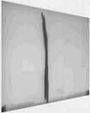
10 Ejector Flow Valve CT Image CT X Ray Ejector Flow Valve CT Image Valve Closed Valve Open Altimeter 10


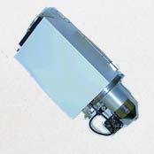
11 Carburetor Carburetor Video Click on photo to play video Carburetor Video Click on photo to play video 11


12 Project Example Pitch Servo Pitch Servo Pitch Servo Pitch Servo 12


13 Pitch Servo Capstan Pinion Gear Capstan Gear Pitch Servo CT Scan of Pitch Servo 2D detector X-ray source 13


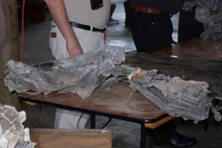
14 CT Scan Slices of Pitch Servo Pitch Servo Disassembly Capstan Pinion Gear Pitch Servo Capstan Gear Contact marks on gear teeth 14


15 Pitch Servo Capstan Gear Contact marks on gear teeth Contact marks Pitch Servo Capstan Gear Pitch Servo Pinion Gear 5 mm Contact marks evidence of gear train particle ingestion and binding 15

16 CT Scan of Pitch Servo Capstan Gear Pinion Gear Pitch Servo CT Slices Y_347 Y_682 Pinion Gear Capstan Gear 122 μm = inch slices Pitch Servo CT Slices Y_347 Y_682 Pinion Gear Capstan Gear 122 μm = inch slices 16


17 Pitch Servo CT Slices Pinion Gear Capstan Gear Pitch Servo CT Slices Pinion Gear Capstan Gear Pitch Servo CT Slices Pinion Gear Y_682 Capstan Gear Subject Exemplar 17


18 Pitch Servo CT Slices Pinion Gear Capstan Gear Contact Points Pitch Servo Gear Interaction Summary Contact marks nothing more than marks imparted post accident with gears misaligned and partially rotated likely during wreckage retrieval. 18

 of Parts Laser Scanning LiDAR New Aircraft Simulation")
19 Pitch Servo Capstan Mount Plate Y_347 Pinion Gear engaged here Pitch Servo Capstan Gear Y_347 Position at disassembly Pinion Gear engaged here Shadow from hole position during postcrash fire Overview X ray Computed Tomography (CT) of Parts Laser Scanning LiDAR New Aircraft Simulation Capabilities 19


20 Laser Scanning An extension of surveying equipment Provides a cloud of millions of points in color By moving the scanner to several locations but keeping the same reference points, a true 3 D object is created You can view the cloud from any vantage point and get very accurate measurements Laser Scanning Laser Scanning 20
 A laser scanning unit could be deployed and provide")

21 Laser Scanning Laser Scanning Laser Scanning Has yet to be used on scene for an aircraft accident (to my knowledge) A laser scanning unit could be deployed and provide valuable information to every aircraft accident scene Excellent method for preserving evidence Can capture data/information that investigator does not immediately know is important 21

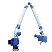
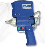
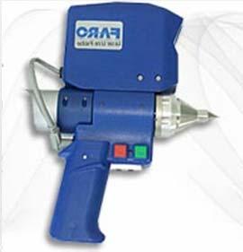
22 Laser Scanning Laser Scanning Laser & Camera Articulating Arm Hard Contact Probe Laser Scanning Camera Laser 22


23 Laser Scanning Laser Scanning Laser Scanning Triangulation Laser Camera Camera Image Laser line projected over an object gives the profile of the object which is imaged by the camera Software renders a visual surface model 23


24 Laser Scanning Point Cloud Data Surface Deviation Map Exemplar Subject Section Deviation Map 24


25 Overview X ray Computed Tomography (CT) of Parts Laser Scanning LiDAR New Aircraft Simulation Capabilities LiDAR Light Detection And Ranging Optical remote sensing technology that can measure the distance to targets by illuminating the target with laser light and analyzing the backscattered light Highly accurate vertical measurements Can get a 3 D digital image of an accident scene, regardless of the site s remoteness LiDAR 25

26 LiDAR LiDAR LiDAR 26
 of Parts Laser Scanning LiDAR New Aircraft Simulation Capabilities")
27 LiDAR LiDAR Was recently used to document an aircraft accident scene Can provide VERY accurate 3 D accident scene documentation Particularly useful for remote accident sites Can be very useful to subsequent accident reconstruction Overview X ray Computed Tomography (CT) of Parts Laser Scanning LiDAR New Aircraft Simulation Capabilities 27
 aspect to")

28 Simulations If animated, simulations help provide Visualization that posters cannot match 4 dimensional (x, y, z, time) aspect to the understanding Understanding of the dynamic sequence of events in an accident More detailed reconstructions Simulations Simulations 28


29 Simulations Radar Data Simulations Reconstructed Data Altitude and Airspeed Histories Altitude Calibrated Airspeed, kt Airspeed Altitude, ft MSL Approximate Airspeed for Stall Warning Horn and Autopilot Disconnect :40 20:41 20:42 20:43 20:44 20:45 20:46 20:47 20:48 20:49 UTC Simulations Plaintiffs alleged that all three occupants were overcome by carbon monoxide poisoning and the plane entered a hands off spiral Could it be shown that the plaintiff s spiral could not be flown without human input? J2 Aircraft Dynamics software provides a tool that can accurately relate the control deflections required to fly the flight path defined from the radar data 29

30 J2 Dynamics Software Provides aircraft modeling and analysis Used to construct a reliable simulator model Simulator validated with Aircraft Flight Manual and/or Flight Test data Yields the control deflections required to fly a given flight path with tolerances provides insight on what the pilot was doing J2 Dynamics Software J2 Dynamics Software Virtual function allows user to produce instant 3D animations of the reconstructed flight path with a graphic of the subject airplane and terrain map Data can be used to produce a high fidelity, courtroom quality animation 30
31 Summary This has been a quick look at some of the tools that can be used in aircraft accident reconstruction Most of these tools came from other disciplines, so a broad view beyond the accident reconstruction community discipline is necessary Technology is changing rapidly new tools continue to become available 31
Digital Image Processing
 Digital Image Processing SPECIAL TOPICS CT IMAGES Hamid R. Rabiee Fall 2015 What is an image? 2 Are images only about visual concepts? We ve already seen that there are other kinds of image. In this lecture
Light Detection and Ranging (LiDAR)
") Light Detection and Ranging (LiDAR) http://code.google.com/creative/radiohead/ Types of aerial sensors passive active 1 Active sensors for mapping terrain Radar transmits microwaves in pulses determines
Light Detection and Ranging (LiDAR) http://code.google.com/creative/radiohead/ Types of aerial sensors passive active 1 Active sensors for mapping terrain Radar transmits microwaves in pulses determines
Integrating the Generations, FIG Working Week 2008,Stockholm, Sweden June 2008
 H. Murat Yilmaz, Aksaray University,Turkey Omer Mutluoglu, Selçuk University, Turkey Murat Yakar, Selçuk University,Turkey Cutting and filling volume calculation are important issues in many engineering
Computer and Machine Vision
 Computer and Machine Vision Lecture Week 12 Part-2 Additional 3D Scene Considerations March 29, 2014 Sam Siewert Outline of Week 12 Computer Vision APIs and Languages Alternatives to C++ and OpenCV API
Creating a Competitive Edge with FARO Scanners
 CASE STUDY Creating a Competitive Edge with FARO Scanners Wesley Grimes President of Collision Engineering Associates, Inc Crash Reconstruction Firm Adopts FARO Laser Scanners To Safely Capture Scenes
ENY-C2005 Geoinformation in Environmental Modeling Lecture 4b: Laser scanning
 1 ENY-C2005 Geoinformation in Environmental Modeling Lecture 4b: Laser scanning Petri Rönnholm Aalto University 2 Learning objectives To recognize applications of laser scanning To understand principles
Wieblinger Weg 92a, Heidelberg, Germany, Phone: , Fax: ;
 HOW INDUSTRIAL COMPUTER TOMOGRAPHY ACCELERATES PRODUCT DEVELOPMENT IN THE LIGHT METAL CASTING AND INJECTION MOULDING INDUSTRY. Christof REINHART 1, Christoph POLIWODA 1, Thomas GÜNTHER 1 1 Volume Graphics
Radiographic Simulator artist: Version 2
 18th World Conference on Nondestructive Testing, 16-20 April 2012, Durban, South Africa Radiographic Simulator artist: Version 2 Carsten Bellon 1, Andreas Deresch 1, Christian Gollwitzer 1, Gerd-Rüdiger
Range Sensors (time of flight) (1)
 (1)") Range Sensors (time of flight) (1) Large range distance measurement -> called range sensors Range information: key element for localization and environment modeling Ultrasonic sensors, infra-red sensors
Range Sensors (time of flight) (1) Large range distance measurement -> called range sensors Range information: key element for localization and environment modeling Ultrasonic sensors, infra-red sensors
LiDAR & Orthophoto Data Report
 LiDAR & Orthophoto Data Report Tofino Flood Plain Mapping Data collected and prepared for: District of Tofino, BC 121 3 rd Street Tofino, BC V0R 2Z0 Eagle Mapping Ltd. #201 2071 Kingsway Ave Port Coquitlam,
Aerial and Mobile LiDAR Data Fusion
 Creating Value Delivering Solutions Aerial and Mobile LiDAR Data Fusion Dr. Srini Dharmapuri, CP, PMP What You Will Learn About LiDAR Fusion Mobile and Aerial LiDAR Technology Components & Parameters Project
Ch 22 Inspection Technologies
 Ch 22 Inspection Technologies Sections: 1. Inspection Metrology 2. Contact vs. Noncontact Inspection Techniques 3. Conventional Measuring and Gaging Techniques 4. Coordinate Measuring Machines 5. Surface
Visualisation : Lecture 1. So what is visualisation? Visualisation
 So what is visualisation? UG4 / M.Sc. Course 2006 toby.breckon@ed.ac.uk Computer Vision Lab. Institute for Perception, Action & Behaviour Introducing 1 Application of interactive 3D computer graphics to
UNIT 22. Remote Sensing and Photogrammetry. Start-up. Reading. In class discuss the following questions:
 UNIT 22 Remote Sensing and Photogrammetry Start-up In class discuss the following questions: A. What do you know about remote sensing? B. What does photogrammetry do? C. Is there a connection between the
10/5/09 1. d = 2. Range Sensors (time of flight) (2) Ultrasonic Sensor (time of flight, sound) (1) Ultrasonic Sensor (time of flight, sound) (2) 4.1.
 (2) Ultrasonic Sensor (time of flight, sound) (1) Ultrasonic Sensor (time of flight, sound) (2) 4.1.") Range Sensors (time of flight) (1) Range Sensors (time of flight) (2) arge range distance measurement -> called range sensors Range information: key element for localization and environment modeling Ultrasonic
Range Sensors (time of flight) (1) Range Sensors (time of flight) (2) arge range distance measurement -> called range sensors Range information: key element for localization and environment modeling Ultrasonic
Exterior Orientation Parameters
 Exterior Orientation Parameters PERS 12/2001 pp 1321-1332 Karsten Jacobsen, Institute for Photogrammetry and GeoInformation, University of Hannover, Germany The georeference of any photogrammetric product
HIGH RESOLUTION COMPUTED TOMOGRAPHY FOR METROLOGY
 HIGH RESOLUTION COMPUTED TOMOGRAPHY FOR METROLOGY David K. Lehmann 1, Kathleen Brockdorf 1 and Dirk Neuber 2 1 phoenix x-ray Systems + Services Inc. St. Petersburg, FL, USA 2 phoenix x-ray Systems + Services
Structured light 3D reconstruction
 Structured light 3D reconstruction Reconstruction pipeline and industrial applications rodola@dsi.unive.it 11/05/2010 3D Reconstruction 3D reconstruction is the process of capturing the shape and appearance
Image Acquisition Systems
 Image Acquisition Systems Goals and Terminology Conventional Radiography Axial Tomography Computer Axial Tomography (CAT) Magnetic Resonance Imaging (MRI) PET, SPECT Ultrasound Microscopy Imaging ITCS
USER S MANUAL Duo Flight Panel. User s Manual. Rev 1.0 June VirtualFly, S.L. tel
 User s Manual Rev 1.0 June 2015 1 TABLE OF CONTENTS 1. IDENTIFICATION OF ELEMENTS 2. INSTALLATION 3. START UP 4. SELECTION OF PANEL TYPE (according to plane) 5. ANALOGIC PANEL INDICATORS 6. RADIOSTACK
MODERN DIMENSIONAL MEASURING TECHNIQUES BASED ON OPTICAL PRINCIPLES
 MODERN DIMENSIONAL MEASURING TECHNIQUES BASED ON OPTICAL PRINCIPLES J. Reichweger 1, J. Enzendorfer 1 and E. Müller 2 1 Steyr Daimler Puch Engineering Center Steyr GmbH Schönauerstrasse 5, A-4400 Steyr,
Comparison of Probing Error in Dimensional Measurement by Means of 3D Computed Tomography with Circular and Helical Sampling
 nd International Symposium on NDT in Aerospace - We..A. Comparison of Probing Error in Dimensional Measurement by Means of D Computed Tomography with Circular and Helical Sampling Jochen HILLER, Stefan
USER S MANUAL Solo Flight Panel. User s Manual. Rev 1.6 October VirtualFly, S.L. tel
 User s Manual Rev 1.6 October 2015 1 TABLE OF CONTENTS 1. IDENTIFICATION OF ELEMENTS 2. INSTALLATION 3. START UP 4. SELECTION OF PANEL TYPE (according to plane) 5. ANALOGIC PANEL INDICATORS 6. RADIOSTACK
Introduction to Biomedical Imaging
 Alejandro Frangi, PhD Computational Imaging Lab Department of Information & Communication Technology Pompeu Fabra University www.cilab.upf.edu X-ray Projection Imaging Computed Tomography Digital X-ray
Depth. Common Classification Tasks. Example: AlexNet. Another Example: Inception. Another Example: Inception. Depth
 Common Classification Tasks Recognition of individual objects/faces Analyze object-specific features (e.g., key points) Train with images from different viewing angles Recognition of object classes Analyze
REMOTE SENSING LiDAR & PHOTOGRAMMETRY 19 May 2017
 REMOTE SENSING LiDAR & PHOTOGRAMMETRY 19 May 2017 SERVICES Visual Inspections Digital Terrain Models Aerial Imagery Volume Computations Thermal Inspections Photo maps Aerial Video Training & Consultancy
Multi-View Stereo for Community Photo Collections Michael Goesele, et al, ICCV Venus de Milo
 Vision Sensing Multi-View Stereo for Community Photo Collections Michael Goesele, et al, ICCV 2007 Venus de Milo The Digital Michelangelo Project, Stanford How to sense 3D very accurately? How to sense
The new generation of industrial computed tomography. The Desktop CT exact S
 The new generation of industrial computed tomography The Desktop CT S Volume scanning technology Innovation with a family tradition Founded in 1968, the family-owned, WEN- ZEL Metrology Group is one of
Position accuracy analysis of the stereotactic reference defined by the CBCT on Leksell Gamma Knife Icon
 Position accuracy analysis of the stereotactic reference defined by the CBCT on Leksell Gamma Knife Icon WHITE PAPER Introduction An image guidance system based on Cone Beam CT (CBCT) is included in Leksell
Using X-Ray Micro Tomography to assess the quality of Packaging Foil
 Using X-Ray Micro Tomography to assess the quality of Packaging Foil Martin Koster 1, Gerard van Dalen 2, Robert Hoeve 3 1 Unilever Research 2 Unilever Research 3 Unilever Research, Olivier van Noortlaaan
Advanced Reconstruction Techniques Applied to an On-Site CT System
 2nd International Symposium on NDT in Aerospace 2010 - We.1.A.4 Advanced Reconstruction Techniques Applied to an On-Site CT System Jonathan HESS, Markus EBERHORN, Markus HOFMANN, Maik LUXA Fraunhofer Development
Quinnipiac Post Flight Aerial Acquisition Report
 Quinnipiac Post Flight Aerial Acquisition Report August 2011 Post-Flight Aerial Acquisition and Calibration Report FEMA REGION 1 Quinnipiac Watershed, Connecticut, Massachusesetts FEDERAL EMERGENCY MANAGEMENT
Geometry of Aerial photogrammetry. Panu Srestasathiern, PhD. Researcher Geo-Informatics and Space Technology Development Agency (Public Organization)
") Geometry of Aerial photogrammetry Panu Srestasathiern, PhD. Researcher Geo-Informatics and Space Technology Development Agency (Public Organization) Image formation - Recap The geometry of imaging system
Geometry of Aerial photogrammetry Panu Srestasathiern, PhD. Researcher Geo-Informatics and Space Technology Development Agency (Public Organization) Image formation - Recap The geometry of imaging system
Range Imaging Through Triangulation. Range Imaging Through Triangulation. Range Imaging Through Triangulation. Range Imaging Through Triangulation
 Obviously, this is a very slow process and not suitable for dynamic scenes. To speed things up, we can use a laser that projects a vertical line of light onto the scene. This laser rotates around its vertical
3D Modeling of Objects Using Laser Scanning
 1 3D Modeling of Objects Using Laser Scanning D. Jaya Deepu, LPU University, Punjab, India Email: Jaideepudadi@gmail.com Abstract: In the last few decades, constructing accurate three-dimensional models
RIEGL LMS-Q780. The Versatile, High Altitude Airborne LIDAR Sensor
 RIEGL LMS-Q780 4700m 400kHz The full waveform airborne laser scanner offers great versatility, accuracy, and data quality. The scanner enables you to successfully deliver your projects with industry leading
MULTI-PURPOSE 3D COMPUTED TOMOGRAPHY SYSTEM
 MULTI-PURPOSE 3D COMPUTED TOMOGRAPHY SYSTEM M. Simon, C. Sauerwein, I. Tiseanu, S. Burdairon Hans Wälischmiller GmbH Klingleweg 8, D-88709 Meersburg, Germany e-mail: ms@hwm.com ABSTRACT A new flexible
Light Detection and Ranging (LiDAR) Radiohead House of Cards
 Radiohead House of Cards") Light Detection and Ranging (LiDAR) Radiohead House of Cards http://the-moni-blog.blogspot.com/2009/03/lidar-is-going-mainstream-mtv-baby.html h =? Laser Vision GPS + IMU θ H X a h Types of aerial sensors
Light Detection and Ranging (LiDAR) Radiohead House of Cards http://the-moni-blog.blogspot.com/2009/03/lidar-is-going-mainstream-mtv-baby.html h =? Laser Vision GPS + IMU θ H X a h Types of aerial sensors
Course Outline (1) #6 Data Acquisition for Built Environment. Fumio YAMAZAKI
 #6 Data Acquisition for Built Environment. Fumio YAMAZAKI") AT09.98 Applied GIS and Remote Sensing for Disaster Mitigation #6 Data Acquisition for Built Environment 9 October, 2002 Fumio YAMAZAKI yamazaki@ait.ac.th http://www.star.ait.ac.th/~yamazaki/ Course Outline
AT09.98 Applied GIS and Remote Sensing for Disaster Mitigation #6 Data Acquisition for Built Environment 9 October, 2002 Fumio YAMAZAKI yamazaki@ait.ac.th http://www.star.ait.ac.th/~yamazaki/ Course Outline
MULTI-MODALITY 3D VISUALIZATION OF HARD-ALPHA IN TITANIUM
 MULTI-MODALITY 3D VISUALIZATION OF HARD-ALPHA IN TITANIUM BILLETS UTILIZING CT X-RAY AND ULTRASONIC IMAGING Mano Bashyam and Vi Sub GE Aircraft Engines, Mail Drop Q45 1, Neumann Way Cincinnati, OH 45215
New Approach in Non- Contact 3D Free Form Scanning
 New Approach in Non- Contact 3D Free Form Scanning Contents Abstract Industry Trends The solution A smart laser scanning system Implementation of the laser scanning probe in parts inspection Conclusion
HIGH-PERFORMANCE TOMOGRAPHIC IMAGING AND APPLICATIONS
 HIGH-PERFORMANCE TOMOGRAPHIC IMAGING AND APPLICATIONS Hua Lee and Yuan-Fang Wang Department of Electrical and Computer Engineering University of California, Santa Barbara ABSTRACT Tomographic imaging systems
Traditional pipeline for shape capture. Active range scanning. New pipeline for shape capture. Draw contours on model. Digitize lines with touch probe
 Traditional pipeline for shape capture Draw contours on model Active range scanning Digitize lines with touch probe Fit smooth surfaces CAD/CAM Texturing and animation 1 2 New pipeline for shape capture
Case Study for Long- Range Beyond Visual Line of Sight Project. March 15, 2018 RMEL Transmission and Planning Conference
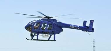
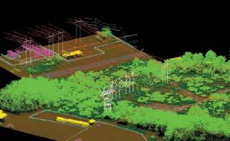
 Case Study for Long- Range Beyond Visual Line of Sight Project March 15, 2018 RMEL Transmission and Planning Conference 2014 HDR Architecture, 2016 2014 HDR, Inc., all all rights reserved. Helicopters
Terrasolid European Training Event
 Terrasolid European Training Event February 13 th 18 th, 2012 - Levi / Finland Nikolaus STUDNICKA Business Development Manager RIEGL Laser Measurement Systems GmbH Content Mobile Laser Scanning System
Dedicated Software Algorithms for 3D Clouds of Points
 Dedicated Software Algorithms for 3D Clouds of Points Introduction AQSENSE develops and commercializes 3D image acquisition and processing technologies that allow high speed in-line 100% production inspection,
Digital Laminography and Computed Tomography with 600 kv for Aerospace Applications
 4th International Symposium on NDT in Aerospace 2012 - Tu.3.A.1 Digital Laminography and Computed Tomography with 600 kv for Aerospace Applications Malte KURFISS 1, Gerd STRECKENBACH 2 1 YXLON International
STARTING WITH DRONES. Data Collection and Remote Sensing with UAVs, etc. Dr. Bill Hazelton LS
 STARTING WITH DRONES Data Collection and Remote Sensing with UAVs, etc. Dr. Bill Hazelton LS What this Talk is About UAV-based data acquisition: What you need to get involved Processes in getting spatial
Computed Tomography & 3D Metrology Application of the VDI/VDE Directive 2630 and Optimization of the CT system
 Computed Tomography & 3D Metrology Application of the VDI/VDE Directive 2630 and Optimization of the CT system ECNDT 2014 Prague October 6-10, 2014 Dr. Eberhard Neuser Dr. Alexander Suppes Imagination
2/9/2016. Session Agenda: Implementing new Geospatial Technologies for more efficient data capture
 Implementing new Geospatial Technologies for more efficient data capture Jay Haskamp Applied Geospatial Engineer Steve Richter VP Sales Session Agenda: Today s changing technologies and what lies ahead
USER S MANUAL SOLO PRO. User s Manual. Rev 1.1 June VirtualFly, S.L. tel
 User s Manual Rev 1.1 June 2016 1 TABLE OF CONTENTS 1. IDENTIFICATION OF ELEMENTS 2. INSTALLATION 3. START UP 4. SELECTION OF PANEL TYPE (according to plane) 5. ANALOGIC PANEL INDICATORS 6. RADIOSTACK
Advanced Vision Guided Robotics. David Bruce Engineering Manager FANUC America Corporation
 Advanced Vision Guided Robotics David Bruce Engineering Manager FANUC America Corporation Traditional Vision vs. Vision based Robot Guidance Traditional Machine Vision Determine if a product passes or
Radiology. Marta Anguiano Millán. Departamento de Física Atómica, Molecular y Nuclear Facultad de Ciencias. Universidad de Granada
 Departamento de Física Atómica, Molecular y Nuclear Facultad de Ciencias. Universidad de Granada Overview Introduction Overview Introduction Tecniques of imaging in Overview Introduction Tecniques of imaging
Leica ALS70. Airborne Laser Scanners Performance for diverse Applications
 Leica ALS70 Airborne Laser Scanners Performance for diverse Applications Three Models, One Result. Highest Productivity in all Applications. Imagine an affordable 500 khz pulse rate city-mapping LIDAR
3D Scanning. Qixing Huang Feb. 9 th Slide Credit: Yasutaka Furukawa
 3D Scanning Qixing Huang Feb. 9 th 2017 Slide Credit: Yasutaka Furukawa Geometry Reconstruction Pipeline This Lecture Depth Sensing ICP for Pair-wise Alignment Next Lecture Global Alignment Pairwise Multiple
Multiple View Geometry
 Multiple View Geometry Martin Quinn with a lot of slides stolen from Steve Seitz and Jianbo Shi 15-463: Computational Photography Alexei Efros, CMU, Fall 2007 Our Goal The Plenoptic Function P(θ,φ,λ,t,V
Calibration of a rotating multi-beam Lidar
 The 2010 IEEE/RSJ International Conference on Intelligent Robots and Systems October 18-22, 2010, Taipei, Taiwan Calibration of a rotating multi-beam Lidar Naveed Muhammad 1,2 and Simon Lacroix 1,2 Abstract
XRADIA microxct Manual
 XRADIA microxct Manual Multiscale CT Lab Table of Contents 1. Introduction and Basics 1.1 Instrument Parts 1.2 Powering up the system 1.3 Preparing your sample 2. TXM Controller 2.1 Starting up 2.2 Finding
Other Reconstruction Techniques
 Other Reconstruction Techniques Ruigang Yang CS 684 CS 684 Spring 2004 1 Taxonomy of Range Sensing From Brain Curless, SIGGRAPH 00 Lecture notes CS 684 Spring 2004 2 Taxonomy of Range Scanning (cont.)
Volume visualization. Volume visualization. Volume visualization methods. Sources of volume visualization. Sources of volume visualization
 Volume visualization Volume visualization Volumes are special cases of scalar data: regular 3D grids of scalars, typically interpreted as density values. Each data value is assumed to describe a cubic
AIT Inline Computational Imaging: Geometric calibration and image rectification
 AIT Inline Computational Imaging: Geometric calibration and image rectification B. Blaschitz, S. Štolc and S. Breuss AIT Austrian Institute of Technology GmbH Center for Vision, Automation & Control Vienna,
WAVELENGTH MANAGEMENT
 BEAM DIAGNOS TICS SPECIAL PRODUCTS OEM DETECTORS THZ DETECTORS PHOTO DETECTORS HIGH POWER SOLUTIONS POWER DETECTORS ENERGY DETECTORS MONITORS Camera Accessories WAVELENGTH MANAGEMENT UV CONVERTERS UV Converters
VJ Technologies Inspection Services Division. By Bob Maziuk, February 2015
 White Paper on the Inspection of Underground Electrical Conductors, Insulation, and Splices in Oil-Filled Piping Using High Energy Computed Tomography (CT) VJ Technologies Inspection Services Division
Case Studies in the Use of Computed Tomography for Non-Destructive Testing, Inspection and Measurement
 SINCE2013 Singapore International NDT Conference & Exhibition 2013, 19-20 July 2013 Case Studies in the Use of Computed Tomography for Non-Destructive Testing, Inspection and Measurement Andrew A. MALCOLM,
NATIONWIDE POINT CLOUDS AND 3D GEO- INFORMATION: CREATION AND MAINTENANCE GEORGE VOSSELMAN
 NATIONWIDE POINT CLOUDS AND 3D GEO- INFORMATION: CREATION AND MAINTENANCE GEORGE VOSSELMAN OVERVIEW National point clouds Airborne laser scanning in the Netherlands Quality control Developments in lidar
Developments in Dimensional Metrology in X-ray Computed Tomography at NPL
 Developments in Dimensional Metrology in X-ray Computed Tomography at NPL Wenjuan Sun and Stephen Brown 10 th May 2016 1 Possible factors influencing XCT measurements Components Influencing variables Possible
High Resolution Laserscanning, not only for 3D-City Models
 Lohr 133 High Resolution Laserscanning, not only for 3D-City Models UWE LOHR, Ravensburg ABSTRACT The TopoSys laserscanner system is designed to produce digital elevation models (DEMs) of the environment
Industrial Computer Tomography for Dimensional Metrology: Overview of Influence Factors and Improvement Strategies
 1 2 3 4 5 6 7 8 9 10 11 12 13 14 15 16 17 18 19 20 21 22 23 24 25 26 27 28 29 30 31 32 33 34 35 36 37 38 39 40 Industrial Computer Tomography for Dimensional Metrology: Overview of Influence Factors and
Combining Analytical and Monte Carlo Modelling for Industrial Radiology
 19 th World Conference on Non-Destructive Testing 2016 Combining Analytical and Monte Carlo Modelling for Industrial Radiology Carsten BELLON, Gerd-Rüdiger JAENISCH, Andreas DERESCH BAM Bundesanstalt für
N.J.P.L.S. An Introduction to LiDAR Concepts and Applications
 N.J.P.L.S. An Introduction to LiDAR Concepts and Applications Presentation Outline LIDAR Data Capture Advantages of Lidar Technology Basics Intensity and Multiple Returns Lidar Accuracy Airborne Laser
Effectiveness of UPRT in Preventing LOC-I Events
 Henry Defalque, ICAO Module 5 Day 2 Effectiveness of UPRT in Preventing LOC-I Events Overview LOC I contributing factors Measuring LOC I risks from contributing factors Monitor UPRT effectiveness using
SAMPLING AND NOISE. Increasing the number of samples per pixel gives an anti-aliased image which better represents the actual scene.
 SAMPLING AND NOISE When generating an image, Mantra must determine a color value for each pixel by examining the scene behind the image plane. Mantra achieves this by sending out a number of rays from
Delayline Detectors. Imaging Detection of Electrons, Ions & Photons with Picosecond Time Resolution. e - I +
 Delayline Detectors Imaging Detection of Electrons, Ions & Photons with Picosecond Time Resolution e - I + Delayline Readout of MCPs - The Technical Approach - Microchannel-Plate (MCP) detectors provide
Microwave. Infrared. Preprogrammed Chip
 Advanced Technology for Design Mapping and Construction Layout AACE A.A.C.E. Meeting August 5, 2009 Daniel K. Mardock RBF Consulting Survey Manager Registered Land Surveyor Certified Federal Surveyor Arizona
A New Protocol of CSI For The Royal Canadian Mounted Police
 A New Protocol of CSI For The Royal Canadian Mounted Police I. Introduction The Royal Canadian Mounted Police started using Unmanned Aerial Vehicles to help them with their work on collision and crime
RIEGL LMS-Q780. The Versatile, High Altitude Airborne LIDAR Sensor
 RIEGL LMS-Q780 3050m 400kHz The full waveform airborne laser scanner offers great versatility, accuracy, and data quality. The scanner enables you to successfully deliver your projects with industry leading
Optiv CT160 Accurate measurement for every detail. Computed Tomography System
 Optiv CT160 Accurate measurement for every detail Computed Tomography System Computed Tomography CT Technology. New prospects for metrology. Computed tomography (CT), a technology with unique advantages,
Depth Camera for Mobile Devices
 Depth Camera for Mobile Devices Instructor - Simon Lucey 16-423 - Designing Computer Vision Apps Today Stereo Cameras Structured Light Cameras Time of Flight (ToF) Camera Inferring 3D Points Given we have
Runway Centerline Deviation Estimation from Point Clouds using LiDAR imagery
 Runway Centerline Deviation Estimation from Point Clouds using LiDAR imagery Seth Young 1, Charles Toth 2, Zoltan Koppanyi 2 1 Department of Civil, Environmental and Geodetic Engineering The Ohio State
Generating 3D Meshes from Range Data
 Princeton University COS598B Lectures on 3D Modeling Generating 3D Meshes from Range Data Robert Kalnins Robert Osada Overview Range Images Optical Scanners Error sources and solutions Range Surfaces Mesh
Shadow casting. What is the problem? Cone Beam Computed Tomography THE OBJECTIVES OF DIAGNOSTIC IMAGING IDEAL DIAGNOSTIC IMAGING STUDY LIMITATIONS
 Cone Beam Computed Tomography THE OBJECTIVES OF DIAGNOSTIC IMAGING Reveal pathology Reveal the anatomic truth Steven R. Singer, DDS srs2@columbia.edu IDEAL DIAGNOSTIC IMAGING STUDY Provides desired diagnostic
Medical Image Processing: Image Reconstruction and 3D Renderings
 Medical Image Processing: Image Reconstruction and 3D Renderings 김보형 서울대학교컴퓨터공학부 Computer Graphics and Image Processing Lab. 2011. 3. 23 1 Computer Graphics & Image Processing Computer Graphics : Create,
A PRACTICAL ALGORITHM FOR RECONSTRUCTION FROM X-RAY
 A PRACTICAL ALGORITHM FOR RECONSTRUCTION FROM X-RAY BACKSCATTER DATA Young S. Ham and C.F. Poranski Materials Chemistry Branch Naval Research Laboratory Washington DC 20375 E.C. Greenawald Geo-Centers,
Terrestrial GPS setup Fundamentals of Airborne LiDAR Systems, Collection and Calibration. JAMIE YOUNG Senior Manager LiDAR Solutions
 Terrestrial GPS setup Fundamentals of Airborne LiDAR Systems, Collection and Calibration JAMIE YOUNG Senior Manager LiDAR Solutions Topics Terrestrial GPS reference Planning and Collection Considerations
Coordinate Measuring Machines with Computed Tomography
 Always a Step Ahead with Quality Coordinate Measuring Machines with Computed Tomography Multisensor Coordinate Measuring Machines with Computed Tomography Computed Tomography in Coordinate Measuring Machines
BME I5000: Biomedical Imaging
 1 Lucas Parra, CCNY BME I5000: Biomedical Imaging Lecture 4 Computed Tomography Lucas C. Parra, parra@ccny.cuny.edu some slides inspired by lecture notes of Andreas H. Hilscher at Columbia University.
EVOLUTION OF POINT CLOUD
 Figure 1: Left and right images of a stereo pair and the disparity map (right) showing the differences of each pixel in the right and left image. (source: https://stackoverflow.com/questions/17607312/difference-between-disparity-map-and-disparity-image-in-stereo-matching)
X-ray tomographic study of wetting bentonite
 UNIVERSITY OF JYVÄSKYLÄ X-ray tomographic study of wetting bentonite Tero Harjupatana Department of Physics, University of Jyväskylä BOA seminar 19.8.2014 Goal To develop and apply experimental techniques
LABORATORY SYSTEM FOR X-RAY NANOTOMOGRAPHY
 79 LABORATORY SYSTEM FOR X-RAY NANOTOMOGRAPHY Alexander Sasov, SkyScan, Vluchtenburgstraat 3, Aartselaar B2630, Belgium, www.skyscan.be. ABSTRACT Using advanced X-ray technologies and X-ray scattering
4X Beam Expander P/N SPZ17022 and Optional Beam Splitter P/N SPZ17027 User Notes
 4X Beam Expander P/N SPZ17022 and Optional Beam Splitter P/N SPZ17027 User Notes Ophir-Spiricon Inc. 60 West 1000 North Logan, UT 84321 For Sales, Service or Technical Support Phone (435) 753-3729 Fax
DEVELOPMENT OF CONE BEAM TOMOGRAPHIC RECONSTRUCTION SOFTWARE MODULE
 Rajesh et al. : Proceedings of the National Seminar & Exhibition on Non-Destructive Evaluation DEVELOPMENT OF CONE BEAM TOMOGRAPHIC RECONSTRUCTION SOFTWARE MODULE Rajesh V Acharya, Umesh Kumar, Gursharan
Overview of Active Vision Techniques
 SIGGRAPH 99 Course on 3D Photography Overview of Active Vision Techniques Brian Curless University of Washington Overview Introduction Active vision techniques Imaging radar Triangulation Moire Active
CLASSIFICATION OF NONPHOTOGRAPHIC REMOTE SENSORS
 CLASSIFICATION OF NONPHOTOGRAPHIC REMOTE SENSORS PASSIVE ACTIVE DIGITAL CAMERA THERMAL (e.g. TIMS) VIDEO CAMERA MULTI- SPECTRAL SCANNERS VISIBLE & NIR MICROWAVE HYPERSPECTRAL (e.g. AVIRIS) SLAR Real Aperture
Lidar Sensors, Today & Tomorrow. Christian Sevcik RIEGL Laser Measurement Systems
 Lidar Sensors, Today & Tomorrow Christian Sevcik RIEGL Laser Measurement Systems o o o o Online Waveform technology Stand alone operation no field computer required Remote control through wireless network
Forward Time-of-Flight Geometry for CLAS12
 Forward Time-of-Flight Geometry for CLAS12 D.S. Carman, Jefferson Laboratory ftof geom.tex April 13, 2016 Abstract This document details the nominal geometry for the CLAS12 Forward Time-of- Flight System
Photogrammetry: A Modern Tool for Crash Scene Mapping
 Photogrammetry: A Modern Tool for Crash Scene Mapping Background A police accident investigator (AI) has many tasks when arriving at a crash scene. The officer s highest priority is public safety; the
A Study of Medical Image Analysis System
 Indian Journal of Science and Technology, Vol 8(25), DOI: 10.17485/ijst/2015/v8i25/80492, October 2015 ISSN (Print) : 0974-6846 ISSN (Online) : 0974-5645 A Study of Medical Image Analysis System Kim Tae-Eun
CIVA Computed Tomography Modeling
 CIVA Computed Tomography Modeling R. FERNANDEZ, EXTENDE, France S. LEGOUPIL, M. COSTIN, D. TISSEUR, A. LEVEQUE, CEA-LIST, France page 1 Summary Context From CIVA RT to CIVA CT Reconstruction Methods Applications
SYSTEM LINEARITY LAB MANUAL: 2 Modifications for P551 Fall 2013 Medical Physics Laboratory
 SYSTEM LINEARITY LAB MANUAL: 2 Modifications for P551 Fall 2013 Medical Physics Laboratory Introduction In this lab exercise, you will investigate the linearity of the DeskCAT scanner by making measurements
Introduction to 3D Machine Vision
 Introduction to 3D Machine Vision 1 Many methods for 3D machine vision Use Triangulation (Geometry) to Determine the Depth of an Object By Different Methods: Single Line Laser Scan Stereo Triangulation