Smart Systems for Aerial Survey & Mobile Mapping
|
|
|
- Ashley Fowler
- 5 years ago
- Views:
Transcription


1 Moscow, Feb NEWS from IGI Smart Systems for Aerial Survey & Mobile Mapping Christian Grimm IGI, Kreuztal / Germany


2 IGI mbh Langenauer Str Kreuztal, Germany


3 IGIs Modular Sensorsystems Missionplanning Navigation Sensormanagment GLONASS/GPS & IMU Datarecording

4 AEROcontrol IMU-IIf free export Weight 2.2 kg Data rate 400Hz Gyro drift 0.03deg/h System accuracy Position: 0.05m Velocity: 0.005m/s Roll/Pitch: 0.003deg Heading: 0.007deg
: Position: <0.05m Velocity: 0.005m/s Roll/Pitch: 0.015 Heading: 0.")
5 NEW IMU: free export AEROcontrol / TERRAcontrol MEMS IMU MEMS design (Micro-Electro-Mechanical Systems) Fully compatible to the IMU-IIf Data rate 400Hz Weight ~ 1kg System accuracy (dgps): Position: <0.05m Velocity: 0.005m/s Roll/Pitch: Heading: 0.030

6 IGI presented UAV in 8 years ago at PhoWo 2005


7 IGI tested Geocopter UAV DigiCAM with AEROcontrol IMU


8 UAV Mapping I DigiCAM test result with Geocopter UAV DigiCAM 50, 35mm lens h = 50m GSD = 0.86cm Image footprint= 70 * 53m

9 Flettner type UAV test campaign 35kg payload Different sensors possible
 Flettner EUR 160.")

10 Price level of UAVs for aerial survey (incl. autopilot) Flettner EUR RUB Geocopter EUR RUB Schiebel EUR RUB
11 How can I benefit from the UAV advantages (flexibility, ) but avoid the disadvantages? (high UAV price, big flight permission issues, very limited payload, need for many ground control points, etc.) Is there a solution?

12 Is there a solution? Yes, there is a solution! Complete new aircraft EUR RUB

13 Portable Hangar

14 Operational with one person (pilot only)

15 Gyrocopter: efficient survey platform Equipment: LiteMapper, airborne LiDAR & DigiCAM, metric camera

16 CCNS5 in Gyrocopter cockpit
17 Gyrocopter advantages Can carry a METRIC camera AND LiDAR for serious photogrammetric work No payload or power supply issues. Affordable price, at least 50% less than UAV or even better price ratio. Perfect tool for repeated flights e.g. like needed for open cast mines, all corridor mapping applications Extrem low operational costs Gyrocopter advantages Transportable to any operation area Very high GSD possible (e.g. better than 1 cm) Extremly stable in the air, not wind sensitive Only Ultra Light (UL) license needed for pilot. Can start & land from everywhere; 50m for take-off & landing on grass. disadvantages: Not good for large format cameras


18 Test result MTOsport Cavalon Aerial Survey Calidus
19 Cavalon Aerial Survey with + LiteMapper-4800 laser scanner + DigiCAM-60 digital camera
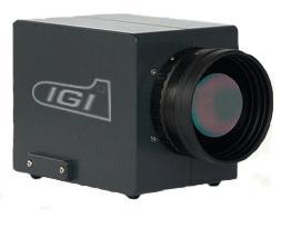
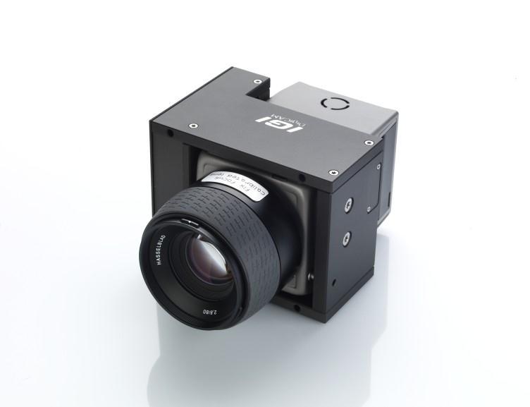
20 Cavalon Aerial Survey with + LiteMapper-6800 laser scanner + DigiCAM-60 digital camera

21 Cavalon Aerial Survey with + DigiCAM-60 digital camera + Stabilized Mount
22 Cavalon Aerial Survey with + Penta-DigiCAM (5 cameras)

23 Penta-DigiCAM 4x Oblique (45 deg) 1x Nadir / vertical oblique & vertical simultaneously 5x 60 Mpixel with one shot fits into a stabilized mount original Ferrari red paint no cables, no rack computers within camera body SSD storage units

24 Radar fits for Cavalon Aerial Survey as well

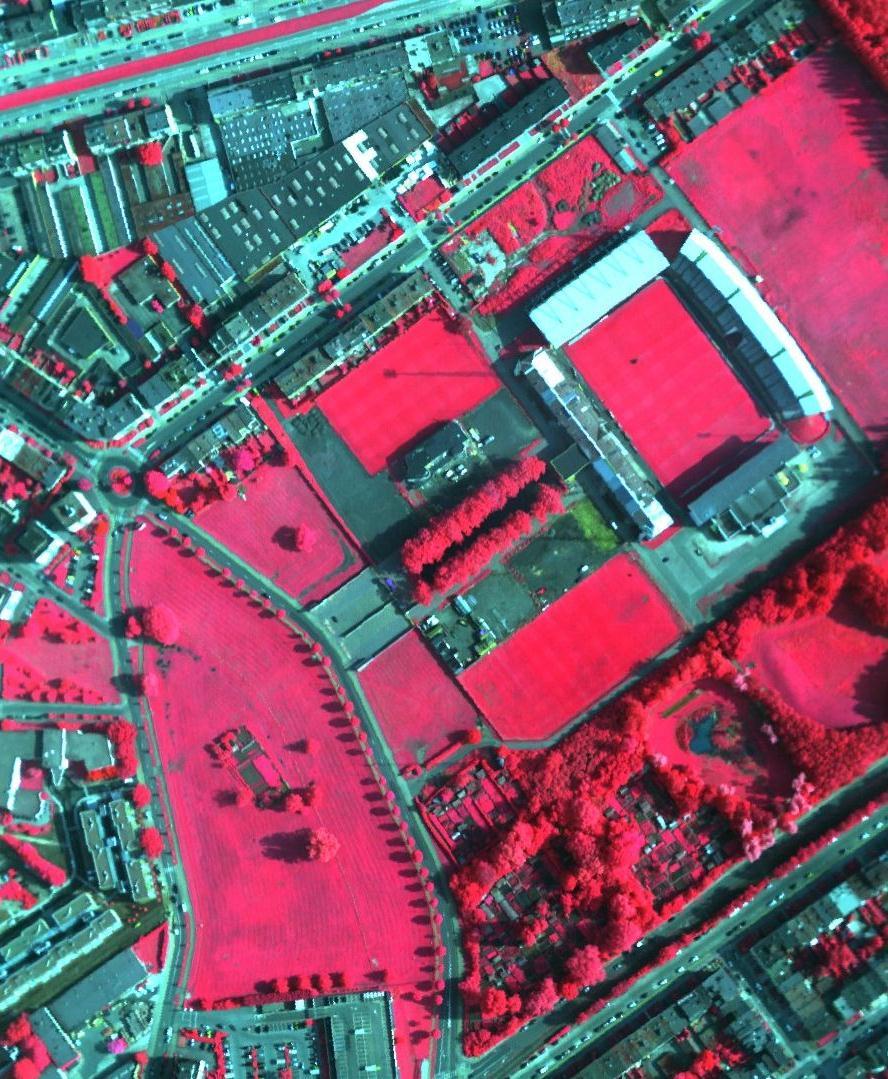
25
 27.02. 01.03.")
26 Cavalon Aerial Survey Today: under production End of Feb: grand unveiling at the Austrian / German / Swiss congress (Freiburg) End of March: start of operations

27 IGI Gyrocopter Project Hessigheim Missionplanning


28 CCNS 5 th Generation Computer Controlled Navigation System All-in-one design, no separate computer, less cables


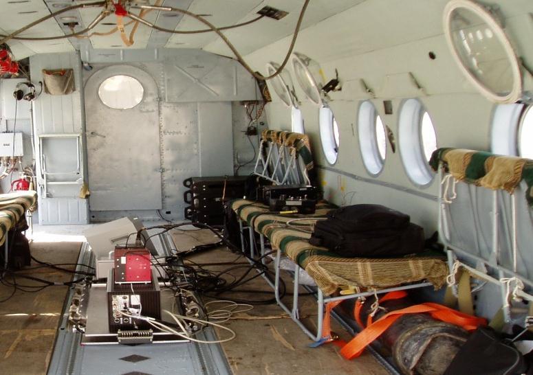
29 DigiCAM
30 IGI Gyrocopter Project Hessigheim

31 IGI Gyrocopter Project Hessigheim

32 IGI Gyrocopter Project Hessigheim Point Cloud via SGM


33

34 Quattro DigiCAM Oblique Aerial Images and 3D City Modell from AEROWEST GmbH

35 Quattro DigiCAM Oblique Aerial Images and 3D City Modell from AEROWEST GmbH
36


37


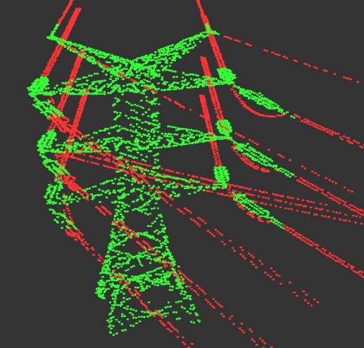
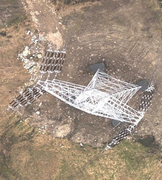
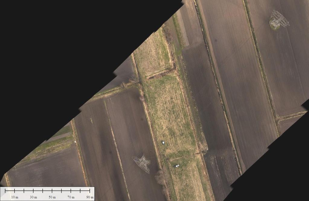
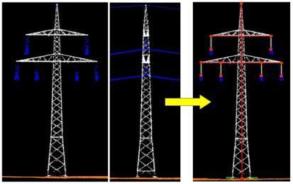
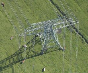
38 Airborne LiDAR Mapping point cloud digital elevation model (DEM)


39 LiteMapper Mi-8 LiteMapper DigiCAM
![LiteMapper 6800/400 PRR 80kHz 200kHz 300kHz 400kHz Max range [m] 3000 2200 1850 1650 Typical operating flying height [m] 1600](/docs-images/82/85832604/images/40-5.jpg "1100 950 800 Point density@80kts [pts/m²] 0.7 2.5 4.4 7.")
40 LiteMapper 6800/400 PRR 80kHz 200kHz 300kHz 400kHz Max range [m] Typical operating flying height [m] Point [pts/m²] (Reflectivity ρ>20%, scan angle 60 ) LiteMapper 6800/400 with DigiCAM


41 New: LiteMapper 7800/400 PRR 100kHz 200kHz 300kHz 400kHz ρ = 20% 3750m 3200m 2800m 2450m ρ = 60% 5400m 4700m 4100m 3700m up to pulses simultaneously in the air

42

43

44


45 Multi Sensor Systems Penta DigiCAM LiteMapper 6800

46 Installation and Certification

47 DigiCAM Vertical & Oblique

48 Power Line Mapping Photos: Interpretation Visual inspection Photogrammetry Power Line flight MGGP Aero


49 forward backward nadir Example fowrad

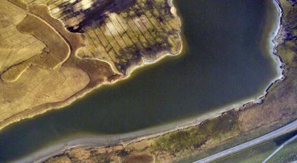
50 Project Example
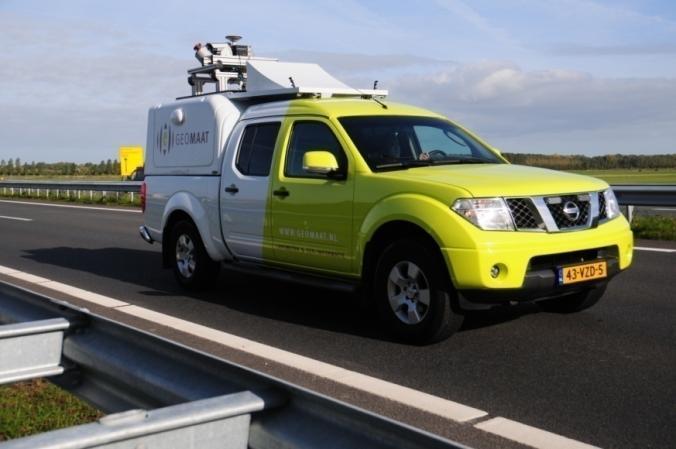
51

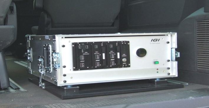
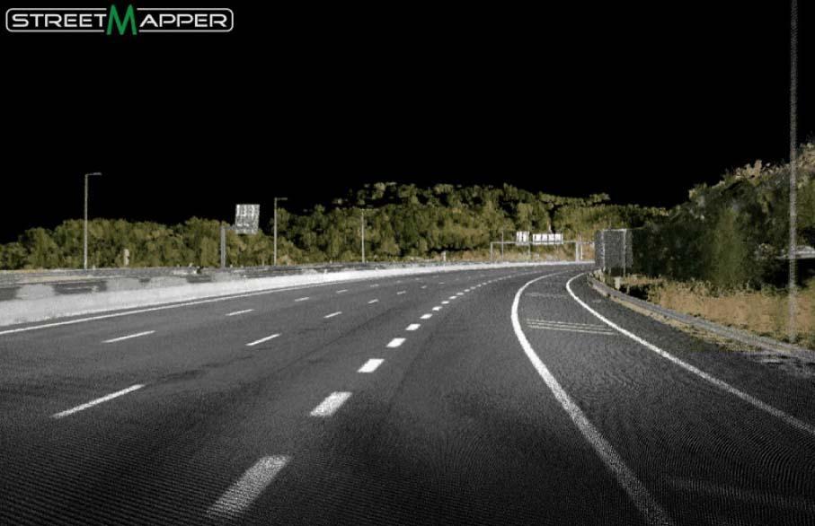
52 Direct Georeferencing with AEROcontrol


53 Surveying - Data Evaluation - Documentation 3D powerline geometry Distance measurement Documentation 53

54 Additional Sensors For example Optical cameras with other properties or orientations DigiTHERM thermal cameras Hyperspectral sensors Video cameras


55 Additional Sensors DigiTHERM power line images

56 DigiTHERM - Motivation City of Montpellier, France


57 Multi Sensor Systems DigiCAM 60 LiteMapper 6800 Aisa EAGLE II Hyperspectral sensor


58

59 235 Mpixel


60 Quattro-DigiCAM More than just four cameras: a ready to use airborne system with rigid design download unit camera body

61 Results of LiteMapper 2500 system Height: 500ft Speed: 40kn Cavalon Aerial Survey with + LiteMapper-4800 laser scanner + DigiCAM-60 digital camera


62 Mobile Mapping Systems


63 StreetMapper Portable - at work

64 We make your scanner move!


65 Static And Mobile LiDAR System


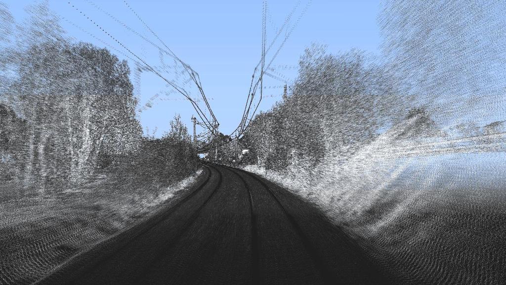
66 Static And Mobile LiDAR System

67 Static And Mobile LiDAR System Trajectory Schloss Neuhaus

68 In front of the palace Static And Mobile LiDAR System

69 In the palace garden Static And Mobile LiDAR System

70 In front of the palace Static And Mobile LiDAR System

71
72 72

73 DigiTHERM Mobile Thermal Mapping city: Essen, 40km/h 73

74
75

76 scanner: Z+F Profiler 9012

77 RailMapper sensor: Z+F Profiler deg scanner 120 meter range more than 1. mio points / sec 200 profiles /sec


78 IGI RailMapper with Z+F Profiler 9012 Surveys Streets, Rails and Tunnels Tunnel requirement (German Railways): 2cm profile distance RailMapper 1 km/h 30 km/h

79 IGI RailMapper with Z+F Profiler 9012


 IMU-IIf")
80 x2-x3 360 scanner wi 1,100,000 points/s x1 Digital-Camera x1 Video-Camera x1 optical odometer TERRAcontrol III (GNSS/IMU) IMU-IIf with 400 Hz 80
81 for Tram in Helsinki 81


82 Survey at 90 km/h DB-route no (electrified)

83 Pointclound 83

84 Classified Pointcloud 84

85 Colorised Pointcloud 85

86 Classification of the rails with LiDAR data 86


87 Measuring Track Distance

88 Automatic Clearance Measurement SiRailScan Software / technet-rail 2010 GmbH

89 Detailed information about collision points Transit simulation and collision test Automatic clearance measurement for freely definable reference blocks Marking the collision point based on the laser point cloud Detailed position information


90 Extreme Modularity: One set of equipmet for multiple applications Drone Gyrocopter or Helicopter Vehicle on street Vehicle on rails Train Boat / Vessel CoastMapper


91 Summary: IGI providing you a world of customized & smart solutions. Thank you!
92


93
GNSS/INS for High Accuracy Mobile Mapping. Olaf Gross 11 th Terrasolid European User Event Kittilä, Finland
 GNSS/INS for High Accuracy Mobile Mapping Olaf Gross 11 th Terrasolid European User Event 15.02.2012 Kittilä, Finland IGI mbh Founded 1978 25 staff about half in R&D More than 380 customers in 60 different
THE RAILMAPPER - A DEDICATED MOBILE LIDAR MAPPING SYSTEM FOR RAILWAY NETWORKS
 THE RAILMAPPER - A DEDICATED MOBILE LIDAR MAPPING SYSTEM FOR RAILWAY NETWORKS Jens Kremer & Albrecht Grimm IGI mbh, Langenauer Straße 46, 57223 Kreuztal, Germany (j.kremer, a.grimm)@igi-systems.com ICWG
2-in-1 Large Format and Oblique Aerial Camera Systems for 3D Urban Mapping. Philipp Grimm EUROSDR/ISPRS Workshop Oblique, Barcelona,
 2-in-1 Large Format and Oblique Aerial Camera Systems for 3D Urban Mapping Philipp Grimm EUROSDR/ISPRS Workshop Oblique, Barcelona, 09.10.2017 Mission Planning & Flight Guidance Sensor Management GNSS/IMU
Mobile Mapping The StreetMapper Approach. Andrew Fuller LiDAR Systems Engineer
 Mobile Mapping The StreetMapper Approach Andrew Fuller LiDAR Systems Engineer UK company based in Nottingham Global 3D Laser Mapping Solutions Innovative solutions StreetMapper Over 11 years experience
1. Introduction. A CASE STUDY Dense Image Matching Using Oblique Imagery Towards All-in- One Photogrammetry
 Submitted to GIM International FEATURE A CASE STUDY Dense Image Matching Using Oblique Imagery Towards All-in- One Photogrammetry Dieter Fritsch 1, Jens Kremer 2, Albrecht Grimm 2, Mathias Rothermel 1
 Die im Vortrag gezeigten Video Clips können unter http://www.streetmapper.net/gallery/animations.htm heruntergeladen werden. Stuttgart, 19. Juni 2007 Mobile Mapping - 3D-Datenerfassung kommt in Fahrt Jens
StreetMapper 360 & StreetMapper Portable
 StreetMapper 360 & StreetMapper Portable 11th February 2010 Dr. Chris Cox & Mr. Olaf Gross 3D Laser Mapping LIDAR Specialists StreetMapper Distributor for RIEGL (UK, Ireland, Southern Africa) Terrasolid
THE RANGER-UAV FEATURES
 THE RANGER-UAV The Ranger Series Ranger-UAV is designed for the most demanding mapping applications, no compromises made. With a 9 meter laser range, this system produces photorealistic 3D point clouds
Photogrammetric Excursion November 10-11, 2016
 Photogrammetric Excursion November 10-11, 2016 GeoEngine, 10 th Generation Introduction On the days 10th and 11th of November 2016, the GeoEngine students from the 10th generation, had the opportunity
Lidar Sensors, Today & Tomorrow. Christian Sevcik RIEGL Laser Measurement Systems
 Lidar Sensors, Today & Tomorrow Christian Sevcik RIEGL Laser Measurement Systems o o o o Online Waveform technology Stand alone operation no field computer required Remote control through wireless network
Overview of the Trimble TX5 Laser Scanner
 Overview of the Trimble TX5 Laser Scanner Trimble TX5 Revolutionary and versatile scanning solution Compact / Lightweight Efficient Economical Ease of Use Small and Compact Smallest and most compact 3D
Leica - Airborne Digital Sensors (ADS80, ALS60) Update / News in the context of Remote Sensing applications
 Update / News in the context of Remote Sensing applications") Luzern, Switzerland, acquired with GSD=5 cm, 2008. Leica - Airborne Digital Sensors (ADS80, ALS60) Update / News in the context of Remote Sensing applications Arthur Rohrbach, Sensor Sales Dir Europe,
Luzern, Switzerland, acquired with GSD=5 cm, 2008. Leica - Airborne Digital Sensors (ADS80, ALS60) Update / News in the context of Remote Sensing applications Arthur Rohrbach, Sensor Sales Dir Europe,
Leica Geosystems UAS Airborne Sensors. MAPPS Summer Conference July 2014 Alistair Stuart
 Leica Geosystems UAS Airborne Sensors MAPPS Summer Conference July 2014 Alistair Stuart 1 Sensors for UAS! Promise of UAS is to expand aerial data acquisition capabilities for traditional and non-traditional
Trimble GeoSpatial Products
 Expanding Solutions for Photogrammetric and Remote Sensing Professionals 55 th Photogrammetric Week in Stuttgart September 7 th 2015 Tobias Heuchel, Trimble Stuttgart, Germany Trimble GeoSpatial Products
James Van Rens CEO Riegl USA, Inc. Mining Industry and UAV s combined with LIDAR Commercial UAV Las Vegas October 2015 James Van Rens CEO Riegl USA
 James Van Rens CEO Riegl USA, Inc. Mining Industry and UAV s combined with LIDAR Commercial UAV Las Vegas October 2015 James Van Rens CEO Riegl USA COST EFFECIENCY CONTINUUM LIDAR and IMU Partnership Technology
Mobile LiDAR for Ground Applications. Spar 2006, March Paul Mrstik, Terrapoint Canada Inc. Craig Glennie, Terrapoint USA LLC
 Mobile LiDAR for Ground Applications Spar 2006, March 27 2006 Paul Mrstik, Terrapoint Canada Inc. Craig Glennie, Terrapoint USA LLC Agenda Introduction to Terrapoint What is mobile LiDAR? Advantages of
Mayden VP of Business Development Surdex Corporation
 Making Sense of Sensors Randy Mayden, Mayden VP of Business Development Surdex Corporation randym@surdex.com EARLYAERIAL PHOTOGRAPHY 2 FIRSTAERIAL CAMERA 3 AERIAL CAMERA SYSTEM DEVELOPMENT Aerial Camera
ENY-C2005 Geoinformation in Environmental Modeling Lecture 4b: Laser scanning
 1 ENY-C2005 Geoinformation in Environmental Modeling Lecture 4b: Laser scanning Petri Rönnholm Aalto University 2 Learning objectives To recognize applications of laser scanning To understand principles
ROAD-SCANNER COMPACT APPLICATION FIELDS MAIN FEATURES
 ROAD-SCANNER COMPACT Mobile Mapping System by GEXCEL & SITECO collaboration A smaller mobile system for asset management and cartography suited for ZOLLER & FRÖHLICH PROFILER 9012 laser scanner. 2 + 3
G2-AS100. Presents: A mid-format fully integrated photogrammetric camera
 Presents: G2-AS100 A mid-format fully integrated photogrammetric camera Designed and manufactured by Global Geo Supplies, Inc. Lone Tree, Colorado USA 1 TABLE OF CONTENTS CAMERA SPECIFICATIONS LENSES PERFORMANCE
Case Study for Long- Range Beyond Visual Line of Sight Project. March 15, 2018 RMEL Transmission and Planning Conference
 Case Study for Long- Range Beyond Visual Line of Sight Project March 15, 2018 RMEL Transmission and Planning Conference 2014 HDR Architecture, 2016 2014 HDR, Inc., all all rights reserved. Helicopters
CCNS and AEROcontrol: Products for Efficient Photogrammetric Data Collection
 'Photogrammetric Week 01' D. Fritsch & R. Spiller, Eds. Wichmann Verlag, Heidelberg 2001. Kremer 85 CCNS and AEROcontrol: Products for Efficient Photogrammetric Data Collection JENS KREMER, Kreuztal ABSTRACT
Integrated Multi-Source LiDAR and Imagery
 Figure 1: AirDaC aerial scanning system Integrated Multi-Source LiDAR and Imagery The derived benefits of LiDAR scanning in the fields of engineering, surveying, and planning are well documented. It has
LiForest Software White paper. TRGS, 3070 M St., Merced, 93610, Phone , LiForest
 0 LiForest LiForest is a platform to manipulate large LiDAR point clouds and extract useful information specifically for forest applications. It integrates a variety of advanced LiDAR processing algorithms
Leica ALS70. Airborne Laser Scanners Performance for diverse Applications
 Leica ALS70 Airborne Laser Scanners Performance for diverse Applications Three Models, One Result. Highest Productivity in all Applications. Imagine an affordable 500 khz pulse rate city-mapping LIDAR
Application of GPS/INS-Systems with the HRSC A Comparison of APPLANIX POS/AV-510 and IGI AEROcontrol-IId. F. Scholten*, S. Sujew**, K.
 Application of GPS/INS-Systems with the HRSC A Comparison of APPLANIX POS/AV-510 and IGI AEROcontrol-IId F. Scholten*, S. Sujew**, K. Gwinner* (*) German Aerospace Center (DLR), Institute of Planetary
Redefining Airborne LiDAR Introduction to RIEGL LMS in Airborne LiDAR
 Redefining Airborne LiDAR Introduction to RIEGL LMS in Airborne LiDAR Andres Vargas Integration Systems Engineer LAGF Mexico City, Mexico September 23th, 2014 1 Airborne Laser Scanning History and Evolution
Leica ALS80 Airborne Laser Scanners Performance for every Application
 Leica ALS80 Airborne Laser Scanners Performance for every Application Three Models, One Result. Highest Productivity in all Applications. Imagine an affordable city-mapping LIDAR system with an industry-leading
ixu-rs1900 Aerial Solutions
 Aerial Solutions Seeing the Large Picture Medium Format Evolves Aerial Camera Phase One 190MP Aerial Camera series is the latest Phase One innovation to offer large format metric camera functionality.
Terrasolid European Training Event
 Terrasolid European Training Event February 13 th 18 th, 2012 - Levi / Finland Nikolaus STUDNICKA Business Development Manager RIEGL Laser Measurement Systems GmbH Content Mobile Laser Scanning System
GEO 6895: Airborne laser scanning - workflow, applications, value. Christian Hoffmann
 GEO 6895: Airborne laser scanning - workflow, applications, value. Christian Hoffmann Agenda Why LiDAR? The value of an end-to-end workflow The Trimble AX-Series Data processing & modelling Information
ISPRS Com1 Update Airborne Sensor Systems. Arthur Rohrbach SGPBF meeting, RSL, Fall 2006
 ISPRS Com1 Update Airborne Sensor Systems Arthur Rohrbach SGPBF meeting, RSL, Fall 2006 Significant Meetings / News (for Sensor Systems) 1/2 ASPRS, Reno, USA (May-06) Vexcel, Austria Leica, Switzerland
Leica Systems Overview
 RC30 AERIAL CAMERA SYSTEM Leica Systems Overview The Leica RC30 aerial film camera is the culmination of decades of development, started with Wild's first aerial camera in the 1920s. Beautifully engineered
Airborne Laser Survey Systems: Technology and Applications
 Abstract Airborne Laser Survey Systems: Technology and Applications Guangping HE Lambda Tech International, Inc. 2323B Blue Mound RD., Waukesha, WI-53186, USA Email: he@lambdatech.com As mapping products
STARTING WITH DRONES. Data Collection and Remote Sensing with UAVs, etc. Dr. Bill Hazelton LS
 STARTING WITH DRONES Data Collection and Remote Sensing with UAVs, etc. Dr. Bill Hazelton LS What this Talk is About UAV-based data acquisition: What you need to get involved Processes in getting spatial
Sensor Integration and Image Georeferencing for Airborne 3D Mapping Applications
 Sensor Integration and Image Georeferencing for Airborne 3D Mapping Applications By Sameh Nassar and Naser El-Sheimy University of Calgary, Canada Contents Background INS/GPS Integration & Direct Georeferencing
STATUS OF AIRBORNE OBLIQUE IMAGING EUROSDR COMMISSION I PROJECT OBLIQUE IMAGERY. Markus Gerke May 15, 2014
 STATUS OF AIRBORNE OBLIQUE IMAGING EUROSDR COMMISSION I PROJECT OBLIQUE IMAGERY Markus Gerke May 15, 2014 THE FIRST AIRBORNE PHOTOS WERE OBLIQUE First recorded aerial photograph in the US (Boston), by
Lecture 11. LiDAR, RADAR
 NRMT 2270, Photogrammetry/Remote Sensing Lecture 11 Calculating the Number of Photos and Flight Lines in a Photo Project LiDAR, RADAR Tomislav Sapic GIS Technologist Faculty of Natural Resources Management
An Overview of Applanix.
 An Overview of Applanix The Company The Industry Leader in Developing Aided Inertial Technology Founded on Canadian Aerospace and Defense Industry Expertise Providing Precise Position and Orientation Systems
Terrain Modeling and Mapping for Telecom Network Installation Using Scanning Technology. Maziana Muhamad
 Terrain Modeling and Mapping for Telecom Network Installation Using Scanning Technology Maziana Muhamad Summarising LiDAR (Airborne Laser Scanning) LiDAR is a reliable survey technique, capable of: acquiring
GPS-Aided Inertial Navigation Systems (INS) for Remote Sensing
 for Remote Sensing") GPS-Aided Inertial Navigation Systems (INS) for Remote Sensing www.inertiallabs.com 1 EVOLUTION OF REMOTE SENSING The latest progress in Remote sensing emerged more than 150 years ago, as balloonists took
GPS-Aided Inertial Navigation Systems (INS) for Remote Sensing www.inertiallabs.com 1 EVOLUTION OF REMOTE SENSING The latest progress in Remote sensing emerged more than 150 years ago, as balloonists took
Corridor Survey of Both Existing and New to be Built Pipelines on Land Using LiDAR Scanning
 Corridor Survey of Both Existing and New to be Built Pipelines on Land Using LiDAR Scanning 1. Introduction For good monitoring and planning an onshore pipeline and to feed the Geographic Information System,
Trends in Digital Aerial Acquisition Systems
 Trends in Digital Aerial Acquisition Systems Ernest Yap Regional Sales Manager, Airborne-Americas eyap@applanix.com 1 Medium Format Digital Cameras Medium Format Digital Cameras Where does the Medium
a Geo-Odyssey of UAS LiDAR Mapping Henno Morkel UAS Segment Specialist DroneCon 17 May 2018
 a Geo-Odyssey of UAS LiDAR Mapping Henno Morkel UAS Segment Specialist DroneCon 17 May 2018 Abbreviations UAS Unmanned Aerial Systems LiDAR Light Detection and Ranging UAV Unmanned Aerial Vehicle RTK Real-time
Aerial and Mobile LiDAR Data Fusion
 Creating Value Delivering Solutions Aerial and Mobile LiDAR Data Fusion Dr. Srini Dharmapuri, CP, PMP What You Will Learn About LiDAR Fusion Mobile and Aerial LiDAR Technology Components & Parameters Project
SimActive and PhaseOne Workflow case study. By François Riendeau and Dr. Yuri Raizman Revision 1.0
 SimActive and PhaseOne Workflow case study By François Riendeau and Dr. Yuri Raizman Revision 1.0 Contents 1. Introduction... 2 1.1. Simactive... 2 1.2. PhaseOne Industrial... 2 2. Testing Procedure...
Open Pit Mines. Terrestrial LiDAR and UAV Aerial Triangulation for. Figure 1: ILRIS at work
 Terrestrial LiDAR and UAV Aerial Triangulation for Open Pit Mines Figure 1: ILRIS at work Figure 2: Geo-Copter X-8000 taking off ay what you will about the past few years, it has produced some useful tools
Vexcel Imaging Ve V x e c x el e I l maging I G maging mbh www. wwwv. e v x e c x e c l e -limaging. - c imaging. om c
 Vexcel Imaging History 2016 MBO: becomes a privately owned company again 2006 Vexcel Imaging acquired by Microsoft Corp., Redmond/USA 2003 1992 1985 Merger of Vexcel Corp. & Vexcel Imaging 1 st Digital
Third Rock from the Sun
 Geodesy 101 AHD LiDAR Best Practice The Mystery of LiDAR Best Practice Glenn Jones SSSi GIS in the Coastal Environment Batemans Bay November 9, 2010 Light Detection and Ranging (LiDAR) Basic principles
Terrestrial GPS setup Fundamentals of Airborne LiDAR Systems, Collection and Calibration. JAMIE YOUNG Senior Manager LiDAR Solutions
 Terrestrial GPS setup Fundamentals of Airborne LiDAR Systems, Collection and Calibration JAMIE YOUNG Senior Manager LiDAR Solutions Topics Terrestrial GPS reference Planning and Collection Considerations
Innovation in 3D. Product Overview
 Innovation in 3D Product Overview TERRESTRIAL LASER SCANNING VQ-1560i MULTIPLE-TIME- AROUND-PROCESSING VZ-400i ECHO DIGITIZATION AIRBORNE LASER SCANNING VUX-1UAV HIGHLY ACCURATE EFFICIENT LIGHTWEIGHT RiCOPTER
UAS based laser scanning for forest inventory and precision farming
 UAS based laser scanning for forest inventory and precision farming M. Pfennigbauer, U. Riegl, P. Rieger, P. Amon RIEGL Laser Measurement Systems GmbH, 3580 Horn, Austria Email: mpfennigbauer@riegl.com,
Measuring the potential impact of offshore mining on coastal instability through integrated time-series laser scanning and photography
 Measuring the potential impact of offshore mining on coastal instability through integrated time-series laser scanning and photography by Neil Slatcher, Roberto Vargas, Chris Cox and Liene Starka, 3D Laser
A COMPARISON OF STANDARD FIXED-WING VS MULTIROTOR DRONE PHOTOGRAMMETRY SURVEYS
 A COMPARISON OF STANDARD FIXED-WING VS MULTIROTOR DRONE PHOTOGRAMMETRY SURVEYS Dr Steve Harwin, UAV Operations, Tas KEY QUESTIONS What detail, scale and accuracy are needed? For change analysis the data
Drones for research - Observing the world in 3D from a LiDAR-UAV
 Drones for research - Observing the world in 3D from a LiDAR-UAV Program lunch seminar: Lammert Kooistra: The Unmanned Aerial Remote Sensing Facility goes 3D: Unmanned Aerial Laser Scanning Sander Mücher:
High Resolution Laserscanning, not only for 3D-City Models
 Lohr 133 High Resolution Laserscanning, not only for 3D-City Models UWE LOHR, Ravensburg ABSTRACT The TopoSys laserscanner system is designed to produce digital elevation models (DEMs) of the environment
NEW RIEGL. Triple Scanner Mobile Mapping System Specifically Designed for Rail Application. Typical Applications
 NEW RIEGL VMX -RAIL 3 MHz pulse repetition rate, and 750 lines per second resulting in up to 7000 pts/m 2 in 3m range at 80 km/h platform speed 420m 3 MHz optional The is a fully integrated Mobile Laser
Airborne Sensor Technology
 Airborne Sensor Technology Arthur Rohrbach Airborne Sensor Manager EMEA Geospatial Solutions Division (GSD) 1 The World of Airborne Sensor Technology 2 Agenda Hexagon Geosystems Leica & Z/I airborne solutions
ESTGIS 2012 Priit Leomar 1
 5.12.2012 ESTGIS 2012 Priit Leomar 1 ELI 1995 Haljas tee 25 Tallinn 12012 Estonia +372 6480242 eli@eli.ee 5.12.2012 ESTGIS 2012 Priit Leomar 2 MAIN ACTIVITIES ELI ELI MILITARY SIMULATIONS ELI ENGINEERING
Quinnipiac Post Flight Aerial Acquisition Report
 Quinnipiac Post Flight Aerial Acquisition Report August 2011 Post-Flight Aerial Acquisition and Calibration Report FEMA REGION 1 Quinnipiac Watershed, Connecticut, Massachusesetts FEDERAL EMERGENCY MANAGEMENT
CLASSIFICATION OF NONPHOTOGRAPHIC REMOTE SENSORS
 CLASSIFICATION OF NONPHOTOGRAPHIC REMOTE SENSORS PASSIVE ACTIVE DIGITAL CAMERA THERMAL (e.g. TIMS) VIDEO CAMERA MULTI- SPECTRAL SCANNERS VISIBLE & NIR MICROWAVE HYPERSPECTRAL (e.g. AVIRIS) SLAR Real Aperture
Airborne Laser Scanning: Remote Sensing with LiDAR
 Airborne Laser Scanning: Remote Sensing with LiDAR ALS / LIDAR OUTLINE Laser remote sensing background Basic components of an ALS/LIDAR system Two distinct families of ALS systems Waveform Discrete Return
Equipment. Remote Systems & Sensors. Altitude Imaging uses professional drones and sensors operated by highly skilled remote pilots
 Remote Systems & Sensors Altitude Imaging uses professional drones and sensors operated by highly skilled remote pilots Equipment www.altitude-imaging.com About Us Altitude Imaging has been providing a
Hardware 3D Mapping Systems
 Hardware 3D Mapping Systems About Us GreenValley International GreenValley International provides 3D mapping solutions that include mobile & aerial LiDAR acquisition hardware, post-processing software
Trimble Geospatial Division Integrated Solutions for Geomatics professions. Volker Zirn Regional Sales Representative
 Trimble Geospatial Division Integrated Solutions for Geomatics professions Volker Zirn Regional Sales Representative 1 Agenda Trimble GeoSpatial Division Airborne System Solutions Trimble Inpho Software
RIEGL LMS-Q780. The Versatile, High Altitude Airborne LIDAR Sensor
 RIEGL LMS-Q780 3050m 400kHz The full waveform airborne laser scanner offers great versatility, accuracy, and data quality. The scanner enables you to successfully deliver your projects with industry leading
LANDINS Georeferencing and Orientation System
 LANDINS Georeferencing and Orientation System LANDINS Georeferencing and Orientation System Landins is a simple, turnkey position and orientation system for land-based mobile applications. It offers dependable
High resolution survey and orthophoto project of the Dosso-Gaya region in the Republic of Niger. by Tim Leary, Woolpert Inc.
 High resolution survey and orthophoto project of the Dosso-Gaya region in the Republic of Niger by Tim Leary, Woolpert Inc. Geospatial Solutions Photogrammetry & Remote Sensing LiDAR Professional Surveying
MIDAS 5 Camera System. (Multi-camera Integrated Digital Acquisition System)
") MIDAS 5 Camera System (Multi-camera Integrated Digital Acquisition System) MIDAS 5 in Puppet Air STP-400 Mount The MIDAS Solution The MIDAS 5 system is a complete turn-key oblique Imaging solution for
MIDAS 5 Camera System (Multi-camera Integrated Digital Acquisition System) MIDAS 5 in Puppet Air STP-400 Mount The MIDAS Solution The MIDAS 5 system is a complete turn-key oblique Imaging solution for
RIEGL VQ 880 G Laser Scanner System for Topo Bathymetric Surveying. IR laser scanner channel OCTOBER 2015
 RIEGL VQ 880 G Laser Scanner System for Topo Bathymetric Surveying with NEW optional IR laser scanner channel OCTOBER 2015 VQ 880 G Highlights excellently suited for combined hydrographic and topographic
Comparative study on the differences between the mobile mapping backpack systems ROBIN- 3D Laser Mapping, and Pegasus- Leica Geosystems.
 3 th Bachelor Real Estate, Land Surveying Measuring Methods III Comparative study on the differences between the mobile mapping backpack systems ROBIN- 3D Laser Mapping, and Pegasus- Leica Geosystems.
Photogrammetric Performance of an Ultra Light Weight Swinglet UAV
 Photogrammetric Performance of an Ultra Light Weight Swinglet UAV J. Vallet, F. Panissod, C. Strecha, M. Tracol UAV-g 2011 - Unmanned Aerial Vehicle in Geomatics September 14-16, 2011ETH Zurich Summary
LiDAR data overview. Dr. Keiko Saito Global Facility for Disaster Reduction and Recovery (GFDRR)
") LiDAR data overview Dr. Keiko Saito Global Facility for Disaster Reduction and Recovery (GFDRR) LiDAR (Light Detecting And Ranging) 3D height profile Laser emitted from sensor onboard aircraft to measure
LiDAR data overview Dr. Keiko Saito Global Facility for Disaster Reduction and Recovery (GFDRR) LiDAR (Light Detecting And Ranging) 3D height profile Laser emitted from sensor onboard aircraft to measure
ON THE ACCURAY AND PERFORMANCE OF THE GEOMÒBIL SYSTEM
 ON THE ACCURAY AND PERFORMANCE OF THE GEOMÒBIL SYSTEM R. Alamús, A.Baron, E.Bosch, J.Casacuberta, J.Miranda, M.Pla, S.Sànchez, A.Serra, J.Talaya Institut Cartogràfic de Catalunya (ICC), Parc de Montjuïc,
Sensor Fusion: Potential, Challenges and Applications. Presented by KVH Industries and Geodetics, Inc. December 2016
 Sensor Fusion: Potential, Challenges and Applications Presented by KVH Industries and Geodetics, Inc. December 2016 1 KVH Industries Overview Innovative technology company 600 employees worldwide Focused
MODELLING FOREST CANOPY USING AIRBORNE LIDAR DATA
 MODELLING FOREST CANOPY USING AIRBORNE LIDAR DATA Jihn-Fa JAN (Taiwan) Associate Professor, Department of Land Economics National Chengchi University 64, Sec. 2, Chih-Nan Road, Taipei 116, Taiwan Telephone:
The Leica Geosystems CityMapper Solution
 Photogrammetric Week '13 Dieter Fritsch (Ed.) Wichmann/VDE Verlag, Belin & Offenbach, 2013 Wagner et al. 89 The Leica Geosystems CityMapper Solution RUEDIGER WAGNER, Heerbrugg, Switzerland PETER LIECKFELDT,
ifp Universität Stuttgart Performance of IGI AEROcontrol-IId GPS/Inertial System Final Report
 Universität Stuttgart Performance of IGI AEROcontrol-IId GPS/Inertial System Final Report Institute for Photogrammetry (ifp) University of Stuttgart ifp Geschwister-Scholl-Str. 24 D M. Cramer: Final report
Multisensoral UAV-Based Reference Measurements for Forestry Applications
 Multisensoral UAV-Based Reference Measurements for Forestry Applications Research Manager D.Sc. Anttoni Jaakkola Centre of Excellence in Laser Scanning Research 2 Outline UAV applications Reference level
An Introduction to Lidar & Forestry May 2013
 An Introduction to Lidar & Forestry May 2013 Introduction to Lidar & Forestry Lidar technology Derivatives from point clouds Applied to forestry Publish & Share Futures Lidar Light Detection And Ranging
USE OF DRONE TECHNOLOGY AND PHOTOGRAMMETRY FOR BEACH MORPHODYNAMICS AND BREAKWATER MONITORING.
 Proceedings of the 6 th International Conference on the Application of Physical Modelling in Coastal and Port Engineering and Science (Coastlab16) Ottawa, Canada, May 10-13, 2016 Copyright : Creative Commons
MONITORING COASTAL INSTABILITY USING AIRBORNE AND TERRESTRIAL LIDAR
 MONITORING COASTAL INSTABILITY USING AIRBORNE AND TERRESTRIAL LIDAR A Coastal Challenge Monitoring coastlines is a challenging task, especially due to the typically inaccessible nature of the coastal terrain.
A UAV BASED CLOSE-RANGE RAPID AERIAL MONITORING SYSTEM FOR EMERGENCY RESPONSES
 A UAV BASED CLOSE-RANGE RAPID AERIAL MONITORING SYSTEM FOR EMERGENCY RESPONSES Kyoungah Choi a, Impyeong Lee a, * a Dept. of Geoinformatics, The University of Seoul, 90 Jeonnong-dong, Dongdaemun-gu, Seoul,
LiDAR & Orthophoto Data Report
 LiDAR & Orthophoto Data Report Tofino Flood Plain Mapping Data collected and prepared for: District of Tofino, BC 121 3 rd Street Tofino, BC V0R 2Z0 Eagle Mapping Ltd. #201 2071 Kingsway Ave Port Coquitlam,
N.J.P.L.S. An Introduction to LiDAR Concepts and Applications
 N.J.P.L.S. An Introduction to LiDAR Concepts and Applications Presentation Outline LIDAR Data Capture Advantages of Lidar Technology Basics Intensity and Multiple Returns Lidar Accuracy Airborne Laser
The Applanix Approach to GPS/INS Integration
 Lithopoulos 53 The Applanix Approach to GPS/INS Integration ERIK LITHOPOULOS, Markham ABSTRACT The Position and Orientation System for Direct Georeferencing (POS/DG) is an off-the-shelf integrated GPS/inertial
Light Detection and Ranging (LiDAR)
") Light Detection and Ranging (LiDAR) http://code.google.com/creative/radiohead/ Types of aerial sensors passive active 1 Active sensors for mapping terrain Radar transmits microwaves in pulses determines
Light Detection and Ranging (LiDAR) http://code.google.com/creative/radiohead/ Types of aerial sensors passive active 1 Active sensors for mapping terrain Radar transmits microwaves in pulses determines
Reality Modeling Drone Capture Guide
 Reality Modeling Drone Capture Guide Discover the best practices for photo acquisition-leveraging drones to create 3D reality models with ContextCapture, Bentley s reality modeling software. Learn the
LIDAR MAPPING FACT SHEET
 1. LIDAR THEORY What is lidar? Lidar is an acronym for light detection and ranging. In the mapping industry, this term is used to describe an airborne laser profiling system that produces location and
RIEGL LMS-Q780. The Versatile, High Altitude Airborne LIDAR Sensor
 RIEGL LMS-Q780 4700m 400kHz The full waveform airborne laser scanner offers great versatility, accuracy, and data quality. The scanner enables you to successfully deliver your projects with industry leading
RealWorld RealCity RealTerrain Airborne Reality Capture The Integral World of Leica Airborne Solutions
 RealWorld RealCity RealTerrain Airborne Reality Capture The Integral World of Leica Airborne Solutions Photogrammetric Week, September 11, 2017 Dr. Hartmut Rosengarten, Director Airborne Solutions EMEA,
REMOTE SENSING LiDAR & PHOTOGRAMMETRY 19 May 2017
 REMOTE SENSING LiDAR & PHOTOGRAMMETRY 19 May 2017 SERVICES Visual Inspections Digital Terrain Models Aerial Imagery Volume Computations Thermal Inspections Photo maps Aerial Video Training & Consultancy
The Use of UAV s for Gathering Spatial Information. James Van Rens CEO MAPPS Winter Conference January, 2015
 The Use of UAV s for Gathering Spatial Information James Van Rens CEO MAPPS Winter Conference January, 2015 1 UAV Technological Timeline 1980 s RPV (Remotely Piloted Vehicle) Operator on ground, almost
LAS extrabytes implementation in RIEGL software WHITEPAPER
 in RIEGL software WHITEPAPER _ Author: RIEGL Laser Measurement Systems GmbH Date: May 25, 2012 Status: Release Pages: 13 All rights are reserved in the event of the grant or the registration of a utility
PHOTOGRAMMETRIC SOLUTIONS OF NON-STANDARD PHOTOGRAMMETRIC BLOCKS INTRODUCTION
 PHOTOGRAMMETRIC SOLUTIONS OF NON-STANDARD PHOTOGRAMMETRIC BLOCKS Dor Yalon Co-Founder & CTO Icaros, Inc. ABSTRACT The use of small and medium format sensors for traditional photogrammetry presents a number
Validation of advanced driver assistance systems by airborne optical imagery
 Validation of advanced driver assistance systems by airborne optical imagery Franz Kurz Remote Sensing Technologies, German Aerospace Center, Münchener Str. 24, 82234 Wessling, Germany Dominik Rosenbaum,
APPLANIX DIRECT GEOREFERENCING FOR AIRBORNE MAPPING. and FLIGHT MANAGEMENT SYSTEMS. The Better Way to Reduce the Cost of Airborne Mapping
 APPLANIX DIRECT GEOREFERENCING and FLIGHT MANAGEMENT SYSTEMS FOR AIRBORNE MAPPING The Better Way to Reduce the Cost of Airborne Mapping capture everything. precisely. Applanix Direct Georeferencing and
Development of a Test Field for the Calibration and Evaluation of Kinematic Multi Sensor Systems
 Development of a Test Field for the Calibration and Evaluation of Kinematic Multi Sensor Systems DGK-Doktorandenseminar Graz, Austria, 26 th April 2017 Erik Heinz Institute of Geodesy and Geoinformation
Merging LiDAR Data with Softcopy Photogrammetry Data
 Merging LiDAR Data with Softcopy Photogrammetry Data Cindy McCallum WisDOT\Bureau of Technical Services Surveying & Mapping Section Photogrammetry Unit Overview Terms and processes Why use data from LiDAR
COMPARISON OF AIRBORNE LASER SCANNING OF LOW AND HIGH ABOVE GROUND LEVEL FOR SELECTED INFRASTRUCTURE OBJECTS
 COMPARISON OF AIRBORNE LASER SCANNING OF LOW AND HIGH ABOVE GROUND LEVEL FOR SELECTED INFRASTRUCTURE OBJECTS J. Siwiec a a AGH University of Science and Technology, Faculty of Mining Surveying and Environmental