YRERFS GIS WORKFLOW AND MODELING PROCESS
|
|
|
- Suzan Jemimah Lucas
- 5 years ago
- Views:
Transcription


1 YRERFS GIS WORKFLOW AND MODELING PROCESS Presenter Name Presenter Title SPK Sacramento 7/12/2017 US Army Corps of Engineers


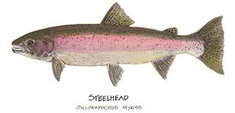
2 YRERFS Juvenile Steelhead Habitat Determination
3 Original Data Sets tree_object_classification (Riparian Scrub/ Riparian Forest) AllCobbles_5000 LYRriprapHBD LYRbedrock Data provided by HDR Originally WSI Vegetation analysis, 2010
4 Create Cover Raster WITHOUT PROJECT CONDITIONS (FWOP) Note: the following additional data layers were provided by the RMT for calculating WUA for these cover versions: LYR_Bedrock_boulder_cover.shp, LYR_riprap_HBD.shp, cobble_5k,lrgcobb_5k, Boulder_5000 and LYR5000_streamwood.shp. Method Process Output Cell Size Format Value CREATE AllCobbles_5000 Combine cobble_5k and lrgcobb_5k rasters by doing an addition function. Each pixel contains a percentage of the pixel that contains cobble, so by adding the two cobble size classes together a total percentage of area within the pixel that s cobble was calculated. MATH cobble_5k+lrgcobb_5k=allcobbles_5000 AllCobbles_5000 3x3 Float32 %Cobble CREATE LYRriprapHBD Converted the file LYR_riprap_HBD.shp containing polygons to a raster format with 3ft x 3ft Feature to pixels. Raster LYR_riprap_HBD.shp to LYRriprapHBD LYRriprapHBD 3x3 Float32 1=RipRap CREATE LYRbedrock Converted the file LYR_Bedrock_boulder_cover.shp containing polygons to a raster format with 3ft x 3 ft pixels. Feature to Raster LYR_Bedrock_boulder_cover.shp to LYRbedrock LYRbedrock 3x3 Float32 1=Bedrock CREATE LYR_Boulder_presence For a given pixel within the raster Boulder_5000 that was greater than 9 the output pixel would be 1; otherwise it was zero. Raster Reclass boulder_5k to LYR_Boulder_presence LYR_Boulder_presence 3x3 Float32 1=Boulder Cover Version Steelhead (O. mykiss) juvenile Note: The following additional data sources were used: LYR_veg_only_dissolve, LYR5000_wettedarea_dissolved.shp, LYR_streamwood.shp. Method Process Cell Size Format Value CALCULATE SHSI If AllCobbles_5000 is less than 30% of a given pixel then the SHSI is.3; otherwise it s.5. Raster Calc AllCobbles_5000 <30=.3 and >30=.5 SHSI_AllCobbles_5000 3x3 Float32 CALCULATE LYR_hardcover_OMYjuv_HSI For a given pixel if the sum of LYRriprapHBD, LYRbedrock and LYR_Boulder_presence is greater than zero then the output pixel value is.5; otherwise.3. Mosaic/Raster Calc <30=.3 >30=.5 LYRriprapHBD+LYRbedrock+LYR_Boulder_pr esence LYR_hardcover_OMYjuv_HSI 3x3 Float32 1=.5 CALCULATE LYR_veg_ OMYjuv_HSI Polygons representing areas of vegetation taller than 2 were buffered by 3 feet and assigned a value of 1. Areas within the 5000 cfs wetted area that were not within the 3 foot buffered vegetation polygons were assigned a value of.3. Raster Calc HeightClass=3ftBuffTree=1 and Shrub=.3 LYR_veg OMYjuv_HSI 3x3 Tree=1 Float32 Shrub=.3 CALCULATE LYR_SW_ OMYjuv_HSI Polygons representing areas of streamwood were buffered by 6 feet and assigned a value of 1. Areas within the 5000 cfs wetted area that were not within the 3 foot buffered vegetation polygons Feature to were assigned a value of.3. Raster 6ftBuffSW=1 LYR_SW OMYjuv_HSI 3x3 Float32 SW=1 CALCULATE COMBINED HSI Overlaying the SHSI, hardcover HSI, streamwood HSI and vegetation HSI rasters and looking at one pixel location at a time the output for that pixel location was whichever of the four inputs had the highest value. Data provided by HDR Originally WSI Vegetation analysis, 2010 Mosaic SHSI+ hardcover HIS+streamwood HIS+vegetation COMBINED_HSI 3x3 Float32 Heighest
5 Create Cover Raster tree_object_classification AllCobbles_5000 LYRriprapHBD LYRbedrock LYR_SW OMYjuv_HSI LYR_veg OMYjuv_HSI LYR_hardcover_OMYjuv_HSI SHSI_AllCobbles_5000 COMBINED_HSI

6 Create Cover Raster COMBINED_HSI

7 MODIFY COVER RASTER FOR FWOP Cover Raster missing data at Timbuctoo Bend Modify Cover Raster(Raster s Measures Feature to Raster) Side Channel Back Water Riparian Planting Floodplain Lowering Assign Habitat Units to Measures Raster s.3 - Side Channel.3 - Back Water.5 - Riparian Planting.5 - Floodplain Lowering Mosaic to Existing Riverine Cover Raster No Riparian Data FWOP_COMBINED_HSI
8 Build Raster for missing data at Timbuctoo Bend Feature to Raster BackWaterCoverRaster LoweringCoverRaster SideChannelCoverRaster PlantingCoverRaster Cover (reclass by table) Cover_class SI value boulder/riprap 0.5 cobble 0.5 none 0.3 riparian vegetation 1 stream wood 1 Reclassify Rasters FWOP_BackWater_HSI FWOP_Lowering_HSI FWOP_Planting_HSI FWOP_SideChannel_HSI FWOP_Timbuctoo_HSI
9 Cover (reclass by table) Cover_class SI value boulder/riprap 0.5 cobble 0.5 COMBINED_HSI none 0.3 riparian vegetation 1 stream wood 1 + FWOP_Timbuctoo_HSI (Back Water and Side Channels in Missing Data Area at Timbuctoo Bend) FWOP SI COVER = *Only areas within FWP footprint added to FWOP (existing) conditions FWOP_COMBINED_HSI
10 Create FWOP Cover Raster FWOP_COMBINED_HSI
11 MODIFY COVER RASTER FOR FWP Create project condition (Raster s Measures Feature to Raster) Side Channel Back Water Riparian Planting Floodplain Lowering Assign Habitat Units to Measures Raster s.5 - Side Channel.5 - Back Water 1 - Riparian Planting 1 - Floodplain Lowering Mosaic to Existing Riverine Cover Raster FWP_COMBINED_HSI
12 Build Raster for missing data at Timbuctoo Bend Feature to Raster BackWaterCoverRaster LoweringCoverRaster SideChannelCoverRaster PlantingCoverRaster Cover (reclass by table) Cover_class SI value boulder/riprap 0.5 cobble 0.5 none 0.3 riparian vegetation 1 stream wood 1 Reclassify Rasters FWP_BackWater_HSI FWP_Lowering_HSI FWP_Planting_HSI FWP_SideChannel_HSI FWOP_Timbuctoo_HSI
13 COMBINED_HSI Cover (reclass by table) Cover_class SI value boulder/riprap 0.5 cobble 0.5 none 0.3 riparian vegetation 1 stream wood 1 + (Floodplain Lowering and Riparian Planting) + (Back Water and Side Channels) = Habitat Values of.5 added to Back Water and Side Channel areas in order to Represent Cobble Cover in FWP conditions. FWP SI COVER Habitat Values of 1 added to Floodplain Lowering and Riparian Planting areas in order to Represent Cobble Cover in FWP conditions. FWP_COMBINED_HSI

14 Create FWP Cover Raster FWP_COMBINED_HSI
15 Raster Reclass Depth Depth (feet) Suitability Index Value Table to Table in ArcGIS (Excel to ASCII Table) with Range whole number (*100)= ( : 300 where fromval toval : HSC) 2 - Depth/Velocity*100 in Raster Calculator 3 - Reclass by ASCII Table 4 - Copy Raster To Float DepthReclass/VelocityReclass/100 in Raster Calc =DepthWith750SI, DepthWithOut750SI DepthWith1850SI, DepthWithOut1850SI, DepthWith5000SI, DepthWithOut5000SI
16 Raster Reclass Velocity Velocity (feet/second) Suitability Index Value =VelocityWith750SI, VelocityWith1850SI, VelocityWith5000SI, VelocityWithOut750SI, VelocityWithOut1850SI, VelocityWithOut5000SI
 1/3 Juvenile Steelhead AKA Riverine FWP HSI RASTER = (SI depthfwp x SI velocityfwp x SI coverfwp )")
17 Create Final Cover HSI Raster s 8 CALCULATE CHSI For each flow for a given pixel the output value for that pixel is the cubic root of the product of the VHSI, DHSI and Combined HSI at that location. Juvenile Steelhead AKA Riverine FWOP HSI RASTER = (SI depthfwop x SI velocityfwop x SI coverfwop ) 1/3 Juvenile Steelhead AKA Riverine FWP HSI RASTER = (SI depthfwp x SI velocityfwp x SI coverfwp ) 1/3 =FWOP_Riverine750_HSI, FWOP_Riverine1850_HSI, FWOP_Riverine5000_HSI, FWP_Riverine750_HSI, FWP_Riverine1850_HSI, FWP_Riverine5000_HSI
18 To refine results of the HSI and make it pertinent to the areas where measures are, a new layer was created to clip out the needed features. The layer, Units, has a north-south boundary based on the 84,000 cfs flow boundary and an east west boundary of 500 feet off either end of the widest measure in each measure grouping. There are 9 units total. (Extract by Mask)


19 All 9 units were used to clip the FWP and FWOP HSI rasters. Units FWOP/FWP_HSI Raster s Unit 1 =FWOP_Riverine750_HSI_U1 through U9, FWOP_Riverine1850_HSI_U1 through U9, FWOP_Riverine5000_HSI_U1 through U9, FWP_Riverine750_HSI_U1 through U9, FWP_Riverine1850_HSI_U1 through U9, FWP_Riverine5000_HSI_U1 through U9 Unit 1: 1850 cfs flow boundary clipped out X54 By-Units HIS Rasters
 9 Add HSI Field 10 Sum from Zonal Statastics *9 11 Add Name Field import arcpy from arcpy import env env.")
20 To calculate actual Habitat Units (end product) need to create a table for each raster. To create a table use the Zonal Statistics tool and input the rasters you want to create a table for. 8 Units Rasters to Table (Zonal Statistics) 9 Add HSI Field 10 Sum from Zonal Statastics *9 11 Add Name Field import arcpy from arcpy import env env.workspace = r"d:\usace Projects\YubaRiverEcosystemRestoration\GDB\Scratch.gdb" for table in arcpy.listtables("*"): name = table.split(".")[0] arcpy.addfield_management(table, "Name", "TEXT") arcpy.calculatefield_management(table, "Name", '"' + name + '"', "PYTHON") 12 Merge Tables and export to Excel
21 Once the table is created, create a new field in each raster and call it Habitat Unit then use the field calculator tool to determine the total ft 2 of for each raster. 9 CALCULATE WUA The CHSI rasters for each flow were grouped by hydraulic zone and a sum total of the pixel values for each zone was calculated. The sum total was then multiplied by the surface area of a single pixel (3 x 3 = 9ft2) to get the WUA for each separate hydraulic zone and for each modeled flow. Use the formula Sum * 9 where nine is the dimensions of each individual raster cell (3X3) and Sum is the total number of cells.

22 Final Product: after calculating all the habitat units, input values for each Evaluation unit based on flow into the GIS Outputs Table of Values
23 BUILDING STRONG
YRERFS GIS WORKFLOW AND MODELING PROCESS
 YRERFS GIS WORKFLOW AND MODELING PROCESS Presenter Name Presenter Title Duty Location Date of Presentation US Army Corps of Engineers YRERFS Yellow Warbler Riparian Scrub Shrub (RSS) Habitat Determination
YRERFS GIS WORKFLOW AND MODELING PROCESS
 YRERFS GIS WORKFLOW AND MODELING PROCESS Presenter Name Presenter Title Duty Location Date of Presentation US Army Corps of Engineers YRERFS Downy Woodpecker Riparian Forest (RF) Habitat Determination
Protocol for Riparian Buffer Restoration Prioritization in Centre County and Clinton County
 Protocol for Riparian Buffer Restoration Prioritization in Centre County and Clinton County Chesapeake Conservancy has developed this methodology to prioritize riparian buffer restoration in Centre County
Meander Modeling 101 by Julia Delphia, DWR Northern Region Office
 Meander Modeling 101 by Julia Delphia, DWR Northern Region Office The following instructions are based upon a demonstration given by the Meander Model creator, Eric Larsen, on May 27, 2014. Larsen was
Suitability Modeling with GIS
 Developed and Presented by Juniper GIS 1/33 Course Objectives What is Suitability Modeling? The Suitability Modeling Process Cartographic Modeling GIS Tools for Suitability Modeling Demonstrations of Models
FOR Save the Poudre: Poudre Waterkeeper BY PetersonGIS. Inputs, Methods, Results. June 15, 2012
 W e t l a n d s A n a l y s i s FOR Save the Poudre: Poudre Waterkeeper BY PetersonGIS Inputs, Methods, Results June 15, 2012 PROJECT GOALS The project goals were 1) create variable width buffers along
Lidar and GIS: Applications and Examples. Dan Hedges Clayton Crawford
 Lidar and GIS: Applications and Examples Dan Hedges Clayton Crawford Outline Data structures, tools, and workflows Assessing lidar point coverage and sample density Creating raster DEMs and DSMs Data area
Notes: Notes: Notes: Notes:
 NR406 GIS Applications in Fire Ecology & Management Lesson 2 - Overlay Analysis in GIS Gathering Information from Multiple Data Layers One of the many strengths of a GIS is that you can stack several data
Welcome to NR402 GIS Applications in Natural Resources. This course consists of 9 lessons, including Power point presentations, demonstrations,
 Welcome to NR402 GIS Applications in Natural Resources. This course consists of 9 lessons, including Power point presentations, demonstrations, readings, and hands on GIS lab exercises. Following the last
UNDERSTAND HOW TO SET UP AND RUN A HYDRAULIC MODEL IN HEC-RAS CREATE A FLOOD INUNDATION MAP IN ARCGIS.
 CE 412/512, Spring 2017 HW9: Introduction to HEC-RAS and Floodplain Mapping Due: end of class, print and hand in. HEC-RAS is a Hydrologic Modeling System that is designed to describe the physical properties
Masking Lidar Cliff-Edge Artifacts
 Masking Lidar Cliff-Edge Artifacts Methods 6/12/2014 Authors: Abigail Schaaf is a Remote Sensing Specialist at RedCastle Resources, Inc., working on site at the Remote Sensing Applications Center in Salt
FEMA Floodplain Mapping
 FEMA Floodplain Mapping By Luke Sturtevant Introduction The National Flood Insurance Program (NFIP) has compiled massive databases containing information and maps of floodplains for the entire United States.
GEOGRAPHIC INFORMATION SYSTEMS Lecture 18: Spatial Modeling
 Spatial Analysis in GIS (cont d) GEOGRAPHIC INFORMATION SYSTEMS Lecture 18: Spatial Modeling - the basic types of analysis that can be accomplished with a GIS are outlined in The Esri Guide to GIS Analysis
Appendix 5. GIS operation guide (Hue) -101-
 -101-") Appendix 5 GIS operation guide (Hue) -101- GIS Operation Guide T.T. Hue Province Contents Object of Training Course Course 1 View [1-1] Base Map [1-2] Add raster [1-3] Setting up raster property [1-4]
Appendix 5 GIS operation guide (Hue) -101- GIS Operation Guide T.T. Hue Province Contents Object of Training Course Course 1 View [1-1] Base Map [1-2] Add raster [1-3] Setting up raster property [1-4]
RASTER ANALYSIS GIS Analysis Winter 2016
 RASTER ANALYSIS GIS Analysis Winter 2016 Raster Data The Basics Raster Data Format Matrix of cells (pixels) organized into rows and columns (grid); each cell contains a value representing information.
Combine Yield Data From Combine to Contour Map Ag Leader
 Combine Yield Data From Combine to Contour Map Ag Leader Exporting the Yield Data Using SMS Program 1. Data format On Hard Drive. 2. Start program SMS Basic. a. In the File menu choose Open. b. Click on
Python Raster Analysis. Kevin M. Johnston Nawajish Noman
 Python Raster Analysis Kevin M. Johnston Nawajish Noman Outline Managing rasters and performing analysis with Map Algebra How to access the analysis capability - Demonstration Complex expressions and optimization
HECRAS 2D: Are you ready for the revolution in the world of hydraulic modeling?
 HECRAS 2D: Are you ready for the revolution in the world of hydraulic modeling? Rishab Mahajan, Emily Campbell and Matt Bardol March 8, 2017 Outline Reasons for hydraulic modeling 1D Modeling 2D Modeling-
Cell based GIS. Introduction to rasters
 Week 9 Cell based GIS Introduction to rasters topics of the week Spatial Problems Modeling Raster basics Application functions Analysis environment, the mask Application functions Spatial Analyst in ArcGIS
DEM Artifacts: Layering or pancake effects
 Outcomes DEM Artifacts: Stream networks & watersheds derived using ArcGIS s HYDROLOGY routines are only as good as the DEMs used. - Both DEM examples below have problems - Lidar and SRTM DEM products are
Copyright The McGraw-Hill Companies, Inc. Permission required for reproduction or display.
 CHAPTER 12 RASTER DATA ANALYSIS 12.1 Data Analysis Environment Box 12.1 How to Make an Analysis Mask 12.2 Local Operations 12.2.1 Local Operations with a Single Raster 12.2.2 Reclassification 12.2.3 Local
Raster Data. James Frew ESM 263 Winter
 Raster Data 1 Vector Data Review discrete objects geometry = points by themselves connected lines closed polygons attributes linked to feature ID explicit location every point has coordinates 2 Fields
Basics of Using LiDAR Data
 Conservation Applications of LiDAR Basics of Using LiDAR Data Exercise #2: Raster Processing 2013 Joel Nelson, University of Minnesota Department of Soil, Water, and Climate This exercise was developed
Making Yield Contour Maps Using John Deere Data
 Making Yield Contour Maps Using John Deere Data Exporting the Yield Data Using JDOffice 1. Data Format On Hard Drive 2. Start program JD Office. a. From the PC Card menu on the left of the screen choose
Using GIS To Estimate Changes in Runoff and Urban Surface Cover In Part of the Waller Creek Watershed Austin, Texas
 Using GIS To Estimate Changes in Runoff and Urban Surface Cover In Part of the Waller Creek Watershed Austin, Texas Jordan Thomas 12-6-2009 Introduction The goal of this project is to understand runoff
Imagery and Raster Data in ArcGIS. Abhilash and Abhijit
 Imagery and Raster Data in ArcGIS Abhilash and Abhijit Agenda Imagery in ArcGIS Mosaic datasets Raster processing ArcGIS is a Comprehensive Imagery System Integrating All Types, Sources, and Sensor Models
Mapping Photoperiod as a Variable in Vegetation Distribution Analysis. Photoperiod is defined as the duration of time for which an organism receives
 Paul Southard December 7 th, 2017 Mapping Photoperiod as a Variable in Vegetation Distribution Analysis Introduction Photoperiod is defined as the duration of time for which an organism receives illumination.
Raster GIS applications
 Raster GIS applications Columns Rows Image: cell value = amount of reflection from surface DEM: cell value = elevation (also slope/aspect/hillshade/curvature) Thematic layer: cell value = category or measured
This tutorial shows how to build a Sedimentation and River Hydraulics Two-Dimensional (SRH-2D) simulation. Requirements
 simulation. Requirements") v. 13.0 SMS 13.0 Tutorial Objectives This tutorial shows how to build a Sedimentation and River Hydraulics Two-Dimensional () simulation. Prerequisites SMS Overview tutorial Requirements Model Map Module
v. 13.0 SMS 13.0 Tutorial Objectives This tutorial shows how to build a Sedimentation and River Hydraulics Two-Dimensional () simulation. Prerequisites SMS Overview tutorial Requirements Model Map Module
Curve Fit: a pixel level raster regression tool
 a pixel level raster regression tool Timothy Fox, Nathan De Jager, Jason Rohweder* USGS La Crosse, WI a pixel level raster regression tool Working with multiple raster datasets that share a common theme
APPENDIX E2. Vernal Pool Watershed Mapping
 APPENDIX E2 Vernal Pool Watershed Mapping MEMORANDUM To: U.S. Fish and Wildlife Service From: Tyler Friesen, Dudek Subject: SSHCP Vernal Pool Watershed Analysis Using LIDAR Data Date: February 6, 2014
WMS 10.1 Tutorial Hydraulics and Floodplain Modeling HEC-RAS Analysis Learn how to setup a basic HEC-RAS analysis using WMS
 v. 10.1 WMS 10.1 Tutorial Hydraulics and Floodplain Modeling HEC-RAS Analysis Learn how to setup a basic HEC-RAS analysis using WMS Objectives Learn how to build cross sections, stream centerlines, and
WMS 9.0 Tutorial Hydraulics and Floodplain Modeling HEC-RAS Analysis Learn how to setup a basic HEC-RAS analysis using WMS
 v. 9.0 WMS 9.0 Tutorial Hydraulics and Floodplain Modeling HEC-RAS Analysis Learn how to setup a basic HEC-RAS analysis using WMS Objectives Learn how to build cross sections, stream centerlines, and bank
Lecture 20 - Chapter 8 (Raster Analysis, part1)
") GEOL 452/552 - GIS for Geoscientists I Lecture 20 - Chapter 8 (Raster Analysis, part) 4 lectures on rasters - but won t cover everything (Raster GIS course: Geol 588: GIS II (Spring 20) Today: Raster data,
GEOL 452/552 - GIS for Geoscientists I Lecture 20 - Chapter 8 (Raster Analysis, part) 4 lectures on rasters - but won t cover everything (Raster GIS course: Geol 588: GIS II (Spring 20) Today: Raster data,
Python Raster Analysis. Kevin M. Johnston Nawajish Noman
 Python Raster Analysis Kevin M. Johnston Nawajish Noman Outline Managing rasters and performing analysis with Map Algebra How to access the analysis capability - Demonstration Complex expressions and optimization
By Colin Childs, ESRI Education Services. Catalog
 s resolve many traditional raster management issues By Colin Childs, ESRI Education Services Source images ArcGIS 10 introduces Catalog Mosaicked images Sources, mosaic methods, and functions are used
RASTER ANALYSIS GIS Analysis Fall 2013
 RASTER ANALYSIS GIS Analysis Fall 2013 Raster Data The Basics Raster Data Format Matrix of cells (pixels) organized into rows and columns (grid); each cell contains a value representing information. What
NV CCS USER S GUIDE V1.1 ADDENDUM
 NV CCS USER S GUIDE V1.1 ADDENDUM PAGE 1 FOR CREDIT PROJECTS THAT PROPOSE TO MODIFY CONIFER COVER Released 5/19/2016 This addendum provides instructions for evaluating credit projects that propose to treat
Introduction to the Image Analyst Extension. Mike Muller, Vinay Viswambharan
 Introduction to the Image Analyst Extension Mike Muller, Vinay Viswambharan What is the Image Analyst Extension? The Image Analyst Extension (IA) is an application extension which extends ArcGIS Pro with
Appendix B: Photo Review of Study Reaches
 Appendix B: Photo Review of Study Reaches Table of Contents 1.0 Rock Creek... 4 Rock Creek Mainstem, Reaches 1 through 4... 4 Rock Creek Mainstem, Reaches 5 and 6... 5 Rock Creek Mainstem, Reaches 7...
Alaska Department of Transportation Roads to Resources Project LiDAR & Imagery Quality Assurance Report Juneau Access South Corridor
 Alaska Department of Transportation Roads to Resources Project LiDAR & Imagery Quality Assurance Report Juneau Access South Corridor Written by Rick Guritz Alaska Satellite Facility Nov. 24, 2015 Contents
Getting Started with Spatial Analyst. Steve Kopp Elizabeth Graham
 Getting Started with Spatial Analyst Steve Kopp Elizabeth Graham Workshop Overview Fundamentals of using Spatial Analyst What analysis capabilities exist and where to find them How to build a simple site
Getting Started with Spatial Analyst. Steve Kopp Elizabeth Graham
 Getting Started with Spatial Analyst Steve Kopp Elizabeth Graham Spatial Analyst Overview Over 100 geoprocessing tools plus raster functions Raster and vector analysis Construct workflows with ModelBuilder,
RASTER ANALYSIS S H A W N L. P E N M A N E A R T H D A T A A N A LY S I S C E N T E R U N I V E R S I T Y O F N E W M E X I C O
 RASTER ANALYSIS S H A W N L. P E N M A N E A R T H D A T A A N A LY S I S C E N T E R U N I V E R S I T Y O F N E W M E X I C O TOPICS COVERED Spatial Analyst basics Raster / Vector conversion Raster data
Exercise 5. Height above Nearest Drainage Flood Inundation Analysis
 Exercise 5. Height above Nearest Drainage Flood Inundation Analysis GIS in Water Resources, Fall 2018 Prepared by David G Tarboton Purpose The purpose of this exercise is to learn how to calculation the
Field-Scale Watershed Analysis
 Conservation Applications of LiDAR Field-Scale Watershed Analysis A Supplemental Exercise for the Hydrologic Applications Module Andy Jenks, University of Minnesota Department of Forest Resources 2013
Python: Working with Raster Data. Nawajish Noman Elizabeth Graham
 Python: Working with Raster Data Nawajish Noman Elizabeth Graham Outline Managing rasters with tools and performing analysis with Map Algebra How to access the analysis capability - Demonstration Complex
Using HEC-RAS and HEC-GeoRAS for River Modeling Adapted by E. Maurer, using an exercise by V. Merwade, Purdue Univ.
 Introduction Using HEC-RAS and HEC-GeoRAS for River Modeling Adapted by E. Maurer, using an exercise by V. Merwade, Purdue Univ. This tutorial uses the output from HEC_GeoRAS from a prior exercise as input
Multi-temporal LIDAR data for forestry an approach to investigate timber yield changes
 Multi-temporal LIDAR data for forestry an approach to investigate timber yield changes UniSA Stefan Peters, Jixue Liu, David Bruce, Jiuyong Li ForestrySA Jim O Hehir, Mary-Anne Larkin, Anthony Hay 1 Why
George Mason University Department of Civil, Environmental and Infrastructure Engineering. Dr. Celso Ferreira Prepared by Lora Baumgartner
 George Mason University Department of Civil, Environmental and Infrastructure Engineering Dr. Celso Ferreira Prepared by Lora Baumgartner Exercise Topic: Getting started with HEC GeoRAS Objective: Create
Remote Sensing & GIS (Bio/Env384 A): 10 November 2015 GIS Database Query
: 10 November 2015 GIS Database Query") Remote Sensing & GIS (Bio/Env384 A): 10 November 2015 GIS Database Query One primary purpose of establishing any GIS database is to provide the possibility of querying that database, i.e., of asking questions
Remote Sensing & GIS (Bio/Env384 A): 10 November 2015 GIS Database Query One primary purpose of establishing any GIS database is to provide the possibility of querying that database, i.e., of asking questions
APPENDIX X SPECIFIC SAMPLING PROTOCOLS AND PROCEDURES FOR TOPOGRAPHIC MAPPING. Dr. Gregory B. Pasternack, Watershed Hydrologist TOPOGRAPHIC MAPPING
 APPENDIX X SPECIFIC SAMPLING PROTOCOLS AND PROCEDURES FOR TOPOGRAPHIC MAPPING Dr. Gregory B. Pasternack, Watershed Hydrologist TOPOGRAPHIC MAPPING 1.0 Background A topographic map is a representation of
GISC 3200K. Python Programming for GIS. Final Project 12/8/2014. Chase Bennett
 GISC 3200K Python Programming for GIS Final Project 12/8/2014 Chase Bennett OBJECTIVE: Throughout this semester we have been studying ways to use python scripting to save time and money in the use of Arc
Spatial Analysis Exercise GIS in Water Resources Fall 2011
 Spatial Analysis Exercise GIS in Water Resources Fall 2011 Prepared by David G. Tarboton and David R. Maidment Goal The goal of this exercise is to serve as an introduction to Spatial Analysis with ArcGIS.
Southern Ontario Interim Landcover (SIL) Data Compilation Documentation
 Data Compilation Documentation") Southern Ontario Interim Landcover (SIL) Data Compilation Documentation Introductory Datasets: Goal: To utilize all relevant corporate MNR datasets as well as external datasets that hold ecological value.
Southern Ontario Interim Landcover (SIL) Data Compilation Documentation Introductory Datasets: Goal: To utilize all relevant corporate MNR datasets as well as external datasets that hold ecological value.
Raster GIS applications Columns
 Raster GIS applications Columns Rows Image: cell value = amount of reflection from surface Thematic layer: cell value = category or measured value - In both cases, there is only one value per cell (in
Fractions Part 1 Chapter Problems
 Fractions Part Chapter Problems Meaning of Fractions Identify the numerator in each of the following fractions:...... Identify the denominator in each of the following fractions:... 0... State whether
Watershed Sciences 4930 & 6920 GEOGRAPHIC INFORMATION SYSTEMS
 HOUSEKEEPING Watershed Sciences 4930 & 6920 GEOGRAPHIC INFORMATION SYSTEMS CONTOURS! Self-Paced Lab Due Friday! WEEK SIX Lecture RASTER ANALYSES Joe Wheaton YOUR EXCERCISE Integer Elevations Rounded up
ArcGIS Enterprise Building Raster Analytics Workflows. Mike Muller, Jie Zhang
 ArcGIS Enterprise Building Raster Analytics Workflows Mike Muller, Jie Zhang Introduction and Context Raster Analytics What is Raster Analytics? The ArcGIS way to create and execute spatial analysis models
GEOG 487 Lesson 7: Step- by- Step Activity
 GEOG 487 Lesson 7: Step- by- Step Activity Part I: Review the Relevant Data Layers and Organize the Map Document In Part I, we will review the data and organize the map document for analysis. 1. Unzip
GIS Workshop Spring 2016
 1/ 14 GIS Geographic Information System. An integrated collection of computer software and data used to view and manage information about geographic places, analyze spatial relationships, and model spatial
RVR MEANDER USER S MANUAL
 RVR MEANDER USER S MANUAL ArcGIS VERSION Roberto Fernández 1, Davide Motta 2, Jorge D. Abad 3, Eddy J. Langendoen 4, Nils Oberg 5, Marcelo H. Garcia 6 August 29, 2011 ABSTRACT This document illustrates
Forest Structure and Bird Nesting Habitat Derived from LiDAR Data
 Forest Structure and Bird Nesting Habitat Derived from LiDAR Data Doug Newcomb USFWS, Dr. William Hargrove at the USDA Eastern Forest Threat Center, Forrest Hoffman, and Dr. Jitendra Kumar with Oak Ridge
Data Assembly, Part II. GIS Cyberinfrastructure Module Day 4
 Data Assembly, Part II GIS Cyberinfrastructure Module Day 4 Objectives Continuation of effective troubleshooting Create shapefiles for analysis with buffers, union, and dissolve functions Calculate polygon
Lecture 21 - Chapter 8 (Raster Analysis, part2)
") GEOL 452/552 - GIS for Geoscientists I Lecture 21 - Chapter 8 (Raster Analysis, part2) Today: Digital Elevation Models (DEMs), Topographic functions (surface analysis): slope, aspect hillshade, viewshed,
GEOL 452/552 - GIS for Geoscientists I Lecture 21 - Chapter 8 (Raster Analysis, part2) Today: Digital Elevation Models (DEMs), Topographic functions (surface analysis): slope, aspect hillshade, viewshed,
Import, view, edit, convert, and digitize triangulated irregular networks
 v. 10.1 WMS 10.1 Tutorial Import, view, edit, convert, and digitize triangulated irregular networks Objectives Import survey data in an XYZ format. Digitize elevation points using contour imagery. Edit
Python Raster Analysis
 2013 Esri International User Conference July 8 12, 2013 San Diego, California Technical Workshop Python Raster Analysis Kevin M. Johnston Ryan DeBruyn Nawajish Noman Esri UC2013. Technical Workshop. The
Mapping Distance and Density
 Mapping Distance and Density Distance functions allow you to determine the nearest location of something or the least-cost path to a particular destination. Density functions, on the other hand, allow
Developing an Interactive GIS Tool for Stream Classification in Northeast Puerto Rico
 Developing an Interactive GIS Tool for Stream Classification in Northeast Puerto Rico Lauren Stachowiak Advanced Topics in GIS Spring 2012 1 Table of Contents: Project Introduction-------------------------------------
Module 7 Raster operations
 Introduction Geo-Information Science Practical Manual Module 7 Raster operations 7. INTRODUCTION 7-1 LOCAL OPERATIONS 7-2 Mathematical functions and operators 7-5 Raster overlay 7-7 FOCAL OPERATIONS 7-8
Pond Distance and Habitat for use in Wildlife Modeling
 Pond Distance and Habitat for use in Wildlife Modeling These instructions enable you to aggregate layers within a study area, calculate new fields, and create new data out of existing data, for use in
Initial Analysis of Natural and Anthropogenic Adjustments in the Lower Mississippi River since 1880
 Richard Knox CE 394K Fall 2011 Initial Analysis of Natural and Anthropogenic Adjustments in the Lower Mississippi River since 1880 Objective: The objective of this term project is to use ArcGIS to evaluate
Esri International User Conference. July San Diego Convention Center. Lidar Solutions. Clayton Crawford
 Esri International User Conference July 23 27 San Diego Convention Center Lidar Solutions Clayton Crawford Outline Data structures, tools, and workflows Assessing lidar point coverage and sample density
Exercise 3: Spatial Analysis GIS in Water Resources Fall 2013
 Exercise 3: Spatial Analysis GIS in Water Resources Fall 2013 Prepared by David G. Tarboton and David R. Maidment Goal The goal of this exercise is to serve as an introduction to Spatial Analysis with
Distributed Image Analysis Using the ArcGIS API for Python
 Distributed Image Analysis Using the ArcGIS API for Python Jie Zhang, Elizabeth Graham The ArcGIS Platform Is a Comprehensive Imagery Platform System of Engagement System of Insight Professional Imagery
AUTOMATING MANNING S N COEFFICIENT VALUE ASSIGNMENTS FOR HYDRAULIC MODELING
 Imagery Source: Bing Maps via ESRI AUTOMATING MANNING S N COEFFICIENT VALUE ASSIGNMENTS FOR HYDRAULIC MODELING Kyle Gallagher, GISP Black & Veatch Special Projects Corp. Project Overview USACE Tulsa District
Using LIDAR to Design Embankments in ArcGIS. Written by Scott Ralston U.S. Fish & Wildlife Service Windom Wetland Management District
 Using LIDAR to Design Embankments in ArcGIS Written by Scott Ralston U.S. Fish & Wildlife Service Windom Wetland Management District This tutorial covers the basics of how to design a dike, embankment
+ = Spatial Analysis of Raster Data. 2 =Fault in shale 3 = Fault in limestone 4 = no Fault, shale 5 = no Fault, limestone. 2 = fault 4 = no fault
 Spatial Analysis of Raster Data 0 0 1 1 0 0 1 1 1 0 1 1 1 1 1 1 2 4 4 4 2 4 5 5 4 2 4 4 4 2 5 5 4 4 2 4 5 4 3 5 4 4 4 2 5 5 5 3 + = 0 = shale 1 = limestone 2 = fault 4 = no fault 2 =Fault in shale 3 =
ENGRG Introduction to GIS
 ENGRG 59910 Introduction to GIS Michael Piasecki April 3, 2014 Lecture 11: Raster Analysis GIS Related? 4/3/2014 ENGRG 59910 Intro to GIS 2 1 Why we use Raster GIS In our previous discussion of data models,
Lecture 9. Raster Data Analysis. Tomislav Sapic GIS Technologist Faculty of Natural Resources Management Lakehead University
 Lecture 9 Raster Data Analysis Tomislav Sapic GIS Technologist Faculty of Natural Resources Management Lakehead University Raster Data Model The GIS raster data model represents datasets in which square
Announcements. Data Sources a list of data files and their sources, an example of what I am looking for:
 Data Announcements Data Sources a list of data files and their sources, an example of what I am looking for: Source Map of Bangor MEGIS NG911 road file for Bangor MEGIS Tax maps for Bangor City Hall, may
Raster Data. James Frew ESM 263 Winter
 Raster Data 1 Vector Data Review discrete objects geometry = points by themselves connected lines closed polygons agributes linked to feature ID explicit localon every point has coordinates 2 Fields in
Survey to Support 2D Hydraulic Aquatic Habitat Models
 Survey to Support 2D Hydraulic Aquatic Habitat Models New Mexico Interstate Stream Commission (NMISC) Presented at the 2015 Esri International User Conference San Diego Convention Center Wednesday, July
Big data for big river science: data intensive tools, techniques, and projects at the USGS/Columbia Environmental Research Center
 Big data for big river science: data intensive tools, techniques, and projects at the USGS/Columbia Environmental Research Center Ed Bulliner U.S. Geological Survey, Columbia Environmental Research Center
Appendix E. HEC-RAS and HEC-Ecosystem Functions Models
 Appendix E HEC-RAS and HEC-Ecosystem Functions Models 1 Appendix E: Modeled Reaches for the Connecticut River Watershed application of HEC-RAS Separate from the report for the Decision Support System of
Submerged Aquatic Vegetation Mapping using Object-Based Image Analysis with Lidar and RGB Imagery
 Submerged Aquatic Vegetation Mapping using Object-Based Image Analysis with Lidar and RGB Imagery Victoria Price Version 1, April 16 2015 Submerged Aquatic Vegetation Mapping using Object-Based Image Analysis
What s New in Imagery in ArcGIS. Presented by: Christopher Patterson Date: September 12, 2017
 What s New in Imagery in ArcGIS Presented by: Christopher Patterson Date: September 12, 2017 Agenda Ortho Mapping Elevation extraction Drone2Map Raster Analytics ArcGIS is a Comprehensive Imagery System
Terms and definitions * keep definitions of processes and terms that may be useful for tests, assignments
 Lecture 1 Core of GIS Thematic layers Terms and definitions * keep definitions of processes and terms that may be useful for tests, assignments Lecture 2 What is GIS? Info: value added data Data to solve
GIS Fundamentals: Supplementary Lessons with ArcGIS Pro
 Station Analysis (parts 1 & 2) What You ll Learn: - Practice various skills using ArcMap. - Combining parcels, land use, impervious surface, and elevation data to calculate suitabilities for various uses
The Reference Library Generating Low Confidence Polygons
 GeoCue Support Team In the new ASPRS Positional Accuracy Standards for Digital Geospatial Data, low confidence areas within LIDAR data are defined to be where the bare earth model might not meet the overall
Map Analysis of Raster Data I 3/8/2018
 Map Analysis of Raster Data I /8/8 Spatial Analysis of Raster Data What is Spatial Analysis? = shale = limestone 4 4 4 4 5 5 4 4 4 4 5 5 4 4 4 5 4 5 4 4 4 5 5 5 + = = fault =Fault in shale 4 = no fault
Managing Imagery And Raster Data Using Mosaic Dataset. Peter Becker & Cody Benkelman
 Managing Imagery And Raster Data Using Mosaic Dataset Peter Becker & Cody Benkelman ArcGIS is a Comprehensive Imagery Platform Imagery is integral to the ArcGIS Platform System of Engagement System of
v SMS 11.1 Tutorial SRH-2D Prerequisites None Time minutes Requirements Map Module Mesh Module Scatter Module Generic Model SRH-2D
 v. 11.1 SMS 11.1 Tutorial SRH-2D Objectives This lesson will teach you how to prepare an unstructured mesh, run the SRH-2D numerical engine and view the results all within SMS. You will start by reading
Sedimentation in Aquilla Lake Hill County, Texas
 Sedimentation in Aquilla Lake Hill County, Texas by Lorena Roque Martinez, GIS and GPS Applications in Earth Sciences (GEO 327G) Introduction The Texas Water Development Board (TWDB) is in charge of offering
Python - Raster Analysis
 Esri International User Conference San Diego, California Technical Workshops July 2012 Python - Raster Analysis Kevin M. Johnston Ryan DeBruyn The problem that is being addressed You have a complex modeling
v SMS Tutorials SRH-2D Prerequisites Requirements SRH-2D Model Map Module Mesh Module Data files Time
 v. 11.2 SMS 11.2 Tutorial Objectives This tutorial shows how to build a Sedimentation and River Hydraulics Two-Dimensional () simulation using SMS version 11.2 or later. Prerequisites SMS Overview tutorial
ArcGIS Desktop The Road Ahead. Amadea Azerki
 ArcGIS Desktop The Road Ahead Amadea Azerki Agenda An Overview of ArcGIS 10 Desktop Enhancements User Interface Mapping Editing Analysis Sharing Q & A ArcGIS 10 Overview Focuses on Usability and Productivity
GIS and Forest Engineering Applications
 FE 257. GIS and Forest Engineering Applications Week 3 This week s topics Clip and erase processes Chapter 6 Selecting landscape features in a GIS Chapter 5 GIS Lab3: Determining land use and ownership
Raster Analysis and Image Processing in ArcGIS Enterprise
 Raster Analysis and Image Processing in ArcGIS Enterprise Vinay Viswambharan, Jie Zhang Overview Patterns of use - Introduction to image processing and analysis in ArcGIS - Client/Server side processing
MODULE 1 BASIC LIDAR TECHNIQUES
 MODULE SCENARIO One of the first tasks a geographic information systems (GIS) department using lidar data should perform is to check the quality of the data delivered by the data provider. The department