OBLIQUE AERIAL IMAGERY FOR NMA SOME BEST PRACTICES
|
|
|
- Meryl Tucker
- 5 years ago
- Views:
Transcription
1 OBLIQUE AERIAL IMAGERY FOR NMA SOME BEST PRACTICES F. Remondino 1, I. Toschi 1, M. Gerke 2, F. Nex 2, D. Holland 3, A. McGill 4, J. Talaya Lopez 5, A. Magarinos 5 1 3D Optical Metrology (3DOM) unit, Bruno Kessler Foundation (FBK), Trento, Italy <remondino><toschi>@fbk.eu, 2 University of Twente, Faculty of Geo-Information Science and Earth Observation (ITC), Department of Earth Observation Science, The Netherlands <m.gerke><f.nex>@utwente.nl 3 Ordnance Survey, Southampton, UK david.holland@os.uk 4 Ordnance Survey, Dublin, Ireland andy.mcgill@osi.ie 5 ICGC, Spain <julia.talaya><antonio.magarinos>@icgc.cat
2 NMCAs Research Org. EuroSDR is an organization composed of European NMCAs/NMAs and research organizations of most EU member states EuroSDR is following the development of oblique aerial cameras since 2013, when a research activity was created to: EuroSDR & oblique aerial imagery continuously update its members on the developments in this technology explore more deeply the potential of oblique imagery investigate performances of hardware and software solutions provide practical and cost-effective methodologies for mapping agencies underline substantial technical and operational benefits provide clear statements and best practices Oblique research activity of EuroSDR is couple to the ISPRS Scientific Initiative on Multiplatform Photogrammetry see presentation on Saturday 16/Jul/2016: 10:30am-12:00pm, room Club B Gerke, M., Nex, F., Remondino, F., Jacobsen, K., Kremer, J., Karel, W., 2016: Orientation of oblique airborne image sets - Experiences from the ISPRS/EuroSDR benchmark on multiplatform photogrammetry +


3 Oblique imagery and cameras First recorded aerial photo in the US (1860) by J.W. Black and S. King in Boston (USA) was an oblique shot from a balloon In the two World Wars, oblique were used for inspection & reconnaissance In the analogue times too expensive technology Almost 10 years ago: Pictometry system Nowadays different systems available A returned technology / system USGC-9 Vexcel Osprey Source: Wikipedia Zeiss twin RMK Leica DRC30

4 Current oblique aerial systems General classification of oblique digital cameras single swiping camera VisionMap


5 Current oblique aerial systems General classification of oblique digital cameras single swiping camera 2 cameras IGI Dual Zeiss twin RMK DiMAC


6 Current oblique aerial systems General classification of oblique digital cameras single swiping camera 2 cameras 3 cameras DLR-3K 3x Jena LMK 3x Fairchild K-17 Bagley 3-lens (1920)

 Rolleimetric")
7 Current oblique aerial systems General classification of oblique digital cameras single swiping camera 2 cameras 3 cameras 4 cameras NPO KSI Zeiss (1930) Rolleimetric AIC x4
 Microsoft/Vexcel")
8 Current oblique aerial systems General classification of oblique digital cameras single swiping camera 2 cameras 3 cameras 4 cameras 5 cameras Leica RCS30 Fairchild T-3A (1930 s) Microsoft/Vexcel Osprey


9 Current oblique aerial systems General classification of oblique digital cameras single swiping camera 2 cameras 3 cameras 4 cameras 5 cameras Multiple cameras NPO KSI 9-lens Fairchild Schiempflug (1904) Octoblique Midas (2015)
 vs Maltese Cross")


10 Current oblique aerial systems Fan (static or sweeping) vs Maltese Cross configuration - IGI Dual Cam - A3 Visionmap - Track Air MIDAS - IGI Penta DigiCam - Hexagon/Leica RCD30 - Pictometry / BlomOblique - Microsoft/Vexcel Osprey


 vs fixed Small vs medium vs large format")
11 Current oblique aerial systems Maltese Cross configuration One vertically pointing camera + 4 oblique cameras pointing to the four cardinal directions Modular (i.e. varying angles) vs fixed Small vs medium vs large format camera sensors RGB + NIR (in the nadir) Wide vs narrow angle lens Larger image block (more strips, more overlap, more redundancy)


12 Image block comparisons ADS80 coverage RCD30 coverage RCD30 Oblique (PentaPod) coverage

13 Oblique aerial systems - Open research issues handling of occlusions, scale and radiometric changes correct and fast identification of homologues points, in particular across viewing directions automatic AT with well distributed tie points direct geo-referencing use of relative orientation among the oblique views processing time redundancy / overlap exploitation fusion of point clouds coming from different viewing directions (and with different accuracy & resolution) automation in interpretation, especially for complex architectures etc. Most of these issues were tackled within the EuroSDR research activity on oblique aerial cameras


14
15 EuroSDR & oblique aerial imagery Main participant of the EuroSDR oblique research activity : FBK Trento, Italy ITC / Twente University, The Netherlands Ordnance Survey (OS) UK Ordnance Survey (OS) Ireland Institut Cartogràfic i Geològic de Catalunya (ICGC), Spain
16 EuroSDR & oblique aerial imagery Performances of existing hardware and software (benchmark) Needs for using oblique flights / images wrt standard nadir acquisitions Advantages of oblique datasets Lesson learnt from internal experiences Limitations of the oblique pipeline wrt the standard nadir solution Visions
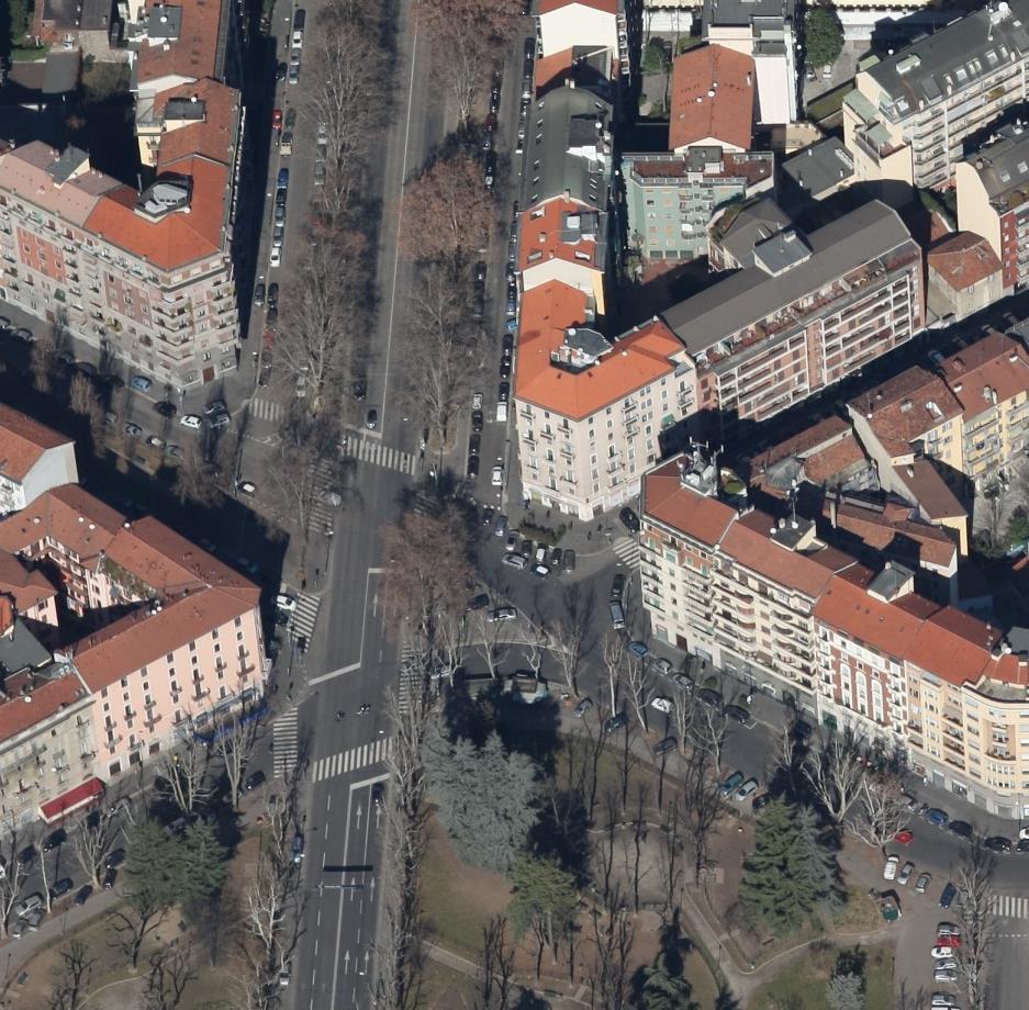
17 Needs for using oblique flights Nadir flights for: update of topographic maps, production of orthophotos, creation of national-wide DSMs/DTMs, generation of Building Height Attribute, etc. Oblique flight for: 3D object extraction and modeling, improve realistic appearance of (3D) geo-products, improve urban mapping, reduce occlusions, improve reliability and redundancy

 Measurements on building")

 Territory identification and interpretation for more efficient")
18 Production of 3D vs 2.5D point clouds Reduced occlusions Advantages of oblique datasets Derivation of 3D topographic layers / info directly from 3D point clouds (no need for stereo restitutions) Measurements on building façades and, generally, in narrow streets Better modeling of man-made and complex objects (sheers, overhangs, canopies, underpasses, etc.) Territory identification and interpretation for more efficient evidencebased decision making process In general, improve the quality of the geo-product offered by NMAs
19 Lesson learnt from internal experiences Better performance with 80x80 overlap configuration and GSD in the order of 6-7cm (Maltese cross configuration / cameras) Reducing overlap to the usual 60x60 or 60x40 produce noisier correlation and higher occlusions need for larger overlap, so blocks! Parallelization (no Cloud) is very mandatory to speed up processing (an oblique block is ca 10 times larger than a nadir block) Covering large areas requires high amount of flight hours so illumination conditions should be carefully considered 25 sq. 7cm GSD #images flight time 60x40 conf. with large format camera < 400 < 1h 80x80 conf. with oblique camera > 6000 > 3h Tridicon (3DCom/Hexagon) suite seems to be the most effective solution to generate 3D building models out of dense point clouds
20 Limitations Medium format cameras (with Bayer filter) have an apparent resolution smaller than the nominal flight GSD. Using synthetic targets an effective resolutions of 1.98xGSD (R), 1.32xGSD (G) and 2.21xGSD (B) were obtained Current off-the-shelf workflows for image processing, aerial triangulation (AT), dense point cloud and 3D data generation have important room for improvement Often manual intervention for subdividing blocks and facilitate AT procedures is requested Although DIM produce more dense and complete point clouds, trueorthos suffer of DIM results, thus DTM still primary source Image block size and management Tools for 3D building generation from dense point clouds normally do not consider points of the façades

21 Visions Soon oblique will be a common source for 3D urban areas and to create high resolution 3D datasets New algorithms and solutions will improve data processing performances and results Oblique imagery will facilitate the complete automatization of LOD2-3 building extraction based on multi-view algorithms Oblique will increase user s expectation wrt current and standard products (e.g. true-ortho, quality 3D textured building models, etc.)
22 Conclusions (1/2) Oblique camera systems are definitely back and a promising solution for mapping purposes Different systems available, new coming out soon on the market Oblique airborne images will probably become a standard complementary to traditional large format nadir images Oblique will not replace traditional nadir acquisitions (urban areas) Many possible applications: map update, 3D city modeling, inspection, interpretation, footprint identification, 3D cadastre, real estate, etc. NMAs are slowly thinking to adjust their production pipeline to cope with oblique datasets Oblique requires a new approach in the photogrammetric and production pipeline Data acquisition (flight plan) + Data processing (convergent, huge point clouds, etc.) + 3D restitution / Automated interpretation

 are not useful for NMAs if not only for visualization versus")
23 Conclusions (2/2) Additional costs of oblique flights (especially additional flight lines) might be compensated by additional outcomes and benefits Benefit offered by oblique imagery are not yet compelling enough to result in a commitment to operational use of oblique flights The images volume in a project increases dramatically affecting image management, AT, dense matching, storage and archive operations Very dense, accurate and detailed point clouds but then? New solutions to derive structured information out of unstructured point clouds Large polygonal models (e.g. GoogleEarth) are not useful for NMAs if not only for visualization versus

24 THANK YOU! F. REMONDINO, I. TOSCHI, M. GERKE, F. NEX, D. HOLLAND, A. MCGILL, J. TALAYA LOPEZ, A. MAGARINOS
OBLIQUE AERIAL IMAGES: POTENTIALITIES, APPLICATIONS AND BEST PRACTICES FRANCESCO NEX
 OBLIQUE AERIAL IMAGES: POTENTIALITIES, APPLICATIONS AND BEST PRACTICES FRANCESCO NEX f.nex@utwente.nl The history of oblique imagery First recorded aerial photo in the US (1860) by J.W. Black and S. King
OBLIQUE AERIAL IMAGERY A REVIEW
 OBLIQUE AERIAL IMAGERY A REVIEW FABIO REMONDINO 3D Optical Metrology unit Bruno Kessler Foundation (FKB) Trento, Italy http://3dom.fbk.eu Email: remondino@fbk.eu MARKUS GERKE EOS dept. ITC / Univ. Twente,
STATUS OF AIRBORNE OBLIQUE IMAGING EUROSDR COMMISSION I PROJECT OBLIQUE IMAGERY. Markus Gerke May 15, 2014
 STATUS OF AIRBORNE OBLIQUE IMAGING EUROSDR COMMISSION I PROJECT OBLIQUE IMAGERY Markus Gerke May 15, 2014 THE FIRST AIRBORNE PHOTOS WERE OBLIQUE First recorded aerial photograph in the US (Boston), by
USE OF VERTICAL AERIAL IMAGES FOR SEMI-OBLIQUE MAPPING
 USE OF VERTICAL AERIAL IMAGES FOR SEMI-OBLIQUE MAPPING D. Poli a, K. Moe a, K. Legat b, I. Toschi b, F. Lago b, F. Remondino b a Terra Messflug GmbH, Eichenweg 42, 6460 Imst, Austria (k.moe, d.poli)@terra-messflug.at
CURRENT DEVELOPMENTS IN AIRBORNE OBLIQUE IMAGING SYSTEMS AND AUTOMATED INTERPRETATION OF COMPLEX BUILDINGS. Markus Gerke
 CURRENT DEVELOPMENTS IN AIRBORNE OBLIQUE IMAGING SYSTEMS AND AUTOMATED INTERPRETATION OF COMPLEX BUILDINGS Markus Gerke THE FIRST AIRBORNE PHOTOS WERE OBLIQUE First recorded aerial photograph in the US
THE ISPRS/EUROSDR BENCHMARK ON MULTI-PLATFORM PHOTOGRAMMETRY: RESULTS AND LESSON LEARNT FRANCESCO NEX AND MARKUS GERKE
 THE ISPRS/EUROSDR BENCHMARK ON MULTI-PLATFORM PHOTOGRAMMETRY: RESULTS AND LESSON LEARNT FRANCESCO NEX AND MARKUS GERKE Overview Summary of the results Statistics Data release What s next? ISPRS / EuroSDR
POINT CLOUD ACQUISITION & STRUCTURING
 Point Cloud Processing 2018 March 13th, 2018 TU Delft, the Netherlands POINT CLOUD ACQUISITION & STRUCTURING Fabio REMONDINO 3D Optical Metrology (3DOM) Bruno Kessler Foundation (FBK) Trento, Italy Email:
Automated Processing for 3D Mosaic Generation, a Change of Paradigm
 Automated Processing for 3D Mosaic Generation, a Change of Paradigm Frank BIGNONE, Japan Key Words: 3D Urban Model, Street Imagery, Oblique imagery, Mobile Mapping System, Parallel processing, Digital
1. Introduction. A CASE STUDY Dense Image Matching Using Oblique Imagery Towards All-in- One Photogrammetry
 Submitted to GIM International FEATURE A CASE STUDY Dense Image Matching Using Oblique Imagery Towards All-in- One Photogrammetry Dieter Fritsch 1, Jens Kremer 2, Albrecht Grimm 2, Mathias Rothermel 1
Vexcel Imaging Ve V x e c x el e I l maging I G maging mbh www. wwwv. e v x e c x e c l e -limaging. - c imaging. om c
 Vexcel Imaging History 2016 MBO: becomes a privately owned company again 2006 Vexcel Imaging acquired by Microsoft Corp., Redmond/USA 2003 1992 1985 Merger of Vexcel Corp. & Vexcel Imaging 1 st Digital
STATE-OF-THE-ART in DENSE IMAGE MATCHING
 STATE-OF-THE-ART in DENSE IMAGE MATCHING Fabio REMONDINO 3D Optical Metrology (3DOM) Bruno Kessler Foundation (FBK) Trento, Italy Email: remondino@fbk.eu http://3dom.fbk.eu Bruno Kessler Foundation (FBK)
HIGH DENSITY AERIAL IMAGE MATCHING: STATE-OF-THE-ART AND FUTURE PROSPECTS
 HIGH DENSITY AERIAL IMAGE MATCHING: STATE-OF-THE-ART AND FUTURE PROSPECTS N. Haala a *, S. Cavegn a, b a Institute for Photogrammetry, University of Stuttgart, Germany - norbert.haala@ifp.uni-stuttgart.de
Oblique aerial imagery in the praxis: applications and challenges
 ISPRS / EuroSDR Workshop on Oblique aerial cameras sensors and data processing Barcelona, 10 October 2017 Oblique aerial imagery in the praxis: applications and challenges Daniela Poli, Kjersti Moe, Klaus
Multi-ray photogrammetry: A rich dataset for the extraction of roof geometry for 3D reconstruction
 Multi-ray photogrammetry: A rich dataset for the extraction of roof geometry for 3D reconstruction Andrew McClune, Pauline Miller, Jon Mills Newcastle University David Holland Ordnance Survey Background
Oblique aerial photography viewer and monoplotting tool for building façade inspection and disaster assessment
 Oblique aerial photography viewer and monoplotting tool for building façade inspection and disaster assessment Arnadi Murtiyoso Department of Topography INSA Strasbourg, France arnadi.murtiyoso@insa-strasbourg.fr
Mayden VP of Business Development Surdex Corporation
 Making Sense of Sensors Randy Mayden, Mayden VP of Business Development Surdex Corporation randym@surdex.com EARLYAERIAL PHOTOGRAPHY 2 FIRSTAERIAL CAMERA 3 AERIAL CAMERA SYSTEM DEVELOPMENT Aerial Camera
REPORT OF THE SCIENTIFIC INITIATIVE
 Bruno Kessler Foundation (FBK) 3D Optical Metrology Unit (3DOM) Via Sommarive 18, Trento, Italy http://3dom.fbk.eu ISPRS BENCHMARK FOR MULTI-PLATFORM PHOTOGRAMMETRY REPORT OF THE SCIENTIFIC INITIATIVE
Leica ADS80 and Leica XPro - A total solution for photogrammetric mapping
 Leica ADS80 and Leica XPro - A total solution for photogrammetric mapping Ruedi Wagner, VP Imaging, Geospatial Solutions Division Phowo 2009 - Real Geospatial Solutions What else can I do with my sensor?
High resolution survey and orthophoto project of the Dosso-Gaya region in the Republic of Niger. by Tim Leary, Woolpert Inc.
 High resolution survey and orthophoto project of the Dosso-Gaya region in the Republic of Niger by Tim Leary, Woolpert Inc. Geospatial Solutions Photogrammetry & Remote Sensing LiDAR Professional Surveying
PHOTOGRAMMETRIC SOLUTIONS OF NON-STANDARD PHOTOGRAMMETRIC BLOCKS INTRODUCTION
 PHOTOGRAMMETRIC SOLUTIONS OF NON-STANDARD PHOTOGRAMMETRIC BLOCKS Dor Yalon Co-Founder & CTO Icaros, Inc. ABSTRACT The use of small and medium format sensors for traditional photogrammetry presents a number
2-in-1 Large Format and Oblique Aerial Camera Systems for 3D Urban Mapping. Philipp Grimm EUROSDR/ISPRS Workshop Oblique, Barcelona,
 2-in-1 Large Format and Oblique Aerial Camera Systems for 3D Urban Mapping Philipp Grimm EUROSDR/ISPRS Workshop Oblique, Barcelona, 09.10.2017 Mission Planning & Flight Guidance Sensor Management GNSS/IMU
Assessing the Performance of Different Direct-Georeferencing with Large Format Digital Cameras
 Assessing the Performance of Different Direct-Georeferencing with Large Format Digital Cameras Civil and Environment Engineering Department, Mu ta University, Mu ta, Al-Karak, Jordan, 61710. E.mail: khaldoun_q@hotamil.com
ACCURACY OF MEASUREMENTS IN OBLIQUE AERIAL IMAGES FOR URBAN ENVIRONMENT
 The International Archives of the Sciences, Volume XLII-2/W2, 2016 ACCURACY OF MEASUREMENTS IN OBLIQUE AERIAL IMAGES FOR URBAN ENVIRONMENT W. Ostrowski Department of Systems, Faculty of Geodesy and Cartography,
Oblique Image Processing in SURE - First Experiments and Results
 EuroSDR / ISPRS Workshop, Southampton 2015 Oblique Image Processing in SURE - First Experiments and Results Mathias Rothermel Outline» General Workflow» 2.5D Meshing» Mesh Texturing» 3D Workflow» First
Segmentation of 3D Photogrammetric Point Cloud for 3D Building Modeling
 Segmentation of 3D Photogrammetric Point Cloud for 3D Building Modeling EMRE ÖZDEMİR 1,2, Fabio Remondino 1 1 3D Optical Metrology unit Bruno Kessler Foundation (FBK) Trento, Italy https://3dom.fbk.eu
PERFORMANCE ANALYSIS OF FAST AT FOR CORRIDOR AERIAL MAPPING
 PERFORMANCE ANALYSIS OF FAST AT FOR CORRIDOR AERIAL MAPPING M. Blázquez, I. Colomina Institute of Geomatics, Av. Carl Friedrich Gauss 11, Parc Mediterrani de la Tecnologia, Castelldefels, Spain marta.blazquez@ideg.es
Image-based 3D Data Capture in Urban Scenarios
 Photogrammetric Week '15 Dieter Fritsch (Ed.) Wichmann/VDE Verlag, Belin & Offenbach, 2015 Haala, Rothermel 119 Image-based 3D Data Capture in Urban Scenarios Norbert Haala, Mathias Rothermel, Stuttgart
ISPRS Benchmark for Multi-Platform Photogrammetry
 ISPRS Benchmark for Multi-Platform Photogrammetry Francesco Nex (FBK) Markus Gerke (University of Twente/ITC) Fabio Remondino (FBK) Heinz-Jürgen Przybilla (HS Bochum) Manfred Bäumker (HS Bochum) Alexander
The Leica Geosystems CityMapper Solution
 Photogrammetric Week '13 Dieter Fritsch (Ed.) Wichmann/VDE Verlag, Belin & Offenbach, 2013 Wagner et al. 89 The Leica Geosystems CityMapper Solution RUEDIGER WAGNER, Heerbrugg, Switzerland PETER LIECKFELDT,
3D recording of archaeological excavation
 5 th International Conference Remote Sensing in Archaeology The Age of Sensing 13-15 October 2014 - Duke University 3D recording of archaeological excavation Stefano Campana UNIVERSITY of CAMBRIDGE Faculty
UAV-BASED DAMAGE MAPPING AND THE FP7-PROJECT RECONASS
 UAV-BASED DAMAGE MAPPING AND THE FP7-PROJECT RECONASS Norman Kerle. ESA Department ITC-OOA-Group (with materials by Markus Gerke, Jorge Fernandez and Anand Vetrivel) ITC/ University Twente International
The Topographic Data Deluge Collecting and Maintaining Data in a 21 st Century Mapping Agency
 The Topographic Data Deluge Collecting and Maintaining Data in a 21 st Century Mapping Agency D. A. Holland a*, C. Pook a, D. Capstick a, A. Hemmings a a Ordnance Survey, Adanac Drive, Southampton SO16
ISPRS Com1 Update Airborne Sensor Systems. Arthur Rohrbach SGPBF meeting, RSL, Fall 2006
 ISPRS Com1 Update Airborne Sensor Systems Arthur Rohrbach SGPBF meeting, RSL, Fall 2006 Significant Meetings / News (for Sensor Systems) 1/2 ASPRS, Reno, USA (May-06) Vexcel, Austria Leica, Switzerland
Leica - Airborne Digital Sensors (ADS80, ALS60) Update / News in the context of Remote Sensing applications
 Update / News in the context of Remote Sensing applications") Luzern, Switzerland, acquired with GSD=5 cm, 2008. Leica - Airborne Digital Sensors (ADS80, ALS60) Update / News in the context of Remote Sensing applications Arthur Rohrbach, Sensor Sales Dir Europe,
Luzern, Switzerland, acquired with GSD=5 cm, 2008. Leica - Airborne Digital Sensors (ADS80, ALS60) Update / News in the context of Remote Sensing applications Arthur Rohrbach, Sensor Sales Dir Europe,
maps.live.com PHOTOGRAMMETRY EVOLUTION PHOTOGRAMMETRY EVOLUTION 3D Geospatial Data for the Internet
 PHOTOGRAMMETRY EVOLUTION ISPRS 1992 Film Scanning ISPRS 1996 Softcopy Stereo ISPRS 2000 Digital Cameras Shown ISPRS 2004 Using Digital Cameras THE INTERNET IS NOW SERVING GEODATA PHOTOGRAMMETRY EVOLUTION
THE INTERIOR AND EXTERIOR CALIBRATION FOR ULTRACAM D
 THE INTERIOR AND EXTERIOR CALIBRATION FOR ULTRACAM D K. S. Qtaishat, M. J. Smith, D. W. G. Park Civil and Environment Engineering Department, Mu ta, University, Mu ta, Karak, Jordan, 61710 khaldoun_q@hotamil.com
The use of different data sets in 3-D modelling
 The use of different data sets in 3-D modelling Ahmed M. HAMRUNI June, 2014 Presentation outlines Introduction Aims and objectives Test site and data Technology: Pictometry and UltraCamD Results and analysis
2. POINT CLOUD DATA PROCESSING
 Point Cloud Generation from suas-mounted iphone Imagery: Performance Analysis A. D. Ladai, J. Miller Towill, Inc., 2300 Clayton Road, Suite 1200, Concord, CA 94520-2176, USA - (andras.ladai, jeffrey.miller)@towill.com
Integrated Multi-Source LiDAR and Imagery
 Figure 1: AirDaC aerial scanning system Integrated Multi-Source LiDAR and Imagery The derived benefits of LiDAR scanning in the fields of engineering, surveying, and planning are well documented. It has
SimActive and PhaseOne Workflow case study. By François Riendeau and Dr. Yuri Raizman Revision 1.0
 SimActive and PhaseOne Workflow case study By François Riendeau and Dr. Yuri Raizman Revision 1.0 Contents 1. Introduction... 2 1.1. Simactive... 2 1.2. PhaseOne Industrial... 2 2. Testing Procedure...
APPLICATION AND ACCURACY EVALUATION OF LEICA ADS40 FOR LARGE SCALE MAPPING
 APPLICATION AND ACCURACY EVALUATION OF LEICA ADS40 FOR LARGE SCALE MAPPING WenYuan Hu a, GengYin Yang b, Hui Yuan c,* a, b ShanXi Provincial Survey and Mapping Bureau, China - sxgcchy@public.ty.sx.cn c
EVALUATION OF WORLDVIEW-1 STEREO SCENES AND RELATED 3D PRODUCTS
 EVALUATION OF WORLDVIEW-1 STEREO SCENES AND RELATED 3D PRODUCTS Daniela POLI, Kirsten WOLFF, Armin GRUEN Swiss Federal Institute of Technology Institute of Geodesy and Photogrammetry Wolfgang-Pauli-Strasse
EVOLUTION OF POINT CLOUD
 Figure 1: Left and right images of a stereo pair and the disparity map (right) showing the differences of each pixel in the right and left image. (source: https://stackoverflow.com/questions/17607312/difference-between-disparity-map-and-disparity-image-in-stereo-matching)
CO-REGISTERING AND NORMALIZING STEREO-BASED ELEVATION DATA TO SUPPORT BUILDING DETECTION IN VHR IMAGES
 CO-REGISTERING AND NORMALIZING STEREO-BASED ELEVATION DATA TO SUPPORT BUILDING DETECTION IN VHR IMAGES Alaeldin Suliman, Yun Zhang, Raid Al-Tahir Department of Geodesy and Geomatics Engineering, University
3D CITY MODELLING WITH CYBERCITY-MODELER
 1 3D CITY MODELLING WITH CYBERCITY-MODELER Kilian Ulm 1 and Daniela Poli 1 1. CyberCity AG, Zurich, Switzerland, (kilian.ulm, daniela.poli)@cybercity.tv ABSTRACT 3D city models using stereo aerial-/satellite
GEOMETRY AND INFORMATION CONTENTS OF LARGE SIZE DIGITAL FRAME CAMERAS
 GEOMETRY AND INFORMATION CONTENTS OF LARGE SIZE DIGITAL FRAME CAMERAS Karsten Jacobsen Institute of Photogrammetry and Geoinformation Leibniz University Hannover jacobsen@ipi.uni-hannover.de KEY WORDS:
Airborne Sensor Technology
 Airborne Sensor Technology Arthur Rohrbach Airborne Sensor Manager EMEA Geospatial Solutions Division (GSD) 1 The World of Airborne Sensor Technology 2 Agenda Hexagon Geosystems Leica & Z/I airborne solutions
Trends in Digital Aerial Acquisition Systems
 Trends in Digital Aerial Acquisition Systems Ernest Yap Regional Sales Manager, Airborne-Americas eyap@applanix.com 1 Medium Format Digital Cameras Medium Format Digital Cameras Where does the Medium
Leica Geosystems UAS Airborne Sensors. MAPPS Summer Conference July 2014 Alistair Stuart
 Leica Geosystems UAS Airborne Sensors MAPPS Summer Conference July 2014 Alistair Stuart 1 Sensors for UAS! Promise of UAS is to expand aerial data acquisition capabilities for traditional and non-traditional
Cultural Heritage. Geometric Recording of Cultural Monuments. Basic Principles of Geometric Recording. Specific requirements
 LOW COST DIGITAL PHOTOGRAMMETRIC TECHNIQUES FOR THE DOCUMENTATION OF CULTURAL HERITAGE Ch. Ioannidis, S. Soile, C. Potsiou Lab. of Photogrammetry School of Rural & Surveying Eng. National Technical University
ifp Universität Stuttgart Performance of IGI AEROcontrol-IId GPS/Inertial System Final Report
 Universität Stuttgart Performance of IGI AEROcontrol-IId GPS/Inertial System Final Report Institute for Photogrammetry (ifp) University of Stuttgart ifp Geschwister-Scholl-Str. 24 D M. Cramer: Final report
Multiray Photogrammetry and Dense Image. Photogrammetric Week Matching. Dense Image Matching - Application of SGM
 Norbert Haala Institut für Photogrammetrie Multiray Photogrammetry and Dense Image Photogrammetric Week 2011 Matching Dense Image Matching - Application of SGM p q d Base image Match image Parallax image
Course Outline (1) #6 Data Acquisition for Built Environment. Fumio YAMAZAKI
 #6 Data Acquisition for Built Environment. Fumio YAMAZAKI") AT09.98 Applied GIS and Remote Sensing for Disaster Mitigation #6 Data Acquisition for Built Environment 9 October, 2002 Fumio YAMAZAKI yamazaki@ait.ac.th http://www.star.ait.ac.th/~yamazaki/ Course Outline
AT09.98 Applied GIS and Remote Sensing for Disaster Mitigation #6 Data Acquisition for Built Environment 9 October, 2002 Fumio YAMAZAKI yamazaki@ait.ac.th http://www.star.ait.ac.th/~yamazaki/ Course Outline
Overview of the Trimble TX5 Laser Scanner
 Overview of the Trimble TX5 Laser Scanner Trimble TX5 Revolutionary and versatile scanning solution Compact / Lightweight Efficient Economical Ease of Use Small and Compact Smallest and most compact 3D
A NEW APPROACH FOR GENERATING A MEASURABLE SEAMLESS STEREO MODEL BASED ON MOSAIC ORTHOIMAGE AND STEREOMATE
 A NEW APPROACH FOR GENERATING A MEASURABLE SEAMLESS STEREO MODEL BASED ON MOSAIC ORTHOIMAGE AND STEREOMATE Mi Wang State Key Laboratory of Information Engineering in Surveying Mapping and Remote Sensing
Presented at the FIG Congress 2018, May 6-11, 2018 in Istanbul, Turkey
 Presented at the FIG Congress 2018, May 6-11, 2018 in Istanbul, Turkey Evangelos MALTEZOS, Charalabos IOANNIDIS, Anastasios DOULAMIS and Nikolaos DOULAMIS Laboratory of Photogrammetry, School of Rural
Experiences with High density image matching (idsm) at the LVG Bavaria and other NMA in Germany Wolfgang Stößel Photogrammetry and Remote Sensing
 at the LVG Bavaria and other NMA in Germany Wolfgang Stößel Photogrammetry and Remote Sensing") Experiences with High density image matching (idsm) at the LVG Bavaria and other NMA in Germany Wolfgang Stößel Photogrammetry and Remote Sensing EuroSDR Workshop 16. 02-2012 Vienna 1 Image based surface
Experiences with High density image matching (idsm) at the LVG Bavaria and other NMA in Germany Wolfgang Stößel Photogrammetry and Remote Sensing EuroSDR Workshop 16. 02-2012 Vienna 1 Image based surface
Automatic image network design leading to optimal image-based 3D models
 Automatic image network design leading to optimal image-based 3D models Enabling laymen to capture high quality 3D models of Cultural Heritage Bashar Alsadik & Markus Gerke, ITC, University of Twente,
Photogrammetry and 3D city modelling
 Digital Architecture and Construction 209 Photogrammetry and 3D city modelling Y. Kobayashi School of Architecture and Landscape Architecture, Arizona State University, USA Abstract 3D city modelling and
2017 PROGRAM OVERVIEW. Geospatial Intelligence for Better Outcomes
 2017 PROGRAM OVERVIEW Geospatial Intelligence for Better Outcomes NICB SOLUTION : GEOSPATIAL INTELLIGENCE CENTER Key Program Areas 1. CAT / Disaster Response 2. National Imagery Program 3. Digital Delivery
GABRIELE GUIDI, PHD POLITECNICO DI MILANO, ITALY VISITING SCHOLAR AT INDIANA UNIVERSITY NOV OCT D IMAGE FUSION
 GABRIELE GUIDI, PHD POLITECNICO DI MILANO, ITALY VISITING SCHOLAR AT INDIANA UNIVERSITY NOV 2017 - OCT 2018 3D IMAGE FUSION 3D IMAGE FUSION WHAT A 3D IMAGE IS? A cloud of 3D points collected from a 3D
The ISPRS Benchmark on Urban Object Classification and 3D Building Reconstruction
 Franz Rottensteiner XXII ISPRS Congress Melbourne 2012 26 August 2012 The ISPRS Benchmark on Urban Object Classification and 3D Building Reconstruction Franz Rottensteiner a, Gunho Sohn b, Jaewook Jung
DIGITAL PHOTOGRAMMETRY, DEVELOPMENTS AT ORDNANCE SURVEY
 DIGITAL PHOTOGRAMMETRY, DEVELOPMENTS AT ORDNANCE SURVEY Lynne ALLAN *, David HOLLAND ** Ordnance Survey, Southampton, GB * lallan@ordsvy.gov.uk ** dholland@ordsvy.gov.uk KEY WORDS: Photogrammetry, Digital,
Great Stories Start Here at HxGN LIVE 04/07/10: EDIT OR DELETE THIS IN THE MASTER > SLIDE MASTER UNDER THE INSERT MENU.
 Great Stories Start Here at HxGN LIVE 04/07/10: EDIT OR DELETE THIS IN THE MASTER > SLIDE MASTER UNDER THE INSERT MENU. Geosystems at HxGN LIVE Transitioning from Frame to Pushbroom Cameras Craig Molander
BUNDLE BLOCK ADJUSTMENT WITH HIGH RESOLUTION ULTRACAMD IMAGES
 BUNDLE BLOCK ADJUSTMENT WITH HIGH RESOLUTION ULTRACAMD IMAGES I. Baz*, G. Buyuksalih*, K. Jacobsen** * BIMTAS, Tophanelioglu Cad. ISKI Hizmet Binasi No:62 K.3-4 34460 Altunizade-Istanbul, Turkey gb@bimtas.com.tr
Merging LiDAR Data with Softcopy Photogrammetry Data
 Merging LiDAR Data with Softcopy Photogrammetry Data Cindy McCallum WisDOT\Bureau of Technical Services Surveying & Mapping Section Photogrammetry Unit Overview Terms and processes Why use data from LiDAR
INVESTIGATION OF 1:1,000 SCALE MAP GENERATION BY STEREO PLOTTING USING UAV IMAGES
 INVESTIGATION OF 1:1,000 SCALE MAP GENERATION BY STEREO PLOTTING USING UAV IMAGES S. Rhee a, T. Kim b * a 3DLabs Co. Ltd., 100 Inharo, Namgu, Incheon, Korea ahmkun@3dlabs.co.kr b Dept. of Geoinformatic
Leica ALS80 Airborne Laser Scanners Performance for every Application
 Leica ALS80 Airborne Laser Scanners Performance for every Application Three Models, One Result. Highest Productivity in all Applications. Imagine an affordable city-mapping LIDAR system with an industry-leading
AUTOMATIC ROOF OUTLINES RECONSTRUCTION FROM PHOTOGRAMMETRIC DSM
 AUTOMATIC ROOF OUTLINES RECONSTRUCTION FROM PHOTOGRAMMETRIC DSM F. Nex, F. Remondino 3D Optical Metrology (3DOM) unit, Bruno Kessler Foundation (FBK), Trento, Italy @fbk.eu, http://3dom.fbk.eu
Trimble GeoSpatial Products
 Expanding Solutions for Photogrammetric and Remote Sensing Professionals 55 th Photogrammetric Week in Stuttgart September 7 th 2015 Tobias Heuchel, Trimble Stuttgart, Germany Trimble GeoSpatial Products
3D BUILDINGS MODELLING BASED ON A COMBINATION OF TECHNIQUES AND METHODOLOGIES
 3D BUILDINGS MODELLING BASED ON A COMBINATION OF TECHNIQUES AND METHODOLOGIES Georgeta Pop (Manea), Alexander Bucksch, Ben Gorte Delft Technical University, Department of Earth Observation and Space Systems,
New Features in SOCET SET Stewart Walker, San Diego, USA
 New Features in SOCET SET Stewart Walker, San Diego, USA 2610083107A EXPORT CONTROL DATA. This presentation is approved for export as of 31 August 2007. The actual product and its technical information
Remote Sensing Sensor Integration
 Remote Sensing Sensor Integration Erica Tharp LiDAR Supervisor Table of Contents About 3001 International Inc Remote Sensing Platforms Why Sensor Integration? Technical Aspects of Sensor Integration Limitations
Photogrammetry for forest inventory.
 Photogrammetry for forest inventory. Marc Pierrot Deseilligny. IGN/ENSG, France. Jonathan Lisein. Ulg Gembloux Agro-Bio Tech, Belgium. 1- Photogrammetry 2- Application to forestry 3- Tools and proposed
Geometry of Aerial photogrammetry. Panu Srestasathiern, PhD. Researcher Geo-Informatics and Space Technology Development Agency (Public Organization)
") Geometry of Aerial photogrammetry Panu Srestasathiern, PhD. Researcher Geo-Informatics and Space Technology Development Agency (Public Organization) Image formation - Recap The geometry of imaging system
Geometry of Aerial photogrammetry Panu Srestasathiern, PhD. Researcher Geo-Informatics and Space Technology Development Agency (Public Organization) Image formation - Recap The geometry of imaging system
High-Accuracy Satellite Image Analysis and Rapid DSM Extraction for Urban Environment Evaluations (Tripoli-Libya)
") High-Accuracy Satellite Image Analysis and Rapid DSM Extraction for Urban Environment Evaluations (Tripoli-Libya) Abdunaser Abduelmula, Maria Luisa M. Bastos, José A. Gonçalves International Science Index,
High-Accuracy Satellite Image Analysis and Rapid DSM Extraction for Urban Environment Evaluations (Tripoli-Libya) Abdunaser Abduelmula, Maria Luisa M. Bastos, José A. Gonçalves International Science Index,
Trimble VISION Positions from Pictures
 Trimble VISION Positions from Pictures This session will cover What Is Trimble VISION? Trimble VISION Portfolio What Do you Need? How Does It Work & How Accurate Is It? Applications Resources Trimble VISION
New Requirements for the Relief in the Topographic Databases of the Institut Cartogràfic de Catalunya
 New Requirements for the Relief in the Topographic Databases of the Institut Cartogràfic de Catalunya Blanca Baella, Maria Pla Institut Cartogràfic de Catalunya, Barcelona, Spain Abstract Since 1983 the
LIDAR MAPPING FACT SHEET
 1. LIDAR THEORY What is lidar? Lidar is an acronym for light detection and ranging. In the mapping industry, this term is used to describe an airborne laser profiling system that produces location and
Outline of Presentation. Introduction to Overwatch Geospatial Software Feature Analyst and LIDAR Analyst Software
 Outline of Presentation Automated Feature Extraction from Terrestrial and Airborne LIDAR Presented By: Stuart Blundell Overwatch Geospatial - VLS Ops Co-Author: David W. Opitz Overwatch Geospatial - VLS
INTEGRATION OF MOBILE LASER SCANNING DATA WITH UAV IMAGERY FOR VERY HIGH RESOLUTION 3D CITY MODELING
 INTEGRATION OF MOBILE LASER SCANNING DATA WITH UAV IMAGERY FOR VERY HIGH RESOLUTION 3D CITY MODELING Xianfeng Huang 1,2 Armin Gruen 1, Rongjun Qin 1 Tangwu Du 1, Wei Fang 1 1 Singapore-ETH Center, Future
THE ETRUSCANS IN 3D: FROM SPACE TO UNDERGROUND
 THE ETRUSCANS IN 3D: FROM SPACE TO UNDERGROUND Fabio Remondino 1, Alessandro Rizzi 1, Belen Jimenez 1, Giorgio Agugiaro 1, Giorgio Baratti 1, Raffaele De Amicis 2 (1) 3D Optical Metrology (3DOM) Bruno
Development of Geospatial Smart Cities and Management
 Presented at the FIG Congress 2018, May 6-11, 2018 in Istanbul, Turkey Development of Geospatial Smart Cities and Management (E. Yılmaz, F. Kartal, E. Uçar, K. Eren) FIG2018 - Istanbul, 8 th May 2018 1
Comeback of Digital Image Matching
 Photogrammetric Week '09 Dieter Fritsch (Ed.) Wichmann Verlag, Heidelberg, 2009 Haala 289 Comeback of Digital Image Matching NORBERT HAALA, Stuttgart ABSTRACT Despite the fact that tools for automatic
LiDAR-Maps. and More for. Engineers. TechTime New Mapping Tools for Transportation Engineering. Airborne LiDAR. Digital Cameras
 LiDAR-Maps Airborne LiDAR and More for Digital Cameras Engineers and Their Applications Presenter: Azadeh Koohzare, Ph.D., P.Eng. Project Manager, Geodesy and Geomatics AKoohzare@mcelhanney.com 604-683-8521
Introduction Photogrammetry Photos light Gramma drawing Metron measure Basic Definition The art and science of obtaining reliable measurements by mean
 Photogrammetry Review Neil King King and Associates Testing is an art Introduction Read the question Re-Read Read The question What is being asked Answer what is being asked Be in the know Exercise the
TRAINING MATERIAL HOW TO OPTIMIZE ACCURACY WITH CORRELATOR3D
 TRAINING MATERIAL WITH CORRELATOR3D Page2 Contents 1. UNDERSTANDING INPUT DATA REQUIREMENTS... 4 1.1 What is Aerial Triangulation?... 4 1.2 Recommended Flight Configuration... 4 1.3 Data Requirements for
Photogrammetry: DTM Extraction & Editing
 Photogrammetry: DTM Extraction & Editing Review of terms Vertical aerial photograph Perspective center Exposure station Fiducial marks Principle point Air base (Exposure Station) Digital Photogrammetry:
PHOTOGRAMMETRY AND GEOINFORMATION TRENDS FOR LARGE SCALE MAPPING. Karsten Jacobsen University of Hannover
 PHOTOGRAMMETRY AND GEOINFORMATION TRENDS FOR LARGE SCALE MAPPING Karsten Jacobsen University of Hannover jacobsen@ipi.uni-hannover.de Key words: digital images, mapping, automatic object recognition, GIS,
INCORPORATING SCENE CONSTRAINTS INTO THE TRIANGULATION OF AIRBORNE OBLIQUE IMAGES
 INCORPORATING SCENE CONSTRAINTS INTO THE TRIANGULATION OF AIRBORNE OBLIQUE IMAGES M. Gerke and A.P. Nyaruhuma International Institute for Geo-Information Science and Earth Observation ITC, Department of
Drone2Map: an Introduction. October 2017
 Drone2Map: an Introduction October 2017 Drone2Map: An Introduction Topics: - Introduction to Drone Mapping - Coordinate Systems - Overview of Drone2Map - Basic Drone2Map Workflow - 2D Data Processing -
INTERPRETING BUILDING FAÇADES FROM VERTICAL AERIAL IMAGES USING THE THIRD DIMENSION
 INTERPRETING BUILDING FAÇADES FROM VERTICAL AERIAL IMAGES USING THE THIRD DIMENSION Meixner P. and Leberl F. Institute for Computer Graphics and Vision, Graz University of Technology, Inffeldgasse 16/II,
Relative and absolute calibration of a multihead camera system with oblique and nadir looking cameras for a UAS
 Relative and absolute calibration of a multihead camera system with oblique and nadir looking cameras for a UAS Dipl.-Ing. Frank Niemeyer Rostock University Chair for Geodesy and Geoinformatics UAV-g 2013,
AN INTEGRATED SENSOR ORIENTATION SYSTEM FOR AIRBORNE PHOTOGRAMMETRIC APPLICATIONS
 AN INTEGRATED SENSOR ORIENTATION SYSTEM FOR AIRBORNE PHOTOGRAMMETRIC APPLICATIONS M. J. Smith a, *, N. Kokkas a, D.W.G. Park b a Faculty of Engineering, The University of Nottingham, Innovation Park, Triumph
Reality Modeling Drone Capture Guide
 Reality Modeling Drone Capture Guide Discover the best practices for photo acquisition-leveraging drones to create 3D reality models with ContextCapture, Bentley s reality modeling software. Learn the
CHANGE DETECTION FOR TOPOGRAPHIC MAPPING USING THREE- DIMENSIONAL DATA STRUCTURES
 CHANGE DETECTION FOR TOPOGRAPHIC MAPPING USING THREE- DIMENSIONAL DATA STRUCTURES D. M. Barber a, D. Holland b, J. P. Mills c a DSTL, Porton Down, Salisbury, SP4 OJQ, UK dbarber@dstl.gov.uk b Ordnance
MODEL DEFORMATION ACCURACY OF DIGITAL FRAME CAMERAS
 MODEL DEFORMATION ACCURACY OF DIGITAL FRAME CAMERAS V. Spreckels a, A. Schlienkamp a, K. Jacobsen b a Deutsche Steinkohle AG (DSK), Dept. Geoinformation/Engineering Survey BG G, Shamrockring 1, D-44623
Leica ADS80 and Leica XPro: A Total Solution for Photogrammetric Mapping
 Photogrammetric Week '11 Dieter Fritsch (Ed.) Wichmann/VDE Verlag, Belin & Offenbach, 2011 Wagner 79 Leica ADS80 and Leica XPro: A Total Solution for Photogrammetric Mapping RUEDI WAGNER, Heerbrugg ABSTRACT
Harnessing GIS and Imagery for Power Transmission Inspection. ESRI European Users Conference October 15, 2015
 Harnessing GIS and Imagery for Power Transmission Inspection ESRI European Users Conference October 15, 2015 About Us Airborne/Threod Designer, manufacturer & service provider for multi-rotor & fixed wing
GENERATING BUILDING OUTLINES FROM TERRESTRIAL LASER SCANNING
 GENERATING BUILDING OUTLINES FROM TERRESTRIAL LASER SCANNING Shi Pu International Institute for Geo-information Science and Earth Observation (ITC), Hengelosestraat 99, P.O. Box 6, 7500 AA Enschede, The