maps.live.com PHOTOGRAMMETRY EVOLUTION PHOTOGRAMMETRY EVOLUTION 3D Geospatial Data for the Internet
|
|
|
- Leo Martin
- 5 years ago
- Views:
Transcription

 Supported by Microsoft Virtual Earth")
1 PHOTOGRAMMETRY EVOLUTION ISPRS 1992 Film Scanning ISPRS 1996 Softcopy Stereo ISPRS 2000 Digital Cameras Shown ISPRS 2004 Using Digital Cameras THE INTERNET IS NOW SERVING GEODATA PHOTOGRAMMETRY EVOLUTION ISPRS 1992 Film Scanning ISPRS 1996 Softcopy Stereo ISPRS 2000 Digital Cameras Shown ISPRS 2004 Using Digital Cameras ISPRS 2008 Internet Serving Geodata maps.live.com Consumer Electronics Show, January D Geospatial Data for the Internet 1) Franz Leberl Graz University of Technology School of Computer Science Austria 1) Supported by Microsoft Virtual Earth


")


2 Semi-Manually Fully Automatically Visual Computing in Graz (Austria) MICROSOFT & AERIAL IMAGERY COMPANY VEXCEL May 2006 Vector MAY Dimensional plus Oblique Imagery


3 Aerial Bird s Eye maps.live.com Virtual Earth At Work In Our Everyday Life maps.live.com Virtual Earth At Work In Our Everyday Life Search and locate points of interest by category, business name, or address using VE search maps.live.com Virtual Earth At Work In Our Everyday Life maps.live.com Virtual Earth At Work In Our Everyday Life Get directions from one location to another. Traffic reporting to plan your commutin g


4 Maps.live.com Virtual Earth At Work In Our Everyday Life Maps.live.com Live Traffic Cams maps.live.com Create and Share Collections of Our Favorite Points of Interest


5 PERSPECTIVES Search Navigation Games e-commerce Smart Phones Mixed Reality Internet of Things Chips on Body LOCATIONAL AWARENESS SATELLITES GEODATA SOURCES?


6 Kiev New Zealand Aerial Mapping Rockwell 690 Turbo Commander 100 m SATELLITES 18 m Golden Gate New Zealand Aerial Mapping Rockwell 690 Turbo Commander THE INTERNET SERVES GEOSPATIAL DATA YES Every Place, Anywhere, Anytime


7 THE EARTH S LAND MASS THE EARTH S LAND MASS The World in 15 cm per Pixel Sq km 148 million THE EARTH S LAND MASS The World in 15 cm per Pixel ~ 20 Peta Bytes, 2-D THE EARTH S LAND MASS The World in 15 cm per Pixel ~ 20 Peta Bytes, 2-D Kilo Mega Giga Tera Peta Exa Zetta Yotta Kilo Mega Giga Tera Peta Exa Zetta Yotta Denver WE WANT 3D NOVEMBER D Introduced


8 Atlanta Virtual Earth 3D displays realistic images of buildings instead of gray boxes. Microsoft s maps can also be accessed through a web browser and do not require a separate application. Michael Liedtke, AP OCTOBER 2007 Oblique Matches 3D APRIL 2008 All Buildings Refined Textures Vegetation Tree Detection


9 HOW 3D? FIRST EXCELLENT AERIAL IMAGERY UltraCamX/UltraCam Xp 3 Gigabits per Second 565 MB per Trigger One Image per ~ 1 Second ± 2 µm Geometric Accuracy 7,000 Gray Values 565 MB 6 cm resolution UCX Sample Image 11,310 Pxl. ~ 4 Tera-Bytes per Data Unit Unlimited # of Images in One Aerial Sortie Extreme Environmental Challenge 17,310 Pxl.


10 UltraCamX Prime Image Format 17,330 x 11,3100 Pixel 196 Mega Pixel 6,600 Images per Removable Storage Unit UltraCam -- Cone Design 1.8 cm at 300m Flying Height above Ground Digital Sensors Create Range of Image Types Pan + Red + Green + Blue + I-red Slow Film, Fast Film, B&W, Color, Color Infrared CCD Sensors 9 µm pitch UC-D 7,2 µm pitch UC-X 6 µm pitch UC-Xp Microsoft/Vexcel Aerial Camera Evolution UltraCamD UltraCamX UltraCamXp Lens System 100 mm panchromatic 33 mm color 6 0


11 Color Graz GSD 5 cm July 2008 Color Infrared Gleisdorf GSD at 5 cm August


12 cm cm


13 Large Scale Capability Gleisdorf GSD 5 cm August 2008 Radiometric Performance of UltraCam Xp
 14 bit ADC")


14 72 db CCD Sensor (> 6000 DN) 14 bit ADC (16384 DN) 16 bit postprocessing (65536 DN) Area (Pan): Min 60 Max Grey Levels bit Market Shares Leica ADS40..55, May 08 Intergraph DMC.71, May 08 MSFT/Vexcel UC.101, Jul 08 Microsoft Vexcel UltraCAM Dynamic Range bits


15 THE MOST SUCCESSFUL AERIAL CAMERA GERMANY Weser Luftbild CHINA Maiden Flight Fall 2006 HOW 3D? SECOND IMAGERY PRODUCTION WITH REDUNDANCY


16 80% Forward Overlap 60% Sideward Overlap
17 Stereo Geometry Two Ray Intersection Frame 175 Frame 176 Frame 177 Frame 178 Frame 179 No redundancy 10 cm Pixel Frame 218 Frame 219 Frame 220 Frame 221 Frame Links σ z ~ ±16.0 to ±33.0 [cm] Multi-Image Geometry Redundancy accuracy Multi-Intersections Improve Statistical Optimum 10 cm Pixel 8 Links σ z ~ ± 4.3 to ± 4.6 [cm] Redundancy automation Redundancy occlusion avoidance


 HOW 3D?")


18 Redundancy outlier detection THE EARTH S LAND MASS The World in 15 cm per Pixel towards ~ 200 Peta Bytes, 2-D Kilo Mega Giga Tera Peta Exa Zetta Yotta Dragonfly (Child of Seadragon) HOW 3D? THIRD AUTOMATED 3D PROCESS IMAGE ORIENTATION Extract area and feature based points of interest Link images pairwise: relative orientation


19 Coarse Match Bundle adjustment - Several thousand images -Few GCPs INITIAL CLASSIFICATION DENSE DIGITAL SURFACE MODEL FROM ULTRACAM Graz, Austria TRUE NADIR ORTHOIMAGE MOSAIC Classification Image Mosaic


")


20 DTM GENERATION DSM DTM Use classification info to remove buildings and trees Smoothing (filtering) Winston-Salem DSM to DEM AUTOMATED BUILDING EXTRACTION Image classification in combination with dense surface model IDs building to be extracted Recent Results Apartment complex in Atlanta Coca-cola building


 Hyatt hotel Phototexture")


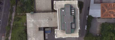
21 AUTOMATED BUILDING EXTRACTION Extrude / intersect roof polygons to each other Extrude completed roof geometry to the DTM (ie 2.5D) Hyatt hotel Phototexture from UltraCam images AUTOMATED BUILDING EXTRACTION Combined with DEM and Ortho in Virtual Earth 2.5 Dimensional Building, Denver 2.5D has its limitations! MID 2009 ~ 600 CITIES HOW 3D? FOURTH UNCOMPROMISING GEOMETRIC ACCURACY


22 LABORATORY CALIBRATION Target UltraCam X Lab ±0.5 µm level ± 0.5 µm Target Contour Field Calibration by AT Test Area Gleisdorf Flight 2 Altitudes GSD 10 cm 1400m AGL GRAZ GSD 25 cm 3500m AGL Cross Strips Ground Truth / GCPs GPS/IMU UltraCam X GCP results #of GCP positions 516 > 85% GCPS < ±1.5 µm UltraCam X TP-Results #of TP-positions >91% TPs < ±1.5 µm >50% TPs < ± 0.5 µm µm µm
 Reg 0-00 1 Reg 12-18 18 UltraCam X TPT results 1% of Image (pos 0-0, center) UltraCam X TP-Results 1% of")


23 UltraCam X TPT results Reg UltraCam X TPT results Reg Zoom in 3 1% of image (~1400 by 940 Pixel) Reg Reg Zoom in 3 1% of image (~1400 by 940 Pixel) Reg Reg UltraCam X TPT results 1% of Image (pos 0-0, center) UltraCam X TP-Results 1% of Image (pos 12-18) #of TPT positions 1858 mean shift x 0.10 µm mean shift y µm min/max x -3.0 µm / 2.8 µm min/max y -2.6 µm / 2.7 µm >90% TPTS < 1.5 µm #of TP-positions mean shift x 0.06 µm mean shift y 0.33 µm min/max x -2.6 µm / 2.8 µm min/max y -3.0 µm / 2.7 µm >90% TPs < ±1.5 µm UltraCam X TP-Results 1% of Image (pos 30-47) #of TP-positions 1057 mean shift x 0.14 µm mean shift y µm min/max x -2.6 µm / 2.8 µm min/max y -3.1 µm / 2.6 µm UltraCam X BA-Result GSD = 10 cm Sig_o = 0.77 µm CheckPts RMSE mm GCPts RMSE mm >88% TPs <±1.5 µm with Add l Parameters


24 UltraCam X 1.0 µm level Stitching of Separate Image Files µm Sensors and 12 Overlaps of the PAN Tie Point Matching RMSE: << ±0.1 pixel Recorded User accessible Two Flights North/South East/West Dense Surface 10 cm Pixel Digital Surface Model From North/South Images


 Serves as Projection Surface TRUE")
25 Digityal Surface Model From East/West Images Difference DSM North/South minus East/West Images R.M.S. Differences ± 7 cm Vegetation moving in the wind GEOMETRIC ACCURACY Input Multiple Raw Aerial Photos Laboratory Calibration ± 0.5 µm Stitching.. ± 0.6 µm Field Calibration by AT σ o...± 1.0 µm Output Single Ortho Photo TRADITIONAL ORTHOPHOTO Bald Earth Serves as Projection Surface REFLECTIVE SURFACE ORTHOPHOTO Digital Surface Model (DSM) Serves as Projection Surface TRUE ORTHOPHOTO Bald Earth Bald Earth Bald Earth Ortho Projection Reflective Surface Ortho Projection


26 True Ortho-Photo Factory Building Frame 176 GSD 8 cm Frame 219 GSD 8 cm RSO GSD 8 cm HIGHEST QUALITY DENSE MATCHING Previous Current 1 Patch with 988 x 1016 Postings


27 DSM-QUALITY VS ORTHOPHOTO Previous Current GSD 12 cm Previous Dense Matching GSD 12 cm Improved Dense Matching HOW 3D? Multi-Image Trees: Multi- vs. Two-Image Stereo, 2-Image Stereo THIRD & FOURTH REDUNDANCY IMPROVES AUTOMATION Individual Trees No Trees, just Forest Multi-Image Trees: Multi- vs. Two-Image Stereo 2-Image Stereo UltraCam Vegetation Modeling, M. Schardt Individual Trees No Trees, just Forest


28 RECALL Where are the cars? GRAZ ON ~ 46,000 x 23,000 PIXELS 4,500 4, Test Cars


29 90% Correct Substantial redundancy-inspired progress yet to be expected


30 The Virtual Earth Vision "You'll be walking around in downtown London and be able to see the shops, the stores, see what the Walk traffic is like. in Walk a shop in a? and navigate the merchandise. Not in the flat, 2D interface that we have on the web today, but in a virtual reality walkthrough. Sq km 148 Bill Gates million 50th Birthday, London, March 2005 HOW 3D? FIFTH LIMITLESS DETAIL Streetside 2 Centimeters 2 Centimeters


31 Stitched Street-Side Indoors 0.5 Centimeters THE THE EARTH S HUMAN LAND HABITAT MASS The World in 15 cm per Pixel towards ~ 200 Street Peta Side Bytes, in 2 cm 2-D Interior in 0.5 cm USER GENERATED and with 10 x redundancy Towards 1 Exabyte MICROSOFT PHOTOSYNTH Available since 20 August 08 DRIVERS FOR INNOVATIONS?

32 Price-Performance Performance of Computing Moore s Rule: Doubling each 1.5 Years Price-Performance Performance of Computing Moore s Rule: Doubling each 1.5 Years 1 Million MILLION? HONEY, PICK UP A 6-PACK OF COMPUTERS ON THE WAY HOME Mark Weiser, 1996 mind expanding VIRTUAL EARTH S EXABYTE FANTASTIC, UNMATCHED GEO DATA SET WITH GLOBAL USEFULNESS
GEOMETRIC ASPECTS CONCERNING THE PHOTOGRAMMETRIC WORKFLOW OF THE DIGITAL AERIAL CAMERA ULTRACAM X
 GEOMETRIC ASPECTS CONCERNING THE PHOTOGRAMMETRIC WORKFLOW OF THE DIGITAL AERIAL CAMERA ULTRACAM X Richard Ladstädter a, Michael Gruber b a Institute of Remote Sensing and Photogrammetry, Graz University
Multiray Photogrammetry and Dense Image. Photogrammetric Week Matching. Dense Image Matching - Application of SGM
 Norbert Haala Institut für Photogrammetrie Multiray Photogrammetry and Dense Image Photogrammetric Week 2011 Matching Dense Image Matching - Application of SGM p q d Base image Match image Parallax image
GEOMETRY AND INFORMATION CONTENTS OF LARGE SIZE DIGITAL FRAME CAMERAS
 GEOMETRY AND INFORMATION CONTENTS OF LARGE SIZE DIGITAL FRAME CAMERAS Karsten Jacobsen Institute of Photogrammetry and Geoinformation Leibniz University Hannover jacobsen@ipi.uni-hannover.de KEY WORDS:
3D-MODELS OF THE HUMAN HABITAT FOR THE INTERNET
 3D-MODELS OF THE HUMAN HABITAT FOR THE INTERNET Franz Leberl Institute of Computer Graphics and Vision, Graz University of Technology, Graz, Austria, leberl@icg.tugraz.at Michael Gruber Microsoft Photogrammetry,
BUNDLE BLOCK ADJUSTMENT WITH HIGH RESOLUTION ULTRACAMD IMAGES
 BUNDLE BLOCK ADJUSTMENT WITH HIGH RESOLUTION ULTRACAMD IMAGES I. Baz*, G. Buyuksalih*, K. Jacobsen** * BIMTAS, Tophanelioglu Cad. ISKI Hizmet Binasi No:62 K.3-4 34460 Altunizade-Istanbul, Turkey gb@bimtas.com.tr
1. Introduction. A CASE STUDY Dense Image Matching Using Oblique Imagery Towards All-in- One Photogrammetry
 Submitted to GIM International FEATURE A CASE STUDY Dense Image Matching Using Oblique Imagery Towards All-in- One Photogrammetry Dieter Fritsch 1, Jens Kremer 2, Albrecht Grimm 2, Mathias Rothermel 1
3D-MODELS OF THE HUMAN HABITAT FOR THE INTERNET
 3D-MODELS OF THE HUMAN HABITAT FOR THE INTERNET Franz Leberl Institute of Computer Graphics and Vision, Graz University of Technology, Graz, Austria, leberl@icg.tugraz.at Michael Gruber Microsoft Photogrammetry,
ATOMI Automatic road centreline extraction
 ATOMI input and output data Ortho images DTM/DSM 2D inaccurate structured road vector data ATOMI Automatic road centreline extraction 3D accurate structured road vector data Classification of roads according
Scalability for Large Photogrammetry Projects
 Scalability for Large Photogrammetry Projects Dr. Philippe Simard President SimActive Inc. IMAGE About SimActive Founded in 2003, SimActive is the developer of Correlator3D software, a patented end-to-end
PERFORMANCE OF LARGE-FORMAT DIGITAL CAMERAS
 PERFORMANCE OF LARGE-FORMAT DIGITAL CAMERAS K. Jacobsen Institute of Photogrammetry and GeoInformation, Leibniz University Hannover, Germany jacobsen@ipi.uni-hannover.de Inter-commission WG III/I KEY WORDS:
Vexcel Imaging Ve V x e c x el e I l maging I G maging mbh www. wwwv. e v x e c x e c l e -limaging. - c imaging. om c
 Vexcel Imaging History 2016 MBO: becomes a privately owned company again 2006 Vexcel Imaging acquired by Microsoft Corp., Redmond/USA 2003 1992 1985 Merger of Vexcel Corp. & Vexcel Imaging 1 st Digital
Photogrammetry: DTM Extraction & Editing
 Photogrammetry: DTM Extraction & Editing Review of terms Vertical aerial photograph Perspective center Exposure station Fiducial marks Principle point Air base (Exposure Station) Digital Photogrammetry:
SPOT-1 stereo images taken from different orbits with one month difference
 DSM Generation Almost all HR sensors are stereo capable. Some can produce even triplettes within the same strip (facilitating multi-image matching). Mostly SPOT (1-5) used for stereo and Ikonos (in spite
EVALUATION OF WORLDVIEW-1 STEREO SCENES AND RELATED 3D PRODUCTS
 EVALUATION OF WORLDVIEW-1 STEREO SCENES AND RELATED 3D PRODUCTS Daniela POLI, Kirsten WOLFF, Armin GRUEN Swiss Federal Institute of Technology Institute of Geodesy and Photogrammetry Wolfgang-Pauli-Strasse
THE INTERIOR AND EXTERIOR CALIBRATION FOR ULTRACAM D
 THE INTERIOR AND EXTERIOR CALIBRATION FOR ULTRACAM D K. S. Qtaishat, M. J. Smith, D. W. G. Park Civil and Environment Engineering Department, Mu ta, University, Mu ta, Karak, Jordan, 61710 khaldoun_q@hotamil.com
Mayden VP of Business Development Surdex Corporation
 Making Sense of Sensors Randy Mayden, Mayden VP of Business Development Surdex Corporation randym@surdex.com EARLYAERIAL PHOTOGRAPHY 2 FIRSTAERIAL CAMERA 3 AERIAL CAMERA SYSTEM DEVELOPMENT Aerial Camera
A NEW APPROACH FOR GENERATING A MEASURABLE SEAMLESS STEREO MODEL BASED ON MOSAIC ORTHOIMAGE AND STEREOMATE
 A NEW APPROACH FOR GENERATING A MEASURABLE SEAMLESS STEREO MODEL BASED ON MOSAIC ORTHOIMAGE AND STEREOMATE Mi Wang State Key Laboratory of Information Engineering in Surveying Mapping and Remote Sensing
2017 PROGRAM OVERVIEW. Geospatial Intelligence for Better Outcomes
 2017 PROGRAM OVERVIEW Geospatial Intelligence for Better Outcomes NICB SOLUTION : GEOSPATIAL INTELLIGENCE CENTER Key Program Areas 1. CAT / Disaster Response 2. National Imagery Program 3. Digital Delivery
Geomatica OrthoEngine Orthorectifying VEXCEL UltraCam Data
 Geomatica OrthoEngine Orthorectifying VEXCEL UltraCam Data Vexcel s UltraCam digital camera system has a focal distance of approximately 100mm and offers a base panchromatic (black and white) resolution
Photogrammetry and 3D city modelling
 Digital Architecture and Construction 209 Photogrammetry and 3D city modelling Y. Kobayashi School of Architecture and Landscape Architecture, Arizona State University, USA Abstract 3D city modelling and
Assessing the Performance of Different Direct-Georeferencing with Large Format Digital Cameras
 Assessing the Performance of Different Direct-Georeferencing with Large Format Digital Cameras Civil and Environment Engineering Department, Mu ta University, Mu ta, Al-Karak, Jordan, 61710. E.mail: khaldoun_q@hotamil.com
SimActive and PhaseOne Workflow case study. By François Riendeau and Dr. Yuri Raizman Revision 1.0
 SimActive and PhaseOne Workflow case study By François Riendeau and Dr. Yuri Raizman Revision 1.0 Contents 1. Introduction... 2 1.1. Simactive... 2 1.2. PhaseOne Industrial... 2 2. Testing Procedure...
MODEL DEFORMATION ACCURACY OF DIGITAL FRAME CAMERAS
 MODEL DEFORMATION ACCURACY OF DIGITAL FRAME CAMERAS V. Spreckels a, A. Schlienkamp a, K. Jacobsen b a Deutsche Steinkohle AG (DSK), Dept. Geoinformation/Engineering Survey BG G, Shamrockring 1, D-44623
POSITIONING A PIXEL IN A COORDINATE SYSTEM
 GEOREFERENCING AND GEOCODING EARTH OBSERVATION IMAGES GABRIEL PARODI STUDY MATERIAL: PRINCIPLES OF REMOTE SENSING AN INTRODUCTORY TEXTBOOK CHAPTER 6 POSITIONING A PIXEL IN A COORDINATE SYSTEM The essential
EVALUATION OF ZY-3 FOR DSM AND ORTHO IMAGE GENERATION
 EVALUATION OF FOR DSM AND ORTHO IMAGE GENERATION Pablo d Angelo German Aerospace Center (DLR), Remote Sensing Technology Institute D-82234 Wessling, Germany email: Pablo.Angelo@dlr.de KEY WORDS:, Satellite,
STATUS OF AIRBORNE OBLIQUE IMAGING EUROSDR COMMISSION I PROJECT OBLIQUE IMAGERY. Markus Gerke May 15, 2014
 STATUS OF AIRBORNE OBLIQUE IMAGING EUROSDR COMMISSION I PROJECT OBLIQUE IMAGERY Markus Gerke May 15, 2014 THE FIRST AIRBORNE PHOTOS WERE OBLIQUE First recorded aerial photograph in the US (Boston), by
TRIMBLE BUSINESS CENTER PHOTOGRAMMETRY MODULE
 TRIMBLE BUSINESS CENTER PHOTOGRAMMETRY MODULE WHITE PAPER TRIMBLE GEOSPATIAL DIVISION WESTMINSTER, COLORADO, USA July 2013 ABSTRACT The newly released Trimble Business Center Photogrammetry Module is compatible
MASI: Modules for Aerial and Satellite Imagery
 MASI: Modules for Aerial and Satellite Imagery Product Descriptions and Typical Applied Cases Dr. Jinghui Yang jhyang@vip.163.com Sept. 18, 2017 File Version: v1.0 VisionOnSky Co., Ltd. Contents 1 Descriptions
Leica ADS80 and Leica XPro - A total solution for photogrammetric mapping
 Leica ADS80 and Leica XPro - A total solution for photogrammetric mapping Ruedi Wagner, VP Imaging, Geospatial Solutions Division Phowo 2009 - Real Geospatial Solutions What else can I do with my sensor?
Photogrammetry: DTM Extraction & Editing
 Photogrammetry: DTM Extraction & Editing How can one determine the x, y, and z of a location? Approaches to DTM Extraction Ground surveying Digitized topographic maps Traditional photogrammetry Hardcopy
Sasanka Madawalagama Geoinformatics Center Asian Institute of Technology Thailand
 Sasanka Madawalagama Geoinformatics Center Asian Institute of Technology Thailand This learning material was not prepared by ADB. The views expressed in this document are the views of the author/s and
The use of different data sets in 3-D modelling
 The use of different data sets in 3-D modelling Ahmed M. HAMRUNI June, 2014 Presentation outlines Introduction Aims and objectives Test site and data Technology: Pictometry and UltraCamD Results and analysis
Accuracy Assessment of POS AVX 210 integrated with the Phase One ixu150
 White Paper 3/17/2016 Accuracy Assessment of POS AVX 210 integrated with the Phase One ixu150 Omer Mian, Joe Hutton, Greg Lipa, James Lutes, Damir Gumerov, Srdjan Sobol Applanix, William Chan - GeoPixel
Introduction Photogrammetry Photos light Gramma drawing Metron measure Basic Definition The art and science of obtaining reliable measurements by mean
 Photogrammetry Review Neil King King and Associates Testing is an art Introduction Read the question Re-Read Read The question What is being asked Answer what is being asked Be in the know Exercise the
GPU-accelerated 3-D point cloud generation from stereo images
 GPU-accelerated 3-D point cloud generation from stereo images Dr. Bingcai Zhang Release of this guide is approved as of 02/28/2014. This document gives only a general description of the product(s) or service(s)
Efficient Processing of UAV Projects
 Efficient Processing of UAV Projects Dr. Philippe Simard President SimActive Inc. IMAGE About SimActive Leading developer of photogrammetry software since 2003 Thousands of users in 50+ countries: military
THE ISPRS/EUROSDR BENCHMARK ON MULTI-PLATFORM PHOTOGRAMMETRY: RESULTS AND LESSON LEARNT FRANCESCO NEX AND MARKUS GERKE
 THE ISPRS/EUROSDR BENCHMARK ON MULTI-PLATFORM PHOTOGRAMMETRY: RESULTS AND LESSON LEARNT FRANCESCO NEX AND MARKUS GERKE Overview Summary of the results Statistics Data release What s next? ISPRS / EuroSDR
LiDAR & Orthophoto Data Report
 LiDAR & Orthophoto Data Report Tofino Flood Plain Mapping Data collected and prepared for: District of Tofino, BC 121 3 rd Street Tofino, BC V0R 2Z0 Eagle Mapping Ltd. #201 2071 Kingsway Ave Port Coquitlam,
UAV s in Surveying: Integration/processes/deliverables A-Z. 3Dsurvey.si
 UAV s in Surveying: Integration/processes/deliverables A-Z Info@eGPS.net TODAY S PROGRAM Introduction to photogrammetry and 3Dsurvey Theoretical facts about the technology and basics of 3dsurvey Introduction
EVOLUTION OF POINT CLOUD
 Figure 1: Left and right images of a stereo pair and the disparity map (right) showing the differences of each pixel in the right and left image. (source: https://stackoverflow.com/questions/17607312/difference-between-disparity-map-and-disparity-image-in-stereo-matching)
DMC GEOMETRIC PERFORMANCE ANALYSIS
 DMC GEOMETRIC PERFORMANCE ANALYSIS R.Alamús a, W.Kornus a, I.Riesinger b a Cartographic Institute of Catalonia (ICC), Barcelona, Spain - (ramon.alamus; wolfgang.kornus)@icc.cat b Chair for Photogrammetry
Geometry of Aerial photogrammetry. Panu Srestasathiern, PhD. Researcher Geo-Informatics and Space Technology Development Agency (Public Organization)
") Geometry of Aerial photogrammetry Panu Srestasathiern, PhD. Researcher Geo-Informatics and Space Technology Development Agency (Public Organization) Image formation - Recap The geometry of imaging system
Geometry of Aerial photogrammetry Panu Srestasathiern, PhD. Researcher Geo-Informatics and Space Technology Development Agency (Public Organization) Image formation - Recap The geometry of imaging system
PHOTOGRAMMETRY AND GEOINFORMATION TRENDS FOR LARGE SCALE MAPPING. Karsten Jacobsen University of Hannover
 PHOTOGRAMMETRY AND GEOINFORMATION TRENDS FOR LARGE SCALE MAPPING Karsten Jacobsen University of Hannover jacobsen@ipi.uni-hannover.de Key words: digital images, mapping, automatic object recognition, GIS,
Exterior Orientation Parameters
 Exterior Orientation Parameters PERS 12/2001 pp 1321-1332 Karsten Jacobsen, Institute for Photogrammetry and GeoInformation, University of Hannover, Germany The georeference of any photogrammetric product
Evaluation of Digital Surface Models by Semi-Global Matching
 Evaluation of Digital Surface Models by Semi-Global Matching HEIKO HIRSCHMÜLLER1 & TILMAN BUCHER2 Summary: This paper considers a processing chain for automatically creating high resolution digital surface
OBLIQUE AERIAL IMAGERY FOR NMA SOME BEST PRACTICES
 OBLIQUE AERIAL IMAGERY FOR NMA SOME BEST PRACTICES F. Remondino 1, I. Toschi 1, M. Gerke 2, F. Nex 2, D. Holland 3, A. McGill 4, J. Talaya Lopez 5, A. Magarinos 5 1 3D Optical Metrology (3DOM) unit, Bruno
Experiences with High density image matching (idsm) at the LVG Bavaria and other NMA in Germany Wolfgang Stößel Photogrammetry and Remote Sensing
 at the LVG Bavaria and other NMA in Germany Wolfgang Stößel Photogrammetry and Remote Sensing") Experiences with High density image matching (idsm) at the LVG Bavaria and other NMA in Germany Wolfgang Stößel Photogrammetry and Remote Sensing EuroSDR Workshop 16. 02-2012 Vienna 1 Image based surface
Experiences with High density image matching (idsm) at the LVG Bavaria and other NMA in Germany Wolfgang Stößel Photogrammetry and Remote Sensing EuroSDR Workshop 16. 02-2012 Vienna 1 Image based surface
Municipal Projects in Cambridge Using a LiDAR Dataset. NEURISA Day 2012 Sturbridge, MA
 Municipal Projects in Cambridge Using a LiDAR Dataset NEURISA Day 2012 Sturbridge, MA October 15, 2012 Jeff Amero, GIS Manager, City of Cambridge Presentation Overview Background on the LiDAR dataset Solar
High resolution survey and orthophoto project of the Dosso-Gaya region in the Republic of Niger. by Tim Leary, Woolpert Inc.
 High resolution survey and orthophoto project of the Dosso-Gaya region in the Republic of Niger by Tim Leary, Woolpert Inc. Geospatial Solutions Photogrammetry & Remote Sensing LiDAR Professional Surveying
TopoDrone Photogrammetric Mapping Reliable, Accurate, Safe
 TopoDrone Photogrammetric Mapping Reliable, Accurate, Safe A complete solution for accurate airborne data capture and photogrammetric mapping using an unmanned aerial vehicle COST EFFICIENT SOLUTION TO
UAV Flight Operations for Mapping. Precision. Accuracy. Reliability
 UAV Flight Operations for Mapping Precision. Accuracy. Reliability Part One: Why is Mapping different? Part Two: What about accuracy and precision? Part Three: What is the Workflow? Part Four: AGENDA What
DIGITAL SURFACE MODELS IN BUILD UP AREAS BASED ON VERY HIGH RESOLUTION SPACE IMAGES
 DIGITAL SURFACE MODELS IN BUILD UP AREAS BASED ON VERY HIGH RESOLUTION SPACE IMAGES Gurcan Buyuksalih*, Karsten Jacobsen** *BIMTAS, Tophanelioglu Cad. ISKI Hizmet Binasi No:62 K.3-4 34460 Altunizade-Istanbul,
PERFORMANCE ANALYSIS OF FAST AT FOR CORRIDOR AERIAL MAPPING
 PERFORMANCE ANALYSIS OF FAST AT FOR CORRIDOR AERIAL MAPPING M. Blázquez, I. Colomina Institute of Geomatics, Av. Carl Friedrich Gauss 11, Parc Mediterrani de la Tecnologia, Castelldefels, Spain marta.blazquez@ideg.es
Files Used in this Tutorial
 Generate Point Clouds and DSM Tutorial This tutorial shows how to generate point clouds and a digital surface model (DSM) from IKONOS satellite stereo imagery. You will view the resulting point clouds
ADS40 Calibration & Verification Process. Udo Tempelmann*, Ludger Hinsken**, Utz Recke*
 ADS40 Calibration & Verification Process Udo Tempelmann*, Ludger Hinsken**, Utz Recke* *Leica Geosystems GIS & Mapping GmbH, Switzerland **Ludger Hinsken, Author of ORIMA, Konstanz, Germany Keywords: ADS40,
National Science Foundation Engineering Research Center. Bingcai Zhang BAE Systems San Diego, CA
 Bingcai Zhang BAE Systems San Diego, CA 92127 Bingcai.zhang@BAESystems.com Introduction It is a trivial task for a five-year-old child to recognize and name an object such as a car, house or building.
Tree height measurements and tree growth estimation in a mire environment using digital surface models
 Tree height measurements and tree growth estimation in a mire environment using digital surface models E. Baltsavias 1, A. Gruen 1, M. Küchler 2, P.Thee 2, L.T. Waser 2, L. Zhang 1 1 Institute of Geodesy
Mountain mapping and DSM generation using high resolution satellite image data
 Mountain mapping and DSM generation using high resolution satellite image data Mountain Mapping and Visualization Lenk, Switzerland, February 2008 K. Wolff, A. Grün Institut für Geodesie und Photogrammetrie
Trimble Geospatial Division Integrated Solutions for Geomatics professions. Volker Zirn Regional Sales Representative
 Trimble Geospatial Division Integrated Solutions for Geomatics professions Volker Zirn Regional Sales Representative 1 Agenda Trimble GeoSpatial Division Airborne System Solutions Trimble Inpho Software
GEOMETRY OF DIGITAL FRAME CAMERAS INTRODUCTION
 GEOMETRY OF DIGITAL FRAME CAMERAS Karsten Jacobsen Institute of Photogrammetry and Geoinformation Leibniz University Hannover Nienburger Str. 1, D-30167 Hannover, Germany jacobsen@ipi.uni-hannover.de Keywords:
Training i Course Remote Sensing Basic Theory & Image Processing Methods September 2011
 Training i Course Remote Sensing Basic Theory & Image Processing Methods 19 23 September 2011 Geometric Operations Michiel Damen (September 2011) damen@itc.nl ITC FACULTY OF GEO-INFORMATION SCIENCE AND
Presented at the FIG Congress 2018, May 6-11, 2018 in Istanbul, Turkey
 Presented at the FIG Congress 2018, May 6-11, 2018 in Istanbul, Turkey Evangelos MALTEZOS, Charalabos IOANNIDIS, Anastasios DOULAMIS and Nikolaos DOULAMIS Laboratory of Photogrammetry, School of Rural
2. POINT CLOUD DATA PROCESSING
 Point Cloud Generation from suas-mounted iphone Imagery: Performance Analysis A. D. Ladai, J. Miller Towill, Inc., 2300 Clayton Road, Suite 1200, Concord, CA 94520-2176, USA - (andras.ladai, jeffrey.miller)@towill.com
Photogrammetric Performance of an Ultra Light Weight Swinglet UAV
 Photogrammetric Performance of an Ultra Light Weight Swinglet UAV J. Vallet, F. Panissod, C. Strecha, M. Tracol UAV-g 2011 - Unmanned Aerial Vehicle in Geomatics September 14-16, 2011ETH Zurich Summary
Automated Processing for 3D Mosaic Generation, a Change of Paradigm
 Automated Processing for 3D Mosaic Generation, a Change of Paradigm Frank BIGNONE, Japan Key Words: 3D Urban Model, Street Imagery, Oblique imagery, Mobile Mapping System, Parallel processing, Digital
Photo based Terrain Data Acquisition & 3D Modeling
 Photo based Terrain Data Acquisition & 3D Modeling June 7, 2013 Howard Hahn Kansas State University Partial funding by: KSU Office of Research and Sponsored Programs Introduction: Need Application 1 Monitoring
Leica Systems Overview
 RC30 AERIAL CAMERA SYSTEM Leica Systems Overview The Leica RC30 aerial film camera is the culmination of decades of development, started with Wild's first aerial camera in the 1920s. Beautifully engineered
Intelligent photogrammetry. Agisoft
 Intelligent photogrammetry Agisoft Agisoft Metashape is a cutting edge software solution, with its engine core driving photogrammetry to its ultimate limits, while the whole system is designed to deliver
DMC - Practical Experiences and Photogrammetric System Performance
 Photogrammetric Week '03 Dieter Fritsch (Ed.) Wichmann Verlag, Heidelberg, 2003 Dörstel 59 DMC - Practical Experiences and Photogrammetric System Performance CHRISTOPH DÖRSTEL, Z/I Imaging, Aalen ABSTRACT
٥...: (Picture element) Pixel ٧...:
 Pixel ٧...:") ( RS ) : : / : : - ٣... : ٣...: ٤...: ٥...: (Picture element) Pixel ٥...: ٧...: ١٠... : Geo Tiff ١٨... : ١٩... : DEM ٢٨...: ٢ :.. " " RS. :.. Kosmos Land Sat. : : RS :. : (Land Use) :( Change detection
( RS ) : : / : : - ٣... : ٣...: ٤...: ٥...: (Picture element) Pixel ٥...: ٧...: ١٠... : Geo Tiff ١٨... : ١٩... : DEM ٢٨...: ٢ :.. " " RS. :.. Kosmos Land Sat. : : RS :. : (Land Use) :( Change detection
EVALUATION OF WORLDVIEW-1 STEREO SCENES
 EVALUATION OF WORLDVIEW-1 STEREO SCENES Daniela Poli a, Kirsten Wolff b, Armin Gruen b a. European Commission, JRC, via Fermi 2749, Ispra (VA), Italy - daniela.poli@cec.europa.eu b. Swiss Federal Institute
3D CITY MODELLING WITH CYBERCITY-MODELER
 1 3D CITY MODELLING WITH CYBERCITY-MODELER Kilian Ulm 1 and Daniela Poli 1 1. CyberCity AG, Zurich, Switzerland, (kilian.ulm, daniela.poli)@cybercity.tv ABSTRACT 3D city models using stereo aerial-/satellite
ABSTRACT 1. INTRODUCTION
 Published in SPIE Proceedings, Vol.3084, 1997, p 336-343 Computer 3-d site model generation based on aerial images Sergei Y. Zheltov, Yuri B. Blokhinov, Alexander A. Stepanov, Sergei V. Skryabin, Alexander
AN INTEGRATED SENSOR ORIENTATION SYSTEM FOR AIRBORNE PHOTOGRAMMETRIC APPLICATIONS
 AN INTEGRATED SENSOR ORIENTATION SYSTEM FOR AIRBORNE PHOTOGRAMMETRIC APPLICATIONS M. J. Smith a, *, N. Kokkas a, D.W.G. Park b a Faculty of Engineering, The University of Nottingham, Innovation Park, Triumph
Practical Considerations of UAS Operations on Data Quality
 Practical Considerations of UAS Operations on Data Quality Precision. Accuracy. Reliability OVERVIEW Project Planning and Execution Ground Control Data Processing and Delivery 1 OVERVIEW Get Legal: Section
UAV Surveying II. Precision. Accuracy. Reliability
 UAV Surveying II Precision. Accuracy. Reliability Part One: Project Lifecycle Deliverables Part Two: Evaluation of UAV Data Accuracy and Examples of Error Part Three: AGENDA Review of Results Examples
COMPARATIVE CHARACTERISTICS OF DEM OBTAINED FROM SATELLITE IMAGES SPOT-5 AND TK-350
 COMPARATIVE CHARACTERISTICS OF DEM OBTAINED FROM SATELLITE IMAGES SPOT-5 AND TK-350 Dr. V. F. Chekalin a*, M. M. Fomtchenko a* a Sovinformsputnik, 47, Leningradsky Pr., 125167 Moscow, Russia common@sovinformsputnik.com
ISPRS Com1 Update Airborne Sensor Systems. Arthur Rohrbach SGPBF meeting, RSL, Fall 2006
 ISPRS Com1 Update Airborne Sensor Systems Arthur Rohrbach SGPBF meeting, RSL, Fall 2006 Significant Meetings / News (for Sensor Systems) 1/2 ASPRS, Reno, USA (May-06) Vexcel, Austria Leica, Switzerland
QUALITY CHECK OF MOMS-2P ORTHOIMAGES OF SEMI-ARID LANDSCAPES
 QUALIT CHECK OF MOMS-2P ORTHOIMAGES OF SEMI-ARID LANDSCAPES Manfred Lehner, Rupert Müller German Aerospace Center (DLR), Remote Sensing Technology Institute, D-82234 Wessling, Germany Email: Manfred.Lehner@dlr.de,
REMOTE SENSING LiDAR & PHOTOGRAMMETRY 19 May 2017
 REMOTE SENSING LiDAR & PHOTOGRAMMETRY 19 May 2017 SERVICES Visual Inspections Digital Terrain Models Aerial Imagery Volume Computations Thermal Inspections Photo maps Aerial Video Training & Consultancy
Trimble GeoSpatial Products
 Expanding Solutions for Photogrammetric and Remote Sensing Professionals 55 th Photogrammetric Week in Stuttgart September 7 th 2015 Tobias Heuchel, Trimble Stuttgart, Germany Trimble GeoSpatial Products
New Features in SOCET SET Stewart Walker, San Diego, USA
 New Features in SOCET SET Stewart Walker, San Diego, USA 2610083107A EXPORT CONTROL DATA. This presentation is approved for export as of 31 August 2007. The actual product and its technical information
ixu-rs1900 Aerial Solutions
 Aerial Solutions Seeing the Large Picture Medium Format Evolves Aerial Camera Phase One 190MP Aerial Camera series is the latest Phase One innovation to offer large format metric camera functionality.
A MULTI-SENSOR APPROACH TO SEMI-GLOBAL MATCHING
 A MULTI-SENSOR APPROACH TO SEMI-GLOBAL MATCHING S. Gehrke a, M. Downey a, R. Uebbing a, J. Welter a, W. LaRocque b a North West Geomatics Ltd., Suite 212, 5438-11 th Street NE, Calgary, Alberta, T2E 7E9,
Drone2Map: an Introduction. October 2017
 Drone2Map: an Introduction October 2017 Drone2Map: An Introduction Topics: - Introduction to Drone Mapping - Coordinate Systems - Overview of Drone2Map - Basic Drone2Map Workflow - 2D Data Processing -
The Use of UAS in modern field work
 The Use of UAS in modern field work SplitRS 2015, Thessaloniki, GREECE 22/05/2015 1 ebee by sensefly Swiss-made UAV Fully autonomous flight Suitable for: Mapping, GIS, Surveying Precision Agriculture Environmental
CO-REGISTERING AND NORMALIZING STEREO-BASED ELEVATION DATA TO SUPPORT BUILDING DETECTION IN VHR IMAGES
 CO-REGISTERING AND NORMALIZING STEREO-BASED ELEVATION DATA TO SUPPORT BUILDING DETECTION IN VHR IMAGES Alaeldin Suliman, Yun Zhang, Raid Al-Tahir Department of Geodesy and Geomatics Engineering, University
PHOTOGRAMMETRIC SOLUTIONS OF NON-STANDARD PHOTOGRAMMETRIC BLOCKS INTRODUCTION
 PHOTOGRAMMETRIC SOLUTIONS OF NON-STANDARD PHOTOGRAMMETRIC BLOCKS Dor Yalon Co-Founder & CTO Icaros, Inc. ABSTRACT The use of small and medium format sensors for traditional photogrammetry presents a number
UAV-based Mapping of Surface Imperviousness for Water Runoff Modelling
 UAV-based Mapping of Surface Imperviousness for Water Runoff Modelling Piotr Tokarczyk, Jörg Rieckermann, Frank Blumensaat, Joao Paulo Leitao and Konrad Schindler Institute for Geodesy and Photogrammetry
Chapters 1 9: Overview
 Chapters 1 9: Overview Chapter 1: Introduction Chapters 2 4: Data acquisition Chapters 5 9: Data manipulation Chapter 5: Vertical imagery Chapter 6: Image coordinate measurements and refinements Chapters
Unmanned Aerial Systems: A Look Into UAS at ODOT
 Ohio Department of Transportation John R. Kasich, Governor Jerry Wray, Director Unmanned Aerial Systems: Tim Burkholder, PS Mapping Manager Division of Engineering Office of CADD and Mapping Services Kyle
EXTRACTING ORTHOGONAL BUILDING OBJECTS IN URBAN AREAS FROM HIGH RESOLUTION STEREO SATELLITE IMAGE PAIRS
 EXTRACTING ORTHOGONAL BUILDING OBJECTS IN URBAN AREAS FROM HIGH RESOLUTION STEREO SATELLITE IMAGE PAIRS Thomas Krauß a, Peter Reinartz a, Uwe Stilla b a German Aerospace Center (DLR), Remote Sensing Technology
STATE-OF-THE-ART in DENSE IMAGE MATCHING
 STATE-OF-THE-ART in DENSE IMAGE MATCHING Fabio REMONDINO 3D Optical Metrology (3DOM) Bruno Kessler Foundation (FBK) Trento, Italy Email: remondino@fbk.eu http://3dom.fbk.eu Bruno Kessler Foundation (FBK)
CORRELATOR3D TM Whitepaper
 CORRELATOR3D TM Whitepaper 2018 SimActive Inc. All rights reserved. 1. Table of Contents Executive Summary... 1 Introduction... 2 1. Correlator3D Step-by-Step Guide... 3 Workflow... 3 Project Setup...
MONO-IMAGE INTERSECTION FOR ORTHOIMAGE REVISION
 MONO-IMAGE INTERSECTION FOR ORTHOIMAGE REVISION Mohamed Ibrahim Zahran Associate Professor of Surveying and Photogrammetry Faculty of Engineering at Shoubra, Benha University ABSTRACT This research addresses
Oblique aerial imagery in the praxis: applications and challenges
 ISPRS / EuroSDR Workshop on Oblique aerial cameras sensors and data processing Barcelona, 10 October 2017 Oblique aerial imagery in the praxis: applications and challenges Daniela Poli, Kjersti Moe, Klaus
USE OF VERTICAL AERIAL IMAGES FOR SEMI-OBLIQUE MAPPING
 USE OF VERTICAL AERIAL IMAGES FOR SEMI-OBLIQUE MAPPING D. Poli a, K. Moe a, K. Legat b, I. Toschi b, F. Lago b, F. Remondino b a Terra Messflug GmbH, Eichenweg 42, 6460 Imst, Austria (k.moe, d.poli)@terra-messflug.at
ACCURACY ANALYSIS AND SURFACE MAPPING USING SPOT 5 STEREO DATA
 ACCURACY ANALYSIS AND SURFACE MAPPING USING SPOT 5 STEREO DATA Hannes Raggam Joanneum Research, Institute of Digital Image Processing Wastiangasse 6, A-8010 Graz, Austria hannes.raggam@joanneum.at Commission
INTERPRETING BUILDING FAÇADES FROM VERTICAL AERIAL IMAGES USING THE THIRD DIMENSION
 INTERPRETING BUILDING FAÇADES FROM VERTICAL AERIAL IMAGES USING THE THIRD DIMENSION Meixner P. and Leberl F. Institute for Computer Graphics and Vision, Graz University of Technology, Inffeldgasse 16/II,
Terrain Modeling and Mapping for Telecom Network Installation Using Scanning Technology. Maziana Muhamad
 Terrain Modeling and Mapping for Telecom Network Installation Using Scanning Technology Maziana Muhamad Summarising LiDAR (Airborne Laser Scanning) LiDAR is a reliable survey technique, capable of: acquiring