2017 PROGRAM OVERVIEW. Geospatial Intelligence for Better Outcomes
|
|
|
- Jacob James
- 5 years ago
- Views:
Transcription
1 2017 PROGRAM OVERVIEW Geospatial Intelligence for Better Outcomes

2
3 NICB SOLUTION : GEOSPATIAL INTELLIGENCE CENTER Key Program Areas 1. CAT / Disaster Response 2. National Imagery Program 3. Digital Delivery Platform 4. Advanced Analytics 5. Partner Network

4 CAT RESPONSE : AERIAL AND TERRESTRIAL COLLECTION 1. CAT RESPONSE Imagery Collection Panoramic Street side Street View 360-degree imagery and LiDAR Capability has been tested in numerous scenarios 360 Aerial Streetside by Air for roof and full property / structure damage assessment Incredibly accurate 3D mesh for analytics Accurate digital elevation and measurement Wide-Area Aerial 38,000 pixels across the flight strip 9 kilometer swath width allows wide flight lines providing mass coverage in shorter time
5 THE RESPONSE Harvey, Irma, Maria, and CA Wildfires


6 THE RECENT RESPONSE Activities Handled all planning, collection, processing and hosting Uploaded imagery within 24 hours Distributed Imagery covering: 65,800 square kilometers 23.5 million population 8.8 million homes

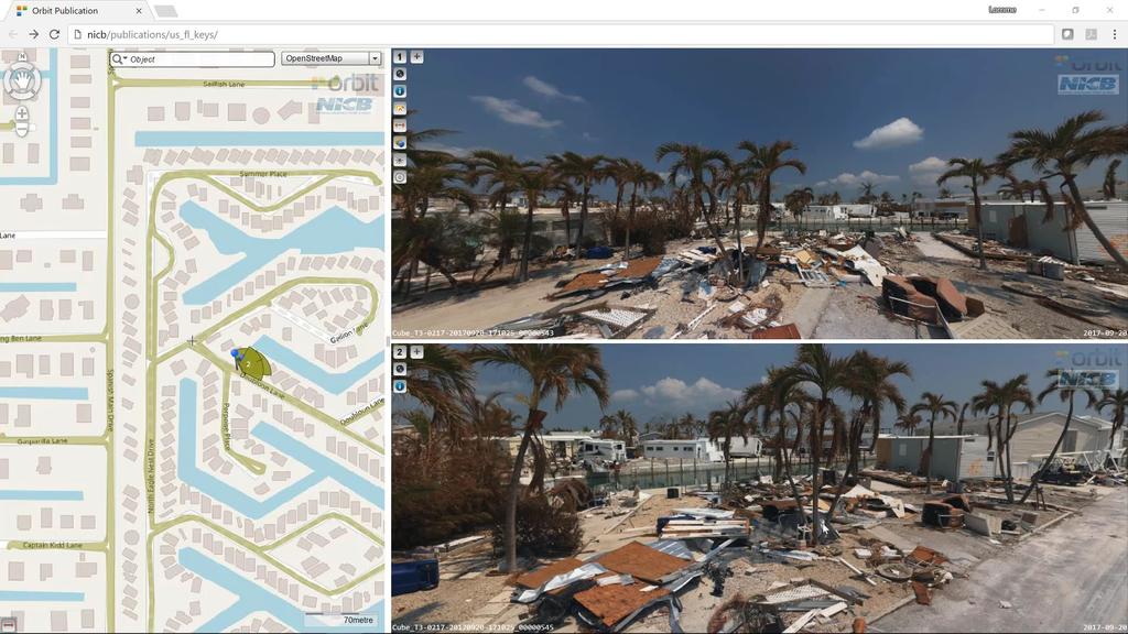
7 HURRICANE HARVEY Neighborhood

8 HURRICANE HARVEY Neighborhood detail

9 HURRICANE IRMA A simple plea for help

10 HURRICANE HARVEY Wind damage

11 Napa Wildfires Before

12 HURRICANE Napa WildfiresIRMA Wind damage After


13 NICB SOLUTION : COLLECTION, ANALYSIS & DELIVERY PLATFORM 2. NATIONAL IMAGERY COLLECTION Full coverage: immersive imagery and geospatial data updated annually Entire U.S. in high resolution 15cm resolution with geospatial data Ultra high-res imagery and data of the top 150 metro 5cm resolution 360 aerial oblique imagery: 45-degree from four angles Ortho imagery: top down view Panoramic street-view imagery and LiDAR Complete 3D mesh with precise building geometry Digital Terrain and Elevation models (DTM / DEM) Imagery and data meet the highest geometric and radiometric standards in the industry Approximately 60 petabytes of data per year

14 NICB SOLUTION : COLLECTION, ANALYSIS & DELIVERY PLATFORM 2. NATIONAL IMAGERY COLLECTION Network effect: ability to collect nationally and respond quickly for CAT situations Collecting and processing imagery and data year-round based on consistent specifications Over 100 aircraft available today, by far the largest fleet network in the U.S. Located across 25 hubs nationally Prepared to respond quickly when needed Partnering with the top U.S. aerial mapping companies and additional Vexcel-certified fliers in specific locations Proven success from prior nationwide programs

15 NICB SOLUTION : OPERATOR BASES


16 NICB SOLUTION: COLLECTION, ANALYSIS & DELIVERY PLATFORM 3. DIGITAL DELIVERY Imagery Platform Revolutionary platform that delivers 360-degree immersive imagery as well as aerial photography to the most common devices. Can process & deliver from CAT site Simple, intuitive interface that provides disaster assessment per property, portfolio analysis, risk scoring for underwriting

17
18
19 NICB SOLUTION : COLLECTION, ANALYSIS & DELIVERY PLATFORM 4. ADVANCED ANALYTICS Data to Insights Processing - automation software produces highest quality finished modules Analysis - apply AI, Computer Vision algorithms Insights damage assessments remotely

20 DIFFERENCE : MEASURING HEIGHT OF THE HOME FROM THE EAST

21 DIFFERENCE : MEASURING HEIGHT OF THE HOME FROM THE EAST

22 DIFFERENCE : MEASURING HEIGHT OF THE HOME FROM THE EAST

23 NICB SOLUTION : COLLECTION, ANALYSIS & DELIVERY PLATFORM

24 NICB SOLUTION : COLLECTION, ANALYSIS & DELIVERY PLATFORM


25 NICB SOLUTION : POST-CATASTROPHE ANALYSIS Data to Insights Imagery captured - immediately after the event Nadir & Oblique Insights Pre and post views of property Leading Insurer: What used to take weeks has been compressed to a matter of days


26 NICB SOLUTION : POST-CATASTROPHE ANALYSIS Supporting Desk Adjusting Measure Impacts Inform Replacement Estimates Claim Level Detail The imagery is very detailed and allows us to quickly and accurately measure buildings
27 NICB SOLUTION : COLLECTION, ANALYSIS & DELIVERY PLATFORM
28 NICB SOLUTION : COLLECTION, ANALYSIS & DELIVERY PLATFORM

29 NICB SOLUTION : COLLECTION, ANALYSIS & DELIVERY PLATFORM

30 NICB SOLUTION : COLLECTION, ANALYSIS & DELIVERY PLATFORM

31 NICB SOLUTION : COLLECTION, ANALYSIS & DELIVERY PLATFORM
 Digital Elevation Model/ Digital Terrain Model (DEM/DTM) Point Cloud 3D Textured")
32 NICB SOLUTION : GEOSPATIAL INTELLIGENCE CENTER Analytic Foundation Digital Surface Model (DSM) Digital Elevation Model/ Digital Terrain Model (DEM/DTM) Point Cloud 3D Textured Mesh
33 2017 PROGRAM OVERVIEW Thank you. Geospatial Intelligence for Better Outcomes
Vexcel Imaging Ve V x e c x el e I l maging I G maging mbh www. wwwv. e v x e c x e c l e -limaging. - c imaging. om c
 Vexcel Imaging History 2016 MBO: becomes a privately owned company again 2006 Vexcel Imaging acquired by Microsoft Corp., Redmond/USA 2003 1992 1985 Merger of Vexcel Corp. & Vexcel Imaging 1 st Digital
High resolution survey and orthophoto project of the Dosso-Gaya region in the Republic of Niger. by Tim Leary, Woolpert Inc.
 High resolution survey and orthophoto project of the Dosso-Gaya region in the Republic of Niger by Tim Leary, Woolpert Inc. Geospatial Solutions Photogrammetry & Remote Sensing LiDAR Professional Surveying
Drone2Map: an Introduction. October 2017
 Drone2Map: an Introduction October 2017 Drone2Map: An Introduction Topics: - Introduction to Drone Mapping - Coordinate Systems - Overview of Drone2Map - Basic Drone2Map Workflow - 2D Data Processing -
National Science Foundation Engineering Research Center. Bingcai Zhang BAE Systems San Diego, CA
 Bingcai Zhang BAE Systems San Diego, CA 92127 Bingcai.zhang@BAESystems.com Introduction It is a trivial task for a five-year-old child to recognize and name an object such as a car, house or building.
Mayden VP of Business Development Surdex Corporation
 Making Sense of Sensors Randy Mayden, Mayden VP of Business Development Surdex Corporation randym@surdex.com EARLYAERIAL PHOTOGRAPHY 2 FIRSTAERIAL CAMERA 3 AERIAL CAMERA SYSTEM DEVELOPMENT Aerial Camera
Development of Geospatial Smart Cities and Management
 Presented at the FIG Congress 2018, May 6-11, 2018 in Istanbul, Turkey Development of Geospatial Smart Cities and Management (E. Yılmaz, F. Kartal, E. Uçar, K. Eren) FIG2018 - Istanbul, 8 th May 2018 1
SimActive and PhaseOne Workflow case study. By François Riendeau and Dr. Yuri Raizman Revision 1.0
 SimActive and PhaseOne Workflow case study By François Riendeau and Dr. Yuri Raizman Revision 1.0 Contents 1. Introduction... 2 1.1. Simactive... 2 1.2. PhaseOne Industrial... 2 2. Testing Procedure...
AIRBORNE GEIGER MODE LIDAR - LATEST ADVANCEMENTS IN REMOTE SENSING APPLICATIONS RANDY RHOADS
 Place image here (10 x 3.5 ) AIRBORNE GEIGER MODE LIDAR - LATEST ADVANCEMENTS IN REMOTE SENSING APPLICATIONS RANDY RHOADS Geospatial Industry Manager HARRIS.COM #HARRISCORP Harris Company Information SECURITY
Course Outline (1) #6 Data Acquisition for Built Environment. Fumio YAMAZAKI
 #6 Data Acquisition for Built Environment. Fumio YAMAZAKI") AT09.98 Applied GIS and Remote Sensing for Disaster Mitigation #6 Data Acquisition for Built Environment 9 October, 2002 Fumio YAMAZAKI yamazaki@ait.ac.th http://www.star.ait.ac.th/~yamazaki/ Course Outline
AT09.98 Applied GIS and Remote Sensing for Disaster Mitigation #6 Data Acquisition for Built Environment 9 October, 2002 Fumio YAMAZAKI yamazaki@ait.ac.th http://www.star.ait.ac.th/~yamazaki/ Course Outline
Image Management in ArcGIS. Vinay Viswambharan
 Image Management in ArcGIS Vinay Viswambharan Topics covered Primary Imagery Management Information Model - Mosaic Dataset Sharing Imagery using mosaic datasets/image services. Image Services and Cloud
Overview of the Trimble TX5 Laser Scanner
 Overview of the Trimble TX5 Laser Scanner Trimble TX5 Revolutionary and versatile scanning solution Compact / Lightweight Efficient Economical Ease of Use Small and Compact Smallest and most compact 3D
Aerial and Mobile LiDAR Data Fusion
 Creating Value Delivering Solutions Aerial and Mobile LiDAR Data Fusion Dr. Srini Dharmapuri, CP, PMP What You Will Learn About LiDAR Fusion Mobile and Aerial LiDAR Technology Components & Parameters Project
UAV Flight Operations for Mapping. Precision. Accuracy. Reliability
 UAV Flight Operations for Mapping Precision. Accuracy. Reliability Part One: Why is Mapping different? Part Two: What about accuracy and precision? Part Three: What is the Workflow? Part Four: AGENDA What
UAV Surveying II. Precision. Accuracy. Reliability
 UAV Surveying II Precision. Accuracy. Reliability Part One: Project Lifecycle Deliverables Part Two: Evaluation of UAV Data Accuracy and Examples of Error Part Three: AGENDA Review of Results Examples
ALS40 Airborne Laser Scanner
 ALS40 Airborne Laser Scanner Airborne LIDAR for Professionals High Performance Laser Scanning Direct Measurement of Ground Surface from the Air The ALS40 Airborne Laser Scanner measures the topography
Oblique aerial imagery in the praxis: applications and challenges
 ISPRS / EuroSDR Workshop on Oblique aerial cameras sensors and data processing Barcelona, 10 October 2017 Oblique aerial imagery in the praxis: applications and challenges Daniela Poli, Kjersti Moe, Klaus
trimble unmanned aircraft systems
 trimble unmanned aircraft systems FOR SURVEYING and MAPPING TRIMBLE UAS AERIAL IMAGING solution: INDUSTRY-LEADING UAS MAPPING SOLUTIONS FOR ALL YOUR APPLICATION NEEDS Trimble prides itself on being a leader
maps.live.com PHOTOGRAMMETRY EVOLUTION PHOTOGRAMMETRY EVOLUTION 3D Geospatial Data for the Internet
 PHOTOGRAMMETRY EVOLUTION ISPRS 1992 Film Scanning ISPRS 1996 Softcopy Stereo ISPRS 2000 Digital Cameras Shown ISPRS 2004 Using Digital Cameras THE INTERNET IS NOW SERVING GEODATA PHOTOGRAMMETRY EVOLUTION
UTILIZACIÓN DE DATOS LIDAR Y SU INTEGRACIÓN CON SISTEMAS DE INFORMACIÓN GEOGRÁFICA
 UTILIZACIÓN DE DATOS LIDAR Y SU INTEGRACIÓN CON SISTEMAS DE INFORMACIÓN GEOGRÁFICA Aurelio Castro Cesar Piovanetti Geographic Mapping Technologies Corp. (GMT) Consultores en GIS info@gmtgis.com Geographic
Drone2Map for ArcGIS: Bring Drone Imagery into ArcGIS. Will
 Drone2Map for ArcGIS: Bring Drone Imagery into ArcGIS Will Meyers @MeyersMaps A New Window on the World Personal Mapping for Micro-Geographies Accurate High Quality Simple Low-Cost Drone2Map for ArcGIS
Alaska Department of Transportation Roads to Resources Project LiDAR & Imagery Quality Assurance Report Juneau Access South Corridor
 Alaska Department of Transportation Roads to Resources Project LiDAR & Imagery Quality Assurance Report Juneau Access South Corridor Written by Rick Guritz Alaska Satellite Facility Nov. 24, 2015 Contents
Unmanned Aerial Systems: A Look Into UAS at ODOT
 Ohio Department of Transportation John R. Kasich, Governor Jerry Wray, Director Unmanned Aerial Systems: Tim Burkholder, PS Mapping Manager Division of Engineering Office of CADD and Mapping Services Kyle
1. Introduction. A CASE STUDY Dense Image Matching Using Oblique Imagery Towards All-in- One Photogrammetry
 Submitted to GIM International FEATURE A CASE STUDY Dense Image Matching Using Oblique Imagery Towards All-in- One Photogrammetry Dieter Fritsch 1, Jens Kremer 2, Albrecht Grimm 2, Mathias Rothermel 1
Trends in Digital Aerial Acquisition Systems
 Trends in Digital Aerial Acquisition Systems Ernest Yap Regional Sales Manager, Airborne-Americas eyap@applanix.com 1 Medium Format Digital Cameras Medium Format Digital Cameras Where does the Medium
Outline of Presentation. Introduction to Overwatch Geospatial Software Feature Analyst and LIDAR Analyst Software
 Outline of Presentation Automated Feature Extraction from Terrestrial and Airborne LIDAR Presented By: Stuart Blundell Overwatch Geospatial - VLS Ops Co-Author: David W. Opitz Overwatch Geospatial - VLS
Intelligent Enterprise meets Science of Where. Anand Raisinghani Head Platform & Data Management SAP India 10 September, 2018
 Intelligent Enterprise meets Science of Where Anand Raisinghani Head Platform & Data Management SAP India 10 September, 2018 Value The Esri & SAP journey Customer Impact Innovation Track Record Customer
2/9/2016. Session Agenda: Implementing new Geospatial Technologies for more efficient data capture
 Implementing new Geospatial Technologies for more efficient data capture Jay Haskamp Applied Geospatial Engineer Steve Richter VP Sales Session Agenda: Today s changing technologies and what lies ahead
An Introduction to Lidar & Forestry May 2013
 An Introduction to Lidar & Forestry May 2013 Introduction to Lidar & Forestry Lidar technology Derivatives from point clouds Applied to forestry Publish & Share Futures Lidar Light Detection And Ranging
Tutorial (Intermediate level): Dense Cloud Classification and DTM generation with Agisoft PhotoScan Pro 1.1
: Dense Cloud Classification and DTM generation with Agisoft PhotoScan Pro 1.1") Tutorial (Intermediate level): Dense Cloud Classification and DTM generation with Agisoft PhotoScan Pro 1.1 This tutorial illustrates how to perform dense point cloud classification in manual and automatic
Tutorial (Intermediate level): Dense Cloud Classification and DTM generation with Agisoft PhotoScan Pro 1.1 This tutorial illustrates how to perform dense point cloud classification in manual and automatic
Accuracy Assessment of POS AVX 210 integrated with the Phase One ixu150
 White Paper 3/17/2016 Accuracy Assessment of POS AVX 210 integrated with the Phase One ixu150 Omer Mian, Joe Hutton, Greg Lipa, James Lutes, Damir Gumerov, Srdjan Sobol Applanix, William Chan - GeoPixel
LiDAR Engineering and Design Applications. Sample Data
 LiDAR Engineering and Design Applications Sample Data High density LiDAR will return points on any visible part of a structure. Modeling of Existing Structures 2 The distance between any two positions
Drone2Map for ArcGIS: Bring Drone Imagery into ArcGIS
 Drone2Map for ArcGIS: Bring Drone Imagery into ArcGIS Mike Sweeney 1 Drone2Map for ArcGIS Turn Drones into Enterprise Productivity Tools ArcGIS Drone2Map for ArcGIS Create 2D and 3D products from raw drone
Xactware User Conference 2011
 Xactware User Conference 2011 Welcome Xactware Proprietary and Confiden2al 1986-2011 Changing the way customers Think.Work.Live.Interact. Changes may be subtle but profound Over 500 Million Ac/ve
DIGITAL SURFACE MODELS OF CITY AREAS BY VERY HIGH RESOLUTION SPACE IMAGERY
 DIGITAL SURFACE MODELS OF CITY AREAS BY VERY HIGH RESOLUTION SPACE IMAGERY Jacobsen, K. University of Hannover, Institute of Photogrammetry and Geoinformation, Nienburger Str.1, D30167 Hannover phone +49
The use of different data sets in 3-D modelling
 The use of different data sets in 3-D modelling Ahmed M. HAMRUNI June, 2014 Presentation outlines Introduction Aims and objectives Test site and data Technology: Pictometry and UltraCamD Results and analysis
NATIONWIDE POINT CLOUDS AND 3D GEO- INFORMATION: CREATION AND MAINTENANCE GEORGE VOSSELMAN
 NATIONWIDE POINT CLOUDS AND 3D GEO- INFORMATION: CREATION AND MAINTENANCE GEORGE VOSSELMAN OVERVIEW National point clouds Airborne laser scanning in the Netherlands Quality control Developments in lidar
A MULTI-SENSOR APPROACH TO SEMI-GLOBAL MATCHING
 A MULTI-SENSOR APPROACH TO SEMI-GLOBAL MATCHING S. Gehrke a, M. Downey a, R. Uebbing a, J. Welter a, W. LaRocque b a North West Geomatics Ltd., Suite 212, 5438-11 th Street NE, Calgary, Alberta, T2E 7E9,
ixu-rs1900 Aerial Solutions
 Aerial Solutions Seeing the Large Picture Medium Format Evolves Aerial Camera Phase One 190MP Aerial Camera series is the latest Phase One innovation to offer large format metric camera functionality.
Files Used in this Tutorial
 Generate Point Clouds and DSM Tutorial This tutorial shows how to generate point clouds and a digital surface model (DSM) from IKONOS satellite stereo imagery. You will view the resulting point clouds
Digital Defence LiDAR based Smart 3D Geospatial Intelligence for Smart Defence
 www. geokno.com Digital Defence LiDAR based Smart 3D Geospatial Intelligence for Smart Defence Presentation Agenda About Geokno About LiDAR Technology LiDAR Products for Security Forces Development uses
IMAGERY FOR ARCGIS. Manage and Understand Your Imagery. Credit: Image courtesy of DigitalGlobe
 IMAGERY FOR ARCGIS Manage and Understand Your Imagery Credit: Image courtesy of DigitalGlobe 2 ARCGIS IS AN IMAGERY PLATFORM Empowering you to make informed decisions from imagery and remotely sensed data
A COMPARISON OF STANDARD FIXED-WING VS MULTIROTOR DRONE PHOTOGRAMMETRY SURVEYS
 A COMPARISON OF STANDARD FIXED-WING VS MULTIROTOR DRONE PHOTOGRAMMETRY SURVEYS Dr Steve Harwin, UAV Operations, Tas KEY QUESTIONS What detail, scale and accuracy are needed? For change analysis the data
Tutorial (Beginner level): Orthomosaic and DEM Generation with Agisoft PhotoScan Pro 1.3 (without Ground Control Points)
: Orthomosaic and DEM Generation with Agisoft PhotoScan Pro 1.3 (without Ground Control Points)") Tutorial (Beginner level): Orthomosaic and DEM Generation with Agisoft PhotoScan Pro 1.3 (without Ground Control Points) Overview Agisoft PhotoScan Professional allows to generate georeferenced dense point
Tutorial (Beginner level): Orthomosaic and DEM Generation with Agisoft PhotoScan Pro 1.3 (without Ground Control Points) Overview Agisoft PhotoScan Professional allows to generate georeferenced dense point
Leica ADS80 and Leica XPro: A Total Solution for Photogrammetric Mapping
 Photogrammetric Week '11 Dieter Fritsch (Ed.) Wichmann/VDE Verlag, Belin & Offenbach, 2011 Wagner 79 Leica ADS80 and Leica XPro: A Total Solution for Photogrammetric Mapping RUEDI WAGNER, Heerbrugg ABSTRACT
Practical Considerations of UAS Operations on Data Quality
 Practical Considerations of UAS Operations on Data Quality Precision. Accuracy. Reliability OVERVIEW Project Planning and Execution Ground Control Data Processing and Delivery 1 OVERVIEW Get Legal: Section
Iowa Department of Transportation Office of Design. Photogrammetric Mapping Specifications
 Iowa Department of Transportation Office of Design Photogrammetric Mapping Specifications March 2015 1 Purpose of Manual These Specifications for Photogrammetric Mapping define the standards and general
3D CITY MODELLING WITH CYBERCITY-MODELER
 1 3D CITY MODELLING WITH CYBERCITY-MODELER Kilian Ulm 1 and Daniela Poli 1 1. CyberCity AG, Zurich, Switzerland, (kilian.ulm, daniela.poli)@cybercity.tv ABSTRACT 3D city models using stereo aerial-/satellite
Pathway Services Inc. Technology Presentation
 Lauren Tran Budapest, Hungary 2015 Largest Vendor of this kind in the U.S. Largest Fleet of Full Service Vehicles in U.S. (26) More Than 5 Million Kilometers Collected Using Our Equipment Nearly 50% of
Bringing Singapore to life in 3D
 Bringing Singapore to life in 3D Dr Victor Khoo, Deputy Director Singapore Land Authority Bringing Singapore to life in 3D ESRI Singapore UC 2016 Dr. Victor Khoo Singapore Land Authority SLA 2016 RESTRICTED
Surveying like never before
 CAD functionalities GCP Mapping and Aerial Image Processing Software for Land Surveying Specialists Surveying like never before www.3dsurvey.si Modri Planet d.o.o., Distributors: info@3dsurvey.si +386
Automated Processing for 3D Mosaic Generation, a Change of Paradigm
 Automated Processing for 3D Mosaic Generation, a Change of Paradigm Frank BIGNONE, Japan Key Words: 3D Urban Model, Street Imagery, Oblique imagery, Mobile Mapping System, Parallel processing, Digital
Lecture 11. LiDAR, RADAR
 NRMT 2270, Photogrammetry/Remote Sensing Lecture 11 Calculating the Number of Photos and Flight Lines in a Photo Project LiDAR, RADAR Tomislav Sapic GIS Technologist Faculty of Natural Resources Management
Photogrammetry for forest inventory.
 Photogrammetry for forest inventory. Marc Pierrot Deseilligny. IGN/ENSG, France. Jonathan Lisein. Ulg Gembloux Agro-Bio Tech, Belgium. 1- Photogrammetry 2- Application to forestry 3- Tools and proposed
Image-based 3D Data Capture in Urban Scenarios
 Photogrammetric Week '15 Dieter Fritsch (Ed.) Wichmann/VDE Verlag, Belin & Offenbach, 2015 Haala, Rothermel 119 Image-based 3D Data Capture in Urban Scenarios Norbert Haala, Mathias Rothermel, Stuttgart
Tutorial (Beginner level): Orthomosaic and DEM Generation with Agisoft PhotoScan Pro 1.3 (with Ground Control Points)
: Orthomosaic and DEM Generation with Agisoft PhotoScan Pro 1.3 (with Ground Control Points)") Tutorial (Beginner level): Orthomosaic and DEM Generation with Agisoft PhotoScan Pro 1.3 (with Ground Control Points) Overview Agisoft PhotoScan Professional allows to generate georeferenced dense point
Tutorial (Beginner level): Orthomosaic and DEM Generation with Agisoft PhotoScan Pro 1.3 (with Ground Control Points) Overview Agisoft PhotoScan Professional allows to generate georeferenced dense point
ATOMI Automatic road centreline extraction
 ATOMI input and output data Ortho images DTM/DSM 2D inaccurate structured road vector data ATOMI Automatic road centreline extraction 3D accurate structured road vector data Classification of roads according
CO-REGISTERING AND NORMALIZING STEREO-BASED ELEVATION DATA TO SUPPORT BUILDING DETECTION IN VHR IMAGES
 CO-REGISTERING AND NORMALIZING STEREO-BASED ELEVATION DATA TO SUPPORT BUILDING DETECTION IN VHR IMAGES Alaeldin Suliman, Yun Zhang, Raid Al-Tahir Department of Geodesy and Geomatics Engineering, University
2010 LiDAR Project. GIS User Group Meeting June 30, 2010
 2010 LiDAR Project GIS User Group Meeting June 30, 2010 LiDAR = Light Detection and Ranging Technology that utilizes lasers to determine the distance to an object or surface Measures the time delay between
STATUS OF AIRBORNE OBLIQUE IMAGING EUROSDR COMMISSION I PROJECT OBLIQUE IMAGERY. Markus Gerke May 15, 2014
 STATUS OF AIRBORNE OBLIQUE IMAGING EUROSDR COMMISSION I PROJECT OBLIQUE IMAGERY Markus Gerke May 15, 2014 THE FIRST AIRBORNE PHOTOS WERE OBLIQUE First recorded aerial photograph in the US (Boston), by
TrueOrtho with 3D Feature Extraction
 TrueOrtho with 3D Feature Extraction PCI Geomatics has entered into a partnership with IAVO to distribute its 3D Feature Extraction (3DFE) software. This software package compliments the TrueOrtho workflow
Orthophotography and LiDAR Terrain Data Collection Rogue River, Oregon Final Report
 Orthophotography and LiDAR Terrain Data Collection Rogue River, Oregon Final Report Prepared by Sky Research, Inc. 445 Dead Indian Memorial Road Ashland, OR 97520 Prepared for Rogue Valley Council of Governments
Reality Check: Processing LiDAR Data. A story of data, more data and some more data
 Reality Check: Processing LiDAR Data A story of data, more data and some more data Red River of the North Red River of the North Red River of the North Red River of the North Introduction and Background
Volumetric Calculations. Sample Data
 Volumetric Calculations Sample Data Stockpiles of industrial materials are often difficult to measure accurately. LiDAR offers a fast and extremely accurate solution for taking periodical inventory of
2-4 April 2019 Taets Art and Event Park, Amsterdam CLICK TO KNOW MORE
 Co-Host Host 2-4 April 2019 Taets Art and Event Park, Amsterdam CLICK TO KNOW MORE Presentation Outline review modern survey methodologies available to support railway requirements measuring everything
Leica - Airborne Digital Sensors (ADS80, ALS60) Update / News in the context of Remote Sensing applications
 Update / News in the context of Remote Sensing applications") Luzern, Switzerland, acquired with GSD=5 cm, 2008. Leica - Airborne Digital Sensors (ADS80, ALS60) Update / News in the context of Remote Sensing applications Arthur Rohrbach, Sensor Sales Dir Europe,
Luzern, Switzerland, acquired with GSD=5 cm, 2008. Leica - Airborne Digital Sensors (ADS80, ALS60) Update / News in the context of Remote Sensing applications Arthur Rohrbach, Sensor Sales Dir Europe,
UAS for Surveyors. An emerging technology for the Geospatial Industry. Ian Murgatroyd : Technical Sales Rep. Trimble
 UAS for Surveyors An emerging technology for the Geospatial Industry Ian Murgatroyd : Technical Sales Rep. Trimble Project Overview Voyager Quarry, located near Perth Australia Typical of hard rock mines,
A Strategy and Vision for Enterprise 3D GIS. B r o o k s P a t r i c k A c c o u n t E x e c u t i v e b p a t r i c e s r i.
 A Strategy and Vision for Enterprise 3D GIS B r o o k s P a t r i c k A c c o u n t E x e c u t i v e b p a t r i c k @ e s r i. c o m Understanding where things are, and why, is essential for rational
IMAGINE EXPANSION PACK Extend the Power of ERDAS IMAGINE
 IMAGINE EXPANSION PACK Extend the Power of ERDAS IMAGINE IMAGINE EXPANSION PACK IMAGINE Expansion Pack is a collection of functionality to extend the utility of ERDAS IMAGINE. It includes 3D visualization
UAV-BASED DAMAGE MAPPING AND THE FP7-PROJECT RECONASS
 UAV-BASED DAMAGE MAPPING AND THE FP7-PROJECT RECONASS Norman Kerle. ESA Department ITC-OOA-Group (with materials by Markus Gerke, Jorge Fernandez and Anand Vetrivel) ITC/ University Twente International
Assessing 3D Point Cloud Fidelity of UAS SfM Software Solutions Over Varying Terrain
 Assessing 3D Point Cloud Fidelity of UAS SfM Software Solutions Over Varying Terrain Michael Schwind, Michael J. Starek (Presenter) 18th Annual JALBTCX Airborne Coastal Mapping and Charting Technical Workshop,
LiDAR & Orthophoto Data Report
 LiDAR & Orthophoto Data Report Tofino Flood Plain Mapping Data collected and prepared for: District of Tofino, BC 121 3 rd Street Tofino, BC V0R 2Z0 Eagle Mapping Ltd. #201 2071 Kingsway Ave Port Coquitlam,
Airborne Laser Survey Systems: Technology and Applications
 Abstract Airborne Laser Survey Systems: Technology and Applications Guangping HE Lambda Tech International, Inc. 2323B Blue Mound RD., Waukesha, WI-53186, USA Email: he@lambdatech.com As mapping products
N.J.P.L.S. An Introduction to LiDAR Concepts and Applications
 N.J.P.L.S. An Introduction to LiDAR Concepts and Applications Presentation Outline LIDAR Data Capture Advantages of Lidar Technology Basics Intensity and Multiple Returns Lidar Accuracy Airborne Laser
Project Overview Mapping Technology Assessment for Connected Vehicle Highway Network Applications
 Project Overview Mapping Technology Assessment for Connected Vehicle Highway Network Applications ESRI International Users Conference July 2012 Table Of Contents Connected Vehicle Program Goals Mapping
Terrestrial GPS setup Fundamentals of Airborne LiDAR Systems, Collection and Calibration. JAMIE YOUNG Senior Manager LiDAR Solutions
 Terrestrial GPS setup Fundamentals of Airborne LiDAR Systems, Collection and Calibration JAMIE YOUNG Senior Manager LiDAR Solutions Topics Terrestrial GPS reference Planning and Collection Considerations
Photogrammetry and 3D city modelling
 Digital Architecture and Construction 209 Photogrammetry and 3D city modelling Y. Kobayashi School of Architecture and Landscape Architecture, Arizona State University, USA Abstract 3D city modelling and
New! Analysis Ready Data Tools Add-on package for image preprocessing for multi-temporal analysis. Example of satellite imagery time series of Canada
 Highlights New! Analysis Ready Data Tools Add-on package for image preprocessing for multi-temporal analysis Rigorous scientific preprocessing Example of satellite imagery time series of Canada A new industry
Chris Rotondo, GIS Specialist. Prince George s County Planning Department The Maryland-National Capital Park and Planning Commission
 Chris Rotondo, GIS Specialist Prince George s County Planning Department The Maryland-National Capital Park and Planning Commission MSGIC, July 2015 A 150-page report on implementing 3D technology, prepared
Photogrammetry: A Modern Tool for Crash Scene Mapping
 Photogrammetry: A Modern Tool for Crash Scene Mapping Background A police accident investigator (AI) has many tasks when arriving at a crash scene. The officer s highest priority is public safety; the
From 2D to 3D at Esri
 From 2D to 3D at Esri Paul Hardy, Esri Inc phardy@esri.com, Cambridge, UK SHORT PAPER This short paper provides an overview of the 3D capabilities of a modern GIS, illustrated by the Esri ArcGIS system,
REGISTRATION OF AIRBORNE LASER DATA TO SURFACES GENERATED BY PHOTOGRAMMETRIC MEANS. Y. Postolov, A. Krupnik, K. McIntosh
 REGISTRATION OF AIRBORNE LASER DATA TO SURFACES GENERATED BY PHOTOGRAMMETRIC MEANS Y. Postolov, A. Krupnik, K. McIntosh Department of Civil Engineering, Technion Israel Institute of Technology, Haifa,
High-Accuracy Satellite Image Analysis and Rapid DSM Extraction for Urban Environment Evaluations (Tripoli-Libya)
") High-Accuracy Satellite Image Analysis and Rapid DSM Extraction for Urban Environment Evaluations (Tripoli-Libya) Abdunaser Abduelmula, Maria Luisa M. Bastos, José A. Gonçalves International Science Index,
High-Accuracy Satellite Image Analysis and Rapid DSM Extraction for Urban Environment Evaluations (Tripoli-Libya) Abdunaser Abduelmula, Maria Luisa M. Bastos, José A. Gonçalves International Science Index,
Oblique Image Processing in SURE - First Experiments and Results
 EuroSDR / ISPRS Workshop, Southampton 2015 Oblique Image Processing in SURE - First Experiments and Results Mathias Rothermel Outline» General Workflow» 2.5D Meshing» Mesh Texturing» 3D Workflow» First
What s New in Imagery in ArcGIS. Presented by: Christopher Patterson Date: October 18, 2017
 What s New in Imagery in ArcGIS Presented by: Christopher Patterson Date: October 18, 2017 Imagery in ArcGIS Advancing 2010 Stretch, Extract Bands Clip, Mask Reproject, Orthorectify, Pan Sharpen Vegetation
STARTING WITH DRONES. Data Collection and Remote Sensing with UAVs, etc. Dr. Bill Hazelton LS
 STARTING WITH DRONES Data Collection and Remote Sensing with UAVs, etc. Dr. Bill Hazelton LS What this Talk is About UAV-based data acquisition: What you need to get involved Processes in getting spatial
PRODUCTION SYSTEM FOR AUTONOMOUS 3-DIMENSIONAL MODELING WITH LIDAR, IFSAR, AND PHOTOGRAMMETRIC DSM DATA INTRODUCTION
 PRODUCTION SYSTEM FOR AUTONOMOUS 3-DIMENSIONAL MODELING WITH LIDAR, IFSAR, AND PHOTOGRAMMETRIC DSM DATA Mark Rahmes, Software Engineer Josef DeVaughn Allen, Software Engineer J. Harlan Yates, System Engineer
What s New in Imagery in ArcGIS. Presented by: Christopher Patterson Date: September 12, 2017
 What s New in Imagery in ArcGIS Presented by: Christopher Patterson Date: September 12, 2017 Agenda Ortho Mapping Elevation extraction Drone2Map Raster Analytics ArcGIS is a Comprehensive Imagery System
From 2D to 3D at Esri
 From 2D to 3D at Esri OGC/EuroSDR workshop on CityGML in National Mapping Paul Hardy phardy@esri.com Business Development Consultant National Mapping & Cadastre Esri 3D GIS Visualize Manage Share Analyze
MODELLING FOREST CANOPY USING AIRBORNE LIDAR DATA
 MODELLING FOREST CANOPY USING AIRBORNE LIDAR DATA Jihn-Fa JAN (Taiwan) Associate Professor, Department of Land Economics National Chengchi University 64, Sec. 2, Chih-Nan Road, Taipei 116, Taiwan Telephone:
Introduction Photogrammetry Photos light Gramma drawing Metron measure Basic Definition The art and science of obtaining reliable measurements by mean
 Photogrammetry Review Neil King King and Associates Testing is an art Introduction Read the question Re-Read Read The question What is being asked Answer what is being asked Be in the know Exercise the
Assessing the Accuracy of Stockpile Volumes Obtained Through Aerial Surveying
 CASE STUDY Assessing the Accuracy of Stockpile Volumes Obtained Through Aerial Surveying Martin Remote Sensing share surveying insight DroneDeploy Introduction This report comes to us from Kelsey Martin,
Mobile Mapping Solutions for Ohio s Integrated Transportation Network. Brian Foster, CP
 Mobile Mapping Solutions for Ohio s Integrated Transportation Network Brian Foster, CP About Woolpert Established in 1911 Over 600 Professionals 25 Offices $12,000,000 invested in new technology in last
Working with Imagery in ArcGIS. Christopher Patterson October 11, 2018
 Working with Imagery in ArcGIS Christopher Patterson October 11, 2018 Imagery What s New Overview Providing Advanced Processing, Analysis, and Management Desktop and Web Full-Motion Video Mensuration NDVI
About LIDAR Data. What Are LIDAR Data? How LIDAR Data Are Collected
 1 of 6 10/7/2006 3:24 PM Project Overview Data Description GIS Tutorials Applications Coastal County Maps Data Tools Data Sets & Metadata Other Links About this CD-ROM Partners About LIDAR Data What Are
TRIMBLE BUSINESS CENTER PHOTOGRAMMETRY MODULE
 TRIMBLE BUSINESS CENTER PHOTOGRAMMETRY MODULE WHITE PAPER TRIMBLE GEOSPATIAL DIVISION WESTMINSTER, COLORADO, USA July 2013 ABSTRACT The newly released Trimble Business Center Photogrammetry Module is compatible
Technical Considerations and Best Practices in Imagery and LiDAR Project Procurement
 Technical Considerations and Best Practices in Imagery and LiDAR Project Procurement Presented to the 2014 WV GIS Conference By Brad Arshat, CP, EIT Date: June 4, 2014 Project Accuracy A critical decision
Surface and Terrain Models
 Advanced Matching Techniques for High Precision Surface and Terrain Models Introduction Comeback of image matching for DTM & DSM generation Very few professional tools for DSM generation from image matching
3D Data Modelling at Esri. Paul Hardy Business Development Consultant Esri Europe
 3D Data Modelling at Esri Paul Hardy phardy@esri.com Business Development Consultant Esri Europe Users of 3D GIS Local government Facilities management Civil engineering 3D GIS Defense / Public Safety
EVALUATION OF WORLDVIEW-1 STEREO SCENES AND RELATED 3D PRODUCTS
 EVALUATION OF WORLDVIEW-1 STEREO SCENES AND RELATED 3D PRODUCTS Daniela POLI, Kirsten WOLFF, Armin GRUEN Swiss Federal Institute of Technology Institute of Geodesy and Photogrammetry Wolfgang-Pauli-Strasse
Feature Extraction from Imagery & Lidar. Kurt Schwoppe, Esri Mark Romero, Esri Gregory Bacon, Fairfax County
 Feature Extraction from & Lidar Kurt Schwoppe, Esri Mark Romero, Esri Gregory Bacon, Fairfax County Today s Speakers Image Processing Experts and Good Colleagues Kurt Schwoppe Industry Lead Esri Mark Romero