County of Loudoun. Department of Planning and Zoning MEMORANDUM
|
|
|
- Emerald Fields
- 6 years ago
- Views:
Transcription
1 County of Loudoun Department of Planning and Zoning MEMORANDUM DATE: June 12, 2015 TO: FROM: Jacqueline Harlow, Project Manager Planner III, Land Use Review Kelly Williams, Planner III Community Planning SUBJECT: ZRTD , Ashburn North- Equinix EXECUTIVE SUMMARY The applicant, Equinix RP II, LLC is requesting a Zoning Conversion (ZRTD) from the Revised 1993 Zoning Ordinance to the newly amended Revised 1993 Zoning Ordinance for the Ashburn North property (formally known as a part of Beaumeade North Parcel C). The approximately acre parcel, located within the Beaumeade Corporate Park is governed by the policies of the Revised General Plan and the Dulles North Area Management Plan. The site is located in the Ashburn Community of the Suburban Policy Area and designated for business uses. The property is considered under the Route 28 Business policies of the Plan. Converting property into the Revised 1993 Zoning Ordinance is consistent with the goals of the Comprehensive Plan. Staff recommends approval of the application. BACKGROUND Equinix RP II, LLC has submitted an application for a Zoning Conversion to convert a portion of Parcel C within Beaumeade Corporate Park from Planned Development Industrial Park (PD-IP) under the Revised 1993 Zoning Ordinance to PD-IP in the newly amended Revised 1993 Zoning Ordinance. The parcel is currently subject to ZRTD with proffers that reference the Zoning Ordinance in effect at the time of approval, and not any future amendments. The purpose of this application is to allow the property to be developed under the current Zoning Ordinance and any future Ordinance amendments. Attachment 1a A-1

2 ZRTD Ashburn North-Equinix Community Planning First Referral June 12, 2015 Page 2 The property is located south of Gloucester Parkway, west of Loudoun County Parkway, and north of the W&OD Trail. Surrounding uses include Redskins Park to the east, vacant land and the Ashby Pond Continuing Care Retirement Community to the north, a Dominion Virginia Power substation is located to the west, and data center uses to the south within Beaumeade Corporate Park. COMPLIANCE WITH THE COMPREHENSIVE PLAN The subject site is governed by the Route 28 Business policies outlined in Loudoun County s Revised General Plan and is located within the Ashburn Community of the Suburban Policy Area and within the Route 28 Highway Improvement Transportation District (Revised General Plan, Chapter 6, Suburban Community Boundaries Map and Route 28 Corridor Plan Planned Land Use Map). The application has been reviewed under the Revised General Plan Economic Development Policies of Chapter 4, Suburban Policies and the Route 28 Business Policies of Chapter 6, the Green Infrastructure policies of Chapter 5, and the Design Guidelines of Chapter 11. ANALYSIS & RECOMMENDATION The County envisions the Route 28 Corridor as a major economic and employment center with predominately commercial development within distinct land development patterns (Revised General Plan, Chapter 6, Route 28 Corridor Plan, Land Use Text). The Route 28 Corridor Plan Land Development Patterns Map identifies the subject site as suitable for Route 28 Business uses (Revised General Plan, Chapter 6, Route 28 Corridor Plan Land Development Patterns Map). The subject site is planned for Route 28 Business (Revised General Plan, Chapter 6, Route 28 Corridor Plan, Route 28 Land Development Patterns Map) which supports up to 100% office and flex uses with floor area ratios (FAR) between 0.4 to 1.0 (Revised General Plan, Chapter 6, Route 28 Corridor Plan, Route 28 Business Area Policies, Policy 1 and 8). The Revised General Plan provides policy direction encouraging property owners within the Route 28 Tax District to convert to the Revised 1993 Zoning Ordinance in order to provide consistent development patterns within the District. The Plan states: The County will look at developing incentives to encourage Route 28 Tax District landowners to opt into the revised zoning ordinance (Revised General Plan, Chapter 4, Economic Development Policy 14). While the PD-IP zoning district allows for uses envisioned for the Route 28 Business areas, the PD-IP district does not necessarily maximize the development potential envisioned for Route 28 Business areas. The County encourages Route 28 Tax District landowners to rezone to appropriate zoning districts in the revised zoning ordinance that are consistent with A-2
3 ZRTD Ashburn North-Equinix Community Planning First Referral June 12, 2015 Page 3 the County s overall land use vision (Revised General Plan, Chapter 6, Route 28 Corridor Plan, General Policy 22). Staff encourages the Applicant to consider developing under the newly adopted Route 28 Corridor Business (CB) Optional Overlay District that permits a 0.6 Floor Area Ratio by-right and up to a 1.0 Floor Area Ratio with incentive elements to maximize the property s development potential. Other incentives include higher permitted lot coverage, reduced setbacks, parking space requirement reduction for structured parking, and others. Plan policies support the proposed conversion and Staff recommends approval. cc: Ricky Barker, AICP, Director, Planning and Zoning (via ) John Merrithew, AICP, Assistant Director (via ) A-3
4 COUNTY OF LOUDOUN DEPARTMENT OF PLANNING AND ZONING ZONING ADMINISTRATION REFERRAL DATE: July 7, 2015 TO: FROM: APPLICATION: Jacqueline Harlow, Land Use Review Planner Mark A. Depo, Planner, Zoning Administration ZRTD , Ashburn North - Equinix 1st Submission Review PROPERTY: Tax Map: /80//13////C2/ PIN: Staff has reviewed the provided Ashburn North - Equinix Rezoning Statement of Justification dated May 18, 2015; Proffer Statement dated April 22, 2015; and Concept Development Plan (CDP) Sheets 1-3 dated May 19, 2015 for the above referenced Rezoning Route 28 District (ZRTD) application. CONCEPT DEVELOPMENT PLAN Sheet 1 of 3, Cover 1. General Note 1. Amend the second sentence by removing the word as that follows property. 2. General Note 4. Staff recommends that the second sentence include the zoning of the Property (PD-IP) and include Loudoun County when referring to the referenced zoning ordinances, as follows: The purpose of this ZRTD application is to convert the PD-IP zoning of the property from the 1993 Loudoun County Zoning Ordinance in effect on July 12, 2012 to the Revised 1993 Loudoun County Zoning Ordinance, as amended. 3. General Note 19. Zoning Staff questions whether the modification to permit private streets is applicable to this application. If so, Zoning Staff further questions whether such modification may be applied to this ZRTD request or whether a new modification must be requested and approve with this application. Sheet 3 of 3, Concept Development Plan 4. Please be advised, in reference to the listed yard (setback) requirements of the PD-IP zoning district, Zoning Ordinance Section 4-505(B)(1) requires that no outdoor storage, areas for collection of refuse, or loading space shall be permitted in such setbacks. STATEMENT OF JUSTIFICATION 5. Zoning Map Amendment Matters for Consideration. In the first full sentence of Page 2, amend the referenced Zoning Ordinance Section from (E) to (E). Attachment 1b A-4
5 ZRTD , Ashburn North - Equinix July 7, 2015 Page 2 6. Zoning Map Amendment Matters for Consideration. Revise Pages 2-4 to address the issues of consideration of Zoning Ordinance Section (E)(1) to (6). The Zoning Map Amendment issues of consideration have been amended and Section (E)(1) to (15) are no longer valid. A-5
6 COUNTY OF LOUDOUN DEPARTMENT OF PLANNING AND ZONING ZONING ADMINISTRATION REFERRAL DATE: August 25, 2015 TO: FROM: APPLICATION: Jacqueline Harlow, Land Use Review Planner Mark A. Depo, Planner, Zoning Administration ZRTD , Ashburn North - Equinix 2 nd Submission Review PROPERTY: Tax Map: /80//13////C2/ PIN: Staff has reviewed the provided Ashburn North - Equinix Rezoning Statement of Justification dated July 30, 2015; Proffer Statement dated July 30, 2015; and Concept Development Plan (CDP) Sheets 1-3 dated May 19, 2015 (Revised August 5, 2015) for the above referenced Rezoning Route 28 District (ZRTD) application. STATEMENT OF JUSTIFICATION Pursuant to Section (E), the applicant shall address all the following in its statement of justification or plat unless not applicable. Issues of Consideration (1) Appropriateness of the proposed uses based on the Comprehensive Plan, trends in growth and development, the current and future requirements of the community as to land for various purposes as determined by population and economic studies and other studies and the encouragement of the most appropriate use of land throughout the locality. (2) The existing character and use of the subject property and suitability for various uses, compatibility with uses permitted and existing on other property in the immediate vicinity, and conservation of land values. (3) Adequacy of sewer and water, transportation, and other infrastructure to serve the uses that would be permitted on the property if it were reclassified to a different zoning district. Zoning Justification Concerns Issue is addressed in the Statement of Justification. Zoning will defer Statement of Justification comments regarding this issue to the Department of Planning and Zoning, Comprehensive Planning. Issue is addressed in the Statement of Justification. The proposed use is consistent with the approved use of the property. Correct the spelling of compatibility in the issue statement. Issue is addressed in the Statement of Justification. Zoning will defer Statement of Justification comments regarding this issue to the Department of Transportation and Capital Infrastructure. A-6
7 ZRTD , Ashburn North - Equinix August 25, 2015 Page 2 (4) The requirements for airports, housing, schools, parks, playgrounds, recreational areas and other public services. (5) Potential impacts on the environment or natural features including but not limited to wildlife habitat, wetlands, vegetation, water quality (including groundwater), topographic features, air quality, scenic, archaeological, and historic features, and agricultural and forestal lands and any proposed mitigation of those impacts. (6) The protection of life and property from impounding structure failures. Issue is addressed in the Statement of Justification. Issue is addressed in the Statement of Justification. Zoning will defer Statement of Justification comments regarding this issue to the Environmental Review Team. Issue is addressed in the Statement of Justification. Zoning will defer Statement of Justification comments regarding this issue to the Environmental Review Team and Building and Development. CONCEPT DEVELOPMENT PLAN Zoning has no additional comments related to the Concept Development Plan. A-7


8 A-8

9 A-9

10 A-10
11 COUNTY OF LOUDOUN, VIRGINIA DEPARTMENT OF ECONOMIC DEVELOPMENT MEMORANDUM DATE: July 2, 2015 TO: FROM: THRU: Jacqueline Harlow, Planner, Department of Planning and Zoning Buddy Rizer, Director, Department of Economic Development Karen Lanham, Real Estate Intelligence Manager, Department of Economic Development SUBJECT: ZRTD , Ashburn North Equinix The Department of Economic Development (DED) is responding to a request from the Department of Planning and Zoning for referral review of the proposed Ashburn North Equinix application. The applicant proposes to rezone acres from PD-IP governed by the Revised 1993 Loudoun County Zoning Ordinance through ZRTD (approved on ) to PD-IP governed by the most recent version of the Revised 1993 Loudoun County Zoning Ordinance as amended. DED is supportive of this application as it will allow the applicant to maximize the property s development potential. Attachment 1c A-11
12 County of Loudoun Department of Transportation and Capital Infrastructure MEMORANDUM DATE: June 24, 2015 TO: FROM: Jacqueline Harlow, Project Manager Department of Planning and Zoning Rory L. Toth, CZA, Senior Transportation Planner DTCI, Transportation Planning & Operations Division SUBJECT: ZRTD Ashburn North-Equinix First Referral Background This Zoning Map Amendment in the Route 28 Tax District (ZRTD) proposes to rezone approximately acres from the PD-IP (Planned Development Industrial Park) zoning district under the Revised 1993 Loudoun County Zoning Ordinance (as rezoned with ZRTD approved in July 17, 2012) to the PD-IP zoning district under the Revised 1993 Zoning Ordinance (Zoning Ordinance), as amended. The site is located west of Loudoun County Parkway (VA Route 607), north of Beaumeade Circle (VA Route 3037) and the W & OD Trail and south of Gloucester Parkway (VA Route 2150). The site is currently vacant and has two existing ROW access points (one opposite Redskin Park Drive and the other approximately 700 feet to the south) along Loudoun County Parkway. A vicinity map is provided as Attachment 1. This review is based on materials received from the Department of Planning and Zoning on May 28, 2015, including (1) an information sheet, dated May 27, 2015; (2) a Statement of Justification dated May 18, 2015; (3) Draft Proffer Statement dated April 22, 2015; (4) Concept Development Plan (CDP) ( ZRTD Plat ) prepared by Pennoni Associates, Inc., dated May 19, 2015; and (5) the Generalized Traffic Statement for Zoning Map Amendment Applications in the Route 28 Tax District, revised July 2012 (commonly referred to as the Route 28 Generalized Traffic Statement ), which reviews and compares the traffic impacts of various land uses under the 1972, 1993 and Revised 1993 Zoning Ordinances. Compliance with the Countywide Transportation Plan The site is located within the Suburban Policy Area (Ashburn Community). The transportation network is specifically governed by the policies of Countywide Transportation Plan (2010 CTP) and the Bicycle & Pedestrian Mobility Master Plan (2003 Bike & Ped Plan). The Department of Transportation and Capital Infrastructure s (DTCI s) assessment of the transportation network is based on review of existing, planned and programmed transportation facilities, review of the Route 28 Generalized Traffic Statement, and applicable County policies. Attachment 1d A-12
13 Existing, Planned and Programmed Transportation Facilities ZRTD Ashburn North Equinix DTCI First Referral Comments June 24, 2015 Page 2 The site is located west of Loudoun County Parkway (VA Route 607), north of Beaumeade Circle (VA Route 3037) and the W & OD Trail and south of Gloucester Parkway (VA Route 2150). Descriptions for planned conditions of CTP roads are taken from Appendix 1 of the 2010 CTP; descriptions of planned bicycle and pedestrian facilities on CTP roads are taken from Appendix 6 of the 2010 CTP and the 2003 Bike & Ped Plan. Loudoun County Parkway (VA Route 607) (segment between Harry Byrd Highway (VA Route 7) and Waxpool Road (VA Route 625)) is classified as a minor arterial in the 2010 CTP. As currently constructed, Loudoun County Parkway varies between two and four-lanes, with and without medians, (U2/U4M) in the vicinity of the site. It its ultimate condition, the 2010 CTP calls for this segment to be a six-lane divided (U6M) minor arterial roadway within a 120- foot ROW. Left- and right-turn lanes are required at all intersections. According to 2014 Daily Traffic Volume Estimates from VDOT, the segment of Loudoun County Parkway from Waxpool Road to VA Route 7 carries approximately 15,000 vehicles per day. It is noted that the developer of Beaumeade North (Lerner) is currently widening the remaining two-lane section of Loudoun County Parkway (for a total of four lanes as shown on construction plans and profiles CPAP ) across the site frontage from the W & OD Trail north to Gloucester Parkway. The expected completion date (by the developer) of this segment of Loudoun County Parkway is Fall It is important to note that modified process site plan STMP is currently processing in the County on the subject site. This site plan proposes approximately 1,161,222 square feet of data center uses or a maximum 0.6 FAR (the maximum allowed FAR approved with ZRTD & SPEX and the Revised 1993 Zoning Ordinance) on the site. It is noted that STMP (active) contains a label which states that the existing ROW for the southern entrance along Loudoun County Parkway will be vacated and a proposed ROW line is depicted. Please see the Transportation Comments and Recommendations section of this referral for additional comments on this matter. Loudoun County Parkway is referenced in the 2003 Bike & Ped Plan as a baseline connecting roadway along which bicycle and pedestrian facilities are envisioned. Furthermore, Appendix 6 of the 2010 CTP calls for 10-foot wide shared use paths (within a 14-foot wide public access easement or within the ROW) along both sides of planned six-lane roadways. Currently, there are no bicycle and pedestrian facilities along Loudoun County Parkway in the vicinity of the site. However, STMP (active) depicts a 10-foot wide asphalt trail within a 14-foot wide easement along the entire site s frontage with Loudoun County Parkway along with a 10- foot trail connection south to the W&OD Trail. Patriot Drive is a proposed private street running in an east-west direction, ending in a cul-desac, which provides access to the subject site (opposite Redskins Park Drive) from Loudoun County Parkway. According to STMP (active), dual left-turn lanes will be provided onto northbound Loudoun County Parkway and a shared thru/right-turn lane onto southbound Loudoun County Parkway. One thru-lane and one left-turn lane are provided along Patriot Drive into the subject site. In addition, DTCI notes that STMP (active) depicts a five-foot wide sidewalk along the southern side of Patriot Drive, consistent with the 2003 Bike & Ped Plan (Chapter 4, Walkways & Sidewalks Policy 2a). A-13
14 ZRTD Ashburn North Equinix DTCI First Referral Comments June 24, 2015 Page 3 It is important to note that ZRTD and SPEX , which was approved by the County on July 17, 2012 allows up to 0.6 FAR of uses and included numerous transportation improvement proffers and conditions in the vicinity of the site. In addition to the subject site, ZRTD also included the adjacent property to the north (PIN ). The ZRTD application, to an extent, has retained many of the previously approved transportation improvement proffers and conditions. Please see the Transportation Comments and Recommendations section of this referral for additional comments on this matter. Review of Traffic Statement for Route 28 ZMAP Applications to the Current Zoning Ordinance The Route 28 Generalized Traffic Statement included with this application (provided as Attachment 2) was approved by the Board of Supervisors on May 20, 2008 and revised in July The purpose of this generalized traffic statement is to expedite the processing of zoning conversion (ZRTD) applications. The preparation and scoping of a separate traffic study requires additional time and expense prior to the acceptance of rezoning and special exception applications at the initial checklist stage. The use of a ready-made generalized traffic statement, which the Applicant includes with the initial application submittal, helps to facilitate this process. DTCI notes that the Route 28 Generalized Traffic Statement was primarily intended for conversion applications within the PD-OP and PD-IP zoning districts. The Route 28 Generalized Traffic Statement indicates that the intersection of Loudoun County Parkway (VA Route 607) and Waxpool Road (VA Route 625) (the nearest intersection to the site included in the generalized traffic statement) operated at LOS F during the AM and PM peak period based on traffic data from the timeframe. The generalized traffic statement also forecasts that in the future (2015) this intersection would operate at LOS F in the AM and PM peak period. Trip Generation from Proposed Development The application draft proffers do not limit the development on the site to any particular use. As stated previously, Staff notes that a site plan (STMP (active)) has been submitted to the County for review and the latest submission currently proposes 1,161,222 square feet of data center uses in the PD-IP zoning district under the Revised 1993 Zoning Ordinance as amended. It is understood that the Revised 1993 Loudoun County Zoning Ordinance approved at the time ZRTD & SPEX was approved allowed for up to 0.4 FAR of PD-IP uses with a 0.6 FAR by special exception with numerous special exception conditions and proffered commitments. It is important to note that under the Revised 1993 Zoning Ordinance, ZOAM was approved on April 2, 2014, which increases the allowable by-right FAR from 0.4 FAR to 0.6 FAR of PD-IP uses by-right, which would yield approximately 1,161,222 square feet of FAR on the acre site. Based on the trip rates published in the Institute of Transportation Engineers (ITE) Trip Generation Report, 9 th Edition, DTCI has developed the following table to show a comparison of trips potentially generated by the most intense traffic generating use (i.e. office) versus data center uses allowed under the Revised 1993 Zoning Ordinances. A-14
15 Table 1-Trip Generation Comparison for Ashburn North, Equinix ZRTD Ashburn North Equinix DTCI First Referral Comments June 24, 2015 Page 4 Maximum Permitted By-Right Uses in the PD-IP Zoning District ITE Code AM Peak PM Peak Weekday Total Revised 1993 Zoning Ordinance 0.6 FAR 100% Office 1,161,222 SF 710 1,812 1,730 12,808 Revised 1993 Zoning Ordinance 0.6 FAR Data Center 1,161,222 SF ,150 Net Difference (Revised 1993 Zoning Ordinance Office Use versus Data Center Use) -1,707-1,625-11,658 As shown in Table 1 above, the existing Revised 1993 Zoning Ordinance could permit up to 100% office uses of up to 1,161,222 square feet or 0.6 FAR on the site by-right. Alternatively, the site could also have up to 1,161,222 square feet or 0.6 FAR of by-right data center uses. This conversion could yield 1,707 fewer AM peak hour, 1,625 fewer PM peak hour, and 11,658 fewer daily vehicular trips than the existing zoning approvals on the property. Transportation Comments and Recommendations DTCI staff has reviewed the Applicant s submitted materials and has the following comments: 1. The specific uses proposed with this application have not been detailed. DTCI understands that zoning conversions typically do not involve a specified land use and that the Board of Supervisors wishes to facilitate the conversions by not requiring detailed plans and studies. Therefore, DTCI is not making specific observations and recommendations regarding traffic impacts for this proposed conversion. 2. Due to the absence of specific development information, the Applicant s concept development plan cannot be evaluated for specific transportation improvements. Therefore, it is unclear what site-specific transportation related improvements may be needed. 3. DTCI notes that the ZRTD application draft Proffer 2 proposes a commitment to regional road improvement contribution of $81,922.50, consistent with the approved proffers for ZRTD Regarding draft Proffer 4, DTCI recommends the proffer language be clarified to state that the trigger for the traffic signal warrant analysis shall be submitted to the County and VDOT with the first site plan for development in excess of 744,130 square feet. On Line 6, the language should include the words if deemed warranted by VDOT after the word If. On Line 12, the words additional traffic signal warrant study should be added after the word an and that the trigger for additional traffic signal analyses should be changed from at zoning permit, to a site plan in excess of 744,130 square feet and constructed or bonded for construction prior to site plan approval. A-15
16 ZRTD Ashburn North Equinix DTCI First Referral Comments June 24, 2015 Page 5 5. Regarding draft Proffer 5, clarify if it is the Applicant s intent to construct a second (dual) left-turn lane beyond the one currently being constructed on Loudoun County Parkway. Revise the proffer accordingly. In addition, regarding draft Proffer 5 Line 1, DTCI recommends the words Prior to site plan and/or CPAP approval be added before the word The. Also, on Line 1, add the words or bond for construction after the word construct. On Line 2, add the words onto Patriot Drive after the word Parkway. 6. Regarding draft Proffer 6, Line 1, DTCI recommends the words within a 14-foot wide public access easement or ROW be added after the word trail. In addition, the aforementioned trail is not shown on the CDP. Revise Sheet 3 of the CDP to depict the 10-foot wide asphalt trail within a 14-foot wide public access easement or ROW along the site s frontage with Loudoun County Parkway. Lastly, Sheet 3 of the CDP and the proffer should be revised to account for and depict the asphalt trail connection between the 10- foot wide trail shown along Loudoun County Parkway and the W & OD Trail, as shown on STMP (active). 7. STMP (active) contains a label which states that the existing ROW for the southern access entrance along Loudoun County Parkway will be vacated and a proposed ROW line is depicted. Please clarify if this ROW will be vacated. If so, DTCI recommends that the CDP be revised to show the vacated/proposed new ROW line and that a proffer be included to state that said ROW vacation and newly created ROW be completed concurrent with STMP (active). Conclusion Due to the general nature of this type of proposal, DTCI has provided comments for information only and, therefore, has no recommendation on this application. ATTACHMENTS 1. Site Vicinity Map 2. Route 28 Generalized Traffic Statement, Revised July 2012 cc: Kathleen Leidich, AICP, Assistant Director, DTCI Lou Mosurak, AICP, Senior Coordinator, DTCI A-16

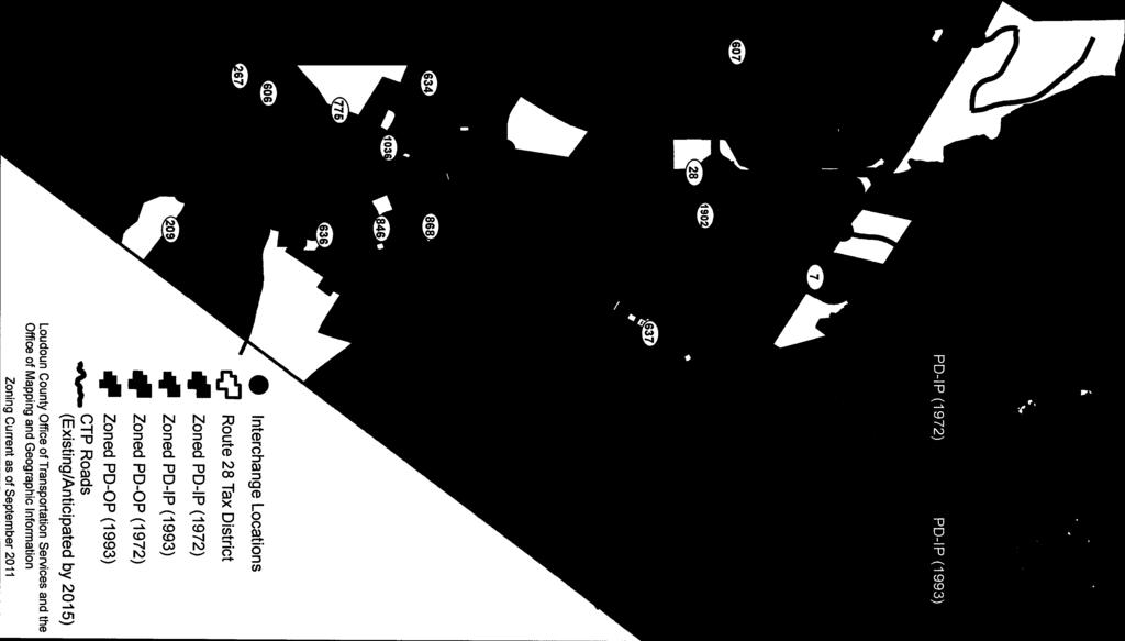
17 Loudoun County Print Map June 22, 2015 SITE ZRTD , Ashburn North-Equinix ATTACHMENT 1 A-17


18 A-18
19 A-19
20 A-20
21 A-21
22 A-22

23 A-23
24 A-24


25 A-25


26 A-26

27 A-27
28 A-28


29 A-29


30 A-30


31 A-31


32 A-32

33 A-33
34 A-34

35 A-35


36 A-36

37 A-37
38 Attachment 2 A-38
39 A-39
40 A-40
41 A-41
42 A-42
43 A-43
44 A-44
45 Attachment 3 A-45
46 A-46
47 A-47
48 Attachment 4 A-48
49 A-49
50 A-50
PLANNING COMMISSION WORK SESSION
 DEPARTMENT OF BUILDING AND DEVELOPMENT Date of Meeting: STAFF REPORT PLANNING COMMISSION WORK SESSION SUBJECT: ELECTION DISTRICT: FIDP-2016-0002, Ashburn Station North Broad Run CRITICAL ACTION DATE: STAFF
PLANNING COMMISSION WORK SESSION
 1 DEPARTMENT OF BUILDING AND DEVELOPMENT Date of Meeting: STAFF REPORT PLANNING COMMISSION WORK SESSION SUBJECT: ELECTION DISTRICT: FIDP-2016-0001, Broad Run CRITICAL ACTION DATE: STAFF CONTACTS: APPLICANT:
CITY OF KIRKLAND TRAFFIC IMPACT ANALYSIS GUIDELINES
 CITY OF KIRKLAND TRAFFIC IMPACT ANALYSIS GUIDELINES SEPA TRANSPORTATION CONCURRENCY - ROAD IMPACT FEES Introduction Revised February 2004 These guidelines describe how to prepare a traffic study, or Traffic
BOARD OF SUPERVISORS 2017 TRANSPORTATION SUMMIT INFORMATION ITEM
 BOARD OF SUPERVISORS 2017 TRANSPORTATION SUMMIT INFORMATION ITEM Date of Meeting: # 9 SUBJECT: ELECTION DISTRICTS: STAFF CONTACTS: Public and Private Infrastructure Improvements Adjacent to the Dulles
# 7. Date of Meeting: March 13, 2018 BOARD OF SUPERVISORS FINANCE/GOVERNMENT OPERATIONS AND ECONOMIC DEVELOPMENT COMMITTEE ACTION ITEM SUBJECT:
 BOARD OF SUPERVISORS FINANCE/GOVERNMENT OPERATIONS AND ECONOMIC DEVELOPMENT COMMITTEE ACTION ITEM Date of Meeting: March 13, 2018 # 7 SUBJECT: ELECTION DISTRICT: Contract Award/Roadway and Civil Design
BOARD OF SUPERVISORS BUSINESS MEETING ACTION ITEM. Consideration of a Board Initiated Zoning Concept Plan Amendment for Moorefield Station
 Date of Meeting: April 4, 2017 # 3 BOARD OF SUPERVISORS BUSINESS MEETING ACTION ITEM SUBJECT: ELECTION DISTRICT: CRITICAL ACTION DATE: STAFF CONTACTS: Consideration of a Board Initiated Zoning Concept
BOARD OF SUPERVISORS PUBLIC HEARING STAFF REPORT. Jennifer Hawkins, Image Brite Inc.
 Date of Hearing: May 9, 2018 #7 BOARD OF SUPERVISORS PUBLIC HEARING STAFF REPORT SUBJECT: ELECTION DISTRICT: SIDP-2017-0005, Extra Space Storage Ashburn Sign Development Plan Broad Run CRITICAL ACTION
ARLINGTON COUNTY, VIRGINIA
 ARLINGTON COUNTY, VIRGINIA County Board Agenda Item Meeting of December 12, 2015 DATE: December 1, 2015 SUBJECT: SP-84-U-15-1 USE PERMIT ASSOCIATED WITH A SITE PLAN for a telecommunications facility; located
Facebook West Campus. Planning Commission Meeting February 25, 2013
 Facebook West Campus Planning Commission Meeting February 25, 2013 Meeting Purpose Review and make a recommendation to the City Council on the following items (Attachment C): Statement of Overriding Considerations
Downtown Boise Multimodal Center
 Treasure Valley High Capacity Transit Study Downtown Boise Multimodal Center Environmental Assessment June 2009 Prepared by the Federal Transit Administration and Valley Regional Transit. U.S. Department
TRAFFIC CONCURRENCY INFORMATION
 PUBLIC WORKS DEPARTMENT 33325 8 th Avenue South Federal Way WA 98003-6325 253-835-2700; Fax 253-835-2709 www.cityoffederalway.com TRAFFIC CONCURRENCY INFORMATION What is a Concurrency Application? The
PUBLIC WORKS ORGANIZATIONAL CHART
 PUBLIC WORKS ORGANIZATIONAL CHART C-108 Actual 2012-13 Adopted Year-End Estimated 2014-15 2015-16 PROGRAM EXPENSES/REVENUES Salaries & Benefits $ 1,725,030 $ 1,855,980 $ 1,676,130 $ 1,956,510 $ 1,979,470
EASTSIDE CITY OF BELLEVUE/ PRIVATE PRIVATE PRIVATE MULTI-PRIVATE MULTI-PRIVATE
 SITE COMPARISON CHART CITY Bellevue County Kirkland Kirkland Redmond ADDRESS 555 116th Ave. Lane 118th Ave. 14955 90th St. ACREAGE 5.6 10.7 7.5 5.5 7.2 to 11.6 ACRES ZONING COMMERCIAL LIGHT INDUSTRIAL
Reston Town Center North Development. Community Update
 Reston Town Center North Development Community Update May 31, 2017 1 Presentation Agenda Project Overview Site and Current Property Ownerships Development Plan/Grid of Streets Proposed Ownership Comprehensive
SITE DESCRIPTION. Vicinity
 SITE DESCRIPTION Vicinity The Montrose Shopping Center is located in the northeast quadrant of the intersection of Randolph Road and Rockville Pike (MD 355). The existing building (formally known as the
Anchorage Land Use Plan Map Update Vision
 Anchorage Land Use Plan Map Update Vision Carol Wong Manger, Tom Davis Project Manager and many others working hard to listen to the community. Hal Hart AICP Planning Director May 9 th 2017 1 Vision: the
BOARD OF SUPERVISORS BUSINESS MEETING ACTION ITEM
 BOARD OF SUPERVISORS BUSINESS MEETING ACTION ITEM Date of Meeting: January 18, 2018 # 8 SUBJECT: ELECTION DISTRICT: Response to Board Member Initiative: Traffic Analysis and Safety Study of Waxpool Road
Unified Development Code. Public Workshop No. 3 November 7, 2017
 Unified Development Code Public Workshop No. 3 November 7, 2017 Purpose of the Project 2 The overall goal of the project is to bring together the County s Land Development Regulations (Chapter 74 of the
Request Conditional Use Permit (Colleges & Universities, public or private) Staff Planner Ashby Moss
 Staff Planner Ashby Moss") Applicant & Property Owner Public Hearing July 13, 2016 City Council Election District Bayside Agenda Item 9 Request Conditional Use Permit (Colleges & Universities, public or private) Staff Planner Ashby
Applicant & Property Owner Public Hearing July 13, 2016 City Council Election District Bayside Agenda Item 9 Request Conditional Use Permit (Colleges & Universities, public or private) Staff Planner Ashby
Northern Virginia Transportation Authority
 IV Northern Virginia Transportation Authority March 23, 2017 Susan Shaw, P.E., Megaprojects Director Virginia Department of Transportation 66 Outside the Beltway Project Scope Multimodal improvements to
Environmental Impact Questionnaire
 Community Development Department 11 English Street Petaluma, CA 94952 Phone: 707-778-4301 Email: cdd@ci.petaluma.ca.us Web: www.cityofpetaluma.net/cdd Building Geographic Information Systems Housing Neighborhood
Dulles Area Transportation Association
 Dulles Area Transportation Association February 8, 2017 Susan Shaw, P.E., Megaprojects Director Virginia Department of Transportation Transform 66: Outside the Beltway 2 Project Scope Multimodal improvements
ENMAX Generation Portfolio Inc.
 Decision 22192-D01-2017 ENMAX Generation Portfolio Inc. September 5, 2017 Alberta Utilities Commission Decision 22192-D01-2017 ENMAX Generation Portfolio Inc. Proceeding 22192 Application 22192-A002 September
Revised 2018 LESLIE KARR MANAGER, CURRENT PLANNING. Attachment. Dear Preliminary Plat Applicant:
 Revised 2018 Dear Preliminary Plat Applicant: As part of your application process, you are required to notify surrounding property owners of your public hearing before the Planning Commission to consider
AGENDA TOWN OF FLOWER MOUND SMARTGROWTH COMMISSION MEETING NOVEMBER 12, 2018 FLOWER MOUND TOWN HALL 2121 CROSS TIMBERS ROAD FLOWER MOUND, TEXAS
 AGENDA TOWN OF FLOWER MOUND SMARTGROWTH COMMISSION MEETING NOVEMBER 12, 2018 FLOWER MOUND TOWN HALL 2121 CROSS TIMBERS ROAD FLOWER MOUND, TEXAS AN AGENDA INFORMATION PACKET IS AVAILABLE FOR PUBLIC INSPECTION
Adoption of the Town of Putnam Valley Comprehensive Plan and the Future Adoption of Zoning and Subdivision Amendments to Implement the Plan
 Final Generic Environmental Impact Statement (GEIS) for the Town of Putnam Valley Comprehensive Plan and the Future Adoption of Zoning and Subdivision Amendments to Implement the Plan Title of Action:
# I-2. Date of Meeting: May 2, 2017 BOARD OF SUPERVISORS BUSINESS MEETING INFORMATION ITEM. Quarterly Metrorail Construction Status Report
 BOARD OF SUPERVISORS BUSINESS MEETING INFORMATION ITEM Date of Meeting: May 2, 2017 # I-2 SUBJECT: Quarterly Metrorail Construction Status Report ELECTION DISTRICTS: Ashburn/Broad Run STAFF CONTACTS: Alan
CASE NUMBER: 15SN0646 APPLICANT: Bon Secours Richmond Health System
 CASE NUMBER: 15SN0646 APPLICANT: Bon Secours Richmond Health System STAFF S ANALYSIS AND RECOMMENDATION Board of Supervisors (BOS) Public Hearing Date: JULY 22, 2015 BOS Time Remaining: 365 DAYS Applicant
Managing DC Work Zones: DDOT s Citywide Transportation Management Plan
 Managing DC Work Zones: DDOT s Citywide Transportation Management Plan ARTBA National Work Zone Management Conference September 20, 2016 1 Outline Citywide Transportation Management Plan (TMP) Citywide
Page 2D-12 Revised the following language in the last sentence on the page from; as shown in Figure 2D-3. To; as shown in Chapter 2H, Figure 2H-35.
 IMPERIAL ROAD DESIGN MANUAL REVISIONS January, 2015 CHAPTER 2A Page 2A-1 Revised the following language at the end of the paragraph under PRELIMINARY ENGINEERING AUTHORIZATION from; Funding Allocation/Verification/Submittal
SECTION 106 ACTIVITIES ANNUAL REPORT
 SECTION 106 ACTIVITIES ANNUAL REPORT FOR THE YEAR ENDING DECEMBER 31, 2016 Metropolitan Washington Airports Authority 198 Van Buren Street, Suite 300 Herndon, Virginia 20170 JANUARY 2017 Introduction The
TRANSIT CENTER DISTRICT PLAN
 TRANSIT CENTER DISTRICT PLAN Informational Presentation Planning Commission 04.19.2012 San Francisco Planning Department In partnership with: San Francisco Redevelopment Agency Transbay Joint Powers Authority
Applicant Type (Conditional Use Permit, Variance, Tract Map, etc.): Applicant: Address: Phone(s): Fax:
: Applicant: Address: Phone(s): Fax:") ENVIRONMENTAL QUESTIONNAIRE City of Twentynine Palms Community Development Department 6136 Adobe Road Twentynine Palms, CA 92277 (760) 367-6799 Fax (760) 367-5400 29palms.org : Please complete each statement
ENVIRONMENTAL QUESTIONNAIRE City of Twentynine Palms Community Development Department 6136 Adobe Road Twentynine Palms, CA 92277 (760) 367-6799 Fax (760) 367-5400 29palms.org : Please complete each statement
APPENDIX D. Traffic Impact Analysis
 APPENDIX D Traffic Impact Analysis TRAFFIC IMPACT ANALYSIS CALEXICO SOLAR FARM I County of Imperial, California July 8, 2011 LLG Ref. 3-11-2034 Prepared by: Cara Leone Transportation Planner II Under the
Proposed FY 06 Project Development Program and FY 05 Project Development Program Update
 Washington Metropolitan Area Transit Authority Proposed FY 06 Project Development Program and FY 05 Project Development Program Update Presented to the Board of Directors: P D E C Planning & Development
Integrating Travel Demand Management into the Long-Range Planning Process 2017 AMPO
 Integrating Travel Demand Management into the Long-Range Planning Process 2017 AMPO October 19, 2017 Chattanooga 2045 RTP Chattanooga 2045 RTP addresses both transportation supply and demand Continued
COUNCIL REPORT. Item Meeting date: August 13, 2018 Engineering & Public Works
 Item 7.3.5 Meeting date: August 13, 2018 Department: Prepared by: Reviewed by: SUBJECT: Engineering & Public Works COUNCIL REPORT George Elliott, P.Eng., Director of Engineering & Public Works Greg McClinchey,
Adopted by La Mesa City Council July 9, 2013 Resolution
 Adopted by La Mesa City Council July 9, 2013 Resolution 2013-059 Table of Contents ACKNOWLEDGEMENTS... A-1 INTRODUCTION... I-1 Vision... I-1 Background... I-1 Citizen Participation... I-3 Planning in La
SECTION 106 ACTIVITIES ANNUAL REPORT
 SECTION 106 ACTIVITIES ANNUAL REPORT FOR THE YEAR ENDING DECEMBER 31, 2015 Metropolitan Washington Airports Authority 198 Van Buren Street, Suite 300 Herndon, Virginia 20170 JANUARY 2016 Introduction The
Municipal Service Park 3 December Consolidation of City services to one centralized complex
 Municipal Service Park 3 December 2010 Consolidation of City services to one centralized complex Overview: Operational Challenges and Opportunities South East Connector impacts Opportunities: The South
TRANSPORTATION DEMAND MANAGEMENT (TDM) PLAN FOR MINNETONKA
 PLAN FOR MINNETONKA") TRANSPORTATION DEMAND MANAGEMENT (TDM) PLAN FOR MINNETONKA Kyle Burrows Kristina Nesse Andrew Owen Renan Snowden Humphrey School of Public Affairs University of Minnesota AGENDA Transportation Demand Management:
TRANSPORTATION DEMAND MANAGEMENT (TDM) PLAN FOR MINNETONKA Kyle Burrows Kristina Nesse Andrew Owen Renan Snowden Humphrey School of Public Affairs University of Minnesota AGENDA Transportation Demand Management:
F O R S A L E 2 Acre Outparcel Four Lane Exposure Gateway Corridor to Downtown 0 Kathleen Road, Lakeland, Florida 33801
 0 Kathleen Road, Lakeland, Florida 33801 Property: This is a 2 acre out parcel. Site is level and serviced by a master water retention system. Adjacent to the south is the newly built Storeright Self Storage
STUDY REPORT #1 ADDENDUM
 STUDY REPORT #1 ADDENDUM 1.0 PURPOSE OF ADDENDUM This document is an addendum to Study Report #1: Sub-System Planning Alternatives. The purpose of this addendum is to bridge the gap between the initial
Director of Public Works/City Engineer. Secretary. Word Processor. Streets and Facilities Supervisor. Traffic Signal Technician.
 PUBLIC WORKS ORGANIZATIONAL CHART Director of Public Works/City Engineer Secretary Word Processor Transit Services Manager Fleet Services Supervisor Streets and Facilities Supervisor Principal Principal
EXTRA TERRITORIAL ZONING COMMISSION CASE ANALYSIS
 DOÑA ANA COUNTY COMMUNITY PLANNING AND ECONOMIC DEVELOPMENT DEPARTMENT Building Planning GIS 845 North Motel Boulevard Las Cruces, New Mexico 88007 (575) 647-7350 Fax: (575) 525-6131 Toll Free: 1 (877)
TRANSPORTATION DEPARTMENT Business Plan
 TRANSPORTATION DEPARTMENT 2018 Business Plan Today s Agenda Mission Department Overview Planning Initiatives Commission Priorities and 2018 Budget Requests Five-year Plan Department of Transportation Mission
PLANNING COMMISSION JUNE 7, 2018 PUBLIC HEARING
 PLANNING COMMISSION JUNE 7, 2018 PUBLIC HEARING SUBJECT: MUNICIPAL CODE AMENDMENT TO UPDATE TITLE 10, VEHICLES AND TRAFFIC, AND TITLE 19, ZONING ORDINANCE, WEST HOLLYWOOD MUNICIPAL CODE TO AMEND THE TRANSPORTATION
Planning: Administrative Permits Instructions
 Building and Development Services Department 1112 Manatee Ave West, Suite 408 Bradenton, FL 34205 Phone: (941) 749-3012 ManateeBADSOnline@mymanatee.org www.mymanatee.org Planning: Administrative Permits
User Guide to Mesquite s Citizen Access Portal (CAP) Planning and Zoning Division New Application
 Planning and Zoning Division New Application") User Guide to Mesquite s Citizen Access Portal (CAP) Planning and Zoning Division New Application Updated: Tuesday, January 16, 2018 The Citizen Access Portal (CAP) website is: https://energov.cityofmesquite.com
User Guide to Mesquite s Citizen Access Portal (CAP) Planning and Zoning Division New Application Updated: Tuesday, January 16, 2018 The Citizen Access Portal (CAP) website is: https://energov.cityofmesquite.com
Snohomish County Tomorrow Steering Committee
 Snohomish County Tomorrow Steering Committee Agenda Bill Action Item 3.c. Date: February 27, 2013 Subject: 2012 Buildable Lands Report Exhibits: SCT Planning Advisory Committee Feb 14, 2013 Recommendation;
Variance Project Black Flag Attachments:
 Variance 15-01 Project Black Flag Attachments: 1. Locator 2. VAR 15-01 Staff report 3. Variance Exhibit 4. Applicant s Statement E Lookout Dr N Plano Rd 1402 E. Lookout Dr. N Greenville Ave Woodglen Dr
Buyer is responsible for any follow up required for land use/compatability concerns
 The following report is an example request with follow up answers from the Planning Department for subject property. Note: Due Diligence Partners ONLY makes initial request to Planning and Land Use Departments.
Calipatria Solar Farm TIA
 Calipatria Solar Farm TIA Prepared for: 7SM 8ME, LLC 71SM 8ME, LLC c/o 8minutenergy Renewables LLC Prepared by: Fehr & Peers March 25, 211 IE1-37 TABLE OF CONTENTS Executive Summary... i Project Trip Estimates...
Traffic Impact Analysis Shotwell Road Residential Clayton, NC
 Shotwell Road Residential Clayton, NC TABLE O CONTENTS 1. INTROUCTION...1 1.1. Site Location and Study Area...1 1.2. Proposed Land Use and Site Access...2 1.3. Adjacent Land Uses...2 1.4. Existing Roadways...2
Traffic Impact Study for the TAVA Homes Project at 1584 East Santa Clara Avenue in the City of Santa Ana
 Traffic Impact Study for the TAVA Homes Project at 1584 East Santa Clara Avenue in the City of Santa Ana March 2011 Prepared for: URS Corporation 2020 E. First Street, Suite #400 Santa Ana, CA 92705 Tel:
COMMERCIAL SITE AT GENERATION PARK
 COMMERCIAL SITE AT GENERATION PARK 77.9 Acre Site on Lockwood Road Generation Park Location Map Close Proximity to Major Destinations & Transportation Corridors Generation Park Features 4,000-acre master-planned
S-03-SegB: South Federal Way to Fife LRT
 Project Number S-03-SegB Subarea South King/Pierce Primary Mode Light Rail Facility Type Corridor Length 4.0 miles Version ST Board Workshop Date Last Modified 11-25-2015 PROJECT AREA AND REPRESENTATIVE
ENHANCED PARKWAY STUDY: PHASE 3 REFINED MLT INTERSECTION ANALYSIS
 ENHANCED PARKWAY STUDY: PHASE 3 REFINED MLT INTERSECTION ANALYSIS Final Report Prepared for Maricopa County Department of Transportation Prepared by TABLE OF CONTENTS Page EXECUTIVE SUMMARY ES-1 STUDY
REVIEW OF REGIONAL GROWTH CENTER APPLICATION
 REGIONAL DESIGNATION RECOMMENDATION REPORT REVIEW OF REGIONAL GROWTH CENTER APPLICATION CITY OF ISSAQUAH MARCH 18, 2015 OVERVIEW On January 30, 2015, PSRC staff received an application from the City of
Pueblo City-County Addressing Standards May 2010
 Pueblo City-County Addressing Standards May 2010 I. Definitions & Descriptions There can be up to four address types in the various databases within the County. They include situs, building, establishment
1. Significant Changes
 Security Upgrades Project (NMSSUP) Phase II, Los Alamos National Laboratory (LANL), Los Alamos, New Mexico Project Data Sheet is for Construction 1. Significant Changes The most recent DOE O 413.3B approved
Georgia Institute of Technology Advanced Computing Technology Building. Draft Program. Vision Program Outline
 Georgia Institute of Technology Advanced Computing Technology Building Draft Program Vision Program Outline Issued April 2, 2001 I N T R O D U C T I O N Scope This document is a summary of the Vision Session
ARLINGTON COUNTY, VIRGINIA. County Board Agenda Item Meeting of September 20, 2014
 ARLINGTON COUNTY, VIRGINIA County Board Agenda Item Meeting of September 20, 2014 DATE: September 8, 2014 SUBJECT: U-3340-12-1 USE PERMIT REVIEW of a 50' telecommunications pole with accompanying equipment
Stem Beach Solar 1041 Application
 Stem Beach Solar 1041 Application September 18 th, 2018 By: Stem Beach Solar LLC, Invenergy LLC 1401 17 th Street, Ste 1100 Denver, Colorado 80202 For: Pueblo County Agenda 1. About Invenergy 2. Project
Boardman to Hemingway Project Advisory Team
 Boardman to Hemingway Project Advisory Team Central Project Advisory Team Meeting 5 Tonight s Objectives Review progress of the Community Advisory Process and discuss next steps Present analysis of revised
FORM-BASED CODES IN THE WEST. Rocky Mountain Land Use Institute March 2007
 FORM-BASED CODES IN THE WEST Rocky Mountain Land Use Institute March 2007 Speakers Matt Goebel, AICP, Clarion Associates Background: What s a form-based code? Recent examples from the western US. Brewster
APPENDIX A TDM Development Guideline
 Appendix A: TDM Development Guideline APPENDIX A TDM Development Guideline Appendix A: TDM Development Guideline Page A.1 1 INTRODUCTION AND OVERVIEW 1.1 About This Guideline This guideline contains information
GORE BUILDING. 238 N. Massachusetts Avenue, Lakeland, FL 33801
 GORE BUILDING 238 N. Massachusetts Avenue, Lakeland, FL 33801 CDB LOCATION REDEVELOPMENT PROJECT MUNN PARK HISTORIC DISTRICT INCENTIVES AVAILABLE ADJACENT PARKING INCLUDED BK698301 Phone: (863) 683-3425
Manatee County Board of County Commissioners Wingate East Wingate Creek Southeast Tract
 Manatee County Board of County Commissioners Wingate East Wingate Creek Southeast Tract July 26, 2018 1 Introductions NAME Hugh McGuire Michelle Tickles BUSINESS INFORMATION Partner McGuire & McGuire,
MINOR DEVELOPMENT PERMIT CHECKLIST RESIDENTIAL DETACHED GARAGE 481 SQ. FT. 767 SQ. FT.
 9500 Civic Center Drive Thornton, CO 80229 CITY DEVELOPMENT DEPARTMENT 303-538-7295 developmentsubmittals@cityofthornton.net MINOR DEVELOPMENT PERMIT CHECKLIST RESIDENTIAL DETACHED GARAGE 481 SQ. FT. 767
Protocol and Guideline for Establishing Wireless Telecommunication Facilities Within City of Brampton
 Protocol and Guideline for Establishing Wireless Telecommunication Facilities Within City of Brampton (February 2002) (Revised, January 2011) Council approval CW062-2011 (Revised, February 2011) revisions
North Metro Corridor Draft Environmental Impact Statement (DEIS) Public Hearings. December 9 & 10, 2009
 Public Hearings. December 9 & 10, 2009") North Metro Corridor Draft Environmental Impact Statement (DEIS) Public Hearings December 9 & 10, 2009 1 Welcome & Introductions 2 3 What Are We Doing Here Tonight? Public Hearing for RTD North Metro Corridor
North Metro Corridor Draft Environmental Impact Statement (DEIS) Public Hearings December 9 & 10, 2009 1 Welcome & Introductions 2 3 What Are We Doing Here Tonight? Public Hearing for RTD North Metro Corridor
FOR SALE BANK OWNED OFFICE CENTRAL LAKELAND HISTORIC DISTRICT
 Jack Strollo, Broker 500 S. Florida Avenue, Suite 420 Lakeland, Florida 33801 O. 863.683.3425 x103 C. 863.640.8238 jstrollo@resbroadway.com FOR SALE BANK OWNED OFFICE CENTRAL LAKELAND HISTORIC DISTRICT
DATE: September 2014 Project Sponsors Rachel Schuett and Transportation Team Transportation Demand Management (TDM) Data Collection
 Data Collection") DATE: September 2014 TO: FROM: RE: Project Sponsors Rachel Schuett and Transportation Team Transportation Demand Management (TDM) Data Collection The San Francisco Planning Department and the San Francisco
DATE: September 2014 TO: FROM: RE: Project Sponsors Rachel Schuett and Transportation Team Transportation Demand Management (TDM) Data Collection The San Francisco Planning Department and the San Francisco
City Avenue District. City Avenue Rezoning Workshop January 25, :30 p.m. Board of Commissioners
 City Avenue District City Avenue Rezoning Workshop January 25, 2011 6:30 p.m. Board of Commissioners Meeting Agenda Approval process and status of ordinance Amendments to the Regional Center Area Applicability
St. Helena Island 5-6 December,
 5-6 December, 2011 Beaufort County Multi-Jurisdictional Form-Based Code Workshop and Charrette Report 2011 Opticos Design, Inc. 154 Beaufort County Multi-Jurisdictional Form-Based Code Workshop and Charrette
Appendix D Supportive Transportation Materials
 Appendix D Supportive Transportation Materials D.1. Stakeholder Input and Coordination As noted in Section 1.7 of the main Master Plan document, there have been several opportunities for stakeholders to
INDUSTRIAL LAND FOR SALE
 INDUSTRIAL LAND FOR SALE INDUSTRIAL LAND & DEVELOPMENT OPPORTUNITIES 150 ACRE INDUSTRIAL BUSINESS PARK LOTS RANGING FROM 5 150 ACRES Property Features Nexus at DIA provides a compelling opportunity for
BEFORE THE CHRISTCHURCH DISTRICT PLAN INDEPENDENT HEARINGS PANEL
 BEFORE THE CHRISTCHURCH DISTRICT PLAN INDEPENDENT HEARINGS PANEL IN THE MATTER OF The Resource Management Act 1991 AND IN THE MATTER OF The Canterbury Earthquake (Christchurch Replacement District Plan)
Intent. Clarification (Planning) Change per PC work session on
 Change per PC work session on") TELECOMMUNICATIONS Intent The intent of the Telecommunications Plan is to ensure the adequate provision of telecommunications infrastructure in the County that will support economic growth and public safety,
TELECOMMUNICATIONS Intent The intent of the Telecommunications Plan is to ensure the adequate provision of telecommunications infrastructure in the County that will support economic growth and public safety,
ARLINGTON COUNTY, VIRGINIA
 ARLINGTON COUNTY, VIRGINIA County Board Agenda Item Meeting of June 18, 2016 DATE: June 7, 2016 SUBJECT: U-3279-11-1 USE PERMIT AMENDMENT to add an antenna and equipment to an existing telecommunications
26 th Street North and Old Dominion Drive Master Planning Task Force
 26 th Street North and Old Dominion Drive Master Planning Task Force Presentation to Arlington Joint Facilities Advisory Commission October 24, 2018 Site Master Planning Task Force On September 2018, the
Contents. 1. Routing and Siting Process Routing and Siting Process Highlights Timeline Constraints Map
 Ranchtown Substation Project Open House Displays 08/16/2012 Contents 1. Routing and Siting Process Routing and Siting Process Highlights Timeline Constraints Map 2. Scope, Purpose and Need Existing Helotes
Subdivision Application Form
 Applicant Information 1. Property Titleholder Subdivision Application Form Ravalli County Planning Department 215 South 4 th Street, Suite F, Hamilton, MT 59840 / (406) 375-6530 / planning@rc.mt.gov Name:
A New Dimension to Land Development and Subdivision Design: Application of AutoCAD Civil 3D
 A New Dimension to Land Development and Subdivision Design: Application of AutoCAD Civil 3D Tarig Ali College of Engineering and Computer Science University of Central Florida Orlando, Florida taali@mail.ucf.edu
King County Ombudsman Whistle-Blowers Office Complaint
 King County Ombudsman Whistle-Blowers Office Complaint Filed by: Ho-Chuan Chen, Ph.D., P.E., Supervisor, Travel Forecasting and Data Management Group (TFDM) Hossein Barahimi, Transportation Planner III,
Council of State Governments. Takoma Langley Transit Center Purple Line Project Briefing. October 28, 2013
 Council of State Governments Takoma Langley Transit Center Purple Line Project Briefing October 28, 2013 Takoma Langley Transit Center Purpose and Need Provide a safe, attractive and efficient facility
R1 Variation Zones. CODE AMENDMENT Q&A UPDATE October 6, 2016 CPC CA ENV ND. Department of City Planning
 Department of City Planning R1 Variation Zones CODE AMENDMENT Q&A UPDATE October 6, 2016 CPC-2016-2110-CA ENV-2016-2111-ND What are the R1 Variation Zones? The R1 Variation Zones are subsets of the R1
EXISTING STRUCTURE 2252 THIRD AVENUE
 EXISTING STRUCTURE 2252 THIRD AVENUE 50 WIDE DEVELOPMENT SITE: ~ 51,000 BSF Within The New East Harlem Rezoning 2252 THIRD AVENUE - PROPERTY FEATURES ASKING PRICE: $12,000,000 PPBSF: $236 Property Features:
Region 2000 Bicycle Plan
 Region 2000 Bicycle Plan Adopted October 21, 2010 by: Virginia s Region 2000 Local Government Council Central Virginia Metropolitan Planning Organization This report was prepared for the Virginia s Region
Traffic Impact Analysis
 LA PALMA VILLAGE INITIAL STUDY CITY OF ANAHEIM Appendices Appendix I Traffic Impact Analysis September 2015 LA PALMA VILLAGE INITIAL STUDY CITY OF ANAHEIM Appendices This page intentionally left blank.
R1 R2 R3 C/I RC/I AP LR SC/I RP SP RESIDENTIAL *Single-Family Dwelling,
 R1 R2 R3 C/I RC/I AP LR SC/I RP SP RESIDENTIAL *Single-Family Dwelling, P P P P C P P X X P including driveways Cluster Development X C C X X X X X X X Community Living Arrangement P P P P C P X X X X
Annual Report for the Utility Savings Initiative
 Report to the North Carolina General Assembly Annual Report for the Utility Savings Initiative July 1, 2016 June 30, 2017 NORTH CAROLINA DEPARTMENT OF ENVIRONMENTAL QUALITY http://portal.ncdenr.org Page
An Assessment of Congestion in the Kansas City Region using the MARC Travel Demand Model
 An Assessment of Congestion in the Kansas City Region using the MARC Travel Demand Model The Congestion Management Process Federal Regulations state that all metropolitan planning organizations must carry
November 28, 2012 ALTERNATIVES ANALYSIS PUBLIC MEETING
 November 28, 2012 ALTERNATIVES ANALYSIS PUBLIC MEETING Project Background Description of the Project Alternatives Analysis Process Project Progress Activity Stations Comments Adjourn 2 VIA spent 2 years
TEMPORARY USE PERMIT SUBMITTAL REQUIREMENTS
 9500 Civic Center Drive Thornton, CO 80229 CITY DEVELOPMENT DEPARTMENT 303-538-7295 developmentsubmittals@cityofthornton.net TEMPORARY USE PERMIT SUBMITTAL REQUIREMENTS FOR SPECIAL EVENTS & FUNDRAISERS,
the City of Palm Bay Brevard County Florida held on November
 RESOLUTION NO 2018-60 A RESOLUTION OF THE CITY OF PALM BAY, BREVARD COUNTY, FLORIDA, AMENDING RESOLUTION NO 2018-45, ADOPTING RATES, CHARGES, AND FEES, FOR FISCAL YEAR 2018-2019, PURSUANT TO THE CITY OF
DATE: April 8, 2013 REPORT NO. CD TYPE OF REPORT CONSENT ITEM [ ] ITEM FOR CONSIDERATION [ X ]
![DATE: April 8, 2013 REPORT NO. CD TYPE OF REPORT CONSENT ITEM [ ] ITEM FOR CONSIDERATION [ X ]](/thumbs/89/97518073.jpg "DATE: April 8, 2013 REPORT NO. CD TYPE OF REPORT CONSENT ITEM [ ] ITEM FOR CONSIDERATION [ X ]") DATE: April 8, 2013 REPORT NO. CD2013-040 TO: FROM: Chair and Members Committee of the Whole Community Services Gregory Dworak, General Manager Community Services 1.0 TYPE OF REPORT CONSENT ITEM [ ] ITEM
DATE: April 8, 2013 REPORT NO. CD2013-040 TO: FROM: Chair and Members Committee of the Whole Community Services Gregory Dworak, General Manager Community Services 1.0 TYPE OF REPORT CONSENT ITEM [ ] ITEM
Planning Department Civic Center North 470 South Allison Parkway Lakewood, Colorado TTY/TDD Lakewood.
 Planning Department Civic Center North 470 South Allison Parkway Lakewood, Colorado 80226-3127 303.987.7505 303.987.7057 TTY/TDD Lakewood.org/Planning PLANNING COMMISSION REPORT SPECIAL USE PERMIT CASE
ARTS DISTRICT 2018 E. 8 TH STREET, LOS ANGELES, CA
 DOWNTOWN LOS ANGELES ARTS DISTRICT 2018 E. 8 TH STREET, LOS ANGELES, CA INVESTMENT / OWNER-USER OPPORTUNITY MARKETING BROCHURE WWW.LAREALTYPARTNERS.COM PROPERTY SUMMARY PROPERTY OVERVIEW 2017 E. 8TH STREET