NEW APPROACH FOR SAFE, FAST AND ACCURATE SURVEY OF DEEP MINE SHAFTS
|
|
|
- Emory Riley
- 5 years ago
- Views:
Transcription

1 NEW APPROACH FOR SAFE, FAST AND ACCURATE SURVEY OF DEEP MINE SHAFTS by Norbert Benecke & Peter Cain DMT GmbH &Co. KG, Germany / DMT Geosciences, Canada Kinemattic Shaft Survey 2013 Page 1
2 Who is DMT? is established in 1864 based in Essen/Germany employes more than 800 experts world-wide Is an international service provider for mining, oil& gas and infrastructure sectors and provides a wide range of specialized services over the whole life cycle of mining (exploration, engineering, consulting, research, measuring & monitoring) Geosciences Ltd. is wholly owned by DMT based in Calgary/Alberta provides comprehensive geoscience, consulting and engineering support to the minerals, energy, environmental and engineering sectors provides DMT services in North America Kinemattic Shaft Survey 2013 Page 2

3 Some remarks on the importance of shafts in mining Typically high-performance mining operations, esp. underground operations, are producing closely to their capacity limits 24 hours operability of the shafts is essential for the success of the mining operation Often the shaft safety pillar is mined and this affects the shaft or parts of the shaft: In position (inclination, rotation, lateral movements, curves) In shape (compression, deformation) In function The shaft hoisting installations move out of regular position The hoisting speed of the cages must be reduced Production losses Production breakdown Safety risks, e.g. danger to life or physical condition of workers Kinemattic Shaft Survey 2013 Page 3
4 Shaft Inspection is important for shafts under operation as well as for abandoned shafts for different purposes regular inspection on changes and damages (e.g. required by authorities) monitoring, e.g. whilst mining activities are impacting the shaft basis for planning issues, e.g. new installations, reconstruction work or shaft closure work Different information will be needed, e.g. Guides, walls and installations (documentation and condition) Slope, deformation and damages Plumbing of coordinates Kinemattic Shaft Survey 2013 Page 4

5 Shaft Inspection is difficult due to specific and dangerous conditions for any survey, e.g. Risk to fall down the deep hole Limited space Dust, water and darkness Small time window for surveying safe, fast and accurate system is required fast: less than 1 shift per shaft safe: remote operation, no men in the shaft safe for gassy mines: system must fulfil safety requirements concerning presence of methane gas accurate: some millimetre in local details, approx cm in absolute coordinates Kinemattic Shaft Survey 2013 Page 5
6 Kinematic Shaft Survey System by DMT Solutions for different shafts Cage-Based-Shaft-Survey-System for shafts with cage or skip Wireline-Shaft-Survey-System for shafts without cage or skip Odometer Kinemattic Shaft Survey 2013 Page 6

 Investigation of shaft position")


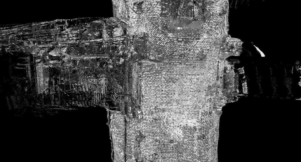
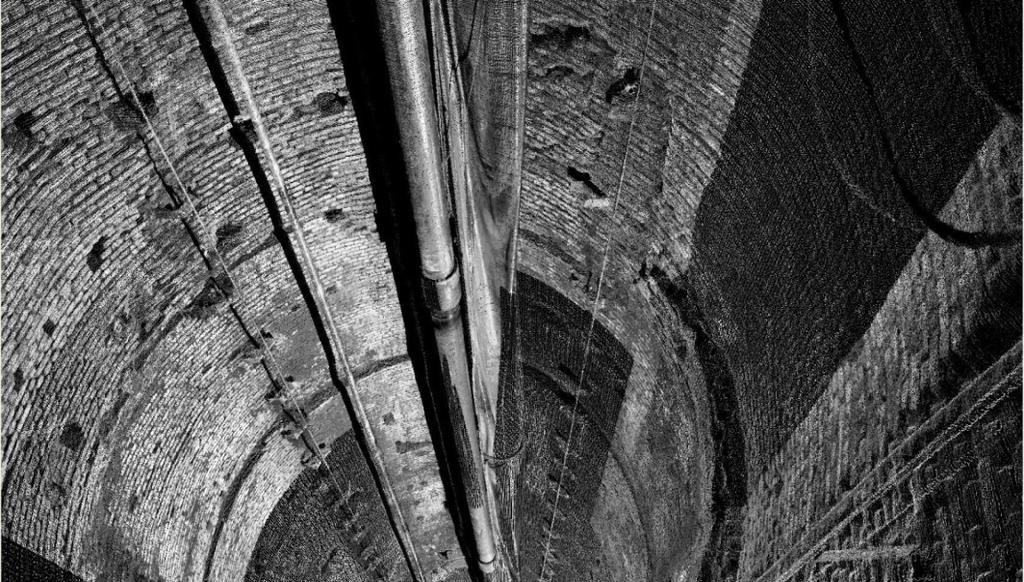
7 Cage-Based-Shaft-Survey-System System Layout for Shafts with Cage 1 st Component Inertial Measurement Unit (IMU) Investigation of shaft position (trace of cage position over depth) 2 nd Component LIDAR system As-built-documentation of shaft walls and installations Kinemattic Shaft Survey 2013 Page 7


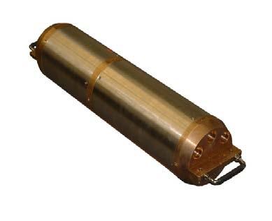
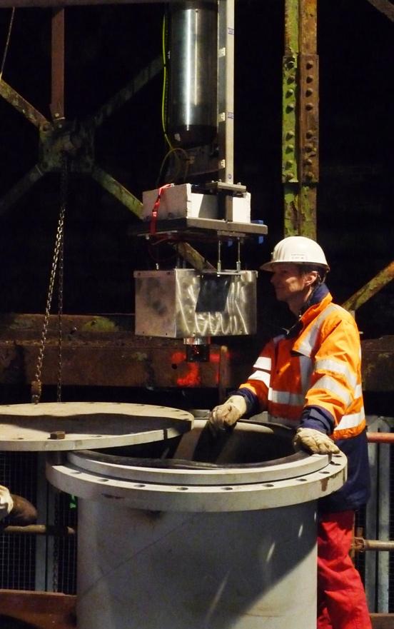
8 Cage-Based-Shaft-Survey-System System Layout for Shafts with Cage Installation of IMU and two IMAGER 5006i on hoisting cage if requested: ex-proofed Kinematic survey of the shaft with both technologies measurement of shaft position by IMU data logging of both scanners in profiler mode Internal power supply and data storage Control unit for synchronisation purposes Odometer Kinemattic Shaft Survey 2013 Page 8
 Odometer Kinemattic Shaft Survey 2013 Page")
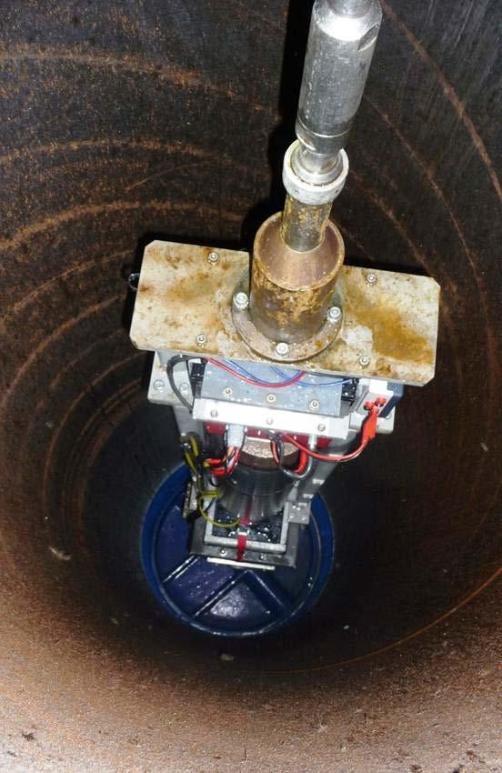
9 Cage-Based-Shaft-Survey-System System mounting on cage LIDAR (ex-proofed) Inertial measurement unit (IMU) Odometer Kinemattic Shaft Survey 2013 Page 9
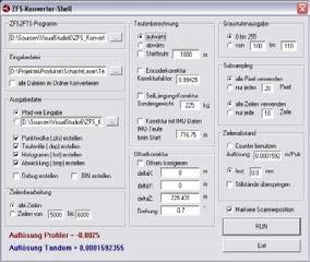
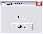
10 Cage-Based-Shaft-Survey-System Workflow Parametereingabe Excel Excel LIDAR systems ZFS- Konvert.exe Image-Viewer ZFS2PTS.exe IMU- Filt.exe Leica Cyclone SightPower IMU Odometer Kinemattic Shaft Survey 2013 Page 10
11 Kinemattic Shaft Survey 2013 Page 11

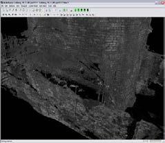
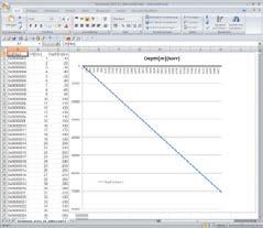
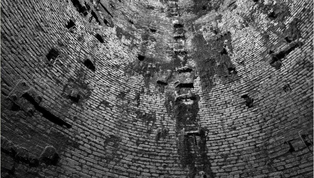
12 Cage-Based-Shaft-Survey-System Immediate result point cloud Kinemattic Shaft Survey 2013 Page 12
 Kinemattic Shaft Survey")
13 Cage-Based-Shaft-Survey-System Any detail is measured with accurate 3D-coordinates Less than 10 % gaps (hidden areas) Kinemattic Shaft Survey 2013 Page 13

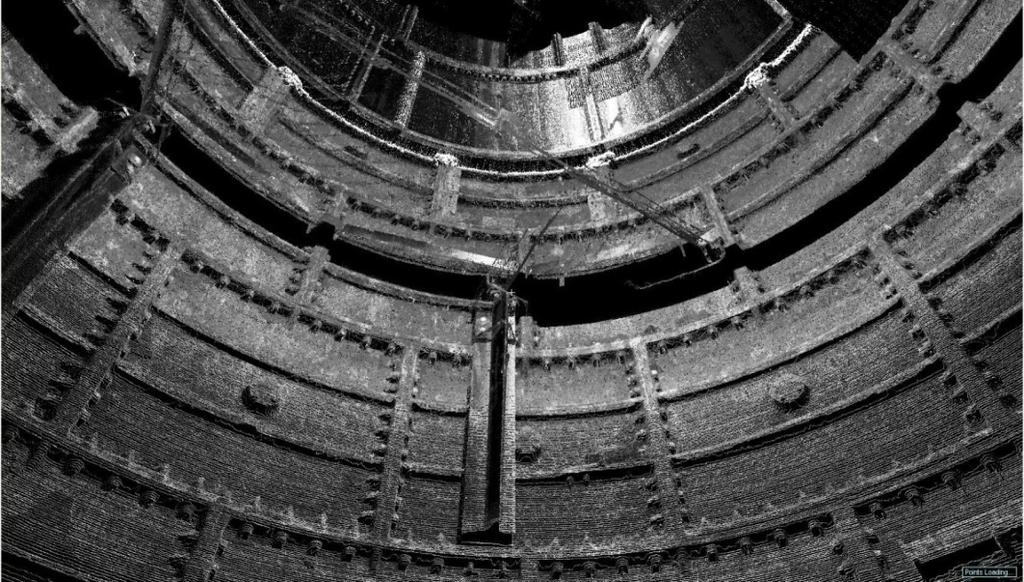
14 Cage-Based-Shaft-Survey-System Immediate result unwrapping of shaft walls Kinemattic Shaft Survey 2013 Page 14

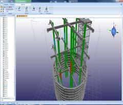
15 Cage-Based-Shaft-Survey-System Further results - CAD-Modeling from point cloud data Kinemattic Shaft Survey 2013 Page 15


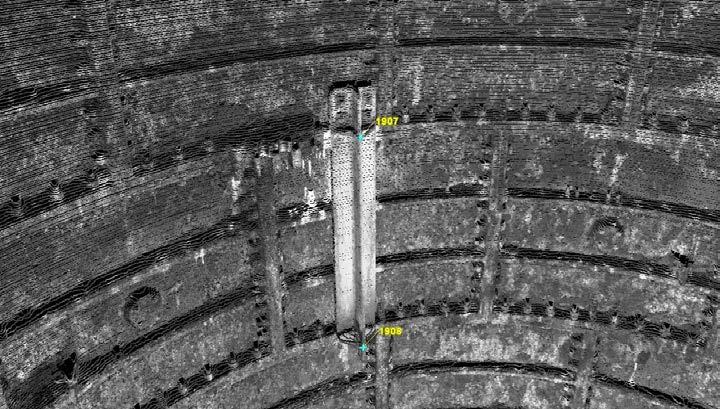
16 Cage-Based-Shaft-Survey-System Further results - CAD-Modeling from point cloud data Point cloud CAD model Example for specific data evaluation: Guide distances with deviations in red Kinemattic Shaft Survey 2013 Page 16
17 Cage-Based-Shaft-Survey-System Further results - Cross-sections in CAD-Format e.g. for installation of additional pipes or as basis for reconstruction work Kinemattic Shaft Survey 2013 Page 17
18 Cage-Based-Shaft-Survey-System Further results - Shaft deviation and local wall deformation e.g. as basis for reconstruction work Kinemattic Shaft Survey 2013 Page 18
19 Cage-Based-Shaft-Survey-System Technical Parameter (for 1,000 m deep shaft, 1 cage) Typical duration for mounting, measurements and demounting: 6 to 10 h Absolute accuracy in position: +/- 10 cm (by inertial measurement unit) Absolute accuracy in height: +/- 10 cm (by inertial measurement unit) Local accuracy of LIDAR measurement: +/- 1 mm up to 10 m distance Kinemattic Shaft Survey 2013 Page 19

: more than 20 projects in Germany initial projects in")

20 References more than 20 years experience with shaft surveying in Germany and international (e.g. Australia) With the new Cage-Based-Shaft-Survey-System (since 2011): more than 20 projects in Germany initial projects in Ukraine and Russia purchase of a full system to Kazakhstan further requests from Russia, Ukraine, South Africa and Australia Kinemattic Shaft Survey 2013 Page 20

21 Wireline-Shaft-Survey-System Kinemattic Shaft Survey 2013 Page 21
 IMU Power supply Data processor and storage Weights/batteries Laser electronic system Rotating mirror (in heated casing) Kinemattic Shaft Survey 2013")
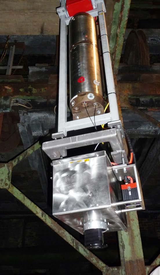
22 Wireline-Shaft-Survey-System System components 2D-LIDAR ( Profiler ) Cable head Inertial Measurement Unit (IMU) Batteries Telemetry Sensor for barrier identification Gas sensors (O 2 and CH 4 ) IMU Power supply Data processor and storage Weights/batteries Laser electronic system Rotating mirror (in heated casing) Kinemattic Shaft Survey 2013 Page 22
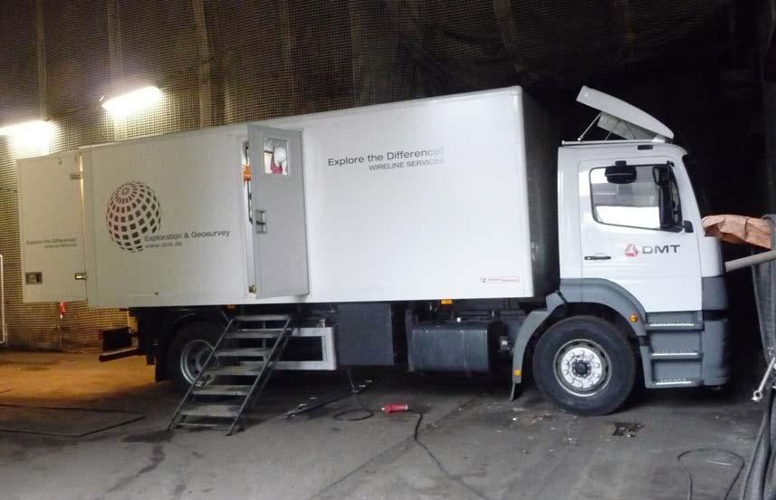
23 Wireline-Shaft-Mapping-System Prototype in practice testing Kinemattic Shaft Survey 2013 Page 23
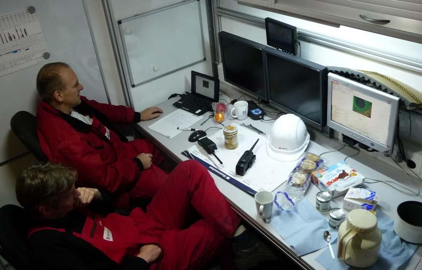
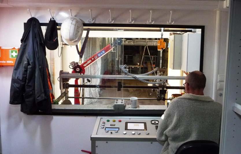
24 Wireline-Shaft-Mapping-System Control unit on surface Kinemattic Shaft Survey 2013 Page 24

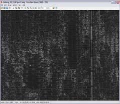
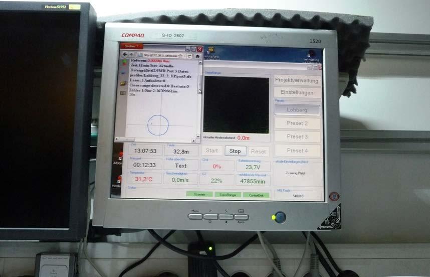
25 Wireline-Shaft-Mapping-System Control screen Kinemattic Shaft Survey 2013 Page 25
 IMU-data Determination of movements (rotation and oscillation) LIDAR IMU Scan data")

26 Wireline-Shaft-Mapping-System Data evaluation Winch Depth correction of the cable (elongation by system weight, winch correcting factor) IMU-data Determination of movements (rotation and oscillation) LIDAR IMU Scan data Unwrapping of measurement values Corrected by depth and rotation Correction of oscillation Conversion into 3D-model Several data evaluation and visualization options 3D-Point cloud Further data evaluation Kinemattic Shaft Survey 2013 Page 26
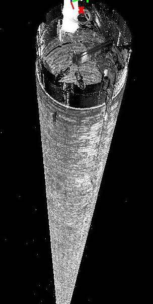
27 Wireline-Shaft-Survey-System Immediate result point cloud Kinemattic Shaft Survey 2013 Page 27

28 Wireline-Shaft-Survey-System Immediate result detail of point cloud with demaged area Kinemattic Shaft Survey 2013 Page 28
29 Wireline-Shaft-Survey-System Immediate result details of point cloud Dreiecksvermaschung: Kinemattic Shaft Survey 2013 Page 29

30 Wireline-Shaft-Survey-System Further result triangulation and measurements Point cloud Triangulation Kinemattic Shaft Survey 2013 Page 30
 Local accuracy of LIDAR measurement: +/- 1 cm up to 10 m distance Kinemattic Shaft Survey 2013 Page")
31 Wireline-Shaft-Survey-System Technical Parameter (for 1,000 m deep shaft) Typical duration for mounting, measurements and demounting: 6 to 10 h Absolute accuracy in position and height: +/- 20 to 30 cm (by inertial measurement unit) Local accuracy of LIDAR measurement: +/- 1 cm up to 10 m distance Kinemattic Shaft Survey 2013 Page 31
32 Conclusions Shafts are extremely important for mines Safe, fast and accurate shaft survey system was missing DMT has solved this problem by development of kinematic shaft survey systems for shafts with cage for shafts without cage for gassy mines Systems are already tested in several projects DMT offers measurement services worldwide Kinemattic Shaft Survey 2013 Page 32
33 Our Service - Your Benefit Faster re-availability of the shaft for operational use by saving of measurement times & minimizing of down-time Enhancement of safety level by avoiding of dangerous work inside the shaft minimizing of required safety measures & decrease of accident risk for workers first opportunity to use laser scanning in explosive areas Enhancement of quality, reliability and rapidity of decisions for Safety measures (e.g. cage speed reduction in case of damaged guides) planning of new installations (e.g. pipelines) reconstruction work (e.g. in case of damages) Enhancement of quality, reliability and rapidity of decisions by increase of measurement quality and detailedness fast availability of results in applicable shape for different themes opportunity for evaluation of additional results without additional survey Comparison of several survey campaigns Saving of time and costs Kinemattic Shaft Survey 2013 Page 33

34 Thank you for your attention! GLÜCKAUF Laser scan by ex-proofed DMT laser scanner in a German underground mine (entrance of longwall operation) Kinemattic Shaft Survey 2013 Page 34
Introducing. GeoSLAM. The experts in go anywhere 3D mobile mapping technology. The Company. The Technology. The Applications. Strategic Partnerships
 Introducing GeoSLAM The experts in go anywhere 3D mobile mapping technology The Company The Technology The Applications Strategic Partnerships The Company Multipurpose Presentation Template 2 About Us
3D Industrial plants. Documentation
 3D Industrial plants Documentation Published by: FARO Europe GmbH & Co. KG, Lingwiesenstrasse 11/2, D-70825 Korntal-Münchingen, Tel: +49 7150 9797-0, Fax: +49 7150 9797-44, info@faroeurope.com, www.faro.com
The Most Comprehensive Solution for Indoor Mapping Applications
 The Most Comprehensive Solution for Indoor Mapping Applications TRIMBLE INDOOR MOBILE MAPPING SOLUTION TRIMBLE INDOOR MOBILE MAPPING SOLUTION (TIMMS): HIGH EFFICIENCY, MAXIMUM FLEXIBILITY, ALL-IN-ONE PACKAGE
Mobile Mapping The StreetMapper Approach. Andrew Fuller LiDAR Systems Engineer
 Mobile Mapping The StreetMapper Approach Andrew Fuller LiDAR Systems Engineer UK company based in Nottingham Global 3D Laser Mapping Solutions Innovative solutions StreetMapper Over 11 years experience
3D Laser Scanning Technology. Fast, Safe, Accurate. Rugged hardware and powerful software combined with streamlined survey workflow
 3D Laser Scanning Technology Fast, Safe, Accurate Rugged hardware and powerful software combined with streamlined survey workflow Maptek specialises in the research, development and application of 3D laser
Jeffrey A. Schepers P.S. EIT Geospatial Services Holland Engineering Inc. 220 Hoover Blvd, Suite 2, Holland, MI Desk
 Jeffrey A. Schepers P.S. EIT Geospatial Services Holland Engineering Inc. 220 Hoover Blvd, Suite 2, Holland, MI 49423 616-594-5127 Desk 616-322-1724 Cell 616-392-5938 Office Mobile LiDAR - Laser Scanning
Storage Tank Solutions TRANSFORMING THE WAY THE WORLD WORKS
 Storage Tank Solutions Trimble TX8 Scanner: A Revolution in 3D Scanning TRUE PERFORMANCE IN A REAL WORLD The Trimble TX8 laser scanner sets new standards for performance and ease of use in high-speed collection
Critical Aspects when using Total Stations and Laser Scanners for Geotechnical Monitoring
 Critical Aspects when using Total Stations and Laser Scanners for Geotechnical Monitoring Lienhart, W. Institute of Engineering Geodesy and Measurement Systems, Graz University of Technology, Austria Abstract
BIM for infrastructure make easy with Laser Scanner. 17 October Beng Chieh Quah Head of Marketing Asia Pacific
 BIM for infrastructure make easy with Laser Scanner 17 October 2016 Beng Chieh Quah Head of Marketing Asia Pacific who is? founded in 1981 NASDAQ since 1997 Global technology company Offering a range of
TAKING LIDAR SUBSEA. Adam Lowry, Nov 2016
 TAKING LIDAR SUBSEA Adam Lowry, Nov 2016 3D AT DEPTH Based in the technology hub of Boulder, Colorado, 3D at Depth is dedicated to the development of underwater laser measurement sensors and software Patented
Laser Scanning. 3D Model is not existing and is required for: studies revamping maintenance HSE integration in another 3D model archiving
 Laser Scanning Laser Scanning Laser scanning is used whenever: 3D Model is not existing and is required for: studies revamping maintenance HSE integration in another 3D model archiving 2 Object acquisition
ROAD SURFACE STRUCTURE MONITORING AND ANALYSIS USING HIGH PRECISION GPS MOBILE MEASUREMENT SYSTEMS (MMS)
") ROAD SURFACE STRUCTURE MONITORING AND ANALYSIS USING HIGH PRECISION GPS MOBILE MEASUREMENT SYSTEMS (MMS) Bonifacio R. Prieto PASCO Philippines Corporation, Pasig City, 1605, Philippines Email: bonifacio_prieto@pascoph.com
ROAD SURFACE STRUCTURE MONITORING AND ANALYSIS USING HIGH PRECISION GPS MOBILE MEASUREMENT SYSTEMS (MMS) Bonifacio R. Prieto PASCO Philippines Corporation, Pasig City, 1605, Philippines Email: bonifacio_prieto@pascoph.com
The S100 Laser Scanner
 PRODUCT INFORMATION The S100 Laser Scanner The compact all-rounder The S100 laser scanner: the sensor for improved process performance Damaged goods, or defective machines and equipment, can impede or
Federica Zampa Sineco SpA V. le Isonzo, 14/1, Milan, 20135, Italy
 LYNX MOBILE MAPPER TM : THE NEW SURVEY TECHNOLOGY Federica Zampa Sineco SpA V. le Isonzo, 14/1, Milan, 20135, Italy federica.zampa@sineco.co.it Dario Conforti Optech Incorporated 300 Interchange Way, Vaughan,
Digital Outdoor Intercom Station DA/DAE 0x5 Series
 Digital Outdoor Intercom Station DA/DAE 0x5 Series Features and Functions Robust construction for use in harsh industrial environments Degree of protection IP66 Glass-fiber reinforced polyester Configurable
Using SLAM-based Handheld Laser Scanning to Gain Information on Difficult-to-access Areas for Use in Maintenance Model
 Using SLAM-based Handheld Laser Scanning to Gain Information on Difficult-to-access Areas for Use in Maintenance Model T. Makkonen a, R. Heikkilä a, P. Tölli b, F. Fedorik a a Construction Technology Research
BEFORE YOU BUY: SEVEN CRITICAL QUESTIONS TO ASK ABOUT LASER SCANNERS. Robert Gardiner
 BEFORE YOU BUY: SEVEN CRITICAL QUESTIONS TO ASK ABOUT LASER SCANNERS Robert Gardiner Table of Contents Introduction... 3 Horizontal and Vertical Angular Accuracies... 4 Movement Tracking... 6 Range Limitations...
ROAD-SCANNER COMPACT APPLICATION FIELDS MAIN FEATURES
 ROAD-SCANNER COMPACT Mobile Mapping System by GEXCEL & SITECO collaboration A smaller mobile system for asset management and cartography suited for ZOLLER & FRÖHLICH PROFILER 9012 laser scanner. 2 + 3
Terrestrial radar and laser scanning for deformation monitoring: first steps towards assisted radar scanning
 Terrestrial radar and laser scanning for deformation monitoring: first steps towards assisted radar scanning Daniel Wujanz 1, Frank Neitzel 1, H.P. Hebel 2, J. Linke 2, W. Busch 2 1 Chair of Geodesy and
GeoSmart Asia Locate 18
 MOBILE MAPPING GeoSmart Asia Locate 18 ESP Associates, P.A. ESP Associates, P.A. ABOUT ESP Founded in 1986 (28 Years of Experience with DOT s) ESP has 14 offices throughout the US 37 States, Canada, and
Overview of the Trimble TX5 Laser Scanner
 Overview of the Trimble TX5 Laser Scanner Trimble TX5 Revolutionary and versatile scanning solution Compact / Lightweight Efficient Economical Ease of Use Small and Compact Smallest and most compact 3D
Digital Explosion-proof Intercom Stations DX/DXE 0x5 Series
 Digital Explosion-proof Intercom Stations DX/DXE 0x5 Series Features and Functions For use in explosive (hazardous) areas of Ex zone 1 and 2 Equipment group and category Ex II 2G Temperature range of DX
ENY-C2005 Geoinformation in Environmental Modeling Lecture 4b: Laser scanning
 1 ENY-C2005 Geoinformation in Environmental Modeling Lecture 4b: Laser scanning Petri Rönnholm Aalto University 2 Learning objectives To recognize applications of laser scanning To understand principles
Trimble MX2 mobile mapping
 Trimble MX2 mobile mapping user applications Point clouds within your reach The Trimble MX2 is a vehicle-mounted spatial imaging system which combines high resolution laser scanning and panoramic cameras
3D Terrestrial Laser Scanner Innovative Applications for 3D Documentation
 3D Terrestrial Laser Scanner Innovative Applications for 3D Documentation Rodney Chaffee Head of Sales, FARO Asia Pacific 3D Laser Scaning Market 2017 2.3 Billion $ 2012 1.3 Billion $ CAGR : > 12% Source:
3D Laser Scanner VS1000 User Manual
 3D Laser Scanner VS1000 User Manual 1 VS1000 Introduction SMART MAX GEOSYSTEMS CO., LTD VS1000 3D Laser Scanner based on pulses ranging principle, could quick acquire massive point cloud data from the
Most as-built information is still manually collected. Today s Design Market
 Agenda 1. Overview of 3D laser scanning 2. HDS 3D Laser scanning applications Leica ScanStation2 True Color Scan 3. Demonstration of HDS & Trueview 4. Questions and Answers The advanced 3D Laser Scanning
Coke Drum Laser Profiling
 International Workshop on SMART MATERIALS, STRUCTURES NDT in Canada 2013Conference & NDT for the Energy Industry October 7-10, 2013 Calgary, Alberta, CANADA Coke Drum Laser Profiling Mike Bazzi 1, Gilbert
3D Laser Scanning Technology. Rugged hardware and powerful software combined with streamlined survey workflow
 3D Laser Scanning Technology Rugged hardware and powerful software combined with streamlined survey workflow I-Site XR3 laser scanner The Maptek I-Site XR3 laser scanner represents the latest laser imaging
StreetMapper 360 & StreetMapper Portable
 StreetMapper 360 & StreetMapper Portable 11th February 2010 Dr. Chris Cox & Mr. Olaf Gross 3D Laser Mapping LIDAR Specialists StreetMapper Distributor for RIEGL (UK, Ireland, Southern Africa) Terrasolid
2/9/2016. Session Agenda: Implementing new Geospatial Technologies for more efficient data capture
 Implementing new Geospatial Technologies for more efficient data capture Jay Haskamp Applied Geospatial Engineer Steve Richter VP Sales Session Agenda: Today s changing technologies and what lies ahead
Terrain Modeling and Mapping for Telecom Network Installation Using Scanning Technology. Maziana Muhamad
 Terrain Modeling and Mapping for Telecom Network Installation Using Scanning Technology Maziana Muhamad Summarising LiDAR (Airborne Laser Scanning) LiDAR is a reliable survey technique, capable of: acquiring
Open Pit Mines. Terrestrial LiDAR and UAV Aerial Triangulation for. Figure 1: ILRIS at work
 Terrestrial LiDAR and UAV Aerial Triangulation for Open Pit Mines Figure 1: ILRIS at work Figure 2: Geo-Copter X-8000 taking off ay what you will about the past few years, it has produced some useful tools
InteLAS Family of Mobile LiDAR Systems
 InteLAS Family of Mobile LiDAR Systems September 2015 What we do ilinks Geosolutions LLC Hydrographic surveying and seabed modeling Topographic surveying and mobile mapping Systems engineering and integration
Leica DISTO X3 Designed for tough, rugged conditions
 Leica DISTO X3 Designed for tough, rugged conditions The rugged Leica DISTO X-series combines innovative measuring technologies with a site-proof design and simple user interface. Together with the Leica
T-SCAN 3 3D DIGITIZING
 T-SCAN 3 3D DIGITIZING 2 T-SCAN 3: THE HANDHELD LASER SCANNER Launching the innovative concept of an intuitive-to-use high-precision laser scanner a few years ago, Steinbichler Optotechnik, as the first
Merlin vessel-based lidar system
 Brochure: Merlin vessel-based lidar system Merlin vessel-based lidar system Map the full environment in one pass Scanning the full marine environment in a single operation reduces the amount of time crew
Dräger UCF 8000 NFPA Certified Thermal Imaging Camera
 Dräger UCF 8000 NFPA Certified Thermal Imaging Camera Fires and other hazardous environments pose unseen challenges and dangers. Now you can know before you go with the Dräger UCF 8000 thermal imaging
Leica Geosystems Regional Public Safety Conference. Joshua Rayburn Consolidated Forensic Laboratory, Washington DC Present Date:
 Leica Geosystems Regional Public Safety Conference Joshua Rayburn Consolidated Forensic Laboratory, Washington DC Present Date: 04.15.15 2 What is a Pegasus? Portable survey-grade mobile mapping solution
INSPECTION CAMERA MODEL NO: CIC2410 OPERATION & SAFETY INSTRUCTIONS PART NO: GC0116
 INSPECTION CAMERA MODEL NO: CIC2410 PART NO: 6470385 OPERATION & SAFETY INSTRUCTIONS GC0116 INTRODUCTION Thank you for purchasing this CLARKE Inspection Camera. Before attempting to use this product, please
Integrating the Generations, FIG Working Week 2008,Stockholm, Sweden June 2008
 H. Murat Yilmaz, Aksaray University,Turkey Omer Mutluoglu, Selçuk University, Turkey Murat Yakar, Selçuk University,Turkey Cutting and filling volume calculation are important issues in many engineering
High Resolution Phased Array Imaging using the Total Focusing Method
 19 th World Conference on Non-Destructive Testing 2016 High Resolution Phased Array Imaging using the Total Focusing Method Wolfram A. Karl DEUTSCH 1, Werner ROYE 1, Helge RAST 1, Philippe BENOIST 2 1
Efficient and Large Scale Monitoring of Retaining Walls along Highways using a Mobile Mapping System W. Lienhart 1, S.Kalenjuk 1, C. Ehrhart 1.
 The 8 th International Conference on Structural Health Monitoring of Intelligent Infrastructure Brisbane, Australia 5-8 December 2017 Efficient and Large Scale Monitoring of Retaining Walls along Highways
Construction Progress Management and Interior Work Analysis Using Kinect 3D Image Sensors
 33 rd International Symposium on Automation and Robotics in Construction (ISARC 2016) Construction Progress Management and Interior Work Analysis Using Kinect 3D Image Sensors Kosei Ishida 1 1 School of
The Most User-Friendly 3D scanner
 The Most User-Friendly 3D scanner The Solutionix C500 is optimized for scanning small- to medium-sized objects. With dual 5.0MP cameras, the C500 provides excellent data quality at a high resolution. In
2/19/2018. Who are we? Who am I? What is Scanning? How does scanning work? How does scanning work? Scanning for Today s Surveyors
 2/19/2018 Who are we? Scanning for Today s Surveyors Survey, GIS, and Construction dealer Founded in 1988 Employee Owned Headquartered in Bismarck, ND States covered: ND, SD, MN, MT, WY, CO, UT, ID, WA,
> > Cut training costs: The low-maintenance Merlin. > > Add value: By expanding your product offering,
 45 27 39.384 N 9 07 30.145 E Merlin Vessel-based lidar system Map the full environment in one pass Scanning the full marine environment in a single operation reduces the amount of time crew spend in hazardous
Control System International a.s., Papírenská 114/5, Praha 6, Czech Republic Web site: www. controlsystem.cz,
 129 Consequences of a complex using of 3D approach in the implementation of the road reconstruction - usage of TLS stop&go and usage of paving control system for milling machines Přikryl, M. and Kutil,
Rigorous Scan Data Adjustment for kinematic LIDAR systems
 Rigorous Scan Data Adjustment for kinematic LIDAR systems Paul Swatschina Riegl Laser Measurement Systems ELMF Amsterdam, The Netherlands 13 November 2013 www.riegl.com Contents why kinematic scan data
AN INTEGRATED SENSOR ORIENTATION SYSTEM FOR AIRBORNE PHOTOGRAMMETRIC APPLICATIONS
 AN INTEGRATED SENSOR ORIENTATION SYSTEM FOR AIRBORNE PHOTOGRAMMETRIC APPLICATIONS M. J. Smith a, *, N. Kokkas a, D.W.G. Park b a Faculty of Engineering, The University of Nottingham, Innovation Park, Triumph
Suite en It Up with Autodesk ReCap
 Chad Studer ADSK Solutions RC3165 Static and mobile laser scanning technologies capture millions of points and provide photorealistic interactive virtual sites known as point clouds. With Autodesk ReCap
3D Laser Scanner. Fast, Portable, Accurate. Long range laser scanner Modular design configured to suit your survey needs
 3D Laser Scanner Fast, Portable, Accurate Long range laser scanner Modular design configured to suit your survey needs Introducing the Maptek I-Site 8820 laser scanner The Maptek I-Site 8820 laser scanner
PC100 - Concept. Advantages in comparison
 PC100 - Concept The future of HMI-devices for the use in explosion endangered areas is less based on short lived proprietary products but more on all-purpose, modular products of latest technology and
Combined video and laser camera for inspection of old mine shafts
 Combined video and laser camera for inspection of old mine shafts Laurent Cauvin To cite this version: Laurent Cauvin. Combined video and laser camera for inspection of old mine shafts. 3. International
Simplicity is the new black: The BLK360 story
 Simplicity is the new black: The BLK360 story Vanda KADLECIKOVA Leica Geosystems Heerbrugg, Switzerland E-mail: vanda.kadlecikova@leica-geosystems.com Abstract Meet the game changer. The new Leica BLK360
Leveraging Point Clouds to Produce Accurate As-Built Models. Sonia Delgadillo
 Leveraging Point Clouds to Produce Accurate As-Built Models Sonia Delgadillo Time What is CADWorx fieldpipe? Easy customization Comprehensive specs Short learning curve AutoCAD -based CADWorx Plant Design
Classical Measurement Methods and Laser Scanning Usage in Shaft Hoist Assembly Inventory
 Classical Measurement Methods and Laser Scanning Usage in Shaft Hoist Assembly Inventory Wojciech Jaśkowski 1,*, Tomasz Lipecki 1, Wojciech Matwij 1, Mateusz Jabłoński 1 1 AGH University of Science and
Geospatial Engineering Problems & Solutions Associated With NDP Roads, Tunnelling & Civil Engineering Projects Use of HDS Leica Laser Scanners
 Geospatial Engineering Problems & Solutions Associated With NDP Roads, Tunnelling & Civil Engineering Projects Use of HDS Leica Laser Scanners Laser Scanning Laser Scanning is a method of collecting large
TEL: / FAX:
 Self-leveling Rotary Laser FRE-211 Operating Manual P.R.Engineering Ltd UK www.laser-level.co.uk TEL: 01246 269 777 / FAX: 01246 260 007 SAFETY PRECAUTIONS: During instrument operation, be careful not
Agenda Rotating Equipment Services. Rotating Equipment Services. Sulzer Full Potential for RES. Summary. Point of Departure. Mission & Strategy
 Capital Market Day 2015 Rotating Equipment Services Peter Alexander, Division President February 12, 2015 Agenda Rotating Equipment Services Sulzer Full Potential for RES Point of Departure Mission & Strategy
RobotEye RE08 3D LIDAR 3D Laser Scanning System. Product Datasheet
 3 D L A S E R S C A N N I N G S Y S T E M S RobotEye RE08 3D LIDAR 3D Laser Scanning System Product Datasheet 2015 Ocular Robotics Ltd All rights reserved RobotEye RE08 3D LIDAR - 3D Laser Scanning System
Airborne LiDAR Surveys and Data Delivery in the Pipeline Industry
 Airborne LiDAR Surveys and Data Delivery in the Pipeline Industry Carlos Femmer Faron Olivier October 25, 2011 October 25, 2011 GITA GIS for Oil and Gas Pipeline 2011 Organization Fugro is a decentralized
Leica Pegasus: Backpack
 Leica Pegasus: Backpack Fast Acquisition Accurate data Indoor/Outdoor projects Pegasus:Backpack Simple workflow Everything, Everywhere 1 Leica Pegasus: Backpack Award Winning System Remarks Multiple Award
LAR 350 rotation laser: Tough DUAL SLOPE laser kit Made in Germany. World s first MOTION CONTROL
 LAR 350 rotation laser: Tough DUAL SLOPE laser kit Made in Germany World s first MOTION CONTROL LAR 350 rotating laser with MOTION CONTROL: Welcome to the new age of laser control For serious professionals:
Rapid Building information modeling. Ivar Oveland 2013
 Rapid Building information modeling Ivar Oveland 2013 Case study How can I rapidly create a building information model? Today: Different methods are used today to establish a building information model
CORPORATE OVERVIEW. Electrical Instrumentation Automation Design Construction
 CORPORATE OVERVIEW Celebrating 25 Years 15+ Years LTI Free Electrical Instrumentation Automation Design Construction 1 1 OVERFLOW INDUSTRIAL Overflow Industrial is an Electrical Engineering and Contracting
MEASURING MEANS UNDERSTANDING.
 MEASURING MEANS UNDERSTANDING. RODUCTS ROTARY TABLE FAST EXCHANGE SYSTEM Bild 1: Base plate including component and fixture in a GOM ScanBox 6130 Rotary table fast exchange system DSW 02 The rotary table
Data Sheet FUJITSU PRIMECENTER M2 19-inch Racks
 Data Sheet FUJITSU PRIMECENTER M2 19-inch Racks Data Sheet FUJITSU PRIMECENTER M2 19-inch Racks 19-inch Industry Standard Rack Systems The trend to consolidation as a result of virtualization and optimization
Interdisciplinary Approach to Design, Analysis, and Modeling of Deformation Surveys
 Interdisciplinary Approach to Design, Analysis, and Modeling of Deformation Surveys Anna Szostak-Chrzanowski and Adam Chrzanowski Canadian Centre for Geodetic Engineering University of New Brunswick Fredericton,
ScienceDirect. The use of Optical Methods for Leak Testing Dampers
 Available online at www.sciencedirect.com ScienceDirect Procedia Engineering 69 ( 2014 ) 788 794 24th DAAAM International Symposium on Intelligent Manufacturing and Automation, 2013 The use of Optical
High Resolution Tree Models: Modeling of a Forest Stand Based on Terrestrial Laser Scanning and Triangulating Scanner Data
 ELMF 2013, 11-13 November 2013 Amsterdam, The Netherlands High Resolution Tree Models: Modeling of a Forest Stand Based on Terrestrial Laser Scanning and Triangulating Scanner Data Lothar Eysn Lothar.Eysn@geo.tuwien.ac.at
Company information PROTEC Facility Solutions PROTEC GmbH » Established: *» General Manager: Ralf Wogawa
 Company information PROTEC Facility Solutions PROTEC GmbH» Established: 02.2008*» General Manager: Ralf Wogawa» Main Office: Heidelberg» Locations: Baumholder Kaiserslautern Stuttgart Wiesbaden» Employees:
QUALITY CONTROL METHOD FOR FILTERING IN AERIAL LIDAR SURVEY
 QUALITY CONTROL METHOD FOR FILTERING IN AERIAL LIDAR SURVEY Y. Yokoo a, *, T. Ooishi a, a Kokusai Kogyo CO., LTD.,Base Information Group, 2-24-1 Harumicho Fuchu-shi, Tokyo, 183-0057, JAPAN - (yasuhiro_yokoo,
KA3-6VS 300mm KA3-6VS 400mm Vertical Spindle
 Vertical KA3-6VS 300mm KA3-6VS 400mm Vertical Spindle The Kira KA3- Series of traveling column (3) Axis CNC Machining Modules are an excellent choice for special application machine builders. These modules
Innovation in 3D. Product Overview
 Innovation in 3D Product Overview TERRESTRIAL LASER SCANNING VQ-1560i MULTIPLE-TIME- AROUND-PROCESSING VZ-400i ECHO DIGITIZATION AIRBORNE LASER SCANNING VUX-1UAV HIGHLY ACCURATE EFFICIENT LIGHTWEIGHT RiCOPTER
3D ponttechnológia használata napjainkban október. 10. Tatabány, Mérnöki továbbképzés Zeke Zsolt Mérnök üzletkötő
 3D ponttechnológia használata napjainkban 2018. október. 10. Tatabány, Mérnöki továbbképzés Zeke Zsolt Mérnök üzletkötő Leica BLK3D NEW based on photogrametry Leica HDS Termékportfólió BLK360 RTC360 P40/50
5 member consortium o University of Strathclyde o Wideblue o National Nuclear Laboratory o Sellafield Ltd o Inspectahire
 3 year, 1.24M Innovate UK funded Collaborative Research and Development Project (Nuclear Call) o Commenced April 2015 o Follows on from a successful 6 month Innovate UK funded feasibility study 2013-2014
Mobile LiDAR for Ground Applications. Spar 2006, March Paul Mrstik, Terrapoint Canada Inc. Craig Glennie, Terrapoint USA LLC
 Mobile LiDAR for Ground Applications Spar 2006, March 27 2006 Paul Mrstik, Terrapoint Canada Inc. Craig Glennie, Terrapoint USA LLC Agenda Introduction to Terrapoint What is mobile LiDAR? Advantages of
Online data sheet. FW101 Ex SCATTERED LIGHT DUST MEASURING DEVICES
 Online data sheet A B C D E F H I J K L M N O P Q R S T Ordering information Type Part no. On request The exact device specifications and performance data of the product may deviate from the information
The company LASE is a system house for Laser measurement technology
 The company LASE is a system house for Laser measurement technology Company data LASE GmbH Founded in 1990 Location Wesel (head office) and Bremen (development department) Offices Shanghai (China), Kolkata
Dräger UCF 6000 Thermal Imaging Camera
 Dräger UCF 6000 Thermal Imaging Camera Missing important details at a fire scene can place lives at risk. But fire, smoke and darkness make visibility and navigation difficult. The UCF 6000 thermal imaging
Real World to Virtual World. With Geomagic Design X
 Real World to Virtual World With Geomagic Design X About OR3D OR3D based in UK with offices in Wrexham (Wales) and Bristol (England) Cover the UK and Internationally UK s largest supplier of Geomagic software
Displayed with permission The American Surveyor April/May Copyright 2009 Cheves Media
 NASA s Environmental Simulation Chamber A at the Johnson Space Center in Houston will require upgrades to accommodate testing of components for the new space telescopes. Laser scanning with the FARO LS
HST -TZ1 Guard-locking mechanism (Translation of Original Manual)
") Installation and Operating Manual for Components HST -TZ1 Guard-locking mechanism (Translation of Original Manual) HST-TZ1 Ident.-No.: 10234 HST-TZ1 Ident.-No.: 10236 HST-TZ1 Ident.-No.: 10235 HST-TZ1
Installation and Operating Manual for Components HST -TZ1 Guard-locking mechanism (Translation of Original Manual) HST-TZ1 Ident.-No.: 10234 HST-TZ1 Ident.-No.: 10236 HST-TZ1 Ident.-No.: 10235 HST-TZ1
Tap Manager TM100. Operating Instructions
 Tap Manager TM100 Operating Instructions 2 Contents Contents 1 General... 5 1.1 Safety instructions... 5 1.2 Application... 5 2 Design... 6 2.1 Controls... 6 2.1.1 Scroll keys in display field... 6 2.1.2
Ability of Terrestrial Laser Scanner Trimble TX5 in Cracks Monitoring at Different Ambient Conditions
 World Applied Sciences Journal 34 (12): 1748-1753, 2016 ISSN 1818-4952 IDOSI Publications, 2016 DOI: 10.5829/idosi.wasj.2016.1748.1753 Ability of Terrestrial Laser Scanner Trimble TX5 in Cracks Monitoring
Gas-actuated thermometer Stainless steel version Model 73
 Temperature Gas-actuated thermometer Stainless steel version Model 73 WIKA data sheet TM 73.01 for further approvals see page 15 Applications General process instrumentation in the chemical and petrochemical
Leica Geosystems Measure, align, level
 Leica Geosystems Measure, align, level Increase your productivity measurably IN- DOOR Save time and money on any construction site: with the products from Leica Geosystems you can work fast, accurate and
GE A Acoustic Belt Tension Tester. User s Operation Manual
 GE-50576-A Acoustic Belt Tension Tester User s Operation Manual This manual will guide the operation of GE-50576-A. Please read this manual carefully before use to understand all functions of GE-50576-A.
NATIONWIDE POINT CLOUDS AND 3D GEO- INFORMATION: CREATION AND MAINTENANCE GEORGE VOSSELMAN
 NATIONWIDE POINT CLOUDS AND 3D GEO- INFORMATION: CREATION AND MAINTENANCE GEORGE VOSSELMAN OVERVIEW National point clouds Airborne laser scanning in the Netherlands Quality control Developments in lidar
Advanced machine automation
 VTT Control System Lab Advanced machine automation VTT R&D HIL-environment integrates the actual machine control system and mechanics and hydraulics models of customer s own machine. Our facilities support
Development of Optimum Assessment Technique for Railway Infrastructure Clearances
 Development of Optimum Assessment Technique for Railway Infrastructure Clearances F. Moghadasnejad 1 and M. Fathali 2 1- Assistant Professor, moghadas@aut.ac.ir 2- PhD. Student, m_fathali@aut.ac.ir Amirkabir
The Trimble 3D Scanning Solution: Designed by Surveyors for Surveyors
 The Trimble 3D Scanning Solution: Designed by Surveyors for Surveyors TRIMBLE 3D SCANNING Designed by surveyors for surveyors, the Trimble 3D scanning solution follows the surveying workflow you re familiar
Case studies about using Mobile Mapping System (MMS) on traffic network mapping
 on traffic network mapping") HUNGARIAN GEODETIC AND MAPPING CORPORATION LTD. Case studies about using Mobile Mapping System (MMS) on traffic network mapping Peter Csörgits Chief Engineer Hungarian Geodetic and Mapping co. Ltd. What
HUNGARIAN GEODETIC AND MAPPING CORPORATION LTD. Case studies about using Mobile Mapping System (MMS) on traffic network mapping Peter Csörgits Chief Engineer Hungarian Geodetic and Mapping co. Ltd. What
PROCESS SAFETY from POINT A to POINT Zed
 excellence in Dependable Automation PROCESS SAFETY from POINT A to POINT Zed From Functional Safety Assessment to Cybersecurity, exida can show you the way. www.exida.com exida: Your TRUSTED PARTNER Companies
Investigating the Applicability of Standard Software Packages for Laser Scanner Based Deformation Analyses
 Investigating the Applicability of Standard Software Packages for Laser Scanner Based Deformation Analyses Presented at the FIG Working Week 2017, May 29 - June 2, 2017 in Helsinki, Finland FIG Working
Trimble S6. General. The Trimble S6 Total Station provides the power and flexibility required by today\'s surveying professionals.
 Trimble S6 General Product Description Product Brochure The Trimble S6 Total Station provides the power and flexibility required by today\'s surveying professionals. /upload/165-868-5836.pdf Demonstration
Robot-Based Solutions for NDT Inspections: Integration of Laser Ultrasonics and Air Coupled Ultrasounds for Aeronautical Components
 19 th World Conference on Non-Destructive Testing 2016 Robot-Based Solutions for NDT Inspections: Integration of Laser Ultrasonics and Air Coupled Ultrasounds for Aeronautical Components Esmeralda CUEVAS
Three-Dimensional Laser Scanner. Field Evaluation Specifications
 Stanford University June 27, 2004 Stanford Linear Accelerator Center P.O. Box 20450 Stanford, California 94309, USA Three-Dimensional Laser Scanner Field Evaluation Specifications Metrology Department
Underground 3D Scanning in Bhutan
 ARTICLE CAVITY MAPPING ABOVE COLLAPSED TUNNEL Underground 3D Scanning in Bhutan Surveying cavities in underground excavation projects can be difficult and dangerous. The collapse of a roof inside the main