Algorithms for GIS: Terrain simplification
|
|
|
- Horatio Tyler
- 6 years ago
- Views:
Transcription
1 Algorithms for GIS: Terrain simplification
2 Digital terrain models in GIS grid (raster) TIN

3 Data Sources: digitizing contour maps

4 Data Sources: satellite imagery

5 Data Sources: satellite imagery \

6 Data Sources: satellite imagery
7 Data Sources: satellite imagery

8 Data Sources: satellite imagery

9 Data Sources: satellite imagery
10 Data Sources: satellite imagery The resolution of satellite images varies depending on the instrument used and the altitude of the satellite's orbit. For example, the Landsat archive offers repeated imagery at 30 meter resolution for the planet, but most of it has not been processed from the raw data. Landsat 7 has an average return period of 16 days. For many smaller areas, images with resolution as high as 41 cm can be available. [5] Satellite imagery is sometimes supplemented with aerial photography, which has higher resolution, but is more expensive per square meter. Satellite imagery can be combined with vector or raster data in a GIS provided that the imagery has been spatially rectified so that it will properly align with other data sets. \
11 Data Sources: satellite imagery Imaging satellites e.g. GeoEye launched September 6, 2008 has the highest resolution imaging system and is able to collect images with a ground resolution of 0.41 meters (16 inches) in the black and white mode. It collects multispectral or color imagery at 1.65-meter resolution or about 64 inches. ASTER (Advanced Spaceborne Thermal Emission and Reflection Radiometer) on board NASA s satellite Terra, part of NASA s EOS
12 satellite imagery terrain topography photogrammetry altimetry SAR interpherometry e.g.
13 satellite imagery terrain topography photogrammetry altimetry SAR interpherometry
14 satellite imagery terrain topography photogrammetry altimetry SAR interpherometry ocean topography (bathymetry)

15 Data Sources: satellite imagery


")
16 Data Sources: (LIDAR) point clouds A point cloud is a set of data points in some coordinate system. in 3D: { (x,y,z)} Created by 3D scanners or LIDAR/etc Many uses: modeling of surfaces and objects visualization, animation medical imaging/computer tomography A point cloud image of a torus Geo-referenced point cloud of Red Rocks, Colorado (by DroneMapper) from wiki page:

17 Data Sources: LIDAR point clouds \

18 Data Sources: LIDAR point clouds \

19 Data Sources: LIDAR point clouds

20 Data Sources: LIDAR point clouds \

21 Data Sources: LIDAR point clouds

22 Data Sources: LIDAR point clouds

23 Data Sources: LIDAR point clouds
24 Data Sources: LIDAR point clouds
25 Data Sources: LIDAR point clouds
26 surface model satellite imagery LIDAR point cloud

27 surface model satellite imagery point cloud to grid point cloud to TIN grid to TIN LIDAR point cloud
28 Terrain simplification P = { (x 1, y 1, z 1 ), (x 2, y 2, z 2 ),, (x n, y n, z n ) } a set of terrain elevation samples For e.g. P could be a set of grid (aerial image) or in general a point cloud (from LIDAR) sometimes called a height field (in graphics and vision) P + interpolation method ===> surface Surf(P) corresponding to P P Surf(P) n points
29 Terrain simplification P = { (x 1, y 1, z 1 ), (x 2, y 2, z 2 ),, (x n, y n, z n ) } a set of terrain elevation samples For e.g. P could be a set of grid (aerial image) or in general a point cloud (from LIDAR) sometimes called a height field (in graphics and vision) P + interpolation method ===> surface Surf(P) corresponding to P P Surf(P) n points P Surf(P ) m points epsilon is a given error threshold dist(s(p}, S(P )) < epsilon Simplification: find an approximation S(P ) which approximates S(P) within the desired error threshold using as few points as possible S(P) has n points ==> S(P ) has m points (m << n)
30 Outline Grid-to-TIN We ll focus on grid-to-tin simplification The methods can be extended to deal with arbitrary (non-grid) data Point-cloud-to-TIN Point-cloud-to-grid
31 Grid to TIN
32 Motivation Grids uniform resolution means a lot of data redundancy grids get very large very fast Example: Area if approx. 800 km x 800 km Sampled at: 100 resolution: 64 million points (128MB) 30m resolution: 640 (1.2GB) 10m resolution: 6400 = 6.4 billion (12GB) 1m resolution: billion (1.2TB)
33 Grid-to-TIN simplification Methods Multi-pass decimation methods start with P and discard points (one by one) E.g.: Lee s drop heuristic Multi-pass refinement methods start with an initial approximation and add points one by one greedy insertion (e.g. Garland & Heckbert) One-pass methods pre-compute importance of points select points that are considered important features and triangulate them based on quad trees or kd-trees
34 Decimation: Lee s drop heuristic
35 Refinement: Greedy insertion Notation: P = set of grid points P = set of points in the TIN Algorithm: TIN(P ): the TIN on P P = {all grid points}, P = {4 corner points} Initialize TIN to two triangles with corners as vertices while not DONE() do for each point p in P, compute error(p) select point p with largest error(p) insert p in P, delete p from P, and update TIN(P ) DONE() :: return (max error below given epsilon)? TRUE; FALSE;
36 Greedy insertion Come up with a straightforward implementation of the generic greedy insertion and analyze its running time. Assume straightforward triangulation: when inserting a point in a triangle, split the triangle in 3
37 Greedy insertion P P n 4 => O(1) iteration 1 n O(1) iteration 2 n O(1).... iteration k n-k k at the end n-m m Note: m = nb of vertices in the simplified TIN at the end (when error of P falls below epsilon) usually m is a fraction of n (e.g. 5%)
38 Greedy insertion VERSION 1 Algorithm: P = {all grid points}, P = {4 corner points} Initialize TIN to two triangles with 4 corners as vertices while not DONE() do for each point p in P, compute error(p) select point p with largest error(p) insert p in P, delete p from P and update TIN(P ) create 3 new triangles find triangle that contains p and compute the vertical difference in height between p and its interpolation on the triangle
39 Greedy insertion VERSION 1 Algorithm: P = {all grid points}, P = {4 corner points} Initialize TIN to two triangles with 4 corners as vertices while not DONE() do RE-CALCULATION SELECTION INSERTION for each point p in P, compute error(p) select point p with largest error(p) insert p in P, delete p from P and update TIN(P ) create 3 new triangles ANALYSIS: At iteration k: we have O(n-k) points in P, O(k) points in P RE-CALCULATION compute the error of a point: must search through all triangles to see which one contains it ==> worst case O(k) compute errors of all points ==> O(n-k) x O(k) SELECTION: select point with largest error: O(n-k) INSERTION: insert p in P, update TIN ==> O(1) unless each point stores the triangle that contains it, need to find the triangle that contains p for a straightforward triangulation: split the triangle that contains p into 3 triangles ==> O(1) time
40 Greedy insertion VERSION 1 Analysis worst case: iteration k: O((n-k) x k) + O(n-k) + O(1) RE-CALC SELECT INSERT overall: SUM { (n-k) x k } = = O(m 2 n) Note: dominant cost is re-calculation of errors (which includes point location) More on point location: to locate the triangle that contains a given point, we walk (traverse) the TIN from triangle to triangle, starting from a triangle on the boundary (aka DFS on the triangle graph). we must be very unlucky to always take O(k) simple trick: start walking the TIN from the triangle that contained the previous point. because points in the grid are spatially adjacent, most of the time a point will fall in the same triangle as the previous point or in one adjacent to it average time for point location will be O(1)
41 Greedy insertion VERSION 1 Worst-case: O(m 2 n) iteration k: O(n-k) x O(k) + O(n-k) + O(1) RE-CALC SELECT INSERT overall: SUM {O(n-k) x k} = O(m 2 n) Average case: O(mn) trick to seed up point location ==> average time for point location will be O(1) iteration k: O(n-k) x O(1) + O(n-k) + O(1) RE-CALC SELECT INSERT SUM {O(n-k)} = O(mn)
42 Greedy insertion VERSION 2 Observation: Only the points that fall inside triangles that have changed need to re-compute their error. Re-compute errors ONLY for points whose errors have changed Each point p in P stores its error, error(p) Each triangle stores a list of points inside it Algorithm: P = {all grid points}, P = {4 corner points} Initialize TIN to two triangles with 4 corners as vertices while not DONE() do for each point p in P, compute error(p) select point p with largest error(p) insert p in P, delete p from P and update TIN(P ) create 3 new triangles for all points in triangle that contains p: find the new triangles where they belong, re-compute their errors
43 Greedy insertion VERSION 2 Worst-case: O(mn) iteration k: - + O(n-k) + O(1) + O(n-k) x O(1) RE-CALC SELECT INSERT + re-calc overall: SUM {O(n-k) } = O(mn) Average case: O(mn) if points are uniformly distributed in the triangles ==> O((n-k)/k) points per triangle iteration k: - + O(n-k) + O(1) + O((n-k)/k) x O(1) RE-CALC SELECT INSERT + re-calc SUM {O(n-k) + O((n-k)/k} = O(mn) SELECTION will be dominant!
44 Greedy insertion VERSION3 Version2, re-calculation goes down and selection becomes dominant Version 3: improve selection store a heap of errors of all points in P Algorithm: P = {all grid points}, P = {4 corner points} Initialize TIN to two triangles with 4 corners as vertices while not DONE() do use heap to select point p with largest error(p) insert p in P, delete p from P and update TIN(P ) for all points in the triangle that contains p: find the new triangles where they belong, re-compute their errors update new errors in heap
45 Greedy insertion VERSION 3 Worst-case: O(mn lg n) iteration k: - + O(lg (n-k)) + O(1) + O(n-k) x O(lg (n-k)) RE-CALC SELECT INSERT + re-calc overall: SUM {(n-k) lg (n-k)} = O(mn lg n) Average case: O((m+n) lg 2 n) if points are uniformly distributed in the triangles ==> O((n-k)/k) points per triangle iteration k: - + O(lg (n-k)) + O(1) + O((n-k)/k) x O(lg (n-k)) RE-CALC SELECT INSERT + re-calc SUM {lg (n-k) + O((n-k)/k} = O((m+n) lg 2 n) heap updates will be dominant!
46 Greedy insertion VERSION 4 Version 3: selection is down, but updating the heap is now dominant Version 4: store in heap only one point per triangle (point of largest error) Algorithm: P = {all grid points}, P = {4 corner points} Initialize TIN to two triangles with 4 corners as vertices while not DONE() do use heap to select point p with largest error(p) insert p in P, delete p from P and update TIN(P ) for all points in the triangle that contains p: find the new triangles where they belong, re-compute their errors find point with largest error per triangle add these points (one per triangle) to the heap
47 Greedy insertion VERSION 4 Worst-case: O(mn) iteration k: - + O(lg k) + O(1) + O(n-k)xO(1) + O(1) x O(lg k) RE-CALC SELECT INSERT + re-calc overall: SUM {lg k + O(n-k) } = O(mn) Average case: O((m+n) lg n) if points are uniformly distributed in the triangles ==> O((n-k)/k) points per triangle iteration k: - + O(lg k) + O(1) + O((n-k)/k)x O(1) + O(1) x O(lg k) RE-CALC SELECT INSERT + re-calc SUM {lg k + O((n-k)/k} = O((m+n) lg n)
48 Triangulations The straightforward way to triangulate when adding new points runs in O(1) time but will create long and skinny triangles
49 Triangulations The straightforward way to triangulate when adding new points runs in O(1) time but will create long and skinny triangles
50 Triangulations The straightforward way to triangulate when adding new points runs in O(1) time but will create long and skinny triangles
51 Triangulations The straightforward way to triangulate when adding new points runs in O(1) time but will create long and skinny triangles
52 Triangulations The straightforward way to triangulate when adding new points runs in O(1) time but will create long and skinny triangles
53 Triangulations The straightforward way to triangulate when adding new points runs in O(1) time but will create long and skinny triangles
54 Triangulations The straightforward way to triangulate when adding new points runs in O(1) time but will create long and skinny triangles Small angles cause troubles!
55 Triangulations The straightforward way to triangulate when adding new points runs in O(1) time but will create long and skinny triangles Small angles cause troubles! Good meshes have uniform triangles and angles that are neither too small nor too large
56 Point-cloud-to-TIN?
57 Triangulation
58 Triangulation A triangulation of a point set P in 2D is a triangulation of the convex hull of P
59 Triangulation A triangulation of a point set P in 2D is a triangulation of the convex hull of P
60 Triangulation A triangulation of a point set P in 2D is a triangulation of the convex hull of P
61 Triangulation Many ways to triangulate a set of points P
62 Triangulation Many ways to triangulate a set of points P Different ways to evaluate a triangulation minimum angle maximum degree sum of edge lengths Algorithms for various kinds of optimal triangulations are known. A triangulation that maximizes the minimum angle across all triangles is called the Delaunay triangulation and can be computed in O( n lg n) time.
63 Greedy insertion with Delaunay triangulation Algorithm: P = {all grid points}, P = {4 corner points} Initialize TIN to two triangles with corners as vertices while not DONE() do for each point p in P, compute error(p) select point p with largest error(p) insert p in P, delete p from P, and update TIN(P ) maintain TIN as a Delaunay triangulation of P
64 Brainstorming: Point-cloud-to-TIN?
65 Brainstorming: Point-cloud-to-TIN? grid (raster) TIN
66 Brainstorming: Point-cloud-to-TIN? What needs to change? Algorithm: P = {all grid points}, P = {4 corner points} Initialize TIN to two triangles with corners as vertices while not DONE() do for each point p in P, compute error(p) select point p with largest error(p) insert p in P, delete p from P, and update TIN(P )
67 Brainstorming: Point-cloud-to-grid?

68 Brainstorming: Point-cloud-to-grid? California Lidar data
69 Brainstorming: Point-cloud-to-grid? Given a point-cloud P and a desired grid spacing, compute a grid that represents P.
70 Brainstorming: Point-cloud-to-grid? Given a point-cloud P and a desired grid spacing, compute a grid that represents P.
71 Brainstorming: Point-cloud-to-grid? Given a point-cloud P and a desired grid spacing, compute a grid that represents P.
72 Brainstorming: Point-cloud-to-grid? Sketch an algorithm to compute a grid given a point cloud and a desired resolution. Analyze it.
Algorithms for GIS csci3225
 Algorithms for GIS csci3225 Laura Toma Bowdoin College Spatial data types and models Spatial data in GIS satellite imagery planar maps surfaces networks point cloud (LiDAR) Spatial data in GIS satellite
Algorithms for GIS. Spatial data: Models and representation (part I) Laura Toma. Bowdoin College
 Laura Toma. Bowdoin College") Algorithms for GIS Spatial data: Models and representation (part I) Laura Toma Bowdoin College Outline Spatial data in GIS applications Point data Networks Terrains Planar maps and meshes Data structures
Algorithms for GIS Spatial data: Models and representation (part I) Laura Toma Bowdoin College Outline Spatial data in GIS applications Point data Networks Terrains Planar maps and meshes Data structures
Flow on terrains. Laura Toma csci 3225 Algorithms for GIS Bowdoin College
 Flow on terrains Laura Toma csci 3225 Algorithms for GIS Bowdoin College Overview Flow on grids (discrete) flow direction flow accumulation algorithms for FD and FA dealing with flat areas watershed hierarchy
Algorithms for GIS csci3225
 Algorithms for GIS csci3225 Laura Toma Bowdoin College LiDAR data in GIS LiDAR (Light Detection and Ranging) Each point records: its geographic location x,y its height z the number of returns in its pulse
FOOTPRINTS EXTRACTION
 Building Footprints Extraction of Dense Residential Areas from LiDAR data KyoHyouk Kim and Jie Shan Purdue University School of Civil Engineering 550 Stadium Mall Drive West Lafayette, IN 47907, USA {kim458,
Files Used in this Tutorial
 Generate Point Clouds and DSM Tutorial This tutorial shows how to generate point clouds and a digital surface model (DSM) from IKONOS satellite stereo imagery. You will view the resulting point clouds
Digital Elevation Models
 Digital Elevation Models National Elevation Dataset 1 Data Sets US DEM series 7.5, 30, 1 o for conterminous US 7.5, 15 for Alaska US National Elevation Data (NED) GTOPO30 Global Land One-kilometer Base
Contents of Lecture. Surface (Terrain) Data Models. Terrain Surface Representation. Sampling in Surface Model DEM
 Data Models. Terrain Surface Representation. Sampling in Surface Model DEM") Lecture 13: Advanced Data Models: Terrain mapping and Analysis Contents of Lecture Surface Data Models DEM GRID Model TIN Model Visibility Analysis Geography 373 Spring, 2006 Changjoo Kim 11/29/2006 1
Lecture 13: Advanced Data Models: Terrain mapping and Analysis Contents of Lecture Surface Data Models DEM GRID Model TIN Model Visibility Analysis Geography 373 Spring, 2006 Changjoo Kim 11/29/2006 1
LiDAR for Urban Change Detection. Keith W. Cunningham, PhD Alaska Satellite Facility November 13, 2009
 LiDAR for Urban Change Detection Keith W. Cunningham, PhD Alaska Satellite Facility November 13, 2009 LiDAR LiDAR Light Detection and Ranging Building Footprints GIS outlines (planimetrics) GIS Geographic
Lecture 06. Raster and Vector Data Models. Part (1) Common Data Models. Raster. Vector. Points. Points. ( x,y ) Area. Area Line.
 Common Data Models. Raster. Vector. Points. Points. ( x,y ) Area. Area Line.") Lecture 06 Raster and Vector Data Models Part (1) 1 Common Data Models Vector Raster Y Points Points ( x,y ) Line Area Line Area 2 X 1 3 Raster uses a grid cell structure Vector is more like a drawn map
Lecture 06 Raster and Vector Data Models Part (1) 1 Common Data Models Vector Raster Y Points Points ( x,y ) Line Area Line Area 2 X 1 3 Raster uses a grid cell structure Vector is more like a drawn map
Outline of Presentation. Introduction to Overwatch Geospatial Software Feature Analyst and LIDAR Analyst Software
 Outline of Presentation Automated Feature Extraction from Terrestrial and Airborne LIDAR Presented By: Stuart Blundell Overwatch Geospatial - VLS Ops Co-Author: David W. Opitz Overwatch Geospatial - VLS
[Youn *, 5(11): November 2018] ISSN DOI /zenodo Impact Factor
![[Youn *, 5(11): November 2018] ISSN DOI /zenodo Impact Factor](/thumbs/91/105079225.jpg "[Youn *, 5(11): November 2018] ISSN DOI /zenodo Impact Factor") GLOBAL JOURNAL OF ENGINEERING SCIENCE AND RESEARCHES AUTOMATIC EXTRACTING DEM FROM DSM WITH CONSECUTIVE MORPHOLOGICAL FILTERING Junhee Youn *1 & Tae-Hoon Kim 2 *1,2 Korea Institute of Civil Engineering
GLOBAL JOURNAL OF ENGINEERING SCIENCE AND RESEARCHES AUTOMATIC EXTRACTING DEM FROM DSM WITH CONSECUTIVE MORPHOLOGICAL FILTERING Junhee Youn *1 & Tae-Hoon Kim 2 *1,2 Korea Institute of Civil Engineering
Light Detection and Ranging (LiDAR)
") Light Detection and Ranging (LiDAR) http://code.google.com/creative/radiohead/ Types of aerial sensors passive active 1 Active sensors for mapping terrain Radar transmits microwaves in pulses determines
Light Detection and Ranging (LiDAR) http://code.google.com/creative/radiohead/ Types of aerial sensors passive active 1 Active sensors for mapping terrain Radar transmits microwaves in pulses determines
DECONFLICTION AND SURFACE GENERATION FROM BATHYMETRY DATA USING LR B- SPLINES
 DECONFLICTION AND SURFACE GENERATION FROM BATHYMETRY DATA USING LR B- SPLINES IQMULUS WORKSHOP BERGEN, SEPTEMBER 21, 2016 Vibeke Skytt, SINTEF Jennifer Herbert, HR Wallingford The research leading to these
Automatic DTM Extraction from Dense Raw LIDAR Data in Urban Areas
 Automatic DTM Extraction from Dense Raw LIDAR Data in Urban Areas Nizar ABO AKEL, Ofer ZILBERSTEIN and Yerach DOYTSHER, Israel Key words: LIDAR, DSM, urban areas, DTM extraction. SUMMARY Although LIDAR
CORRECTING DEM EXTRACTED FROM ASTER STEREO IMAGES BY COMBINING CARTOGRAPHIC DEM
 CORRECTING DEM EXTRACTED FROM ASTER STEREO IMAGES BY COMBINING CARTOGRAPHIC DEM Jin-Duk Lee a, *, Seung-Hee Han b, Sung-Soon Lee c, Jin-Sung Park d a School of Civil and Environmental Engineering, Kumoh
Class #2. Data Models: maps as models of reality, geographical and attribute measurement & vector and raster (and other) data structures
 data structures") Class #2 Data Models: maps as models of reality, geographical and attribute measurement & vector and raster (and other) data structures Role of a Data Model Levels of Data Model Abstraction GIS as Digital
Class #2 Data Models: maps as models of reality, geographical and attribute measurement & vector and raster (and other) data structures Role of a Data Model Levels of Data Model Abstraction GIS as Digital
Title: Improving Your InRoads DTM. Mats Dahlberg Consultant Civil
 Title: Improving Your InRoads DTM Mats Dahlberg Consultant Civil Improving Your InRoads Digital Terrain Model (DTM) Digital Terrain Model A digital representation of a surface topography or terrain composed
3D Terrain Modelling of the Amyntaio Ptolemais Basin
 2nd International Workshop in Geoenvironment and 1 3D Terrain Modelling of the Amyntaio Ptolemais Basin G. Argyris, I. Kapageridis and A. Triantafyllou Department of Geotechnology and Environmental Engineering,
From Multi-sensor Data to 3D Reconstruction of Earth Surface: Innovative, Powerful Methods for Geoscience and Other Applications
 From Multi-sensor Data to 3D Reconstruction of Earth Surface: Innovative, Powerful Methods for Geoscience and Other Applications Bea Csatho, Toni Schenk*, Taehun Yoon* and Michael Sheridan, Department
Mesh Decimation. Mark Pauly
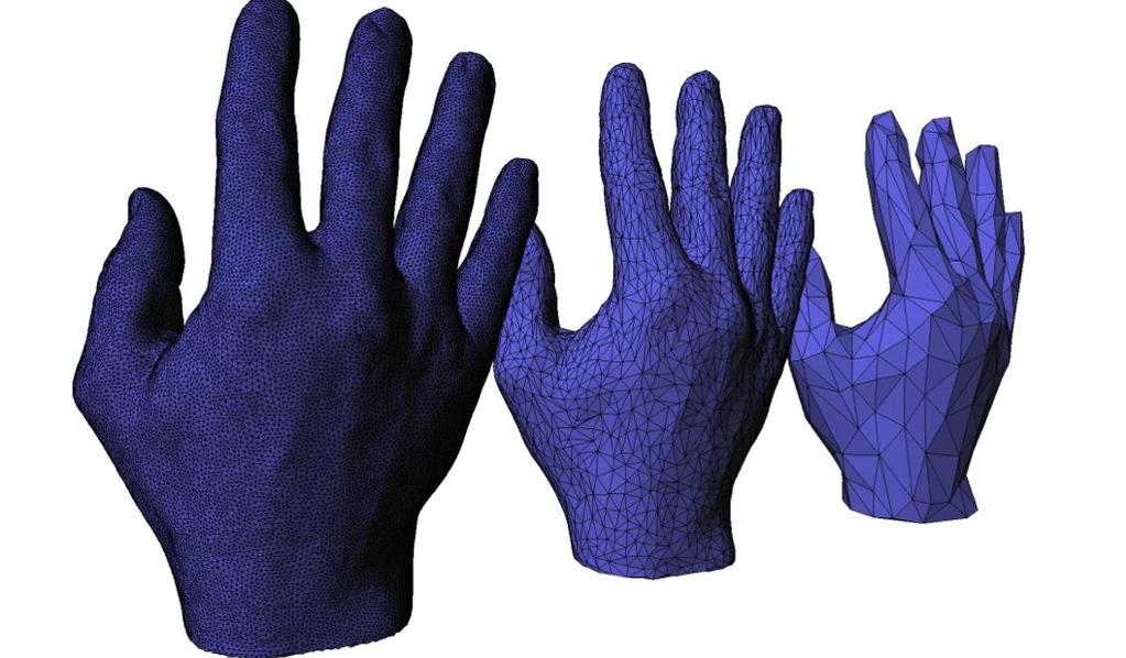
 Mesh Decimation Mark Pauly Applications Oversampled 3D scan data ~150k triangles ~80k triangles Mark Pauly - ETH Zurich 280 Applications Overtessellation: E.g. iso-surface extraction Mark Pauly - ETH Zurich
Building Segmentation and Regularization from Raw Lidar Data INTRODUCTION
 Building Segmentation and Regularization from Raw Lidar Data Aparajithan Sampath Jie Shan Geomatics Engineering School of Civil Engineering Purdue University 550 Stadium Mall Drive West Lafayette, IN 47907-2051
Triangulation and Convex Hull. 8th November 2018
 Triangulation and Convex Hull 8th November 2018 Agenda 1. Triangulation. No book, the slides are the curriculum 2. Finding the convex hull. Textbook, 8.6.2 2 Triangulation and terrain models Here we have
Mesh Repairing and Simplification. Gianpaolo Palma
 Mesh Repairing and Simplification Gianpaolo Palma Mesh Repairing Removal of artifacts from geometric model such that it becomes suitable for further processing Input: a generic 3D model Output: (hopefully)a
Processing 3D Surface Data
 Processing 3D Surface Data Computer Animation and Visualisation Lecture 12 Institute for Perception, Action & Behaviour School of Informatics 3D Surfaces 1 3D surface data... where from? Iso-surfacing
HEURISTIC FILTERING AND 3D FEATURE EXTRACTION FROM LIDAR DATA
 HEURISTIC FILTERING AND 3D FEATURE EXTRACTION FROM LIDAR DATA Abdullatif Alharthy, James Bethel School of Civil Engineering, Purdue University, 1284 Civil Engineering Building, West Lafayette, IN 47907
Geometry Processing & Geometric Queries. Computer Graphics CMU /15-662
 Geometry Processing & Geometric Queries Computer Graphics CMU 15-462/15-662 Last time: Meshes & Manifolds Mathematical description of geometry - simplifying assumption: manifold - for polygon meshes: fans,
coding of various parts showing different features, the possibility of rotation or of hiding covering parts of the object's surface to gain an insight
 Three-Dimensional Object Reconstruction from Layered Spatial Data Michael Dangl and Robert Sablatnig Vienna University of Technology, Institute of Computer Aided Automation, Pattern Recognition and Image
Lecture 4: Digital Elevation Models
 Lecture 4: Digital Elevation Models GEOG413/613 Dr. Anthony Jjumba 1 Digital Terrain Modeling Terms: DEM, DTM, DTEM, DSM, DHM not synonyms. The concepts they illustrate are different Digital Terrain Modeling
GMS 8.2 Tutorial Stratigraphy Modeling TIN Surfaces Introduction to the TIN (triangulated irregular network) surface object
 surface object") v. 8.2 GMS 8.2 Tutorial Introduction to the TIN (triangulated irregular network) surface object Objectives Learn to create, read, alter and manage TIN data from within GMS. Prerequisite Tutorials None
v. 8.2 GMS 8.2 Tutorial Introduction to the TIN (triangulated irregular network) surface object Objectives Learn to create, read, alter and manage TIN data from within GMS. Prerequisite Tutorials None
Drone2Map for ArcGIS: Bring Drone Imagery into ArcGIS. Will
 Drone2Map for ArcGIS: Bring Drone Imagery into ArcGIS Will Meyers @MeyersMaps A New Window on the World Personal Mapping for Micro-Geographies Accurate High Quality Simple Low-Cost Drone2Map for ArcGIS
Tutorial (Intermediate level): Dense Cloud Classification and DTM generation with Agisoft PhotoScan Pro 1.1
: Dense Cloud Classification and DTM generation with Agisoft PhotoScan Pro 1.1") Tutorial (Intermediate level): Dense Cloud Classification and DTM generation with Agisoft PhotoScan Pro 1.1 This tutorial illustrates how to perform dense point cloud classification in manual and automatic
Tutorial (Intermediate level): Dense Cloud Classification and DTM generation with Agisoft PhotoScan Pro 1.1 This tutorial illustrates how to perform dense point cloud classification in manual and automatic
Processing 3D Surface Data
 Processing 3D Surface Data Computer Animation and Visualisation Lecture 17 Institute for Perception, Action & Behaviour School of Informatics 3D Surfaces 1 3D surface data... where from? Iso-surfacing
Iowa Department of Transportation Office of Design. Photogrammetric Mapping Specifications
 Iowa Department of Transportation Office of Design Photogrammetric Mapping Specifications March 2015 1 Purpose of Manual These Specifications for Photogrammetric Mapping define the standards and general
Algorithms for GIS:! Quadtrees
 Algorithms for GIS: Quadtrees Quadtree A data structure that corresponds to a hierarchical subdivision of the plane Start with a square (containing inside input data) Divide into 4 equal squares (quadrants)
Problem Set 6 Solutions
 Introduction to Algorithms October 29, 2001 Massachusetts Institute of Technology 6.046J/18.410J Singapore-MIT Alliance SMA5503 Professors Erik Demaine, Lee Wee Sun, and Charles E. Leiserson Handout 24
VALIDATION OF A NEW 30 METER GROUND SAMPLED GLOBAL DEM USING ICESAT LIDARA ELEVATION REFERENCE DATA
 VALIDATION OF A NEW 30 METER GROUND SAMPLED GLOBAL DEM USING ICESAT LIDARA ELEVATION REFERENCE DATA M. Lorraine Tighe Director, Geospatial Solutions Intermap Session: Photogrammetry & Image Processing
Volume Illumination and Segmentation
 Volume Illumination and Segmentation Computer Animation and Visualisation Lecture 13 Institute for Perception, Action & Behaviour School of Informatics Overview Volume illumination Segmentation Volume
Surface Simplification Using Quadric Error Metrics
 Surface Simplification Using Quadric Error Metrics Authors: Michael Garland & Paul Heckbert Presented by: Niu Xiaozhen Disclaimer: Some slides are modified from original slides, which were designed by
iric Software Changing River Science River2D Tutorials
 iric Software Changing River Science River2D Tutorials iric Software Changing River Science Confluence of the Colorado River, Blue River and Indian Creek, Colorado, USA 1 TUTORIAL 1: RIVER2D STEADY SOLUTION
Understanding Geospatial Data Models
 Understanding Geospatial Data Models 1 A geospatial data model is a formal means of representing spatially referenced information. It is a simplified view of physical entities and a conceptualization of
Automatic Building Extrusion from a TIN model Using LiDAR and Ordnance Survey Landline Data
 Automatic Building Extrusion from a TIN model Using LiDAR and Ordnance Survey Landline Data Rebecca O.C. Tse, Maciej Dakowicz, Christopher Gold and Dave Kidner University of Glamorgan, Treforest, Mid Glamorgan,
Reality Check: Processing LiDAR Data. A story of data, more data and some more data
 Reality Check: Processing LiDAR Data A story of data, more data and some more data Red River of the North Red River of the North Red River of the North Red River of the North Introduction and Background
Modeling & Analyzing Massive Terrain Data Sets (STREAM Project) Pankaj K. Agarwal. Workshop on Algorithms for Modern Massive Data Sets
 Pankaj K. Agarwal. Workshop on Algorithms for Modern Massive Data Sets") Modeling & Analyzing Massive Terrain Data Sets (STREAM Project) Pankaj K. Agarwal Workshop on Algorithms for Modern Massive Data Sets Diverse elevation point data: density, distribution, accuracy Photogrammetry
Modeling & Analyzing Massive Terrain Data Sets (STREAM Project) Pankaj K. Agarwal Workshop on Algorithms for Modern Massive Data Sets Diverse elevation point data: density, distribution, accuracy Photogrammetry
REGISTRATION OF AIRBORNE LASER DATA TO SURFACES GENERATED BY PHOTOGRAMMETRIC MEANS. Y. Postolov, A. Krupnik, K. McIntosh
 REGISTRATION OF AIRBORNE LASER DATA TO SURFACES GENERATED BY PHOTOGRAMMETRIC MEANS Y. Postolov, A. Krupnik, K. McIntosh Department of Civil Engineering, Technion Israel Institute of Technology, Haifa,
Review of Cartographic Data Types and Data Models
 Review of Cartographic Data Types and Data Models GIS Data Models Raster Versus Vector in GIS Analysis Fundamental element used to represent spatial features: Raster: pixel or grid cell. Vector: x,y coordinate
GMS 10.0 Tutorial Stratigraphy Modeling TIN Surfaces Introduction to the TIN (Triangulated Irregular Network) surface object
 surface object") v. 10.0 GMS 10.0 Tutorial Stratigraphy Modeling TIN Surfaces Introduction to the TIN (Triangulated Irregular Network) surface object Objectives Learn to create, read, alter, and manage TIN data from within
v. 10.0 GMS 10.0 Tutorial Stratigraphy Modeling TIN Surfaces Introduction to the TIN (Triangulated Irregular Network) surface object Objectives Learn to create, read, alter, and manage TIN data from within
Import, view, edit, convert, and digitize triangulated irregular networks
 v. 10.1 WMS 10.1 Tutorial Import, view, edit, convert, and digitize triangulated irregular networks Objectives Import survey data in an XYZ format. Digitize elevation points using contour imagery. Edit
Accuracy Assessment of Digital Elevation Model From ASTER Data Using Automatic Stereocorrelation Technique, East Luxor, Egypt
 JAKU: Earth Sci., Vol. 23, No. 1, pp: 23-33 (2012 A.D. / 1433 A.H.) DOI: 10.4197 / Ear. 23-1.2 Accuracy Assessment of Digital Elevation Model From ASTER Data Using Automatic Stereocorrelation Technique,
Topic 5: Raster and Vector Data Models
 Geography 38/42:286 GIS 1 Topic 5: Raster and Vector Data Models Chapters 3 & 4: Chang (Chapter 4: DeMers) 1 The Nature of Geographic Data Most features or phenomena occur as either: discrete entities
Finding Shortest Path on Land Surface
 Finding Shortest Path on Land Surface Lian Liu, Raymond Chi-Wing Wong Hong Kong University of Science and Technology June 14th, 211 Introduction Land Surface Land surfaces are modeled as terrains A terrain
Surface Modeling With TINs
 GMS TUTORIALS The TIN module in GMS is used for general-purpose surface modeling. TIN is an acronym for Triangulated Irregular Network. TINs are formed by connecting a set of xyz points with edges to form
Processing 3D Surface Data
 Processing 3D Surface Data Computer Animation and Visualisation Lecture 15 Institute for Perception, Action & Behaviour School of Informatics 3D Surfaces 1 3D surface data... where from? Iso-surfacing
Improved Visibility Computation on Massive Grid Terrains
 Improved Visibility Computation on Massive Grid Terrains Jeremy Fishman Herman Haverkort Laura Toma Bowdoin College USA Eindhoven University The Netherlands Bowdoin College USA Laura Toma ACM GIS 2009
Applied Cartography and Introduction to GIS GEOG 2017 EL. Lecture-7 Chapters 13 and 14
 Applied Cartography and Introduction to GIS GEOG 2017 EL Lecture-7 Chapters 13 and 14 Data for Terrain Mapping and Analysis DEM (digital elevation model) and TIN (triangulated irregular network) are two
A Method to Create a Single Photon LiDAR based Hydro-flattened DEM
 A Method to Create a Single Photon LiDAR based Hydro-flattened DEM Sagar Deshpande 1 and Alper Yilmaz 2 1 Surveying Engineering, Ferris State University 2 Department of Civil, Environmental, and Geodetic
BUILDING DETECTION AND STRUCTURE LINE EXTRACTION FROM AIRBORNE LIDAR DATA
 BUILDING DETECTION AND STRUCTURE LINE EXTRACTION FROM AIRBORNE LIDAR DATA C. K. Wang a,, P.H. Hsu a, * a Dept. of Geomatics, National Cheng Kung University, No.1, University Road, Tainan 701, Taiwan. China-
AUTOMATIC BUILDING DETECTION FROM LIDAR POINT CLOUD DATA
 AUTOMATIC BUILDING DETECTION FROM LIDAR POINT CLOUD DATA Nima Ekhtari, M.R. Sahebi, M.J. Valadan Zoej, A. Mohammadzadeh Faculty of Geodesy & Geomatics Engineering, K. N. Toosi University of Technology,
AUTOMATIC EXTRACTION OF BUILDING FEATURES FROM TERRESTRIAL LASER SCANNING
 AUTOMATIC EXTRACTION OF BUILDING FEATURES FROM TERRESTRIAL LASER SCANNING Shi Pu and George Vosselman International Institute for Geo-information Science and Earth Observation (ITC) spu@itc.nl, vosselman@itc.nl
Mesh Simplification. Mesh Simplification. Mesh Simplification Goals. Mesh Simplification Motivation. Vertex Clustering. Mesh Simplification Overview
 Mesh Simplification Mesh Simplification Adam Finkelstein Princeton University COS 56, Fall 008 Slides from: Funkhouser Division, Viewpoint, Cohen Mesh Simplification Motivation Interactive visualization
DIGITAL TERRAIN MODELLING. Endre Katona University of Szeged Department of Informatics
 DIGITAL TERRAIN MODELLING Endre Katona University of Szeged Department of Informatics katona@inf.u-szeged.hu The problem: data sources data structures algorithms DTM = Digital Terrain Model Terrain function:
Big Spatial Data Performance With Oracle Database 12c. Daniel Geringer Spatial Solutions Architect
 Big Spatial Data Performance With Oracle Database 12c Daniel Geringer Spatial Solutions Architect Oracle Exadata Database Machine Engineered System 2 What Is the Oracle Exadata Database Machine? Oracle
Lab 12: Sampling and Interpolation
 Lab 12: Sampling and Interpolation What You ll Learn: -Systematic and random sampling -Majority filtering -Stratified sampling -A few basic interpolation methods Videos that show how to copy/paste data
A geoinformatics-based approach to the distribution and processing of integrated LiDAR and imagery data to enhance 3D earth systems research
 A geoinformatics-based approach to the distribution and processing of integrated LiDAR and imagery data to enhance 3D earth systems research Christopher J. Crosby, J Ramón Arrowsmith, Jeffrey Connor, Gilead
Point Cloud Classification
 Point Cloud Classification Introduction VRMesh provides a powerful point cloud classification and feature extraction solution. It automatically classifies vegetation, building roofs, and ground points.
Polyhedral Building Model from Airborne Laser Scanning Data**
 GEOMATICS AND ENVIRONMENTAL ENGINEERING Volume 4 Number 4 2010 Natalia Borowiec* Polyhedral Building Model from Airborne Laser Scanning Data** 1. Introduction Lidar, also known as laser scanning, is a
ENY-C2005 Geoinformation in Environmental Modeling Lecture 4b: Laser scanning
 1 ENY-C2005 Geoinformation in Environmental Modeling Lecture 4b: Laser scanning Petri Rönnholm Aalto University 2 Learning objectives To recognize applications of laser scanning To understand principles
Applications. Oversampled 3D scan data. ~150k triangles ~80k triangles
 Mesh Simplification Applications Oversampled 3D scan data ~150k triangles ~80k triangles 2 Applications Overtessellation: E.g. iso-surface extraction 3 Applications Multi-resolution hierarchies for efficient
Improving wide-area DEMs through data fusion - chances and limits
 Improving wide-area DEMs through data fusion - chances and limits Konrad Schindler Photogrammetry and Remote Sensing, ETH Zürich How to get a DEM for your job? for small projects (or rich people) contract
GIS data input. In the early days of GIS 1980s and early 1990s. We used canned datasets for teaching (from USA)
") GIS data input GIS is the automated : acquisition - input management analysis display of spatial data In the early days of GIS 1980s and early 1990s There were no or little GIS data We used canned datasets
GIS data input GIS is the automated : acquisition - input management analysis display of spatial data In the early days of GIS 1980s and early 1990s There were no or little GIS data We used canned datasets
N.J.P.L.S. An Introduction to LiDAR Concepts and Applications
 N.J.P.L.S. An Introduction to LiDAR Concepts and Applications Presentation Outline LIDAR Data Capture Advantages of Lidar Technology Basics Intensity and Multiple Returns Lidar Accuracy Airborne Laser
The Computational Geometry Algorithms Library. Andreas Fabri GeometryFactory
 The Computational Geometry Algorithms Library Andreas Fabri GeometryFactory Mission Statement Make the large body of geometric algorithms developed in the field of computational geometry available for
Generate Digital Elevation Models Using Laser Altimetry (LIDAR) Data
 Data") Generate Digital Elevation Models Using Laser Altimetry (LIDAR) Data Literature Survey Christopher Weed October 2000 Abstract Laser altimetry (LIDAR) data must be processed to generate a digital elevation
Generate Digital Elevation Models Using Laser Altimetry (LIDAR) Data Literature Survey Christopher Weed October 2000 Abstract Laser altimetry (LIDAR) data must be processed to generate a digital elevation
The 3D Analyst extension extends ArcGIS to support surface modeling and 3- dimensional visualization. 3D Shape Files
 NRM 435 Spring 2016 ArcGIS 3D Analyst Page#1 of 9 0B3D Analyst Extension The 3D Analyst extension extends ArcGIS to support surface modeling and 3- dimensional visualization. 3D Shape Files Analogous to
Map Compilation CHAPTER HISTORY
 CHAPTER 7 Map Compilation 7.1 HISTORY Producing accurate commercial maps from aerial photography began in the 1930s. The technology of stereomapping over the last 70 years has brought vast technological
DIGITAL SURFACE MODELS OF CITY AREAS BY VERY HIGH RESOLUTION SPACE IMAGERY
 DIGITAL SURFACE MODELS OF CITY AREAS BY VERY HIGH RESOLUTION SPACE IMAGERY Jacobsen, K. University of Hannover, Institute of Photogrammetry and Geoinformation, Nienburger Str.1, D30167 Hannover phone +49
Space Robotics. Ioannis Rekleitis
 Space Robotics Ioannis Rekleitis On-Orbit Servicing of Satellites Work done at the Canadian Space Agency Guy Rouleau, Ioannis Rekleitis, Régent L'Archevêque, Eric Martin, Kourosh Parsa, and Erick Dupuis
CPSC 695. Methods for interpolation and analysis of continuing surfaces in GIS Dr. M. Gavrilova
 CPSC 695 Methods for interpolation and analysis of continuing surfaces in GIS Dr. M. Gavrilova Overview Data sampling for continuous surfaces Interpolation methods Global interpolation Local interpolation
Fast unstructured quadrilateral mesh generation
 Fast unstructured quadrilateral mesh generation Andrew Giuliani a, Lilia Krivodonova a, a Department of Applied Mathematics, University of Waterloo Abstract We present a novel approach for the indirect
GENERATING BUILDING OUTLINES FROM TERRESTRIAL LASER SCANNING
 GENERATING BUILDING OUTLINES FROM TERRESTRIAL LASER SCANNING Shi Pu International Institute for Geo-information Science and Earth Observation (ITC), Hengelosestraat 99, P.O. Box 6, 7500 AA Enschede, The
Delaunay Triangulations. Presented by Glenn Eguchi Computational Geometry October 11, 2001
 Delaunay Triangulations Presented by Glenn Eguchi 6.838 Computational Geometry October 11, 2001 Motivation: Terrains Set of data points A R 2 Height ƒ(p) defined at each point p in A How can we most naturally
Leica Systems Overview
 RC30 AERIAL CAMERA SYSTEM Leica Systems Overview The Leica RC30 aerial film camera is the culmination of decades of development, started with Wild's first aerial camera in the 1920s. Beautifully engineered
Light Detection and Ranging (LiDAR) Radiohead House of Cards
 Radiohead House of Cards") Light Detection and Ranging (LiDAR) Radiohead House of Cards http://the-moni-blog.blogspot.com/2009/03/lidar-is-going-mainstream-mtv-baby.html h =? Laser Vision GPS + IMU θ H X a h Types of aerial sensors
Light Detection and Ranging (LiDAR) Radiohead House of Cards http://the-moni-blog.blogspot.com/2009/03/lidar-is-going-mainstream-mtv-baby.html h =? Laser Vision GPS + IMU θ H X a h Types of aerial sensors
USING UNMANNED AERIAL VEHICLE (DRONE/FLYCAM) TECHNOLOGY IN SURVEY WORK OF PORTCOAST
 TECHNOLOGY IN SURVEY WORK OF PORTCOAST") USING UNMANNED AERIAL VEHICLE (DRONE/FLYCAM) TECHNOLOGY IN SURVEY WORK OF PORTCOAST 1. Capturing aerial images by using Drone Taking images by drones is currently applied in many fields especially in topographic
USING UNMANNED AERIAL VEHICLE (DRONE/FLYCAM) TECHNOLOGY IN SURVEY WORK OF PORTCOAST 1. Capturing aerial images by using Drone Taking images by drones is currently applied in many fields especially in topographic
Trimble Geospatial Division Integrated Solutions for Geomatics professions. Volker Zirn Regional Sales Representative
 Trimble Geospatial Division Integrated Solutions for Geomatics professions Volker Zirn Regional Sales Representative 1 Agenda Trimble GeoSpatial Division Airborne System Solutions Trimble Inpho Software
Digital Photogrammetric System. Version 5.3 USER GUIDE. Block adjustment
 Digital Photogrammetric System Version 5.3 USER GUIDE Table of Contents 1. Purpose of the document... 3 2. module... 3 3. Start of work in adjustment module... 4 4. Interface and its elements... 6 4.1.
A METHOD TO PREDICT ACCURACY OF LEAST SQUARES SURFACE MATCHING FOR AIRBORNE LASER SCANNING DATA SETS
 A METHOD TO PREDICT ACCURACY OF LEAST SQUARES SURFACE MATCHING FOR AIRBORNE LASER SCANNING DATA SETS Robert Pâquet School of Engineering, University of Newcastle Callaghan, NSW 238, Australia (rpaquet@mail.newcastle.edu.au)
EVALUATION OF WORLDVIEW-1 STEREO SCENES AND RELATED 3D PRODUCTS
 EVALUATION OF WORLDVIEW-1 STEREO SCENES AND RELATED 3D PRODUCTS Daniela POLI, Kirsten WOLFF, Armin GRUEN Swiss Federal Institute of Technology Institute of Geodesy and Photogrammetry Wolfgang-Pauli-Strasse
Möbius Transformations in Scientific Computing. David Eppstein
 Möbius Transformations in Scientific Computing David Eppstein Univ. of California, Irvine School of Information and Computer Science (including joint work with Marshall Bern from WADS 01 and SODA 03) Outline
Introduction to GIS 2011
 Introduction to GIS 2011 Digital Elevation Models CREATING A TIN SURFACE FROM CONTOUR LINES 1. Start ArcCatalog from either Desktop or Start Menu. 2. In ArcCatalog, create a new folder dem under your c:\introgis_2011
NATIONWIDE POINT CLOUDS AND 3D GEO- INFORMATION: CREATION AND MAINTENANCE GEORGE VOSSELMAN
 NATIONWIDE POINT CLOUDS AND 3D GEO- INFORMATION: CREATION AND MAINTENANCE GEORGE VOSSELMAN OVERVIEW National point clouds Airborne laser scanning in the Netherlands Quality control Developments in lidar
Computing Visibility on Terrains in External Memory
 Computing Visibility on Terrains in External Memory Herman Haverkort Laura Toma Yi Zhuang TU. Eindhoven Netherlands Bowdoin College USA Visibility Problem: visibility map (viewshed) of v terrain T arbitrary
GIS Data Collection. This chapter reviews the main methods of GIS data capture and transfer and introduces key practical management issues.
 9 GIS Data Collection OVERVIEW This chapter reviews the main methods of GIS data capture and transfer and introduces key practical management issues. It distinguishes between primary (direct measurement)
Geometry of Aerial photogrammetry. Panu Srestasathiern, PhD. Researcher Geo-Informatics and Space Technology Development Agency (Public Organization)
") Geometry of Aerial photogrammetry Panu Srestasathiern, PhD. Researcher Geo-Informatics and Space Technology Development Agency (Public Organization) Image formation - Recap The geometry of imaging system
Geometry of Aerial photogrammetry Panu Srestasathiern, PhD. Researcher Geo-Informatics and Space Technology Development Agency (Public Organization) Image formation - Recap The geometry of imaging system
Maps as Numbers: Data Models
 Maps as Numbers: Data Models vertices E Reality S E S arcs S E Conceptual Models nodes E Logical Models S Start node E End node S Physical Models 1 The Task An accurate, registered, digital map that can
Analysis Ready Data For Land (CARD4L-ST)
") Analysis Ready Data For Land Product Family Specification Surface Temperature (CARD4L-ST) Document status For Adoption as: Product Family Specification, Surface Temperature This Specification should next
Analysis Ready Data For Land Product Family Specification Surface Temperature (CARD4L-ST) Document status For Adoption as: Product Family Specification, Surface Temperature This Specification should next
Copyright The McGraw-Hill Companies, Inc. Permission required for reproduction or display.
 Chapter 13. TERRAIN MAPPING AND ANALYSIS 13.1 Data for Terrain Mapping and Analysis 13.1.1 DEM 13.1.2 TIN Box 13.1 Terrain Data Format 13.2 Terrain Mapping 13.2.1 Contouring 13.2.2 Vertical Profiling 13.2.3
Rectification Algorithm for Linear Pushbroom Image of UAV
 Rectification Algorithm for Linear Pushbroom Image of UAV Ruoming SHI and Ling ZHU INTRODUCTION In recent years, unmanned aerial vehicle (UAV) has become a strong supplement and an important complement
GY461 GIS 1: Environmental Campus Topography Project with ArcGIS 9.x
 I. Introduction GY461 GIS 1: Environmental In this project you will use data from a topographic survey of the USA campus to generate 2 separate maps: 1. A color-coded 2-dimensional topographic contour
SPATIAL DATA MODELS Introduction to GIS Winter 2015
 SPATIAL DATA MODELS Introduction to GIS Winter 2015 GIS Data Organization The basics Data can be organized in a variety of ways Spatial location, content (attributes), frequency of use Come up with a system