GIS-T 2016 PennDOT s Path to Survey123 for Field Collection
|
|
|
- Emily Welch
- 6 years ago
- Views:
Transcription


1 GIS-T 2016 PennDOT s Path to Survey123 for Field Collection Jeff Fennimore, Spatial Infrastructure Manager Pennsylvania DOT Nate Reck, Gov t Solutions Director GeoDecisions

2 Topics/Discussions Asset Condition Assessment - Today Desktop Web Device Why Replace Existing Solution? Technology Assessment Why use Survey123? Findings during the Pilot Portal Proposed Solution Path Forward Server Online Content and Services
3 Asset Condition Assessment - Today
 Survey System was developed in Microsoft")

4 Current Pavement and Asset Survey System Systematic Technique to Analyze and Manage Pennsylvania's pavements (STAMPP) Survey System was developed in Microsoft Access person team per engineering district completes manual distress surveys of the following assets: - Drainage Conditions - Unpaved Roads - Guide Rails - Shoulder
 Surveys are")

5 Current Pavement and Asset Survey System Teams are temporary Engineering, Scientific, and Technical Interns (ESTI) Surveys are performed during the summer months Asset and survey data is retrieved and uploaded via flat files to/from PennDOT s Roadway Management System (RMS)
6 Why Replace Existing System?

7 Why Replace Existing Pavement Survey Solution? Microsoft Access form code is outdated and difficult to update Does not support mobile devices Does not support mapping of assets Upload mechanism is difficult and has no validation Database corruption in the field Would like the forms to be more user friendly Bulky equipment in the vehicle And so on.
8 Technology Assessment Legacy vs Collector vs Survey123 vs
9 Decisions, Decisions, Decisions Timeline 3-4 Years Ago Esri built the Local Roads Collector for PennDOT - ArcGIS Mobile on Rugged tablets running Windows - Works, but hard to maintain. Will run out of support. 8 Months Ago Review of Collector and Its Capabilities - Looked promising, easy to use, light-weight 3 Months Ago Worked with Esri to see if Collector could be altered for PennDOT s workflow needs - No, Collector no longer an option bummer Today Survey123
10 Why Survey123?
11 Why Survey123? Hard requirements for PennDOT: - Editing of Existing Data - Conditional Logic Support - disabling a dropdown(control) based on selecting a value from another control GeoDecisions was invited to participate in the Survey123 Holistic Event - Early March Provide support in customizing Survey123 to edit existing survey data Survey123 Technology - Survey123 is an AppStudio application - Update the Survey123 application by using QML and JavaScript programming languages
12 Why Survey123? Contains out of the box templates or you can expand on them and build your own Easy to deploy them to a device Similar thought process to that of AGOL templates Full support and integration of the Esri Platform AGOL or Portal Offline Editing and Syncing Desktop Web Device Portal Server Online Content and Services
13 Proposed Solution
14 Proposed Survey123 Architecture ArcGIS Server Enterprise GIS/RMS Web Service Feature Service AGOL Survey123


15 Proposed Survey123 Solution Download Surveys and Data by County


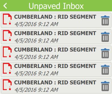
16 Sample Forms Customizable, conditional questions and steps Set to work on a phone or a tablet PennDOT looking to supply ipads for this work to the interns in the field Simple, easy to use Work offline sync later


17 Submit Surveys to Feature Service
18 Path Forward
19 Where Do We Go From Here? Pilot for a single district to be done and ready for June use in the field One member of the team will use the old method while the other member(s) use the new pilot method. Used to benchmark the data collected and accuracy. After this collection season is over, tweak application and roll out statewide for next year Possible enhancements: Map integration and routing of surveys More LRS data on the forms for reference???
20 Questions? Thank You! Jeff Fennimore, Spatial Infrastructure Manager Pennsylvania DOT Nate Reck, Gov t Solutions Director GeoDecisions nreck@geodecisions.com
Customizing Survey123 Customization & Submission URL. Kelly Fisher, Project/GIS Manager GeoDecisions
 Customizing Survey123 Customization & Submission URL Kelly Fisher, Project/GIS Manager GeoDecisions Topics/Discussions Desktop Web Device PennDOT STAMPP Review Current STAMPP Application Why Change Current
Developing Cross-Platform Native Apps with AppStudio for ArcGIS. Jo Fraley Erwin Soekianto
 Developing Cross-Platform Native Apps with AppStudio for ArcGIS Jo Fraley Erwin Soekianto AppStudio for ArcGIS ios Android Linux 1App Windows Mac What is AppStudio for ArcGIS? A suite of productivity tools
KEEPING DATA ACCURATE WITH THE DUSA APPLICATION
 KEEPING DATA ACCURATE WITH THE DUSA APPLICATION Jenn Sylvester, Mapping Branch Team Lead Adam Breznicky, Mapping Branch Web Master Transportation Planning & Programming Division (TPP) ESRI International
Using Collector for ArcGIS and Operations Dashboard for ArcGIS. Mike Sweeney Esri-Charlotte
 Using Collector for ArcGIS and Operations Dashboard for ArcGIS Mike Sweeney Esri-Charlotte Agenda The ArcGIS Platform Desktop Web Device Portal Cloud Server Online Content and Services On-Premises Available
Navigator for ArcGIS Presented by
 Navigator for ArcGIS Presented by Navigator for ArcGIS Get your field workforce where it needs to be Custom data (search, route, display) Fully integrated with other apps Advanced vehicle travel modes
An Introduction to GIS for developers
 An Introduction to GIS for developers Part 4: GIS Sharing Canserina Kurnia & Tom Shippee Agenda Web GIS ArcGIS Online Cloud-based ArcGIS Server ArcGIS Server on-premises ArcGIS a complete platform discover,
GRID. Geospatial Roadway Inventory Database. Michael Chamberlain, TxDOT. TPP Planning Conference Houston, TX
 GRID Geospatial Roadway Inventory Database Michael Chamberlain, TxDOT TPP Planning Conference - 2016 Houston, TX Topics 1 2 3 4 5 6 7 8 History (pre GRID) 3-6 GIS Resources 7-8 The Project 9-11 Assets
North Carolina Department of Transportation MSAU Mobile Data Collection
 GIS-T Conference April 2016 North Carolina Department of MSAU Mobile Data Collection Stephen T. Shepard NCDOT-Arcadis U.S. Stephen T. Shepard 2 Management Systems Assessment Unit Assisting and aiding all
ArcGIS Runtime SDK for Qt: Building Apps. Koushik Hajra and Lucas Danzinger
 ArcGIS Runtime SDK for Qt: Building Apps Koushik Hajra and Lucas Danzinger Cross-platform apps Agenda for today Intro to Qt Framework and ArcGIS Runtime SDK for Qt App design patterns with this SDK SDK
LOCAL STREETS AND THE ARNOLD INITIATIVE
 LOCAL STREETS AND THE ARNOLD INITIATIVE Jenn Sylvester, Mapping Branch Team Lead Transportation Planning & Programming Division (TPP) GIS-T Symposium Des Moines, IA Key Terms 1 2 3 ARNOLD FC Streets Local
Collector for ArcGIS. Paul Barker Bert Yagrich
 Collector for ArcGIS Paul Barker Bert Yagrich Agenda What are we going to cover today? ArcGIS as a platform for data collection Device strategy and field data collection Collector for ArcGIS an overview
Collector for ArcGIS: What s New. Chris LeSueur & James Tedrick
 Collector for ArcGIS: What s New Chris LeSueur & James Tedrick Outline Product overview Workflows Preparing data for Collector for ArcGIS What s new in Collector for ArcGIS v18.1.0 (Aurora) Advanced topics
Collector for ArcGIS Preparing for and Working in a disconnected environment
 Collector for ArcGIS Preparing for and Working in a disconnected environment Peter Nasuti, Dan Moore, Nicholas Davis Topics Covered With demonstrations throughout each step 1) What is Collector? What can
ArcGIS Enterprise: Portal Administration BILL MAJOR CRAIG CLEVELAND
 ArcGIS Enterprise: Portal Administration BILL MAJOR CRAIG CLEVELAND Agenda Welcome & Introduction to ArcGIS Enterprise Portal for ArcGIS - Basic Configuration - Advanced Configuration - Deploying Apps
Architecting the ArcGIS Platform: Best Practices. Raymond Bunn, GISP, PMP Esri Patterns & Practices Solution Architect
 Architecting the ArcGIS Platform: Best Practices Raymond Bunn, GISP, PMP Esri Patterns & Practices Solution Architect E M E R A L D S A P P H I R E T H A N K Y O U T O O UR SPONSORS Please Take Our Survey
Citizen Reporter App for DuPage County. Illinois GIS Association Annual Conference Ryan Nosek, GIS Analyst, DuPage County October 18 th, 2016
 Citizen Reporter App for DuPage County Illinois GIS Association Annual Conference Ryan Nosek, GIS Analyst, DuPage County October 18 th, 2016 Presentation Topics Crowdsourcing Apps from Esri Crowdsource
ArcGIS App Strategies Ben
 ArcGIS App Strategies Ben Ramseth Bramseth@esri.com @esrimapninja DevSummit DC February 26, 2016 Washington, DC Session overview Topics Understanding ArcGIS s Defining strategies for building s Applying
ArcPad An Introduction
 2013 Esri International User Conference July 8 12, 2013 San Diego, California Technical Workshop ArcPad An Introduction Chris LeSeuer, Marika Vertzonis, Hannah Ferrier Esri UC2013. Technical Workshop.
Deploying ArcGIS at an Electric Utility. Previn Wong Patrick Demer Patrick Dolan
 Deploying ArcGIS at an Electric Utility Previn Wong Patrick Demer Patrick Dolan Deploying ArcGIS at a Electric Utility Start from scratch Start with a data model Start with business problem - Use Solutions
ArcGIS Data Reviewer: Ensuring Accurate and Complete Data to Meet Your Mission. John Grammer Kevin Pusey
 ArcGIS Data Reviewer: Ensuring Accurate and Complete Data to Meet Your Mission John Grammer Kevin Pusey Workshop agenda Defining data quality What is ArcGIS Data Reviewer? Automated review Semi-automated
ArcGIS for Developers: An Introduction. Moey Min Ken
 ArcGIS for Developers: An Introduction Moey Min Ken AGENDA Is development right for me? Building Apps on the ArcGIS platform Rest API & Web API Native SDKs Configurable Apps and Builders Extending the
ArcGIS Apps for the Mobile Worker. Presented by: Sue Enyedy-Goldner
 ArcGIS Apps for the Mobile Worker Presented by: Sue Enyedy-Goldner Agenda 1. Overview of ArcGIS apps for mobile workflows 2. Considerations for configuring the best app for your workflow 3. Configuration
ArcGIS Apps for the Mobile Worker. Presented by: Sue Enyedy-Goldner
 ArcGIS Apps for the Mobile Worker Presented by: Sue Enyedy-Goldner Agenda 1. Overview of ArcGIS apps for mobile workflows 2. Considerations for configuring the best app for your workflow 3. Configuration
AASHTO Transportation Safety Information Management System (TSIMS) Prototype Demonstration Briefing
 Prototype Demonstration Briefing") AASHTO Transportation Safety Information Management System (TSIMS) Prototype Demonstration Briefing Scope of TSIMS Remote Crash Database TSIMS Crash Data Internet Capture Subsystem Forms-based Data Entry
AASHTO Transportation Safety Information Management System (TSIMS) Prototype Demonstration Briefing Scope of TSIMS Remote Crash Database TSIMS Crash Data Internet Capture Subsystem Forms-based Data Entry
ArcGIS Runtime SDKs Building Offline Apps. Nick Furness
 ArcGIS Runtime SDKs Building Offline Apps Nick Furness Agenda The basics - Considerations - Building blocks - Service types New! Offline maps New! Preplanned workflow What we are covering and what not
Collector for ArcGIS. Paul Barker and Russ Roberts
 Collector for ArcGIS Paul Barker and Russ Roberts Agenda A quick look at the mobile landscape ArcGIS the platform Looking at the problem What is Collector for ArcGIS Demo Quick tips What s next? Questions
Getting Started with ArcGIS Runtime SDK for Qt. Thomas Dunn & Nandini Rao
 Getting Started with ArcGIS Runtime SDK for Qt Thomas Dunn & Nandini Rao Agenda Getting Started Creating the Map Geocoding and Routing Geoprocessing Message Processing Work Offline The Next Release ArcGIS
Using the ESRI Collector App: A User s Manual
 Using the ESRI Collector App: A User s Manual Produced by Jim Groot and Carrie Thomas Edited by Erik Cammeraat, Harry Seijmonsbergen and Thijs de Boer Summer 2017 1 Contents Introduction... 3 Getting Started...
ArcGIS Apps: An Overview
 Federal GIS Conference February 9 10, 2015 Washington, DC ArcGIS Apps: An Overview Chris LeSueur Product Manager Marisa Cowdry NCMEC Agenda Apps Introduction Rugged Device Apps Essential Mapping Apps -
LRS Maintenance at Idaho Transportation Department
 LRS Maintenance at Idaho Transportation Department Phil Hardy LRS Product Manager Brian Emmen GIS Manager Idaho Transportation Dept. LRS History at ITD Mainframe-based attribute system (MACS) Functional
ArcGIS Enterprise: Sharing Imagery. Zikang Zhou Imagery and Raster team
 ArcGIS Enterprise: Sharing Imagery Zikang Zhou Imagery and Raster team ArcGIS Enterprise: Sharing Imagery PowerPoint slides will be available online. Send me an E-mail if you need it faster: zzhou@esri.com
ArcGIS Enterprise Extending Services. Bill Major
 ArcGIS Enterprise Extending Services Bill Major Agenda Introduction Geoprocessing tools Server Object Extensions Server Object Interceptors Demo APPS Desktop Web Device SHARING SERVICES Portal API DATA
Introducing Survey123 For ArcGIS
 FedGIS Conference February 24 25, 2016 Washington, DC Introducing Survey123 For ArcGIS James Tedrick, Esri Jawameer Kakakhan, UN OCHA Configurable Solutions That Work Together Vizualize Collect Navigator
Understanding ArcGIS Online - why organizations should embrace the cloud now
 Understanding ArcGIS Online - why organizations should embrace the cloud now Presented to: GeoAlberta - workshop Presented by: David Parry September 25, 2013 Today s Agenda Introduction - Why the Cloud?
STATEWIDE CENTERLINE INITIATIVE EDITED: MAY 17, 2013
 STATEWIDE CENTERLINE INITIATIVE EDITED: MAY 17, 2013 WHAT IS THE CENTERLINE INITIATIVE? The Centerline Initiative is a joint effort between the Minnesota Department of Transportation (MnDOT), Minnesota
Configuring ArcGIS Enterprise in Disconnected Environments
 Configuring ArcGIS Enterprise in Disconnected Environments BILL MAJOR Disconnected Environments Not everyone has internet access? How many of you run disconnected today, i.e. no internet access? Many customers
Web AppBuilder Presented by
 Web AppBuilder Presented by Agenda Product overview Web AppBuilder for ArcGIS tour What s new in the ArcGIS Online June 2016 update Customization Community and Resources Summary The ArcGIS Platform enables
ArcGIS Online: Three-and-a-Half Ways to Create Tile Layers. Eric Anderson & Adam Eversole Esri Support Services
 ArcGIS Online: Three-and-a-Half Ways to Create Tile Layers Eric Anderson & Adam Eversole Esri Support Services Agenda 1. Introduction 2. What is a tile layer 3. How a tile layer works 4. The 3 ½ ways to
Collector for ArcGIS
 Collector for ArcGIS Field GIS Taking GIS Beyond the Office Collecting Data Reporting Observations Managing Work Connecting the Field with the Enterprise Field Mobility Solutions Improve accuracy and currency
Developing Qt Apps with the Runtime SDK
 Developing Qt Apps with the Runtime SDK Thomas Dunn and Michael Tims Esri UC 2014 Technical Workshop Agenda Getting Started Creating the Map Geocoding and Routing Geoprocessing Message Processing Work
ESRI Mobile GIS Solutions Overview. Justin Fan
 ESRI Mobile GIS Solutions Overview Justin Fan Agenda Mobile GIS challenges ESRI Mobile GIS solutions ArcPad ArcGIS Mobile ArcGIS Engine Selecting a mobile GIS solution Q & A Objective To help you select
Working with Feature Layers. Russell Brennan Gary MacDougall
 Working with Feature Layers Russell Brennan Gary MacDougall Working with Feature Layers Session will focus on feature access and editing Highlight new features added over the last few releases Agenda Introduction
Technology & GIS During Sandy Recovery. Outline
 Technology & GIS During Sandy Recovery Picture provided by US Army Corps of Engineers Mayor Michael R. Bloomberg Commissioner Janette Sadik-Khan New York City Department of Transportation 07/18/13 Outline
Introduction to Web AppBuilder for ArcGIS: JavaScript Apps Made Easy
 Introduction to Web AppBuilder for ArcGIS: JavaScript Apps Made Easy Jianxia Song & Derek Law July 21, 2015 Agenda Product overview Web AppBuilder for ArcGIS tour What s New July 2015 ArcGIS Online update
Navigator for ArcGIS an Introduction
 Esri Developer Summit March 8 11, 2016 Palm Springs, CA Navigator for ArcGIS an Introduction Scott Sandusky Navigator for ArcGIS Navigator for ArcGIS is a mobile app that gets your field workforce where
Ensuring the Deer and Antelope Play Free
 IPMA Professional Development Seminar Ensuring the Deer and Antelope Play Free A success story using Survey123 ROB SMITH DATABASE WIZARD WSDOT ENVIRONMENTAL SERVICES OFFICE JESSE ALTON GIS & DATA MANAGER
ArcGIS Enterprise Security: An Introduction. Gregory Ponto & Jeff Smith
 ArcGIS Enterprise Security: An Introduction Gregory Ponto & Jeff Smith Agenda ArcGIS Enterprise Security Model Portal for ArcGIS Authentication Authorization Building the Enterprise Encryption Collaboration
2/27/15. Starts at 10am. Use Chat box to ask Questions
 Toggle Fullscreen mode with this button above 2/27/15 Use Chat box to ask Questions Audio also available via phone: 866-823-7699 For assistance, call: 814-865-5355 Starts at 10am http://metrocount.com
A Developers Guide To Mobile GIS. David Cardella, Jeff Shaner
 A Developers Guide To Mobile GIS David Cardella, Jeff Shaner What is mobile GIS? Extends the reach of ArcGIS from the office to the field With a mobile GIS solution you can: - Carry your maps to the field
City of San Antonio Utilizing Advanced Technologies for Stormwater System Mapping and Condition Assessments
 City of San Antonio Utilizing Advanced Technologies for Stormwater System Mapping and Condition Assessments Prepared for: 2017 ESRI Users Conference Prepared by Noelle Gaspard, PE, GISP, CFM July 12,2017
ArcGIS Runtime: Building Cross-Platform Apps. Rex Hansen Mark Baird Michael Tims Morten Nielsen
 ArcGIS Runtime: Building Cross-Platform Apps Rex Hansen Mark Baird Michael Tims Morten Nielsen Agenda Cross-platform review ArcGIS Runtime cross-platform options - Java - Qt -.NET ArcGIS Runtime: Building
Highway Advertising Sign Mobile Data Capture and Permit Management GIS OAPRT Mobile and OAPRT Web-based Applications
 Highway Advertising Sign Mobile Data Capture and Permit Management GIS OAPRT Mobile and OAPRT Web-based Applications Client Minnesota Department of Transportation (Mn/DOT) St. Paul, Minnesota Project In
Creating a 3D GIS Program in the City of Cambridge
 Creating a 3D GIS Program in the City of Cambridge JEFF AMERO CITY OF CAMBRIDGE ESRI User Conference, San Diego, CA July 13, 2017 Presentation Overview -Bringing 3D GIS to Cambridge -Components of the
Mobile Mapping Solutions for Ohio s Integrated Transportation Network. Brian Foster, CP
 Mobile Mapping Solutions for Ohio s Integrated Transportation Network Brian Foster, CP About Woolpert Established in 1911 Over 600 Professionals 25 Offices $12,000,000 invested in new technology in last
New York State Watercraft Inspection Steward and Decontamination Station Programs. Great Lakes Panel Meeting June 27, 2018
 1 New York State Watercraft Inspection Steward and Decontamination Station Programs Great Lakes Panel Meeting June 27, 2018 2 Goal NYS AIS Management Plan: Stop the introduction and spread of aquatic invasive
Does Your Data Have Harmony. Dan Stone
 Does Your Data Have Harmony Dan Stone Agenda Introduction Configuration Patterns Implementation Approaches Your Feedback ArcGIS for Local Government Esri solutions for local government customers Series
ArcGIS Apps for the Mobile Worker. Presented by: Sue Enyedy-Goldner
 ArcGIS Apps for the Mobile Worker Presented by: Sue Enyedy-Goldner Agenda 1. Overview of ArcGIS apps for mobile workflows 2. Considerations for configuring the best app for your workflow 3. Configuration
ArcGIS Online. The Road Ahead Geoff Mortson
 ArcGIS Online The Road Ahead Geoff Mortson gmortson@esricanada.com ArcGIS Online Easily create and share maps Delivered as intelligent maps Access on virtually any device anyone, anywhere Compliments and
Web App Builder: Code-free Development. Adam Ziegler, Esri-Northeast, Local Government Team
 Web App Builder: Code-free Development Adam Ziegler, aziegler@esri.com Esri-Northeast, Local Government Team Agenda Product overview Web AppBuilder for ArcGIS tour Adding Custom Widgets Community and Resources
Building Applications with the ArcGIS Runtime SDK for WPF
 Esri International User Conference San Diego, California Technical Workshops 24 th July 2012 Building Applications with the ArcGIS Runtime SDK for WPF Euan Cameron & Paul Pilkington Agenda Introduction
Survey123 for ArcGIS: An Introduction. James Tedrick Erin Densford
 Survey123 for ArcGIS: An Introduction James Tedrick Erin Densford Smart Forms for ArcGIS Easily convert paper forms into Digital Smart ArcGIS Forms Why Smart Forms in ArcGIS? Reduce Errors During Data
What is new in ArcGIS 10.2.x for Server
 What is new in ArcGIS 10.2.x for Server Ismael Chivite, Greg Tieman Esri UC 2014 Technical Workshop Map cache status Windows and Linux friendly Simplified architecture 64 bit Performance Improvements Administration
Asset Management for CSDS and BMP Infrastructure
 Asset Management for CSDS and BMP Infrastructure Ramzi K. Bannura GISP, MBA GeoSpatial Programs Manager Bureau of Highways Anne Arundel County Maryland 2662 Riva Road; Suite 123 Annapolis, MD 21401 (410)222-4163
2016 New Zealand Spatial Excellence Awards: Category: Award for Technical Excellence - Award Application
 Lessons learned from one of New Zealand s most challenging civil engineering projects: rebuilding the earthquake damaged pipes, roads, bridges and retaining walls in the city of Christchurch 2011-2016.
Survey123 Deep Dive. Presented by: Sue Enyedy-Goldner Fall 2018
 Survey123 Deep Dive Presented by: Sue Enyedy-Goldner Fall 2018 Today s Agenda 1. Overview of Survey123 - getting stared with Web Designer 2. Create smarter surveys - using Survey123 Connect 3. Examine
ArcGIS for Mobile Devices: An Overview. Jeff Shaner Bonnie Stayer
 ArcGIS for Mobile Devices: An Overview Jeff Shaner Bonnie Stayer Agenda Esri Positioning and Key Benefits Your Mobility Strategy Q & A Positioning and Benefits Key Benefits of Mobile Solutions Leverage
Paul DiGiacobbe, PE, DBIA MASER Consulting Ryan Putt, PE HNTB Corporation Kevin Poad, PE HNTB Corporation
 Paul DiGiacobbe, PE, DBIA MASER Consulting Ryan Putt, PE HNTB Corporation Kevin Poad, PE HNTB Corporation Introduction Using LiDAR to Manage Safety Assets SPEED the acquisition phase is being performed
Hosted Feature Service to Custom Report with Data Driven Pages
 Hosted Feature Service to Custom Report with Data Driven Pages JOANNA NISHIMURA GIS ANALYST jnishimura@interwestgrp.com Problem Client interested in using Survey123 but solution needed to output survey
City of Mobile GIS Web Mapping Applications: New Technology, New Expectations
 City of Mobile GIS Web Mapping Applications: New Technology, New Expectations Presenters : Scott Kearney GIS Manager Patricia Creamer GIS Analyst Background: GIS Department Developing web mapping apps
Sharing Web Layers and Services in the ArcGIS Platform. Melanie Summers and Ty Fitzpatrick
 Sharing Web Layers and Services in the Platform Melanie Summers and Ty Fitzpatrick Agenda Platform overview - Web GIS information model - Two deployment options Pro Sharing - User experience and workflows
System Design and Tuning
 System Design and Tuning Lucity 2018 R2 Overview Lucity Specifications 2018 R2 Web Identity Server Document Server File Server Database Server Service Server Citizen Portal Mobile Server Android Devices
Planning for Your Professional GIS Development: Esri Technical. Renee Schreibman Regional Training Consultant
 Planning for Your Professional GIS Development: Esri Technical Certification Renee Schreibman Regional Training Consultant Session Overview Benefits of Training Budgeting/Purchasing Training Delivery Methods
Enterprise Geographic Information Servers. Dr David Maguire Director of Products Kevin Daugherty ESRI
 Enterprise Geographic Information Servers Dr David Maguire Director of Products Kevin Daugherty ESRI Outline Introduction Enterprise GIS vs. Spatially-enabled IS Architectures for building Enterprise GIS
Building Great Situational Awareness Apps Using ArcGIS Developer Tools. Kerry Robinson Eric Bader Thomas Solow
 Building Great Situational Awareness Apps Using ArcGIS Developer Tools Kerry Robinson Eric Bader Thomas Solow Agenda Situational Awareness in ArcGIS Developing apps in connected environments - ArcGIS Enterprise
Web-Distributed, Geo-temporal, Integrated Information Systems The Apache County Experience
 Web-Distributed, Geo-temporal, Integrated Information Systems The Apache County Experience Josephine R. Wyman Chief Executive Paphun Wangmutitakul Principal Programmer Max M. Wyman, Ph.D. Principal Scientist
INVESTOR PORTAL CLIENT GUIDE
 INVESTOR PORTAL CLIENT GUIDE 2018 CONTENTS 1. An introduction to Investor Portal 3 2. Logging in to Investor Portal 3 3. Viewing your portfolio 3 3.1 Dashboard 3 3.2 Accounts 4 3.3 Holdings 4 3.4 Performance
PI Integrator for Esri ArcGIS: A Journey Through Time and Space
 PI Integrator for Esri ArcGIS: A Journey Through Time and Space Presented by Vadim Fedorov, Sr. Systems Engineer Elizabeth Ammarell, Product Manager The Past: Where We Started 2 Two companies, one vision
Pathway Services Inc. Technology Presentation
 Lauren Tran Budapest, Hungary 2015 Largest Vendor of this kind in the U.S. Largest Fleet of Full Service Vehicles in U.S. (26) More Than 5 Million Kilometers Collected Using Our Equipment Nearly 50% of
Introduction to ArcGIS Online and Story Maps
 Introduction to ArcGIS Online and Story Maps Presented by the University of Connecticut s Center for Land Use Education and Research (CLEAR) CLEAR 1 Welcome! Instructor Introductions Course logistics Student
Real time Mobile GIS For Transportation
 Real time Mobile GIS For Transportation MATT VON WAHLDE GEONETICS, INC BOSTON, MA Boston, MA Introduction Matt von Wahlde Chief Operating Officer, Geonetics, Inc. Custom Application Development Services
New Jersey Statewide Transportation Data Model. Mark Gulbinsky November 5, 2004 NJDOT
 Statewide Transportation Data Model Mark Gulbinsky November 5, 2004 NJDOT Presenter Mark Gulbinsky NJDOT BIMTP/GIS Unit Mark.Gulbinsky@dot.state.nj.us 609-530-3097 Statewide Transportation Data Models
ArcGIS Runtime SDK for ios and macos: Building Apps. Suganya Baskaran, Gagandeep Singh
 ArcGIS Runtime SDK for ios and macos: Building Apps Suganya Baskaran, Gagandeep Singh Get Started Core Components Agenda - Display Map Content - Search for Content - Perform Analysis - Edit Content Summary
Founded in 1979 as an engineering consulting services organization Corporate offices located in Pittsburgh, Pennsylvania
 Founded in 1979 as an engineering consulting services organization Corporate offices located in Pittsburgh, Pennsylvania Entered CADD arena in 1984 Computervision and Intergraph Mainframes 31 Years of
Building Java Apps with ArcGIS Runtime SDK
 Building Java Apps with ArcGIS Runtime SDK Mark Baird and Vijay Gandhi A step back in time Map making 50 years ago - http://www.nls.uk/exhibitions/bartholomew/maps-engraver - http://www.nls.uk/exhibitions/bartholomew/printing
Forest Technology: Apps, Maps, Phones, and Drones
 Forest Technology: Apps, Maps, Phones, and Drones TFA Annual Meeting 2018 Darian Yawn LandMark Spatial Solutions, LLC Forest Technology Company Sales, Training, Support GIS Consulting, Repairs, Rentals
PA Homeland Security/Public Safety Geospatial Portal Applications
 PA Homeland Security/Public Safety Geospatial Portal Applications ESRI FedUC 2006 Washington, DC Jim Knudson (jknudson@state.pa.us) Stacey White (stwhite@state.pa.us) GTO Homeland Security Priorities Understanding
Meeting Date: October 24, 2018
 Town of Moraga Ordinances, Resolutions, Requests for Action Agenda Item 11. A. 1 2 3 4 5 6 7 8 9 10 11 12 13 14 15 16 17 18 21 22 23 24 32 37 38 Meeting Date: October 24, 2018 TOWN OF MORAGA STAFF REPORT_
ArcGIS Server and Portal for ArcGIS An Introduction to Security
 ArcGIS Server and Portal for ArcGIS An Introduction to Security Jeff Smith & Derek Law July 21, 2015 Agenda Strongly Recommend: Knowledge of ArcGIS Server and Portal for ArcGIS Security in the context
MObile. end. complexity
 Go MObile end complexity overview Today s average user has two or more mobile devices connected to the network. This mobile mindset is transforming business processes and requires strategic planning to
ORACLE SPATIAL AT IOWA DOT. Eric Abrams Iowa Department of Transportation GIS-T 2012
 ORACLE SPATIAL AT IOWA DOT Eric Abrams Iowa Department of Transportation GIS-T 2012 HISTORY High and Low Roads to GIS Development Bijan Azad - Beirut, Lebanon 1997 1998 combine business data Road data
ArcPad An Introduction
 ArcPad An Introduction Chris LeSueur, Marika Vertzonis, Hannah Ferrier ArcPad Sessions at the UC Demo Theatre - Preparing and Deploying Data to ArcPad - Using ArcPad in the Field - Customizing ArcPad without
Geospatial Enterprise Search. June
 Geospatial Enterprise Search June 2013 www.voyagersearch.com www.voyagersearch.com/demo The Problem: Data Not Found The National Geospatial-Intelligence Agency is the primary source of geospatial intelligence
2
 1 2 3 4 PennDOT has 11 engineering districts that provide engineering, maintenance, construction, traffic and related services for the state transportation system. PennDOT s Central Office provides administrative,
No Programming Required Create web apps rapidly with Web AppBuilder for ArcGIS
 No Programming Required Create web apps rapidly with Web AppBuilder for ArcGIS By Derek Law, Esri Product Manager, ArcGIS for Server Do you want to build web mapping applications you can run on desktop,
Getting Started with ArcGIS Runtime. Jeff Shaner David Cardella
 Getting Started with ArcGIS Runtime Jeff Shaner David Cardella Agenda ArcGIS Runtime SDK Overview WPF SDK Java SDK ios, Android, Win Phone SDKs Road Ahead Making ArcGIS available from any device anywhere
Web AppBuilder for ArcGIS: JavaScript Apps Made Easy
 Web AppBuilder for ArcGIS: JavaScript Apps Made Easy Ryan Sellman @rcsellman Agenda Product overview Web AppBuilder for ArcGIS tour Customization Community and Resources Summary The ArcGIS Platform enables
Migrating Water & Sanitary Data to the Local Government Model using X-Ray for Geodatabases. Margaret Montgomery Darrell Hill May 2, 2016
 Migrating Water & Sanitary Data to the Local Government Model using X-Ray for Geodatabases Margaret Montgomery Darrell Hill May 2, 2016 Agenda Manassas Overview. GIS in Manassas. Local Govt Schema Review
ArcGIS Runtime: Building 3D Apps. Rex Hansen Adrien Meriaux
 ArcGIS Runtime: Building 3D Apps Rex Hansen Adrien Meriaux Agenda 3D across the ArcGIS Platform 3D in ArcGIS Runtime Road ahead ArcGIS 3D helps customers Create and Manage Design and Simulate Visualize
Planning for Resiliency. June 20, 2017 Richard Tetreault, PE WSP USA Office Lead VT, NH, and ME
 Planning for Resiliency June 20, 2017 Richard Tetreault, PE WSP USA Office Lead VT, NH, and ME 23,000 years ago there would have been more than 8,000 feet of glacier over our heads 2 Provide for the safe
Architect your deployment using Chef
 ArcGIS Enterprise Architect your deployment using Chef Cherry Lin and Scott MacDonald ArcGIS Enterprise base deployment Why automate your ArcGIS Enterprise deployment? Efficiency Get up and running faster