Digital Defence LiDAR based Smart 3D Geospatial Intelligence for Smart Defence
|
|
|
- Giles Griffith
- 5 years ago
- Views:
Transcription


1 www. geokno.com Digital Defence LiDAR based Smart 3D Geospatial Intelligence for Smart Defence

2 Presentation Agenda About Geokno About LiDAR Technology LiDAR Products for Security Forces Development uses of LiDAR data 2


3 Geokno Brief Background Incubated in IIT Kanpur in 2009 Became part of GMR Group in 2012 Owns and operates its own high end LiDAR equipment in all three LiDAR platforms of Aerial, Mobile and Terrestrial 100% Indian Team of over 100 professionals & turnover of Rs Cr in FY17 Has maximum experience in India: Over 15,000 sq km of Aerial LiDAR projects including marquee projects like: Mumbai Ahmedabad Bullet Train Corridor Chandigarh Smart City Mapping Solar Roof modelling using Aerial LiDAR for Bangalore Disaster Mapping for Uttrakhand projects Irrigation & River Interlinking projects in Rajasthan, Telangana and AP Over 15,000 km of Road LiDAR projects Geokno has a track record of delivering to prestigious clients


4 Being part of Champions of Change program Geokno is proud to contribute towards strengthening of Security Forces Geokno CEO Balaji Nagarajan 4


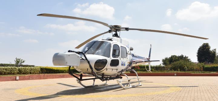
5 Geokno operates state of art LiDAR sensors from Aerial, Mobile & Terrestrial platforms LiDAR Sensor Riegl LMS Q780 Geokno HeliMapper: Only machine in India with Aerial LiDAR capability Camera 100 MP Phase One Industrial Positional System IGI AeroControl Geokno Mobile Mapper Geokno Terrestrial LiDAR 5


6 LiDAR is a revolutionary technology increasing the mapping capabilities by over 100x both in time and accuracy GPS Satellite GPS Unit IMU GPS Ground Station LiDAR Scanner H FOV 2Φ D A Ds


7 LiDAR Advantage: Penetrates below vegetation to get accurate levels and contour (DEM)

8 Development of detailed 3D Terrain Model & updation of Base Maps Geokno has demonstrated the capability of LiDAR in multiple areas Availability of LiDAR data at 10 points/sq m providing 50 cm Digital Terrain Model Availability of 5 cm Ortho Imagery Identification of bunkers, dugouts, small tents & structures in thick forest area Identification of ration dumps throughout the area Mapping of all footpaths & trails below forest cover Mapping of all villages and huts spread throughout the area Mapping of all rivers, water areas & farms

")


9 Development of detailed 3D Terrain Model & updation of Base Maps (I/III) Forest Ortho Image Bare Earth below forest Cross Section 20 m Bare Earth with Contour Heights LiDAR can see under forest also!
")

10 Development of detailed 3D Terrain Model & updation of Base Maps (II/III) Cross-Section Mizoram Project Bare Earth Model of a steep valley Height of Tree Cover


11 Images show least--no target detection LiDAR reveals target along with geometry LiDAR DEM reveals hidden features on ground Paths Goa Project Nalahs LiDAR with images- best tool for Geo-intelligence gathering

12 Hidden tents & small huts: Even tents & small huts can be identified in survey Image View LiDAR View Cross-Section View Goa Project Hut profile clearly revealed although not visible in imagery


13 Benefits of LiDAR developed 3D Terrain Model: Excellent for operational planning, field operations & navigation LiDAR sensors penetrate forest canopy just like sunlight and hence generate accurate Terrain Model Imagery sensors need to see same point from both images to generate 3D co-ordinates and hence can t generate points below forest canopy and rather given only forest top, hence terrain model is not generated 50 cm accurate Terrain Model helps in better navigation for troops due to good correspondence of data with average soldier height of 1.6 m The terrain model helps in better field operations by helping in identifying (1) suitable observation posts, (2) locations for cover and concealment and (3) sites for locating communications transmission and interception equipment Cross Section Ground points captured below vegetation Cross Section LiDAR Data Imagery Data Ground points not captured below vegetation Complete tree profile visible Only top of tree visible


14 Benefits of LiDAR developed 3D Terrain Model: Level of detail difference between LiDAR DEM Vs Imagery DEM LiDAR based Terrain Model Imagery based Terrain Model


15 Case Study: Due to benefits of LiDAR over Imagery, US Army prefers to use LiDAR in areas of conflict over other mapping technologies LiDAR, an optical remote sensing technology, can yield data flows that are orders-ofmagnitude quicker, more accurate and clearer than other mapping tools The National Geospatial-Intelligence Agency (NGA) has been deploying LIDAR in aircraft to map Afghanistan s entire 647,500 square kilometres. Air Force Lt Gen John Koziol, director of Defense Department s Intelligence, Surveillance and Reconnaissance (ISR) Task Force heralded the technology s amazing capacities for coverage down to inch-level fidelity Source: Overall, the scientist said, LiDAR elevation data supports improved battlefield visualization, line-of-sight analysis and urban warfare planning


16 As compared to Satellite Imagery, LiDAR Survey with Aerial Imagery gives a 100x better product Satellite Imagery Accuracy varies from 2 m to 5 m Data below forest is not covered at all hence data is not exhaustive Digital terrain model is not possible as details below forest not covered Data not suitable for operational planning, navigation and field operations Not suitable for forested terrain LiDAR LiDAR data at 10 points per sq m along with imagery of 5 cm GSD Accuracy of 10 cm Exhaustive data including under forest details such as Tents & bunkers captured 50 cm Digital Terrain Model is available Data is highly suitable for operational planning, navigation and field operations 16


17 Geo-Intelligence Roadmap Development of detailed 3D Terrain Model & updation of Base Maps 1 Detailed 3D Terrain Map along with updated base maps are essential for Geo-Intelligence works No detailed 3D terrain maps available for security forces even in Indian areas Current Base maps are based on satellite imagery Satellite data not effective as most operational areas are covered by forests. Free resources like Google Earth provide equivalent information. No Geo-intelligence advantages to Security Forces currently 2 Near Real-time data processing 3 Regular surveillance using UAV LiDAR 4 VR based training systems Current data processing is time consuming Using artificial intelligence and deep learning algorithms, it is proposed to bring down delivery time to within 24 to 36 hrs With updated terrain maps & base maps, UAV based surveillance can be fine tuned UAV based LiDAR can be deployed for providing geointelligence inputs before critical operations High quality LiDAR data can be combined with VR and Game Engine technologies to provide realistic training environment to troops VR based training retention is over 80%


18 Product Development: Automation of Data extraction and Near Real time processing of data Near real time processing being evaluated and will be tested during upcoming projects Artificial Intelligence algorithms being developed for automatic identification of LiDAR pointclouds as in LiDAR data structure details are easily made out In comparison, imagery data has to be analysed on individual images basis and is time consuming LiDAR Roof Shapes 18


19 Product Development: UAV LiDAR can be deployed immediately for small area operational requirements Long endurance UAV along with high payload capacity identified and ready for fitment UAV deployment requires base map development so that UAV operations can be pinpointed rather than random After base map development before operations, UAV recce with real time processing can give highly critical advantage for security forces 19


20 Product development: Virtual reality product ready for demonstration Virtual Reality Product Very high quality of LiDAR data helps in accurate scene generation for 3D Modelling Game Engines being used for providing Virtual Reality simulation war games environment VR training helps in over 80% retention for troops Augmented Reality products can also be developed as a battle management system 20


21 21
Airborne and Mobile LiDAR for Transport Corridor Survey Dr. Bharat Lohani Director, Geokno India Pvt. Ltd. & Professor, Geoinformatics IIT Kanpur
 www.geokno.com Airborne and Mobile LiDAR for Transport Corridor Survey Dr. Bharat Lohani Director, Geokno India Pvt. Ltd. & Professor, Geoinformatics IIT Kanpur Geokno has executed and is executing multiple
Terrain Modeling and Mapping for Telecom Network Installation Using Scanning Technology. Maziana Muhamad
 Terrain Modeling and Mapping for Telecom Network Installation Using Scanning Technology Maziana Muhamad Summarising LiDAR (Airborne Laser Scanning) LiDAR is a reliable survey technique, capable of: acquiring
UTILIZACIÓN DE DATOS LIDAR Y SU INTEGRACIÓN CON SISTEMAS DE INFORMACIÓN GEOGRÁFICA
 UTILIZACIÓN DE DATOS LIDAR Y SU INTEGRACIÓN CON SISTEMAS DE INFORMACIÓN GEOGRÁFICA Aurelio Castro Cesar Piovanetti Geographic Mapping Technologies Corp. (GMT) Consultores en GIS info@gmtgis.com Geographic
Integrated Multi-Source LiDAR and Imagery
 Figure 1: AirDaC aerial scanning system Integrated Multi-Source LiDAR and Imagery The derived benefits of LiDAR scanning in the fields of engineering, surveying, and planning are well documented. It has
LIDAR MAPPING FACT SHEET
 1. LIDAR THEORY What is lidar? Lidar is an acronym for light detection and ranging. In the mapping industry, this term is used to describe an airborne laser profiling system that produces location and
AIRBORNE GEIGER MODE LIDAR - LATEST ADVANCEMENTS IN REMOTE SENSING APPLICATIONS RANDY RHOADS
 Place image here (10 x 3.5 ) AIRBORNE GEIGER MODE LIDAR - LATEST ADVANCEMENTS IN REMOTE SENSING APPLICATIONS RANDY RHOADS Geospatial Industry Manager HARRIS.COM #HARRISCORP Harris Company Information SECURITY
High resolution survey and orthophoto project of the Dosso-Gaya region in the Republic of Niger. by Tim Leary, Woolpert Inc.
 High resolution survey and orthophoto project of the Dosso-Gaya region in the Republic of Niger by Tim Leary, Woolpert Inc. Geospatial Solutions Photogrammetry & Remote Sensing LiDAR Professional Surveying
a Geo-Odyssey of UAS LiDAR Mapping Henno Morkel UAS Segment Specialist DroneCon 17 May 2018
 a Geo-Odyssey of UAS LiDAR Mapping Henno Morkel UAS Segment Specialist DroneCon 17 May 2018 Abbreviations UAS Unmanned Aerial Systems LiDAR Light Detection and Ranging UAV Unmanned Aerial Vehicle RTK Real-time
Hamilton County Enhances GIS Base Mapping with 1-foot Contours
 Hamilton County Enhances GIS Base Mapping with 1-foot Contours Presented by Larry Stout, Hamilton County GIS Manager Brad Fugate, Woolpert Inc. Today s Presentation Hamilton County s 2004 Base Mapping
2-4 April 2019 Taets Art and Event Park, Amsterdam CLICK TO KNOW MORE
 Co-Host Host 2-4 April 2019 Taets Art and Event Park, Amsterdam CLICK TO KNOW MORE Presentation Outline review modern survey methodologies available to support railway requirements measuring everything
Trends in Digital Aerial Acquisition Systems
 Trends in Digital Aerial Acquisition Systems Ernest Yap Regional Sales Manager, Airborne-Americas eyap@applanix.com 1 Medium Format Digital Cameras Medium Format Digital Cameras Where does the Medium
Bringing Singapore to life in 3D
 Bringing Singapore to life in 3D Dr Victor Khoo, Deputy Director Singapore Land Authority Bringing Singapore to life in 3D ESRI Singapore UC 2016 Dr. Victor Khoo Singapore Land Authority SLA 2016 RESTRICTED
LiForest Software White paper. TRGS, 3070 M St., Merced, 93610, Phone , LiForest
 0 LiForest LiForest is a platform to manipulate large LiDAR point clouds and extract useful information specifically for forest applications. It integrates a variety of advanced LiDAR processing algorithms
Development of Geospatial Smart Cities and Management
 Presented at the FIG Congress 2018, May 6-11, 2018 in Istanbul, Turkey Development of Geospatial Smart Cities and Management (E. Yılmaz, F. Kartal, E. Uçar, K. Eren) FIG2018 - Istanbul, 8 th May 2018 1
Aerial and Mobile LiDAR Data Fusion
 Creating Value Delivering Solutions Aerial and Mobile LiDAR Data Fusion Dr. Srini Dharmapuri, CP, PMP What You Will Learn About LiDAR Fusion Mobile and Aerial LiDAR Technology Components & Parameters Project
Overview. 1. Aerial LiDAR in Wisconsin (20 minutes) 2. Demonstration of data in CAD (30 minutes) 3. High Density LiDAR (20 minutes)
 2. Demonstration of data in CAD (30 minutes) 3. High Density LiDAR (20 minutes)") Overview 1. Aerial LiDAR in Wisconsin (20 minutes) 2. Demonstration of data in CAD (30 minutes) 3. High Density LiDAR (20 minutes) 4. Aerial lidar technology advancements (15 minutes) 5. Q & A 1. Aerial
Overview 1. Aerial LiDAR in Wisconsin (20 minutes) 2. Demonstration of data in CAD (30 minutes) 3. High Density LiDAR (20 minutes) 4. Aerial lidar technology advancements (15 minutes) 5. Q & A 1. Aerial
Light Detection and Ranging (LiDAR)
") Light Detection and Ranging (LiDAR) http://code.google.com/creative/radiohead/ Types of aerial sensors passive active 1 Active sensors for mapping terrain Radar transmits microwaves in pulses determines
Light Detection and Ranging (LiDAR) http://code.google.com/creative/radiohead/ Types of aerial sensors passive active 1 Active sensors for mapping terrain Radar transmits microwaves in pulses determines
E3De. E3De Discover the Next Dimension of Your Data.
 International Support Exelis Visual Information Solutions is a global company with direct offices in North America, Europe, and Asia. Combined with our extensive, worldwide distributor network, we can
SPAR, ELMF 2013, Amsterdam. Laser Scanning on the UK Highways Agency Network. Hamish Grierson Blom Uk
 SPAR, ELMF 2013, Amsterdam Laser Scanning on the UK Highways Agency Network Hamish Grierson Blom Uk www.blomasa.com www.blom-uk.co.uk Blom UK Part of the Blom Group Blom Group - Europe s largest aerial
N.J.P.L.S. An Introduction to LiDAR Concepts and Applications
 N.J.P.L.S. An Introduction to LiDAR Concepts and Applications Presentation Outline LIDAR Data Capture Advantages of Lidar Technology Basics Intensity and Multiple Returns Lidar Accuracy Airborne Laser
LiDAR & Orthophoto Data Report
 LiDAR & Orthophoto Data Report Tofino Flood Plain Mapping Data collected and prepared for: District of Tofino, BC 121 3 rd Street Tofino, BC V0R 2Z0 Eagle Mapping Ltd. #201 2071 Kingsway Ave Port Coquitlam,
Terrestrial GPS setup Fundamentals of Airborne LiDAR Systems, Collection and Calibration. JAMIE YOUNG Senior Manager LiDAR Solutions
 Terrestrial GPS setup Fundamentals of Airborne LiDAR Systems, Collection and Calibration JAMIE YOUNG Senior Manager LiDAR Solutions Topics Terrestrial GPS reference Planning and Collection Considerations
James Van Rens CEO Riegl USA, Inc. Mining Industry and UAV s combined with LIDAR Commercial UAV Las Vegas October 2015 James Van Rens CEO Riegl USA
 James Van Rens CEO Riegl USA, Inc. Mining Industry and UAV s combined with LIDAR Commercial UAV Las Vegas October 2015 James Van Rens CEO Riegl USA COST EFFECIENCY CONTINUUM LIDAR and IMU Partnership Technology
STARTING WITH DRONES. Data Collection and Remote Sensing with UAVs, etc. Dr. Bill Hazelton LS
 STARTING WITH DRONES Data Collection and Remote Sensing with UAVs, etc. Dr. Bill Hazelton LS What this Talk is About UAV-based data acquisition: What you need to get involved Processes in getting spatial
LiDAR Engineering and Design Applications. Sample Data
 LiDAR Engineering and Design Applications Sample Data High density LiDAR will return points on any visible part of a structure. Modeling of Existing Structures 2 The distance between any two positions
UAS based laser scanning for forest inventory and precision farming
 UAS based laser scanning for forest inventory and precision farming M. Pfennigbauer, U. Riegl, P. Rieger, P. Amon RIEGL Laser Measurement Systems GmbH, 3580 Horn, Austria Email: mpfennigbauer@riegl.com,
Overview of the Trimble TX5 Laser Scanner
 Overview of the Trimble TX5 Laser Scanner Trimble TX5 Revolutionary and versatile scanning solution Compact / Lightweight Efficient Economical Ease of Use Small and Compact Smallest and most compact 3D
+50,000 Archived GCPs. The Most Comprehensive Ground Control Points Solution. Make Geospatial Data More Accurate
 The Most Comprehensive Ground Control Points Solution Make Geospatial Data More Accurate +50,000 Archived GCPs www.compassdatainc.com +1 (303) 627-4058 solutions@compassdatainc.com HOW GCPs Are Created?
Course Outline (1) #6 Data Acquisition for Built Environment. Fumio YAMAZAKI
 #6 Data Acquisition for Built Environment. Fumio YAMAZAKI") AT09.98 Applied GIS and Remote Sensing for Disaster Mitigation #6 Data Acquisition for Built Environment 9 October, 2002 Fumio YAMAZAKI yamazaki@ait.ac.th http://www.star.ait.ac.th/~yamazaki/ Course Outline
AT09.98 Applied GIS and Remote Sensing for Disaster Mitigation #6 Data Acquisition for Built Environment 9 October, 2002 Fumio YAMAZAKI yamazaki@ait.ac.th http://www.star.ait.ac.th/~yamazaki/ Course Outline
Lidar Sensors, Today & Tomorrow. Christian Sevcik RIEGL Laser Measurement Systems
 Lidar Sensors, Today & Tomorrow Christian Sevcik RIEGL Laser Measurement Systems o o o o Online Waveform technology Stand alone operation no field computer required Remote control through wireless network
Trimble Geospatial Division Integrated Solutions for Geomatics professions. Volker Zirn Regional Sales Representative
 Trimble Geospatial Division Integrated Solutions for Geomatics professions Volker Zirn Regional Sales Representative 1 Agenda Trimble GeoSpatial Division Airborne System Solutions Trimble Inpho Software
Boundary Security. Innovative Planning Solutions. Analysis Planning Design. criterra Technology
 Boundary Security Analysis Planning Design Innovative Planning Solutions criterra Technology Setting the new standard DEFENSOFT - A Global Leader in Boundary Security Planning Threats, illegal immigration
An Introduction to Lidar & Forestry May 2013
 An Introduction to Lidar & Forestry May 2013 Introduction to Lidar & Forestry Lidar technology Derivatives from point clouds Applied to forestry Publish & Share Futures Lidar Light Detection And Ranging
IMAGINE Objective. The Future of Feature Extraction, Update & Change Mapping
 IMAGINE ive The Future of Feature Extraction, Update & Change Mapping IMAGINE ive provides object based multi-scale image classification and feature extraction capabilities to reliably build and maintain
Training i Course Remote Sensing Basic Theory & Image Processing Methods September 2011
 Training i Course Remote Sensing Basic Theory & Image Processing Methods 19 23 September 2011 Geometric Operations Michiel Damen (September 2011) damen@itc.nl ITC FACULTY OF GEO-INFORMATION SCIENCE AND
Volumetric Calculations. Sample Data
 Volumetric Calculations Sample Data Stockpiles of industrial materials are often difficult to measure accurately. LiDAR offers a fast and extremely accurate solution for taking periodical inventory of
The Use of UAV s for Gathering Spatial Information. James Van Rens CEO MAPPS Winter Conference January, 2015
 The Use of UAV s for Gathering Spatial Information James Van Rens CEO MAPPS Winter Conference January, 2015 1 UAV Technological Timeline 1980 s RPV (Remotely Piloted Vehicle) Operator on ground, almost
Sensor Fusion: Potential, Challenges and Applications. Presented by KVH Industries and Geodetics, Inc. December 2016
 Sensor Fusion: Potential, Challenges and Applications Presented by KVH Industries and Geodetics, Inc. December 2016 1 KVH Industries Overview Innovative technology company 600 employees worldwide Focused
Airborne LiDAR Data Acquisition for Forestry Applications. Mischa Hey WSI (Corvallis, OR)
") Airborne LiDAR Data Acquisition for Forestry Applications Mischa Hey WSI (Corvallis, OR) WSI Services Corvallis, OR Airborne Mapping: Light Detection and Ranging (LiDAR) Thermal Infrared Imagery 4-Band
Airborne LiDAR Data Acquisition for Forestry Applications Mischa Hey WSI (Corvallis, OR) WSI Services Corvallis, OR Airborne Mapping: Light Detection and Ranging (LiDAR) Thermal Infrared Imagery 4-Band
Mobile Mapping and Navigation. Brad Kohlmeyer NAVTEQ Research
 Mobile Mapping and Navigation Brad Kohlmeyer NAVTEQ Research Mobile Mapping & Navigation Markets Automotive Enterprise Internet & Wireless Mobile Devices 2 Local Knowledge & Presence Used to Create Most
Mayden VP of Business Development Surdex Corporation
 Making Sense of Sensors Randy Mayden, Mayden VP of Business Development Surdex Corporation randym@surdex.com EARLYAERIAL PHOTOGRAPHY 2 FIRSTAERIAL CAMERA 3 AERIAL CAMERA SYSTEM DEVELOPMENT Aerial Camera
SimActive and PhaseOne Workflow case study. By François Riendeau and Dr. Yuri Raizman Revision 1.0
 SimActive and PhaseOne Workflow case study By François Riendeau and Dr. Yuri Raizman Revision 1.0 Contents 1. Introduction... 2 1.1. Simactive... 2 1.2. PhaseOne Industrial... 2 2. Testing Procedure...
Technical Considerations and Best Practices in Imagery and LiDAR Project Procurement
 Technical Considerations and Best Practices in Imagery and LiDAR Project Procurement Presented to the 2014 WV GIS Conference By Brad Arshat, CP, EIT Date: June 4, 2014 Project Accuracy A critical decision
Extending a Defense Computing Cloud to Warfighters at the Edge
 Extending a Defense Computing Cloud to Warfighters at the Edge Thermopylae Sciences and Technology Abstract The Department of Defense (DoD) has historically adopted innovation from the commercial tech
2017 PROGRAM OVERVIEW. Geospatial Intelligence for Better Outcomes
 2017 PROGRAM OVERVIEW Geospatial Intelligence for Better Outcomes NICB SOLUTION : GEOSPATIAL INTELLIGENCE CENTER Key Program Areas 1. CAT / Disaster Response 2. National Imagery Program 3. Digital Delivery
UAS for Surveyors. An emerging technology for the Geospatial Industry. Ian Murgatroyd : Technical Sales Rep. Trimble
 UAS for Surveyors An emerging technology for the Geospatial Industry Ian Murgatroyd : Technical Sales Rep. Trimble Project Overview Voyager Quarry, located near Perth Australia Typical of hard rock mines,
Third Rock from the Sun
 Geodesy 101 AHD LiDAR Best Practice The Mystery of LiDAR Best Practice Glenn Jones SSSi GIS in the Coastal Environment Batemans Bay November 9, 2010 Light Detection and Ranging (LiDAR) Basic principles
Applications of LiDAR in seismic acquisition and processing Mark Wagaman and Ron Sfara, Veritas DGC
 Applications of LiDAR in seismic acquisition and processing Mark Wagaman and Ron Sfara, Veritas DGC Abstract With its ability to provide accurate land surface elevations, the LiDAR (Light Detection And
CO-REGISTERING AND NORMALIZING STEREO-BASED ELEVATION DATA TO SUPPORT BUILDING DETECTION IN VHR IMAGES
 CO-REGISTERING AND NORMALIZING STEREO-BASED ELEVATION DATA TO SUPPORT BUILDING DETECTION IN VHR IMAGES Alaeldin Suliman, Yun Zhang, Raid Al-Tahir Department of Geodesy and Geomatics Engineering, University
RealWorld. HUAZHENG Panoramic Photorealistic 3D. Geospatial Data at Engineering Level
 3D RealWorld HUAZHENG Panoramic Photorealistic 3D Geospatial Data at Engineering Level District Drainage Facilities Management Simulate the extreme weather effect on buildings, road networks, and especially
Harnessing GIS and Imagery for Power Transmission Inspection. ESRI European Users Conference October 15, 2015
 Harnessing GIS and Imagery for Power Transmission Inspection ESRI European Users Conference October 15, 2015 About Us Airborne/Threod Designer, manufacturer & service provider for multi-rotor & fixed wing
RealWorld RealCity RealTerrain Airborne Reality Capture The Integral World of Leica Airborne Solutions
 RealWorld RealCity RealTerrain Airborne Reality Capture The Integral World of Leica Airborne Solutions Photogrammetric Week, September 11, 2017 Dr. Hartmut Rosengarten, Director Airborne Solutions EMEA,
2/9/2016. Session Agenda: Implementing new Geospatial Technologies for more efficient data capture
 Implementing new Geospatial Technologies for more efficient data capture Jay Haskamp Applied Geospatial Engineer Steve Richter VP Sales Session Agenda: Today s changing technologies and what lies ahead
An Overview of Applanix.
 An Overview of Applanix The Company The Industry Leader in Developing Aided Inertial Technology Founded on Canadian Aerospace and Defense Industry Expertise Providing Precise Position and Orientation Systems
TopoDrone Photogrammetric Mapping Reliable, Accurate, Safe
 TopoDrone Photogrammetric Mapping Reliable, Accurate, Safe A complete solution for accurate airborne data capture and photogrammetric mapping using an unmanned aerial vehicle COST EFFICIENT SOLUTION TO
Trimble GeoSpatial Products
 Expanding Solutions for Photogrammetric and Remote Sensing Professionals 55 th Photogrammetric Week in Stuttgart September 7 th 2015 Tobias Heuchel, Trimble Stuttgart, Germany Trimble GeoSpatial Products
Mobile LiDAR for Ground Applications. Spar 2006, March Paul Mrstik, Terrapoint Canada Inc. Craig Glennie, Terrapoint USA LLC
 Mobile LiDAR for Ground Applications Spar 2006, March 27 2006 Paul Mrstik, Terrapoint Canada Inc. Craig Glennie, Terrapoint USA LLC Agenda Introduction to Terrapoint What is mobile LiDAR? Advantages of
UAV Flight Operations for Mapping. Precision. Accuracy. Reliability
 UAV Flight Operations for Mapping Precision. Accuracy. Reliability Part One: Why is Mapping different? Part Two: What about accuracy and precision? Part Three: What is the Workflow? Part Four: AGENDA What
Lidar Talking Points Status of lidar collection in Pennsylvania Estimated cost and timeline
 Lidar Talking Points Pennsylvania has an immediate need for new lidar (topographic) data coverage. Some uses of the data are enumerated later in this document. USGS has calculated an average return on
Hyperspectral Remote Sensing in Acquisition of Geospatial Information for the Modern Warfare. Dr M R Bhutiyani,
 Hyperspectral Remote Sensing in Acquisition of Geospatial Information for the Modern Warfare Dr M R Bhutiyani, Ex-Director, DTRL, New Delhi Chairman, ISRS, Delhi Chapter Air photo-interpretation Multi-spectral
TrueOrtho with 3D Feature Extraction
 TrueOrtho with 3D Feature Extraction PCI Geomatics has entered into a partnership with IAVO to distribute its 3D Feature Extraction (3DFE) software. This software package compliments the TrueOrtho workflow
VALIDATION OF A NEW 30 METER GROUND SAMPLED GLOBAL DEM USING ICESAT LIDARA ELEVATION REFERENCE DATA
 VALIDATION OF A NEW 30 METER GROUND SAMPLED GLOBAL DEM USING ICESAT LIDARA ELEVATION REFERENCE DATA M. Lorraine Tighe Director, Geospatial Solutions Intermap Session: Photogrammetry & Image Processing
DATA FUSION AND INTEGRATION FOR MULTI-RESOLUTION ONLINE 3D ENVIRONMENTAL MONITORING
 DATA FUSION AND INTEGRATION FOR MULTI-RESOLUTION ONLINE 3D ENVIRONMENTAL MONITORING Yun Zhang, Pingping Xie, Hui Li Department of Geodesy and Geomatics Engineering, University of New Brunswick Fredericton,
GEO 6895: Airborne laser scanning - workflow, applications, value. Christian Hoffmann
 GEO 6895: Airborne laser scanning - workflow, applications, value. Christian Hoffmann Agenda Why LiDAR? The value of an end-to-end workflow The Trimble AX-Series Data processing & modelling Information
Alaska Department of Transportation Roads to Resources Project LiDAR & Imagery Quality Assurance Report Juneau Access South Corridor
 Alaska Department of Transportation Roads to Resources Project LiDAR & Imagery Quality Assurance Report Juneau Access South Corridor Written by Rick Guritz Alaska Satellite Facility Nov. 24, 2015 Contents
National Science Foundation Engineering Research Center. Bingcai Zhang BAE Systems San Diego, CA
 Bingcai Zhang BAE Systems San Diego, CA 92127 Bingcai.zhang@BAESystems.com Introduction It is a trivial task for a five-year-old child to recognize and name an object such as a car, house or building.
Drone2Map for ArcGIS: Bring Drone Imagery into ArcGIS. Will
 Drone2Map for ArcGIS: Bring Drone Imagery into ArcGIS Will Meyers @MeyersMaps A New Window on the World Personal Mapping for Micro-Geographies Accurate High Quality Simple Low-Cost Drone2Map for ArcGIS
REMOTE SENSING LiDAR & PHOTOGRAMMETRY 19 May 2017
 REMOTE SENSING LiDAR & PHOTOGRAMMETRY 19 May 2017 SERVICES Visual Inspections Digital Terrain Models Aerial Imagery Volume Computations Thermal Inspections Photo maps Aerial Video Training & Consultancy
Airborne Laser Survey Systems: Technology and Applications
 Abstract Airborne Laser Survey Systems: Technology and Applications Guangping HE Lambda Tech International, Inc. 2323B Blue Mound RD., Waukesha, WI-53186, USA Email: he@lambdatech.com As mapping products
CLASSIFICATION OF NONPHOTOGRAPHIC REMOTE SENSORS
 CLASSIFICATION OF NONPHOTOGRAPHIC REMOTE SENSORS PASSIVE ACTIVE DIGITAL CAMERA THERMAL (e.g. TIMS) VIDEO CAMERA MULTI- SPECTRAL SCANNERS VISIBLE & NIR MICROWAVE HYPERSPECTRAL (e.g. AVIRIS) SLAR Real Aperture
LiDAR-Maps. and More for. Engineers. TechTime New Mapping Tools for Transportation Engineering. Airborne LiDAR. Digital Cameras
 LiDAR-Maps Airborne LiDAR and More for Digital Cameras Engineers and Their Applications Presenter: Azadeh Koohzare, Ph.D., P.Eng. Project Manager, Geodesy and Geomatics AKoohzare@mcelhanney.com 604-683-8521
Geospatial Intelligence Centres Empowered by Airbus
 DEFENCE AND SPACE Intelligence Geospatial Intelligence Centres Empowered by Airbus Planning Collection Processing Analysis Dissemination 2 Geospatial Intelligence Centres Geospatial Intelligence Centres
ATOMI Automatic road centreline extraction
 ATOMI input and output data Ortho images DTM/DSM 2D inaccurate structured road vector data ATOMI Automatic road centreline extraction 3D accurate structured road vector data Classification of roads according
High Resolution Laserscanning, not only for 3D-City Models
 Lohr 133 High Resolution Laserscanning, not only for 3D-City Models UWE LOHR, Ravensburg ABSTRACT The TopoSys laserscanner system is designed to produce digital elevation models (DEMs) of the environment
V-Sentinel: A Novel Framework for Situational Awareness and Surveillance
 V-Sentinel: A Novel Framework for Situational Awareness and Surveillance Suya You Integrated Media Systems Center Computer Science Department University of Southern California March 2005 1 Objective Developing
EnsoMOSAIC. Kopterit metsäninventointidatan keruualustoina
 EnsoMOSAIC Kopterit metsäninventointidatan keruualustoina 20.4.2017 Company introduction MosaicMill founded in 2009 EnsoMOSAIC technology since 1994 Main businesses EnsoMOSAIC forestry solutions EnsoMOSAIC
Hardware 3D Mapping Systems
 Hardware 3D Mapping Systems About Us GreenValley International GreenValley International provides 3D mapping solutions that include mobile & aerial LiDAR acquisition hardware, post-processing software
Reality Check: Processing LiDAR Data. A story of data, more data and some more data
 Reality Check: Processing LiDAR Data A story of data, more data and some more data Red River of the North Red River of the North Red River of the North Red River of the North Introduction and Background
2. POINT CLOUD DATA PROCESSING
 Point Cloud Generation from suas-mounted iphone Imagery: Performance Analysis A. D. Ladai, J. Miller Towill, Inc., 2300 Clayton Road, Suite 1200, Concord, CA 94520-2176, USA - (andras.ladai, jeffrey.miller)@towill.com
Leica ALS70. Airborne Laser Scanners Performance for diverse Applications
 Leica ALS70 Airborne Laser Scanners Performance for diverse Applications Three Models, One Result. Highest Productivity in all Applications. Imagine an affordable 500 khz pulse rate city-mapping LIDAR
Combat-proven UAV Systems That Give Indian Defence an Unmatched Tactical Advantage
 Combat-proven UAV Systems That Give Indian Defence an Unmatched Tactical Advantage SpyLite ready for launch at 5600m ASL and -200 C at a location in northern India, 2018 YOUR EYE IN THE SKY Autonomous
Remote Sensing Sensor Integration
 Remote Sensing Sensor Integration Erica Tharp LiDAR Supervisor Table of Contents About 3001 International Inc Remote Sensing Platforms Why Sensor Integration? Technical Aspects of Sensor Integration Limitations
Drones for research - Observing the world in 3D from a LiDAR-UAV
 Drones for research - Observing the world in 3D from a LiDAR-UAV Program lunch seminar: Lammert Kooistra: The Unmanned Aerial Remote Sensing Facility goes 3D: Unmanned Aerial Laser Scanning Sander Mücher:
2/19/2018. Who are we? Who am I? What is Scanning? How does scanning work? How does scanning work? Scanning for Today s Surveyors
 2/19/2018 Who are we? Scanning for Today s Surveyors Survey, GIS, and Construction dealer Founded in 1988 Employee Owned Headquartered in Bismarck, ND States covered: ND, SD, MN, MT, WY, CO, UT, ID, WA,
AUTOMATED UAV-BASED VIDEO EXPLOITATION FOR MAPPING AND SURVEILLANCE
 AUTOMATED UAV-BASED VIDEO EXPLOITATION FOR MAPPING AND SURVEILLANCE Stephen Se a, *, Pezhman Firoozfam a, Norman Goldstein a, Melanie Dutkiewicz a, Paul Pace b a MDA Systems Ltd., 13800 Commerce Parkway,
Airborne Laser Scanning: Remote Sensing with LiDAR
 Airborne Laser Scanning: Remote Sensing with LiDAR ALS / LIDAR OUTLINE Laser remote sensing background Basic components of an ALS/LIDAR system Two distinct families of ALS systems Waveform Discrete Return
Case Study for Long- Range Beyond Visual Line of Sight Project. March 15, 2018 RMEL Transmission and Planning Conference
 Case Study for Long- Range Beyond Visual Line of Sight Project March 15, 2018 RMEL Transmission and Planning Conference 2014 HDR Architecture, 2016 2014 HDR, Inc., all all rights reserved. Helicopters
Corridor Survey of Both Existing and New to be Built Pipelines on Land Using LiDAR Scanning
 Corridor Survey of Both Existing and New to be Built Pipelines on Land Using LiDAR Scanning 1. Introduction For good monitoring and planning an onshore pipeline and to feed the Geographic Information System,
Existing Elevation Data Sets. Quality Level 2 (QL2) Lidar Data Sets. Better Land Characterization More Accurate Results!
 Lidar Data Sets. Better Land Characterization More Accurate Results!") Existing Elevation Data Sets Out of Date: Most > 40 yrs old Data range from 15 yrs old to > 70 yrs old Spatial Resolution: 33 ft (10 m) or coarser Vertical Accuracy: 3.3 ft 6.6 ft (1 2 m) or worse Quality
Existing Elevation Data Sets Out of Date: Most > 40 yrs old Data range from 15 yrs old to > 70 yrs old Spatial Resolution: 33 ft (10 m) or coarser Vertical Accuracy: 3.3 ft 6.6 ft (1 2 m) or worse Quality
Measuring the potential impact of offshore mining on coastal instability through integrated time-series laser scanning and photography
 Measuring the potential impact of offshore mining on coastal instability through integrated time-series laser scanning and photography by Neil Slatcher, Roberto Vargas, Chris Cox and Liene Starka, 3D Laser
Practical Considerations of UAS Operations on Data Quality
 Practical Considerations of UAS Operations on Data Quality Precision. Accuracy. Reliability OVERVIEW Project Planning and Execution Ground Control Data Processing and Delivery 1 OVERVIEW Get Legal: Section
Quality Assurance and Quality Control Procedures for Survey-Grade Mobile Mapping Systems
 Quality Assurance and Quality Control Procedures for Survey-Grade Mobile Mapping Systems Latin America Geospatial Forum November, 2015 Agenda 1. Who is Teledyne Optech 2. The Lynx Mobile Mapper 3. Mobile
Files Used in this Tutorial
 Generate Point Clouds and DSM Tutorial This tutorial shows how to generate point clouds and a digital surface model (DSM) from IKONOS satellite stereo imagery. You will view the resulting point clouds
INTEGRATION OF TREE DATABASE DERIVED FROM SATELLITE IMAGERY AND LIDAR POINT CLOUD DATA
 INTEGRATION OF TREE DATABASE DERIVED FROM SATELLITE IMAGERY AND LIDAR POINT CLOUD DATA S. C. Liew 1, X. Huang 1, E. S. Lin 2, C. Shi 1, A. T. K. Yee 2, A. Tandon 2 1 Centre for Remote Imaging, Sensing
PROBLEMS AND LIMITATIONS OF SATELLITE IMAGE ORIENTATION FOR DETERMINATION OF HEIGHT MODELS
 PROBLEMS AND LIMITATIONS OF SATELLITE IMAGE ORIENTATION FOR DETERMINATION OF HEIGHT MODELS K. Jacobsen Institute of Photogrammetry and GeoInformation, Leibniz University Hannover, Germany jacobsen@ipi.uni-hannover.de
The Use and Applications of Unmanned- Aerial Systems (UAS) In Agriculture
 In Agriculture") The Use and Applications of Unmanned- Aerial Systems (UAS) In Agriculture R O B E R T A U S T I N, D E P A R T M E N T O F S O I L S C I E N C E N C S T A T E U N I V E R S I T Y DJI Inspire Photo Credit:
The Use and Applications of Unmanned- Aerial Systems (UAS) In Agriculture R O B E R T A U S T I N, D E P A R T M E N T O F S O I L S C I E N C E N C S T A T E U N I V E R S I T Y DJI Inspire Photo Credit:
Merging LiDAR Data with Softcopy Photogrammetry Data
 Merging LiDAR Data with Softcopy Photogrammetry Data Cindy McCallum WisDOT\Bureau of Technical Services Surveying & Mapping Section Photogrammetry Unit Overview Terms and processes Why use data from LiDAR
Leica - Airborne Digital Sensors (ADS80, ALS60) Update / News in the context of Remote Sensing applications
 Update / News in the context of Remote Sensing applications") Luzern, Switzerland, acquired with GSD=5 cm, 2008. Leica - Airborne Digital Sensors (ADS80, ALS60) Update / News in the context of Remote Sensing applications Arthur Rohrbach, Sensor Sales Dir Europe,
Luzern, Switzerland, acquired with GSD=5 cm, 2008. Leica - Airborne Digital Sensors (ADS80, ALS60) Update / News in the context of Remote Sensing applications Arthur Rohrbach, Sensor Sales Dir Europe,
UAV Surveying II. Precision. Accuracy. Reliability
 UAV Surveying II Precision. Accuracy. Reliability Part One: Project Lifecycle Deliverables Part Two: Evaluation of UAV Data Accuracy and Examples of Error Part Three: AGENDA Review of Results Examples
GPS/GIS Activities Summary
 GPS/GIS Activities Summary Group activities Outdoor activities Use of GPS receivers Use of computers Calculations Relevant to robotics Relevant to agriculture 1. Information technologies in agriculture